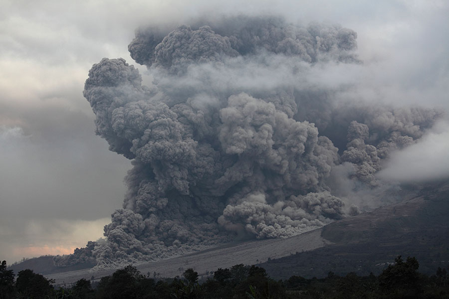
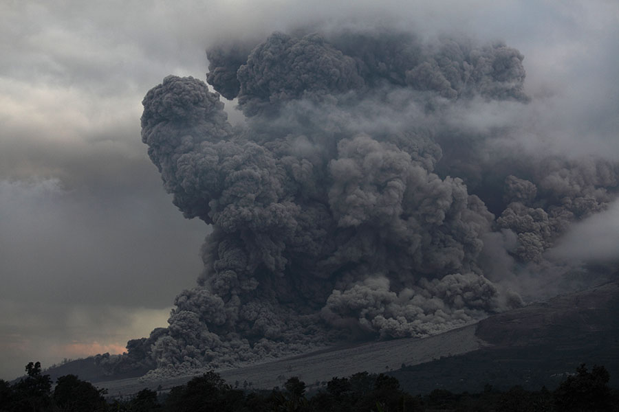
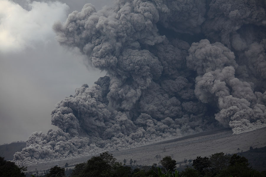
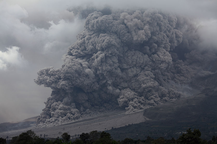
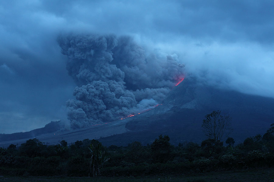
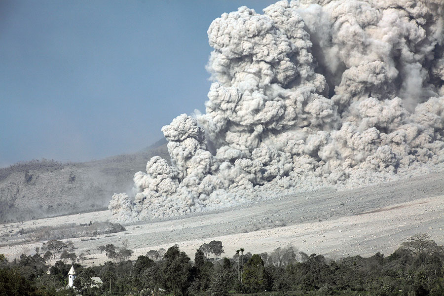
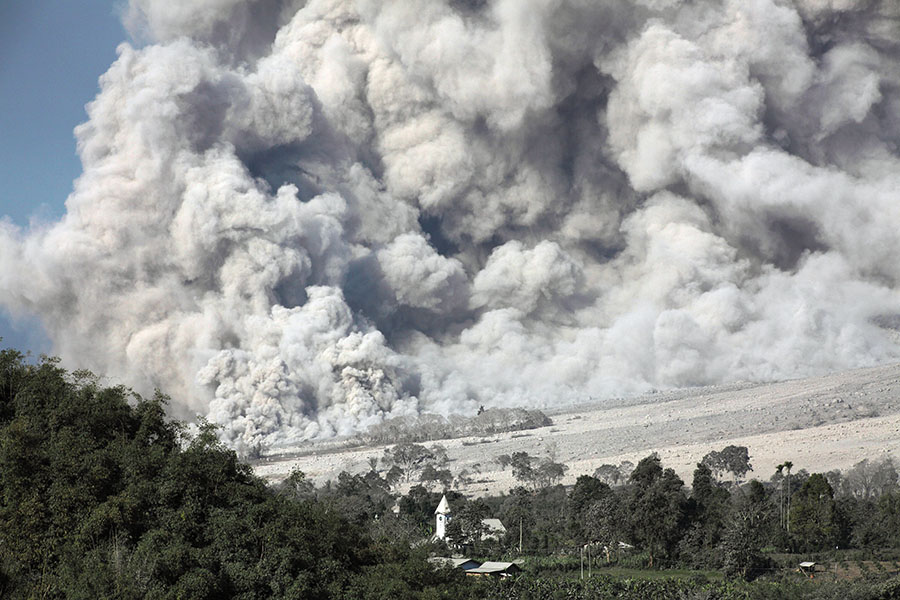
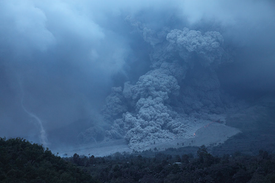
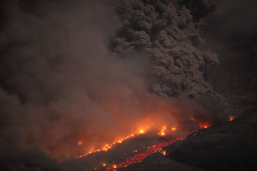
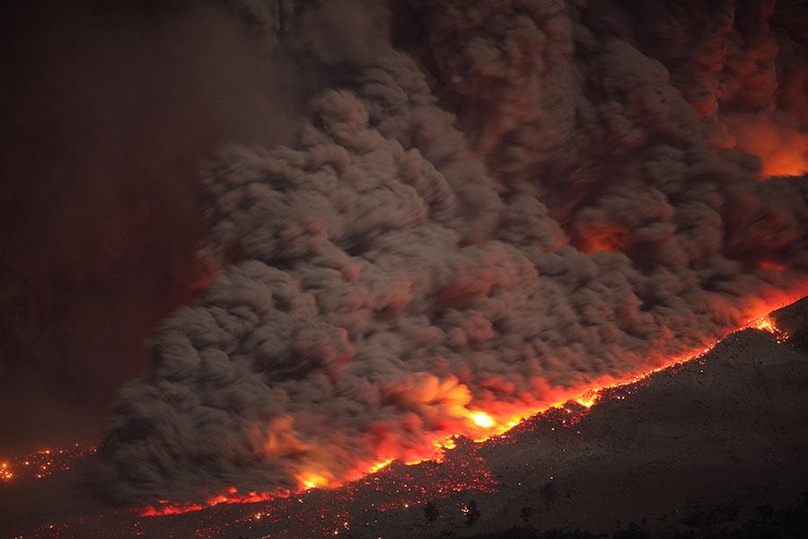
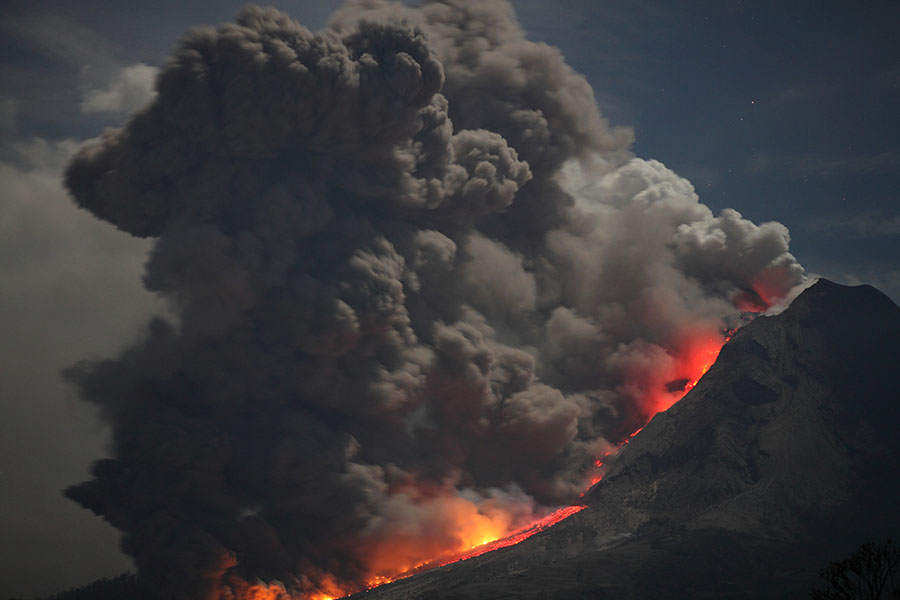
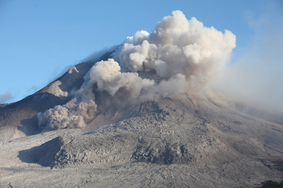
Large pyroclastic flow
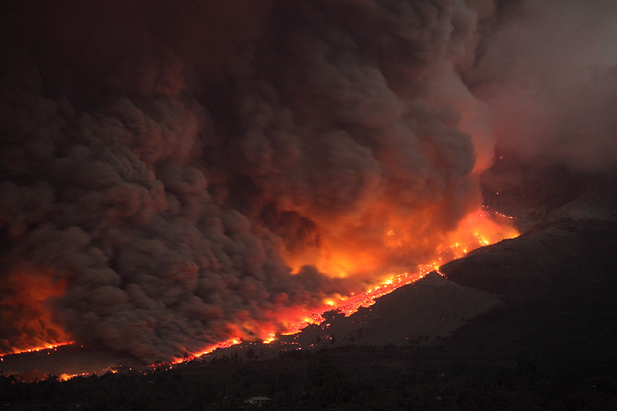
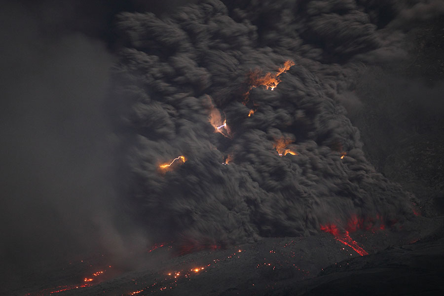
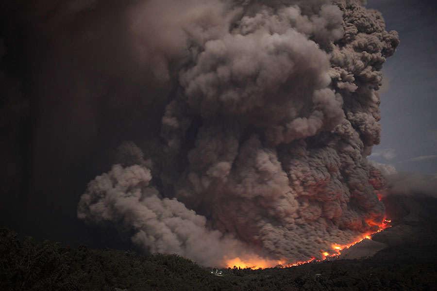
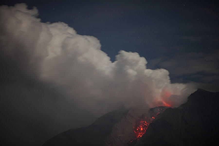
Pyroclastic flow at night
|
|
|
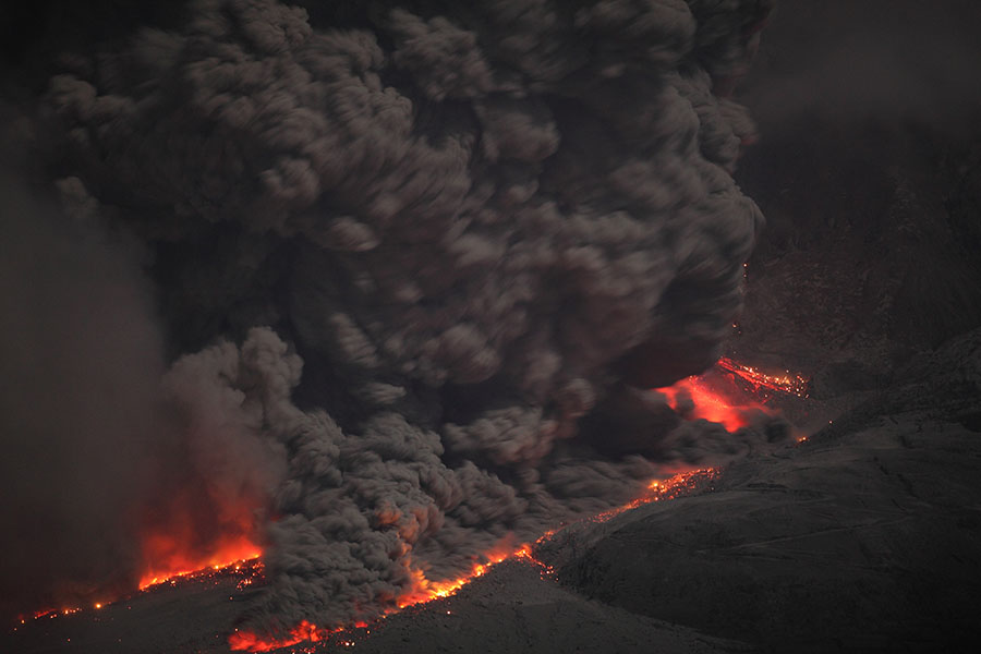
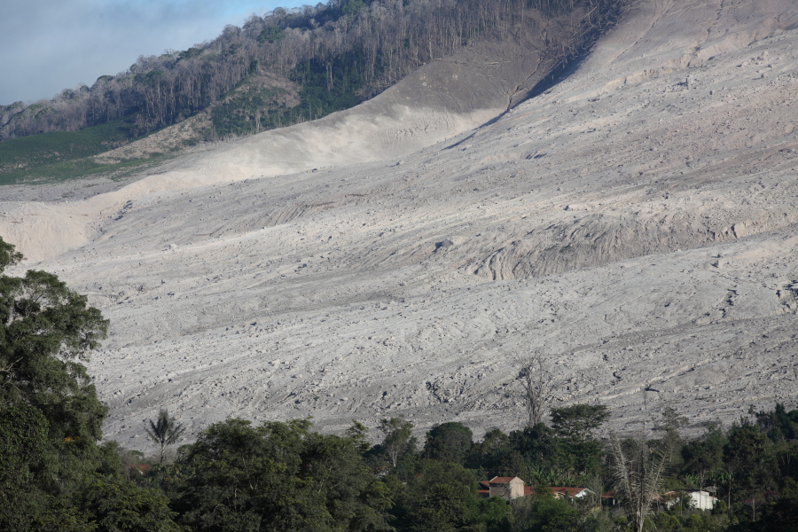
Large pyroclastic flow |
Pyroclastic flow at night |
 |
 |
|
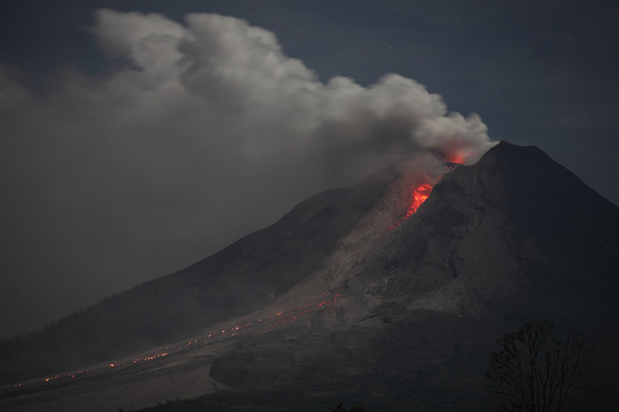
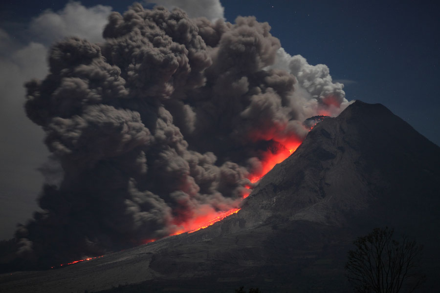
View from east at night with incandescent lava lobe |
Lava lobe under extrusive vent |
 |
|
|
Lobe prior to collapse |
Lobe during collapse |
|
 |
 |
 |
 |
 |
 |
 |
 |
 |
 |
 |
 |
 |
 |
|
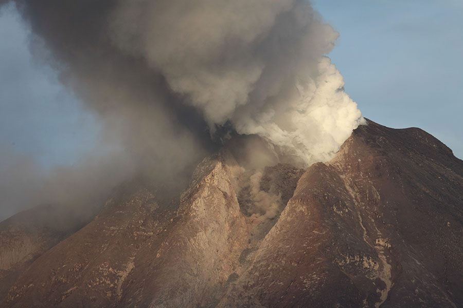
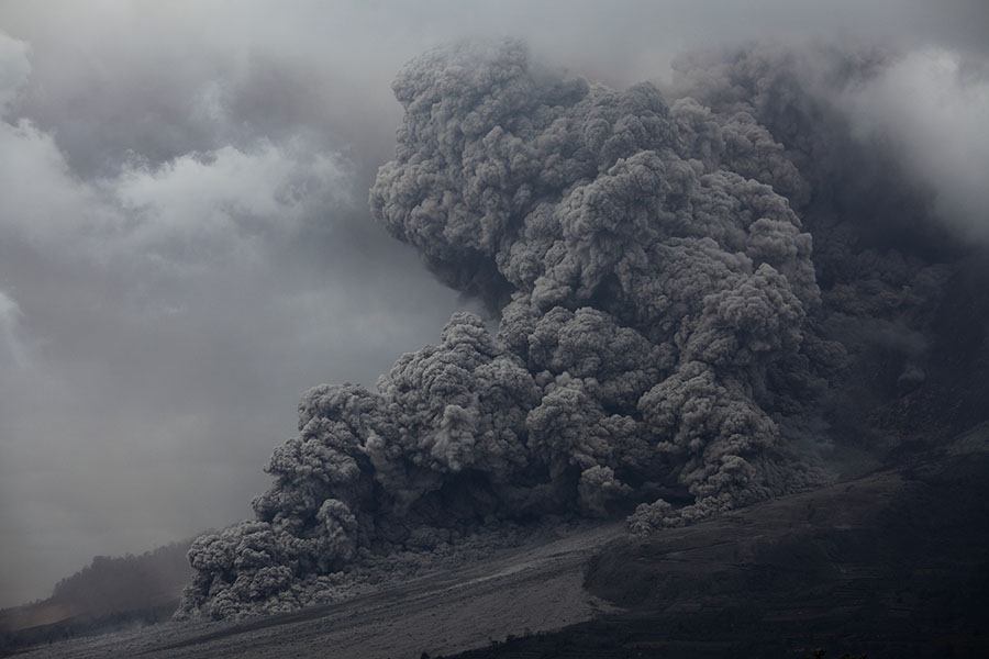
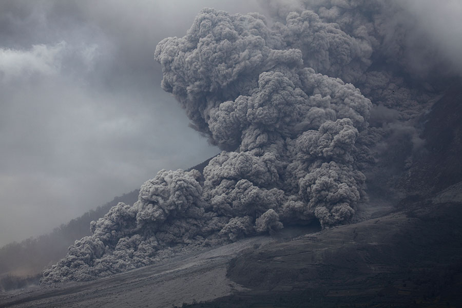
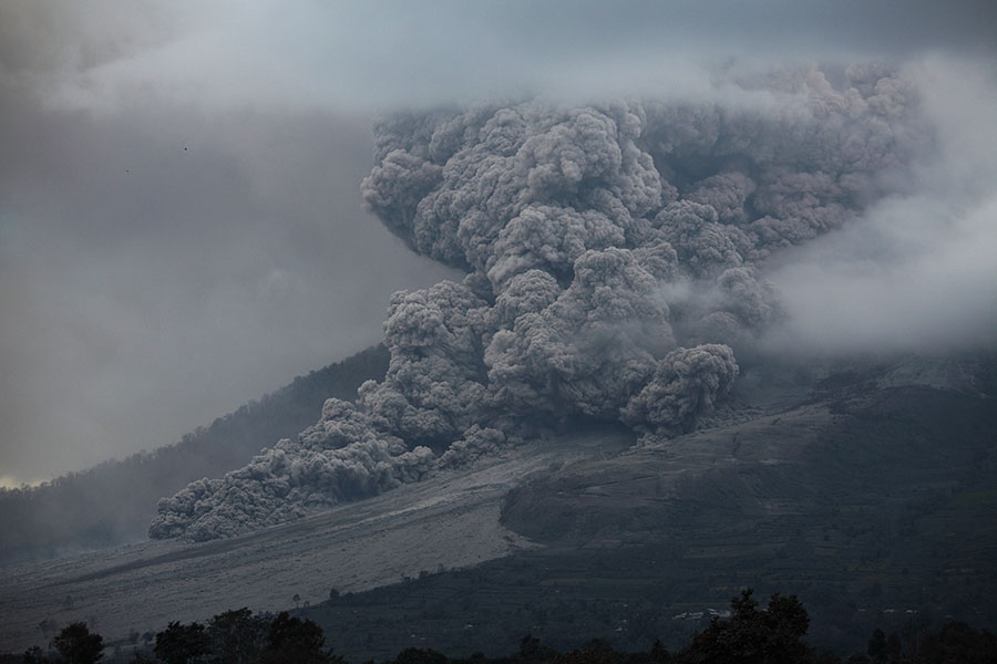
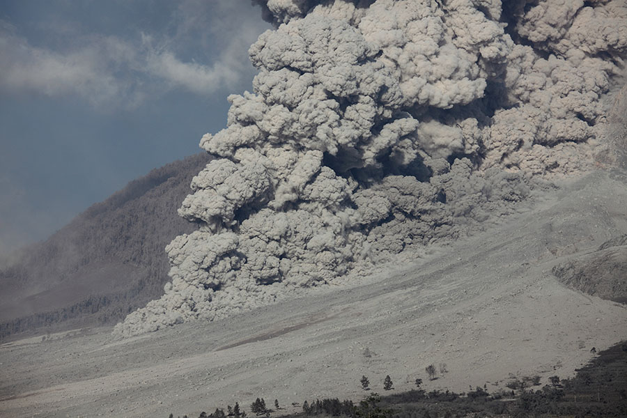
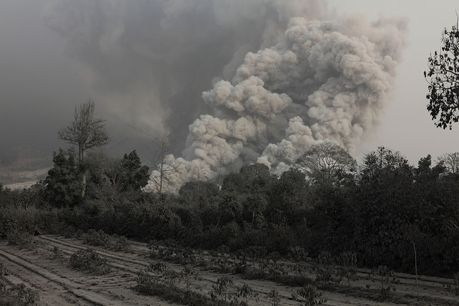
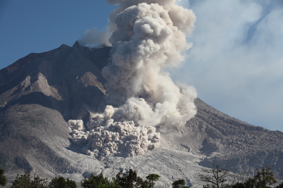
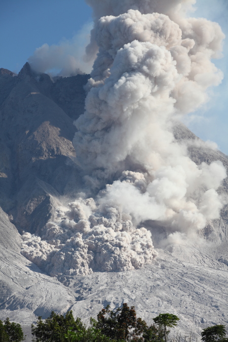
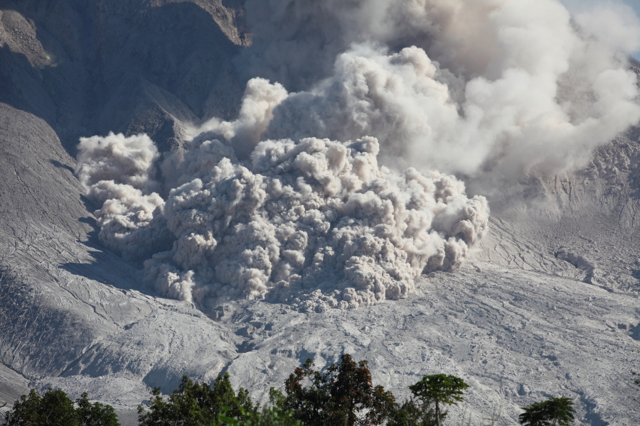
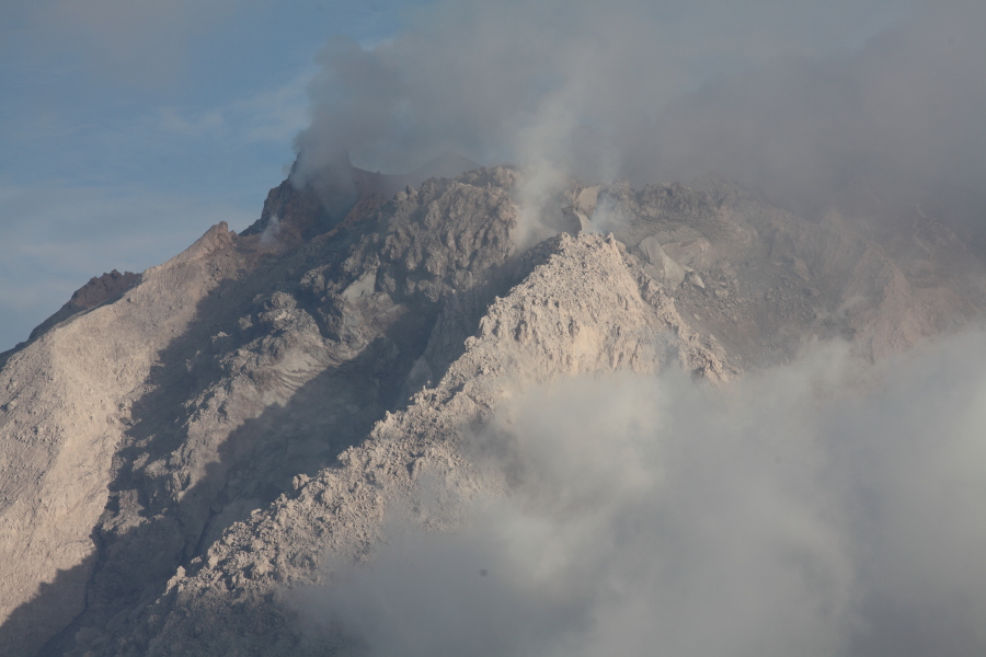
Pyroclastic flow in sunlight |
 |
 |
 |
 |
 |
|
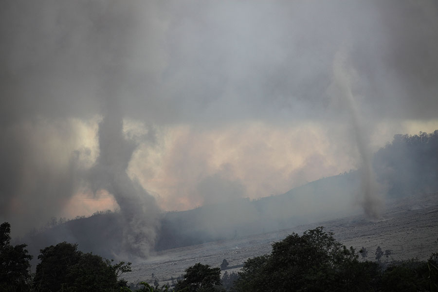
Tornadoes (Large Ash Devils) generated on hot PF deposits |
 |
 |
|
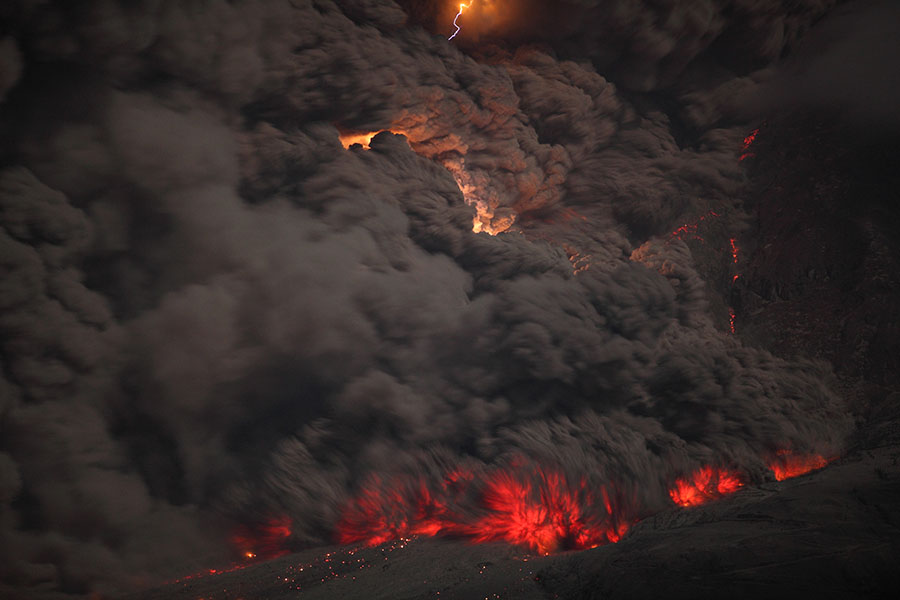
Static discharges (lightning) near PF flow front (Evening 14 Jan.) |
Lightning near PF flow front (Evening 14 Jan.) |
 |
 |
|
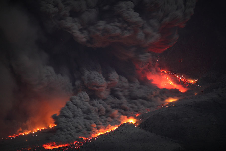
Triple-lobed pyroclastic flow (Evening 14 Jan.) |
Pyroclastic flow with triple lightning (Evening 14 Jan.) |
 |
 |
|
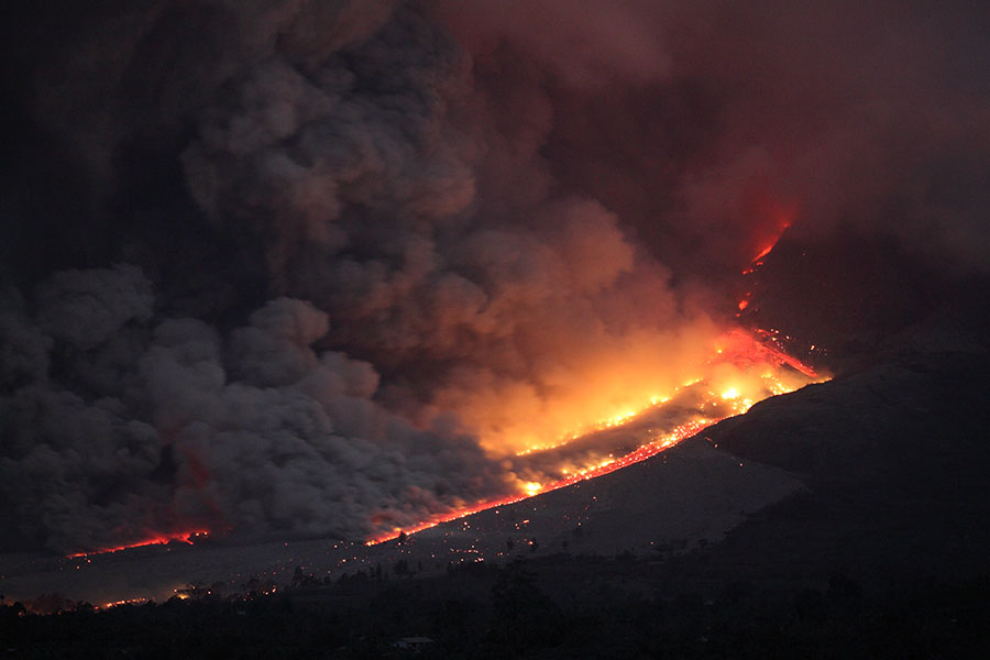
As PF clouds blow away incandescent deposit becomes visible |
Further PF approaching fresh deposits |
 |
 |
|
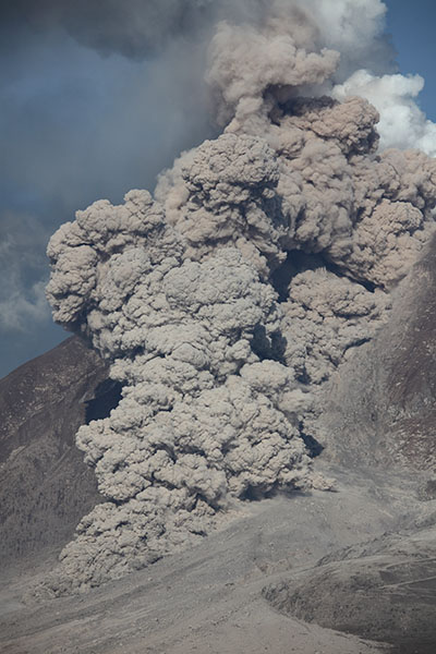
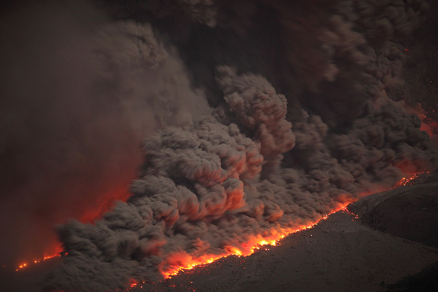
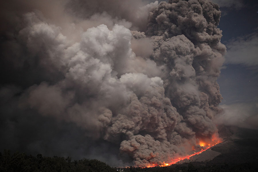
Pyroclastic Flow (Evening 14 Jan.) |
Pyroclastic flow (Evening 14 Jan.) |
 |
 |
|
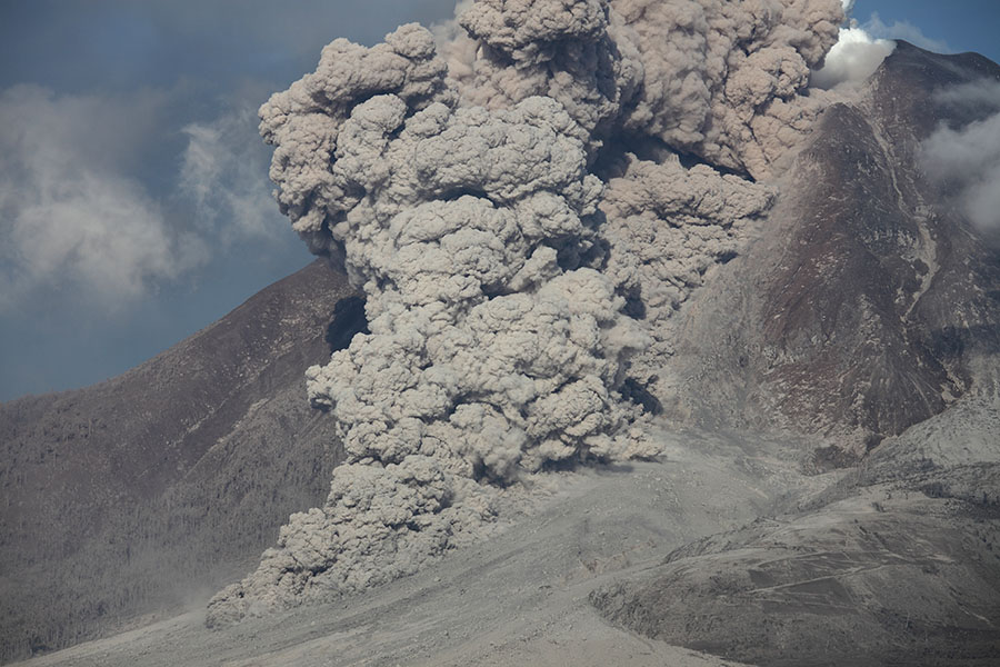
Pyroclastic flow (Evening 14 Jan.) |
Pyroclastic flow (Evening 14 Jan.) |
 |
 |
|
Wide-angle view following series of PFs |
Wide-angle view following series of PFs |
 |
 |
|
Small PF during night 13-14 Jan. |
Small PF during night 13-14 Jan. |
 |
 |
|
Small PF during night 13-14 Jan. |
Glowing lava dome during night 13-14 Jan. |
 |
 |
|
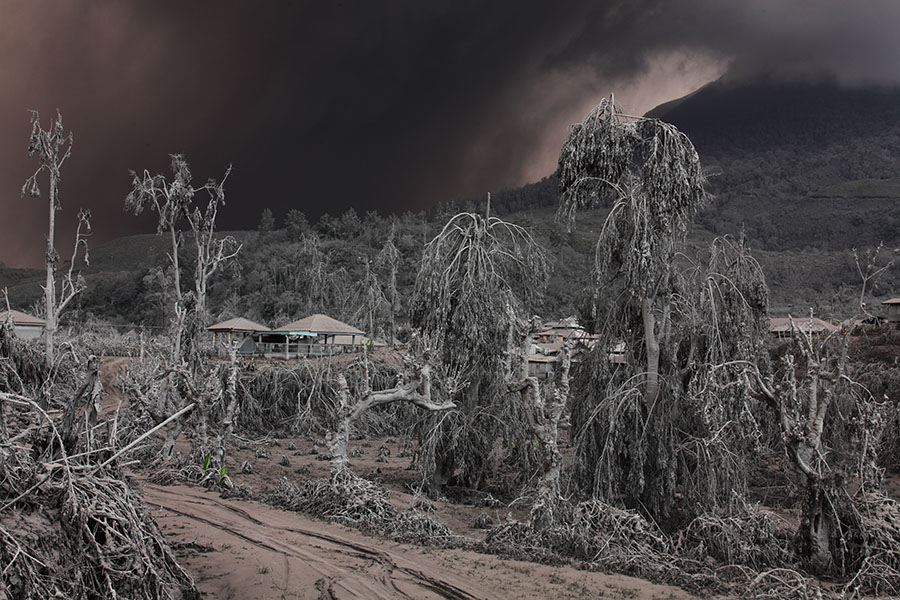
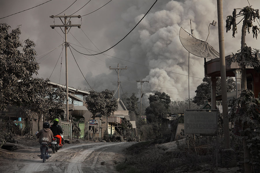
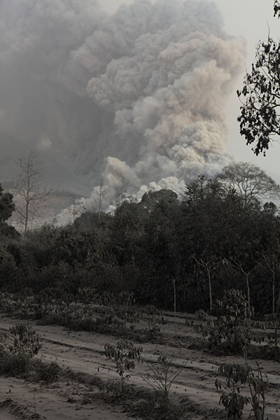
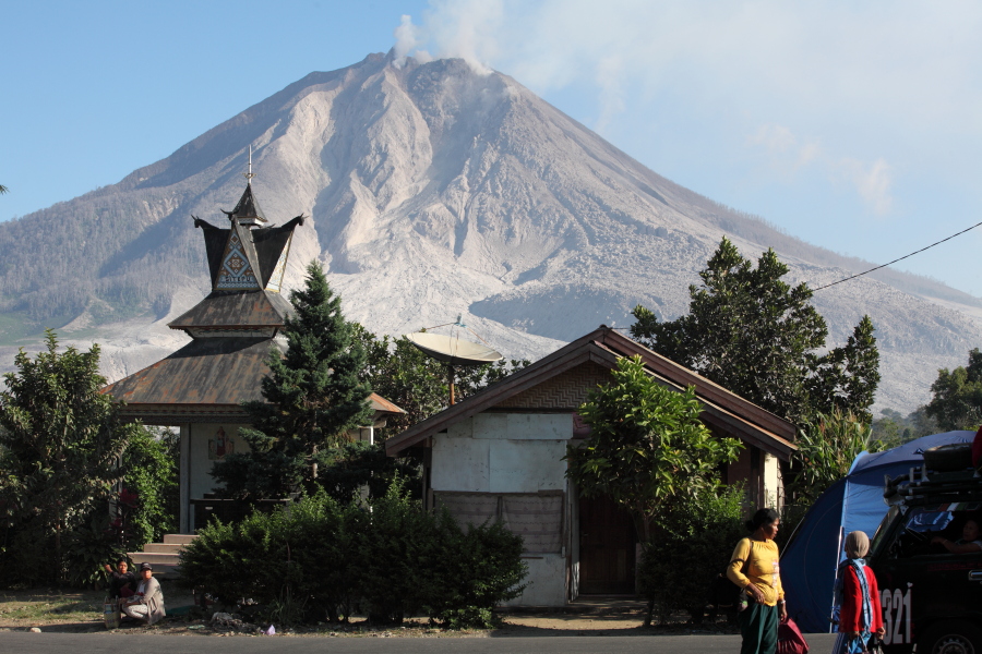
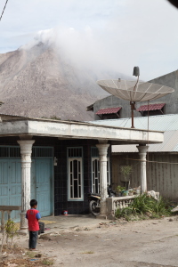
Ash cloud looming over landscape |
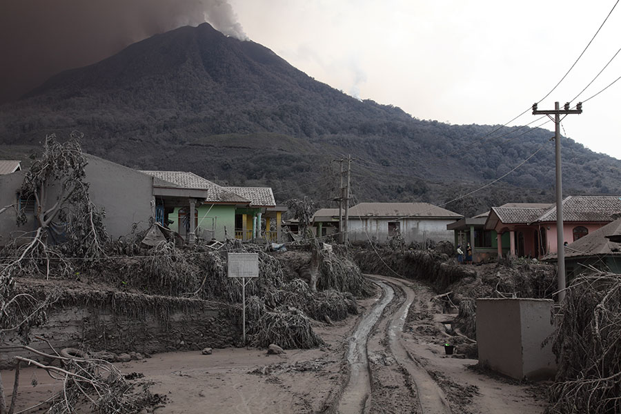
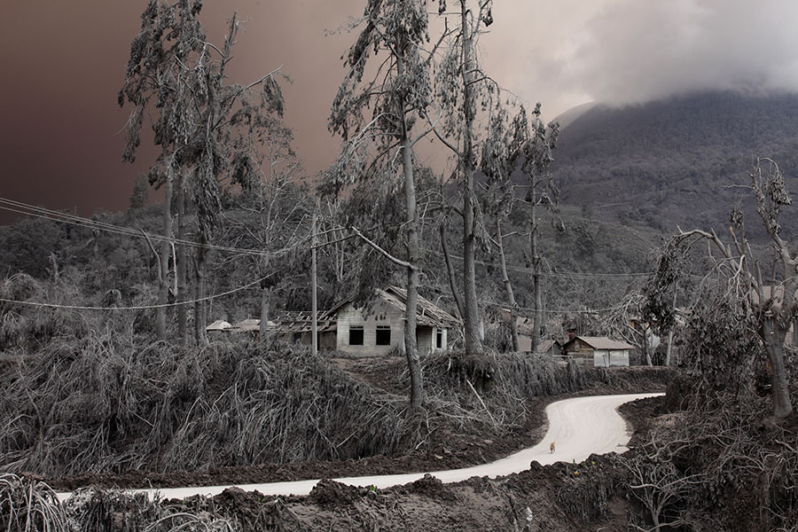
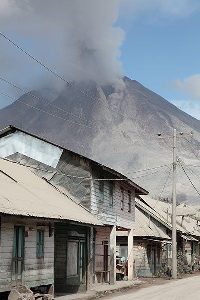
Village NE of Sinabung Volcano covered in ash |
 |
 |
 |
|
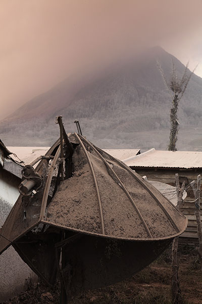
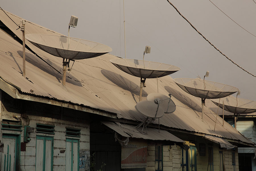
Satellite dish covered by ash and vegetation |
Volcanic ash and grey landscape |
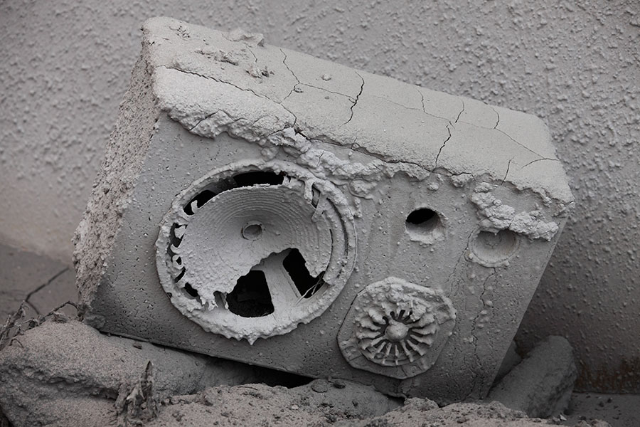
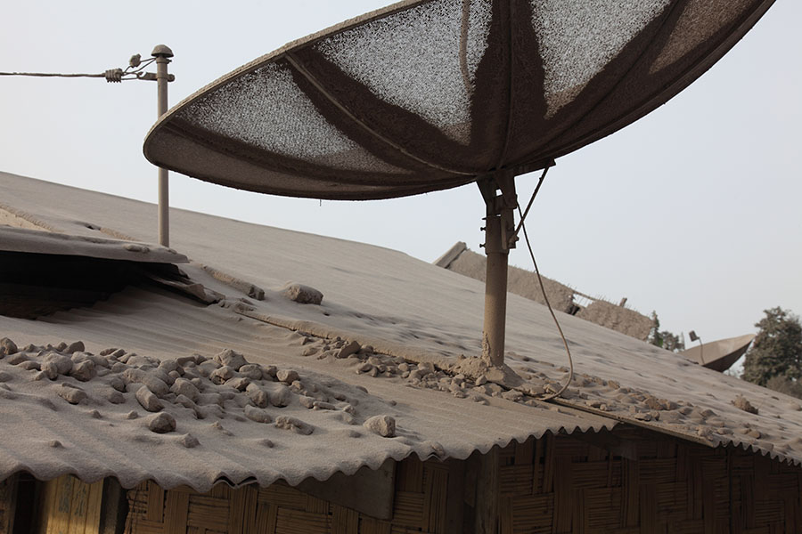
Satellite dish broken by volcanic ash load |
 |
 |
|
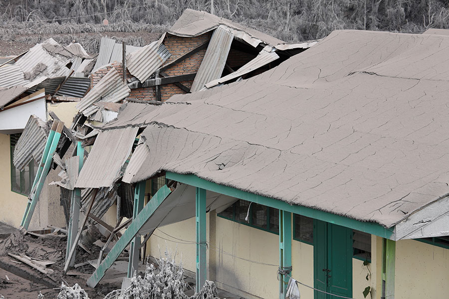
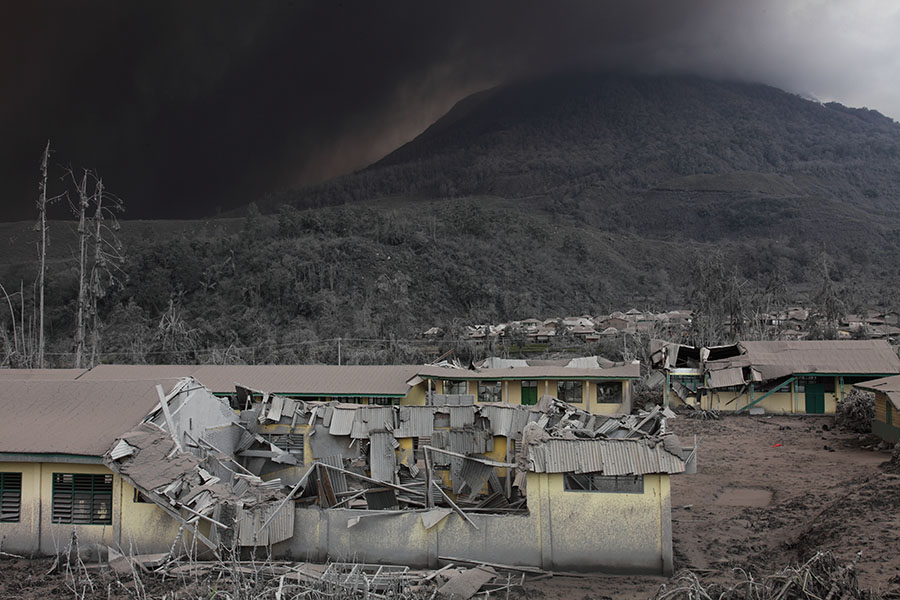
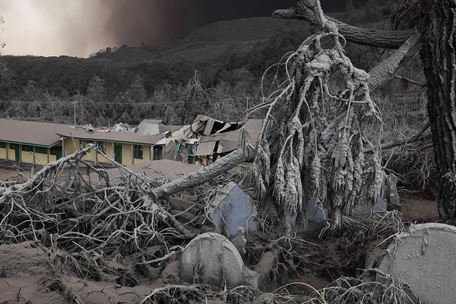
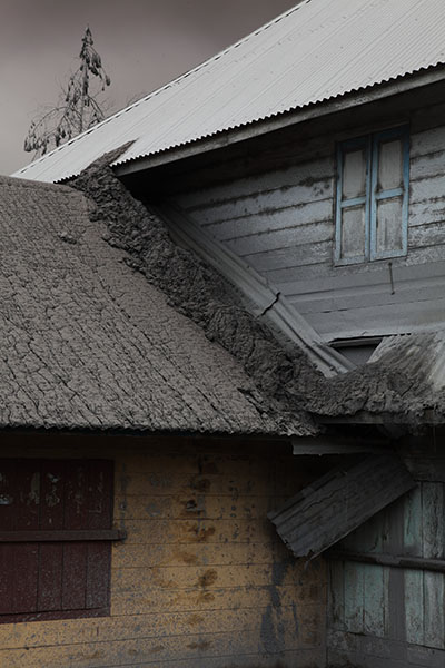
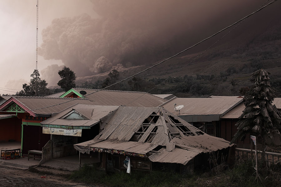
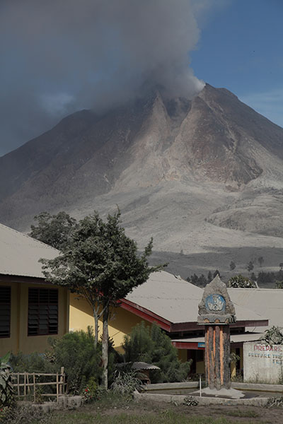
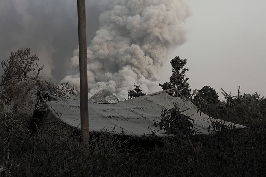
School roof collapsed by volcanic ash load |
School roof collapsed by volcanic ash load, Sinabung Volcano behind |
 |
 |
|
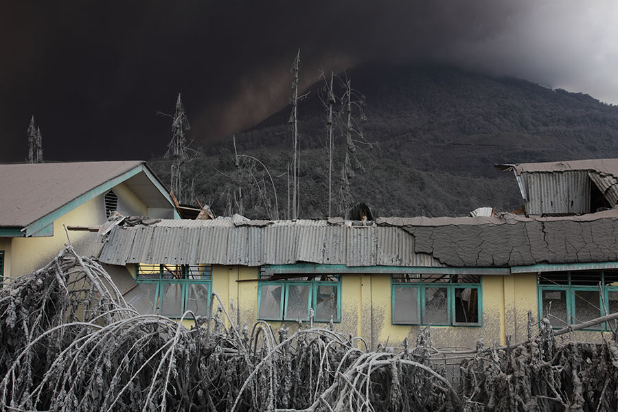
Damaged school against backdrop of heavy ash fall |
Damaged school and trees |
 |
 |
|
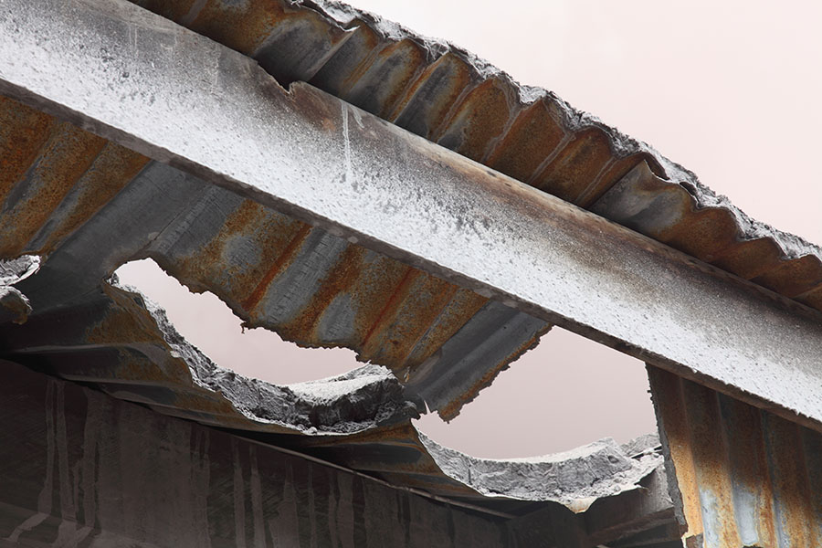
Thin corrugated roofs tear easily under weight of ash |
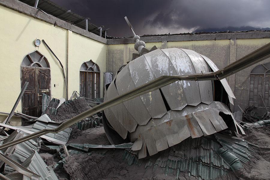
Mosque with roof collapsed under weight of ash |
 |
 |
 |
|
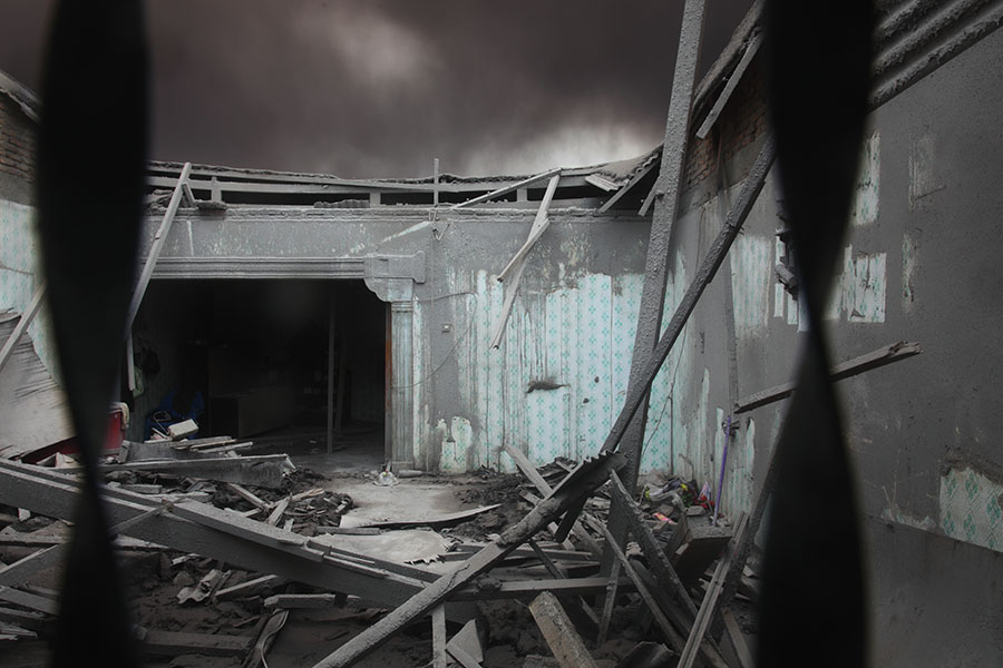
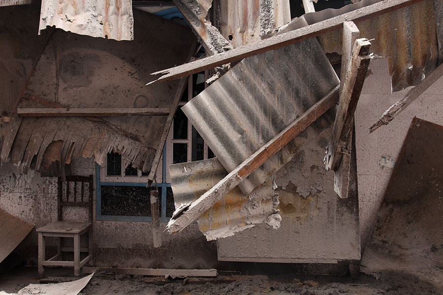
Inside of collapsed house |
Ash falls off steeper roofs |
Collapsed roof material |
 |
 |
|
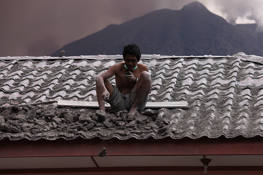
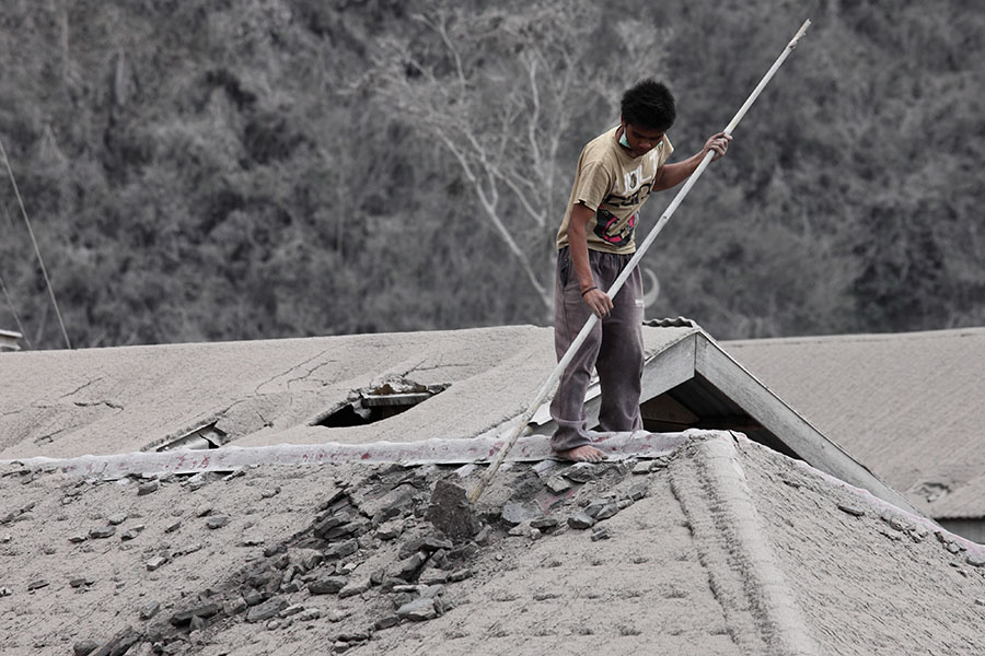
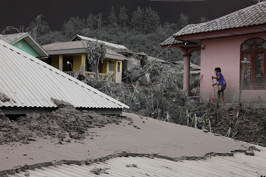
Removing ash from roof |
Removing ash from roof |
 |
 |
 |
|
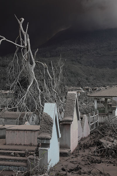
Graveyard under volcanic ash |
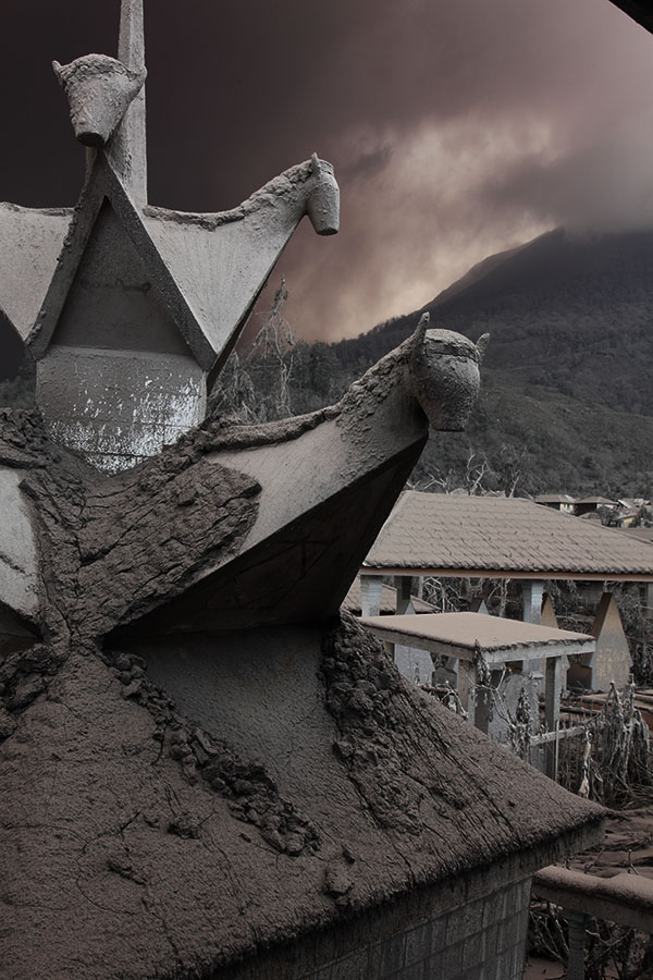
Shrine covered by volcanic ash |
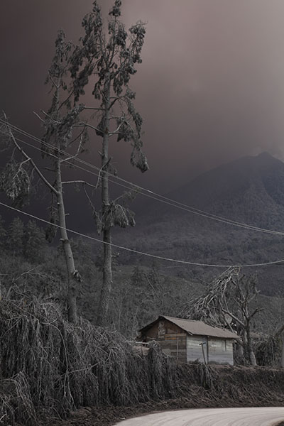
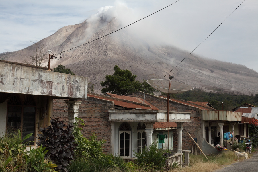
House in shadow of ashing volcano |
 |
 |
|
Layer of hardened ash on roof |
Pyroclastic flow descending behind village |
 |
 |
 |
|
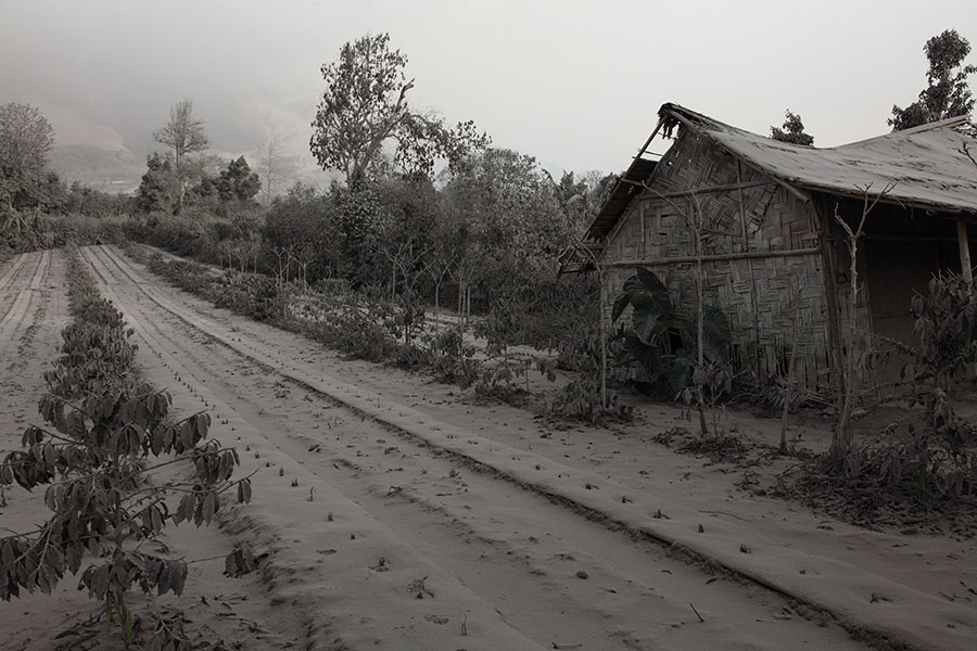
House and trees damaged by ash fall |
Cart covered by ash |
House and trees damaged by ash fall |
 |
 |
|
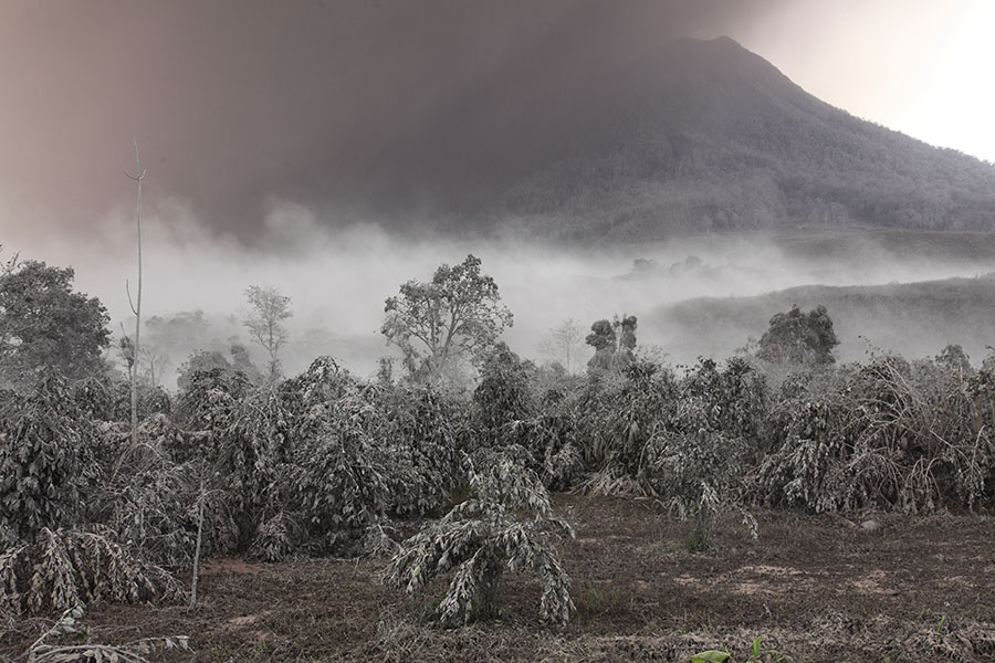
Plantation in ash at foot of Sinabung |
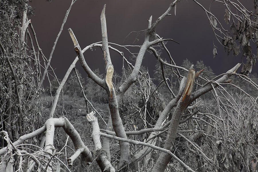
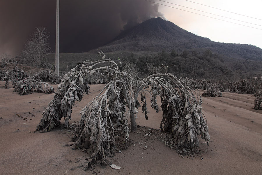
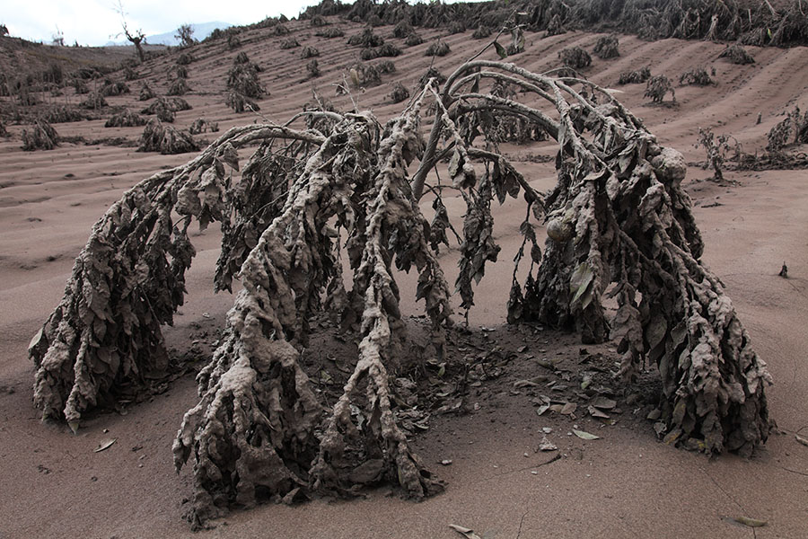
Tree with snapped branches due to weight of ash |
 |
 |
 |
|
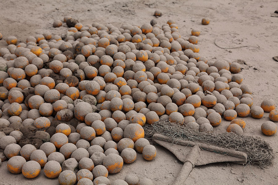
Papaya, Orange plants coated in ash |
Lettuce coated in ash |
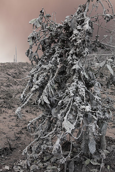
Coffee plant bent by ash |
 |
 |
 |
|
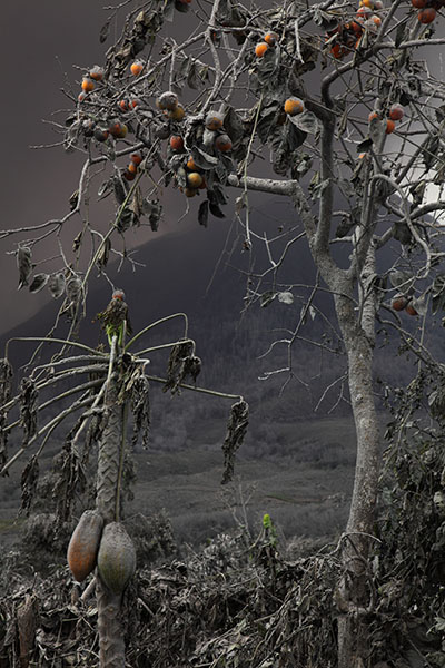
Young orange tree bent by ash |
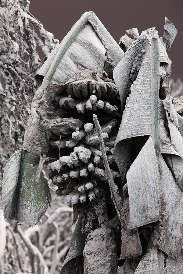
Banana tree |
Young orange tree bent by ash |
 |
 |
 |
|
Ash falls and is remobilized by wind |
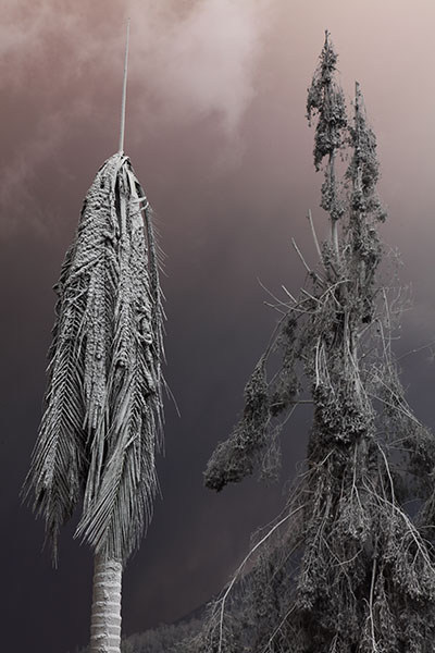
Palm tree folded by ash |
Frog killed by ash fall |
 |
 |
|
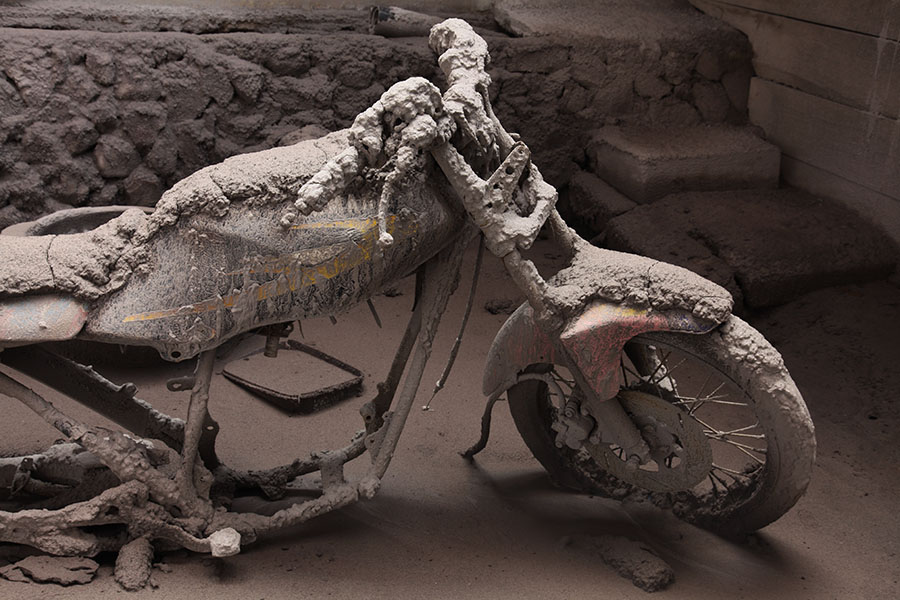
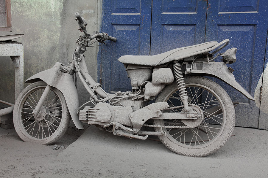
Motorbike in ash |
Loudspeaker in ash |
 |
 |
 |
|
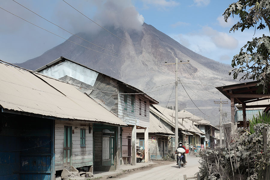
Village SE of Sinabung Volcano |
 |
|
Locals in evacuation zone are not bothered by PF in background |
 |
 |
|
Satellite dishes with light smothering of ash |
Pumice on roof (strange that only seen at one location but local insisted it came from eruption) |
 |
 |
|
BMX bike with ash "icing" stuck in ash layer |
Ash-coated motorbike |
 |
 |
|
Ash-coated BMX bike, detail. Ash was virtually impossible to detach from chain. |
Front wheel of ash-coated BMX bike |
 |
 |
 |
|
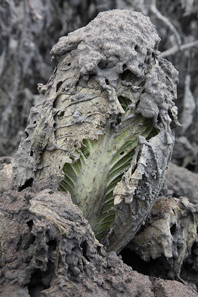
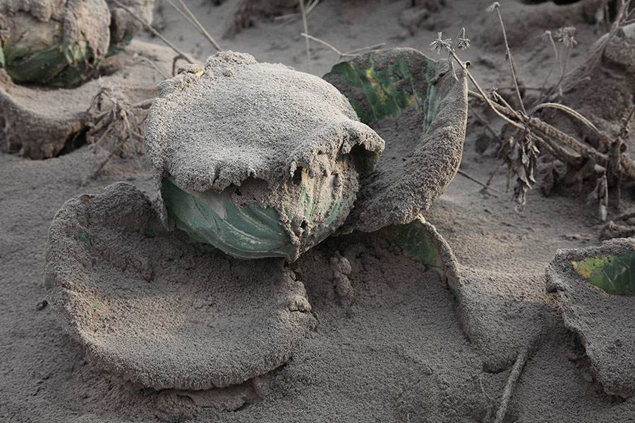
Cabbage coated in ash |
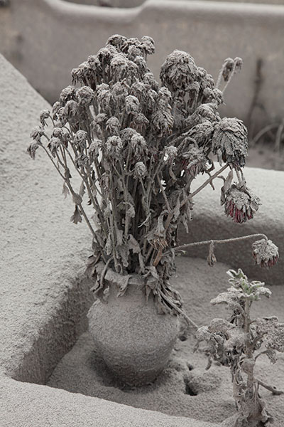
Flowers on grave coated in ash |
Crops from around volcano are unpopular |
 |
 |
|
Abandoned field coated in ash |
Farmers hut with PF behind |
 |
 |
 |
|
Ash-smothered field |
Ash-smothered field |
Field slightly further from volcano |
 |
 |
|
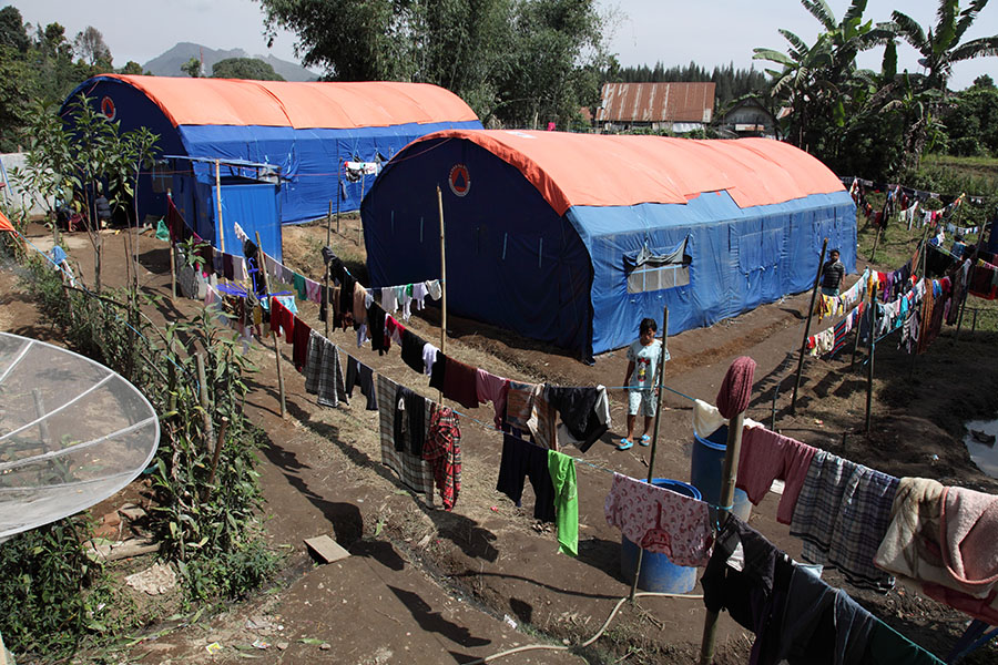
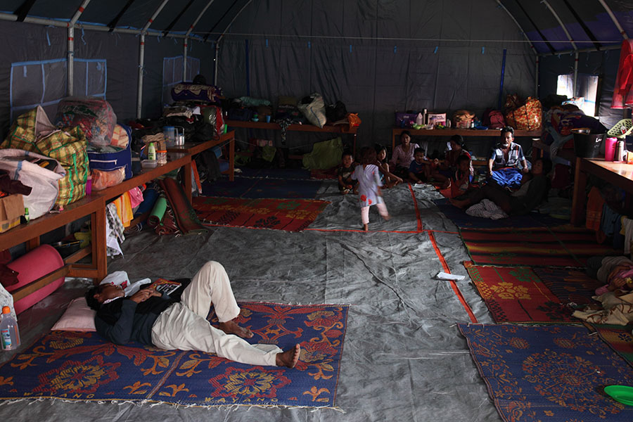
One of evacuation centers in Berestagi |
Inside tent which is now home for many people |
 |
 |
 |
|
Communal kitchen |
Supplies |
Administration office |
 |
 |
|
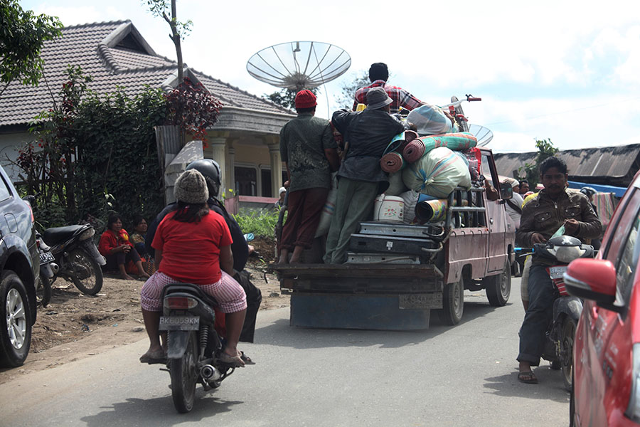
Recovering belongings from evacuation zone |
Human activity deep in evacuation zone continues |
 |
 |
 |
|
View from SE (Kuta Tengah) |
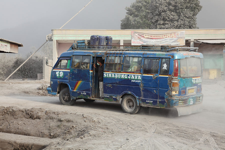
Road Block as approach Kuta Tengah |
View from SE (Kuta Tengah) |
 |
 |
 |
|
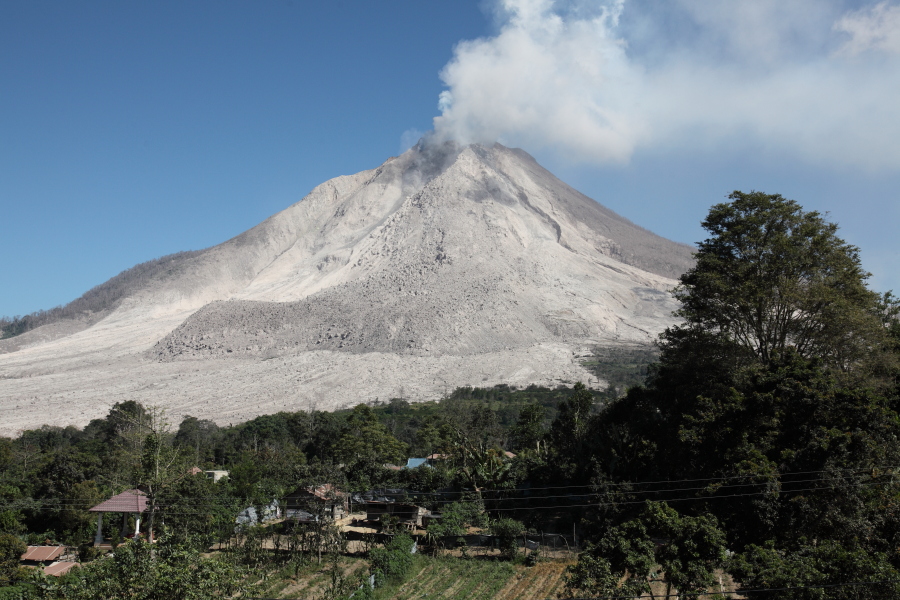
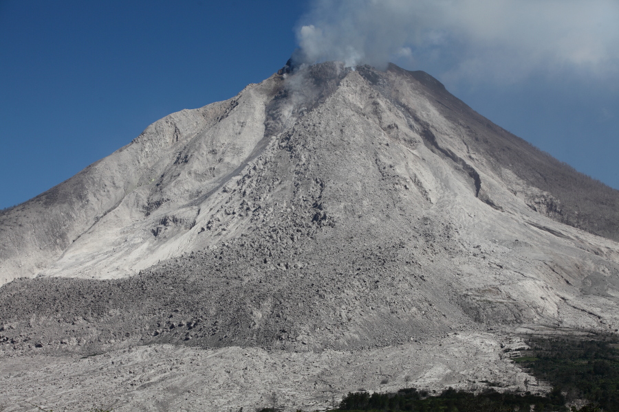
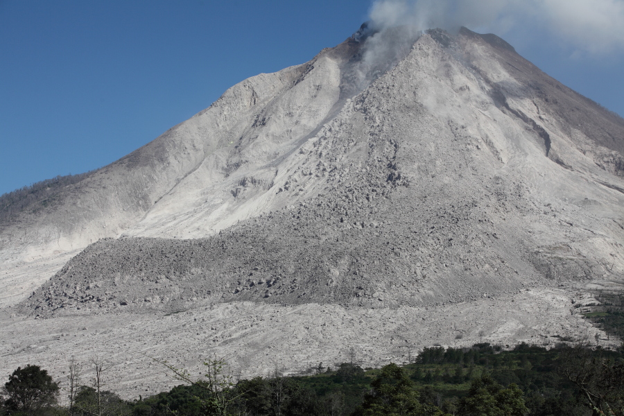
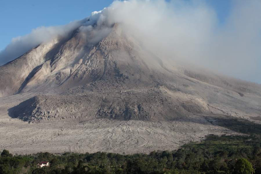
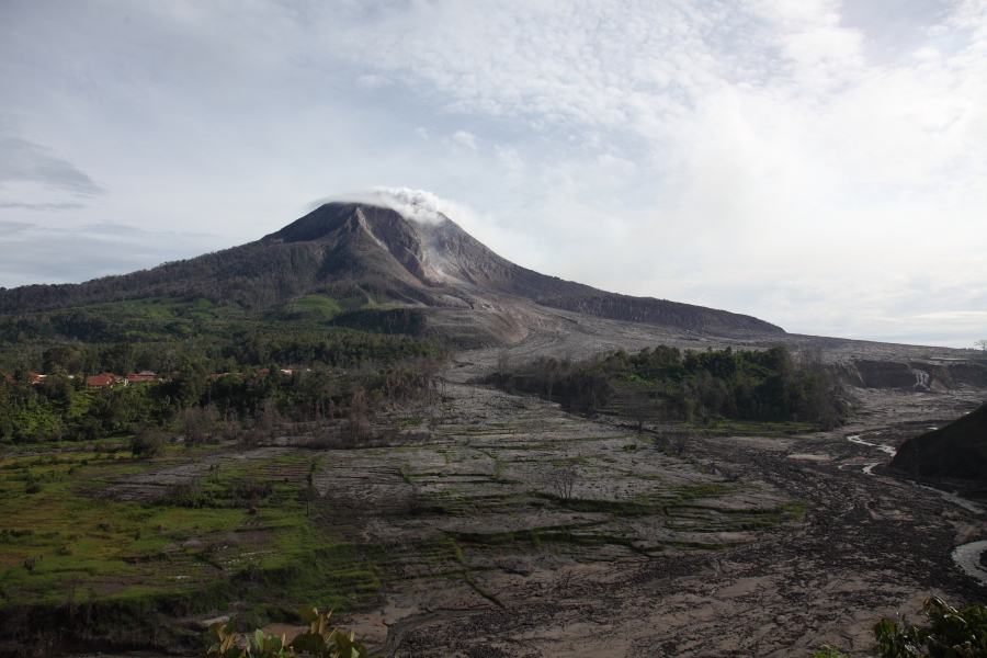
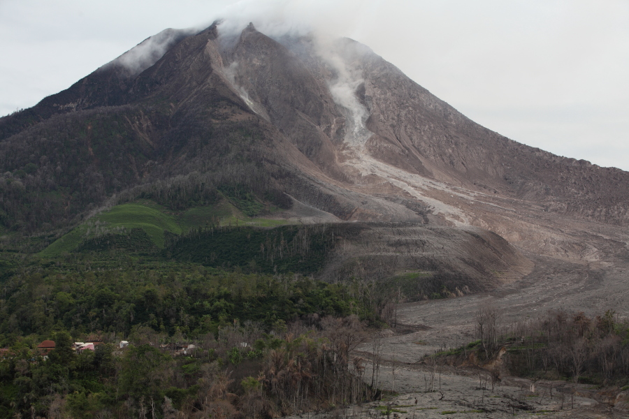
SE View. Note large andesite lava flow deposit |
Summit area |
Front of large andesite flow |
 |
 |
 |
|
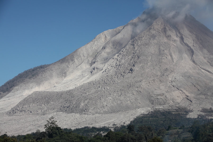
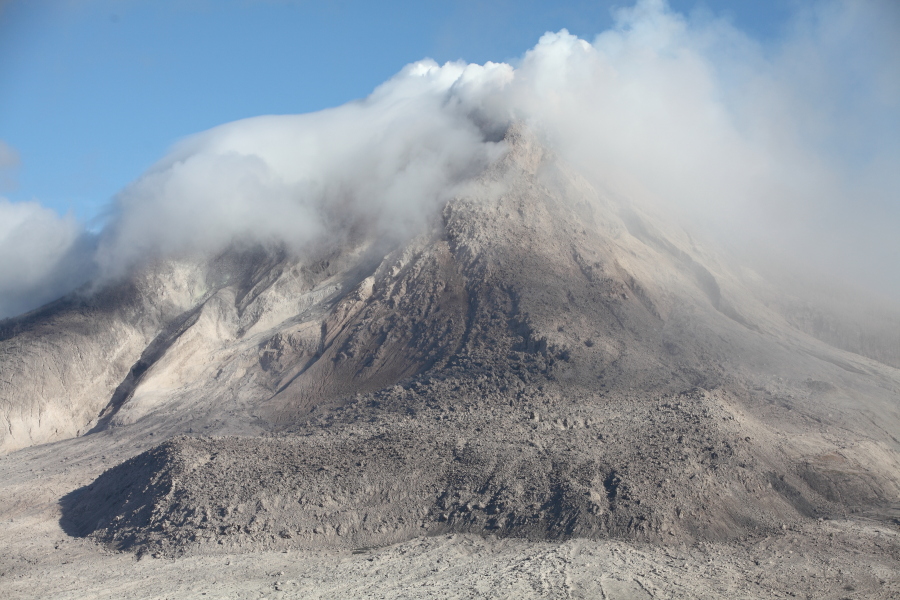
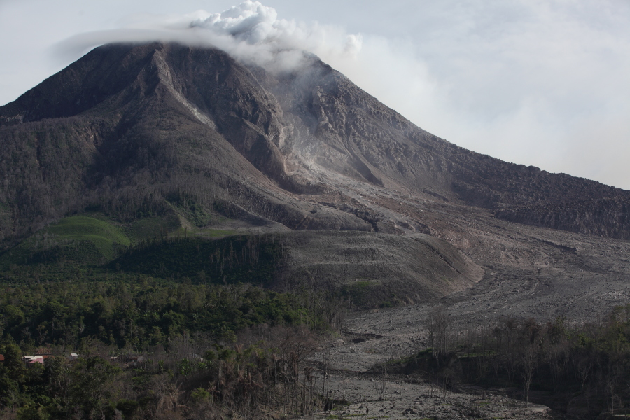
View from SE |
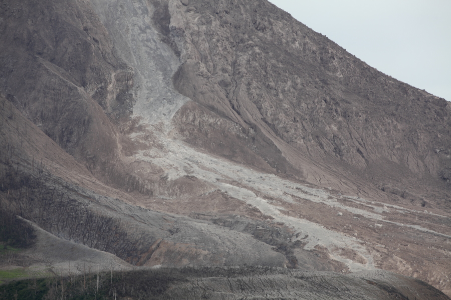
Andesit flow, active dome at top |
View from SE |
 |
 |
|
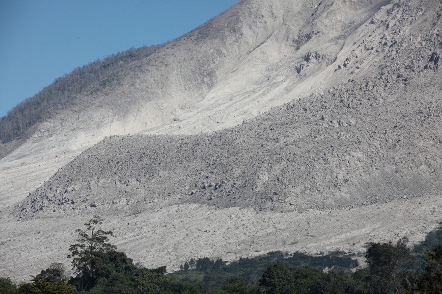
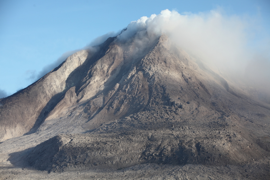
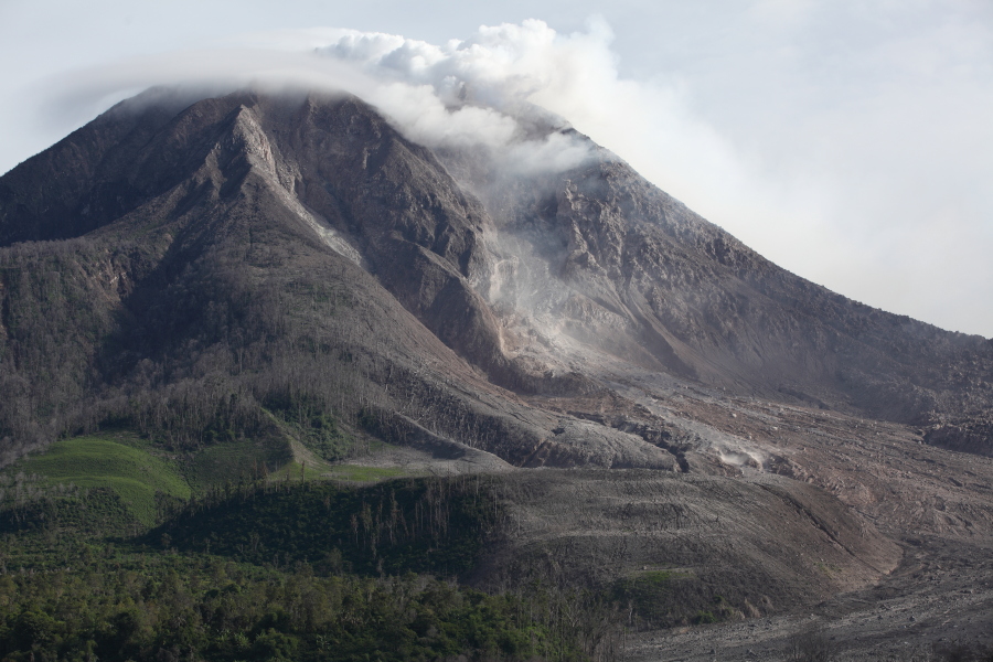
View from ESE |
View from ESE of andesite lava flow |
 |
 |
 |
|
Approaching Sinabung from SSE |
Roadblock SSE of Sinabung |
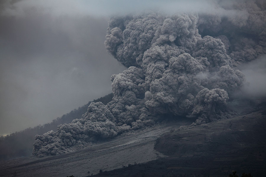
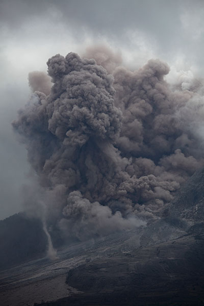
Small pyroclastic flow |
 |
 |
 |
|
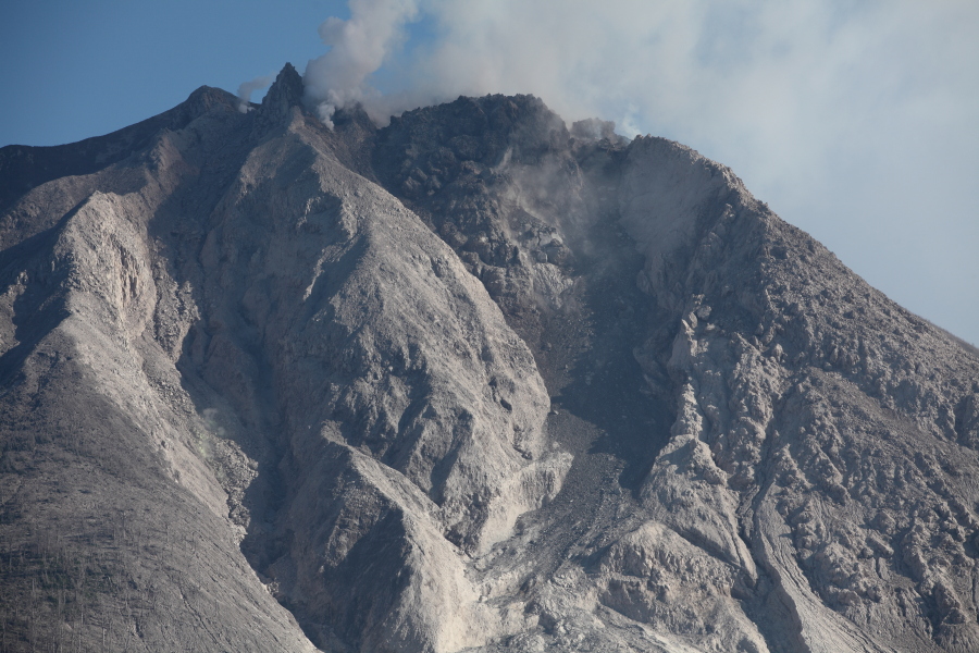
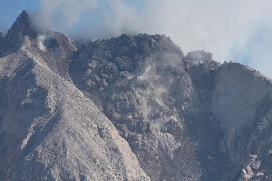
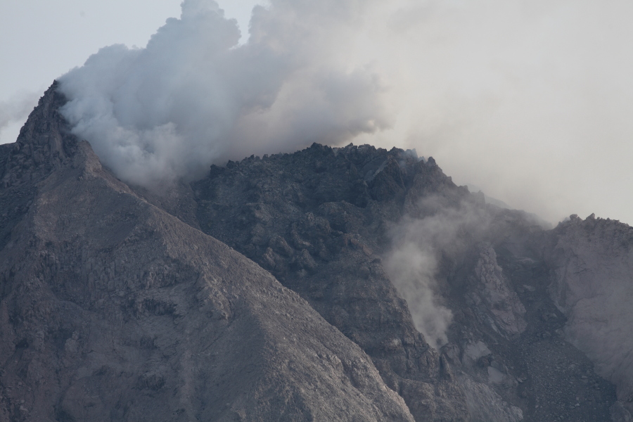
Dome nesting on top of summit crater |
 |
 |
 |
|
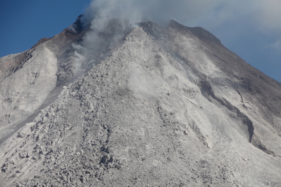
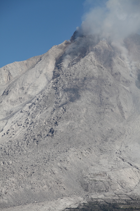
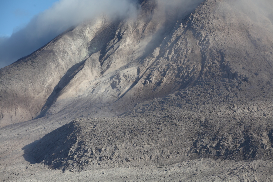
Summit structure |
Close-up of andesitic lava dome |
Close-up taken on later date (note: small right-hand lobe is gone) |
 |
 |
|
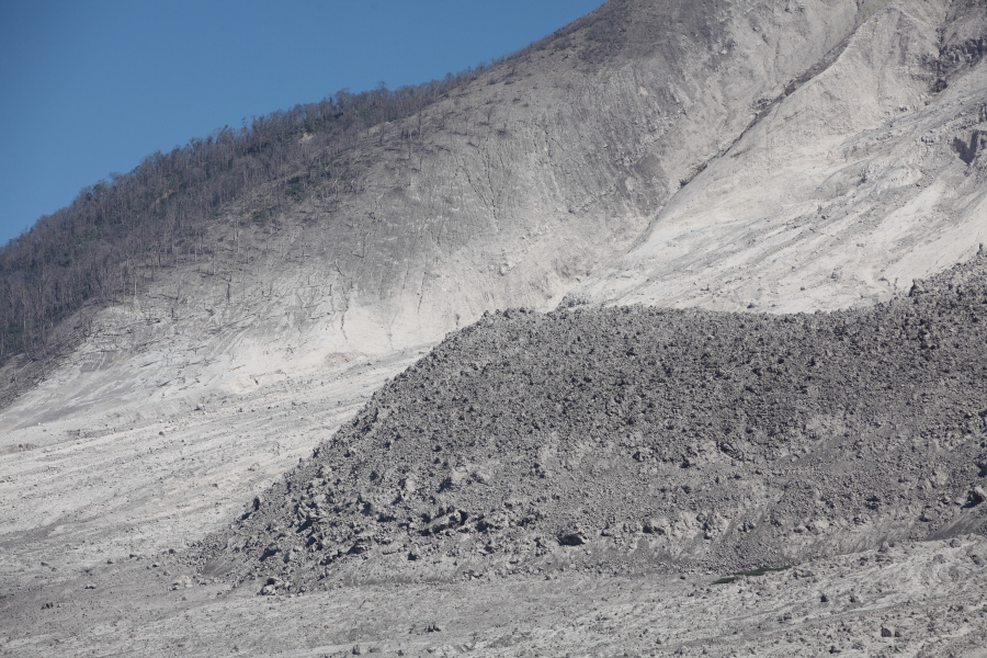
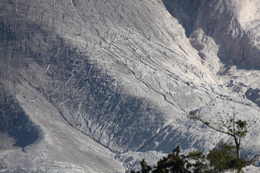
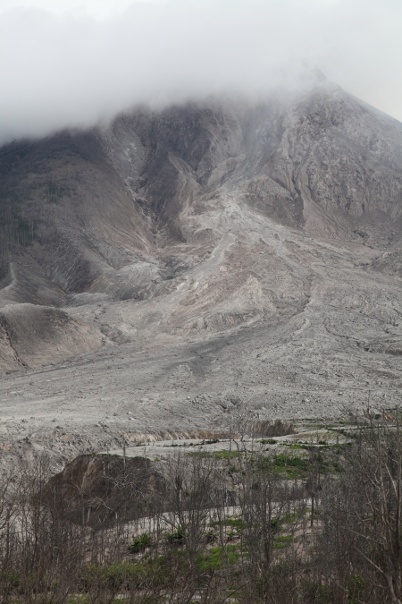
View from SSE of forest flattened by pyroclastic flows |
View of main flow field from SE (flattened trees at top image) |
 |
 |
 |
|
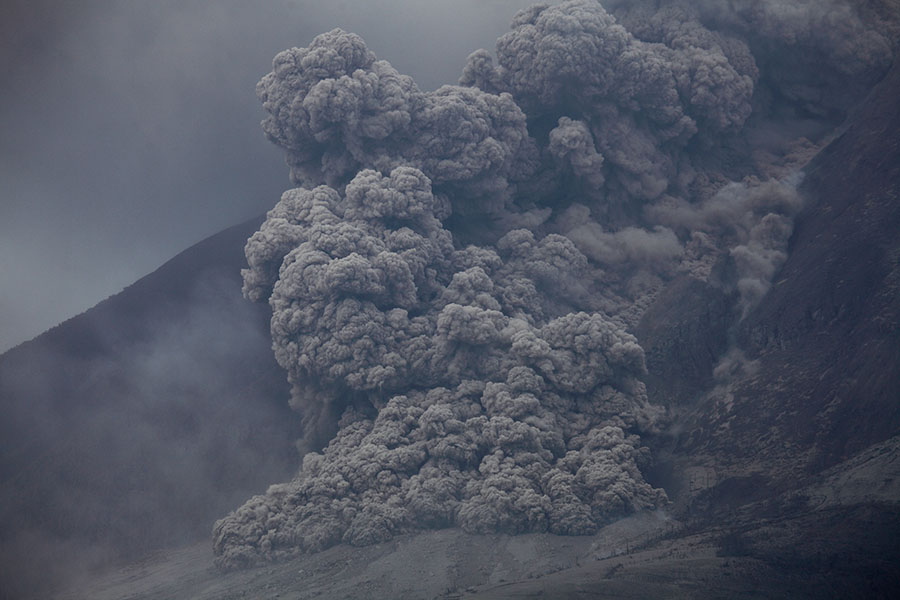
Small dome collapse generated pyroclastic flow |
 |
 |
 |
|
View from SE (about 7km distance) |
 |
 |
 |
|
View from SE (about 7km distance) |
 |
 |
|
Further checkpoint as proceeding from SE to SSE viewpoints |
View from location on left image |
 |
 |
|
Checkpoint south of Sinabung |
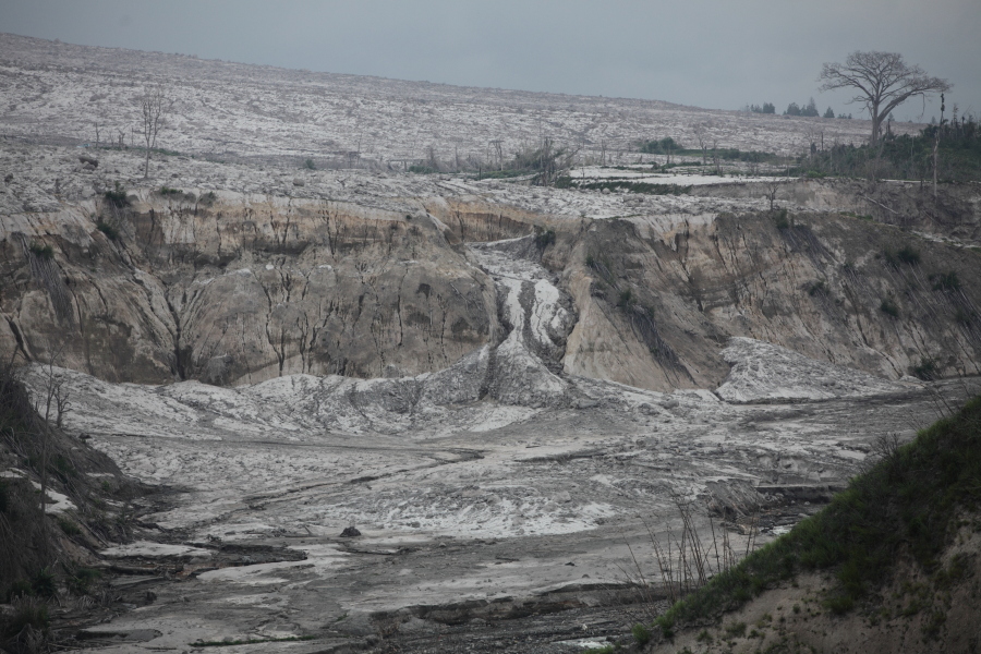
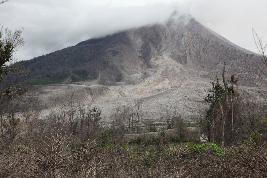
View over PF / Lahar flow field |
 |
 |
 |
|
River bed shaped by lahars flowing off PF flow field |
Structure damaged by lahars |
Structure damaged by lahars |
 |
 |
 |
|
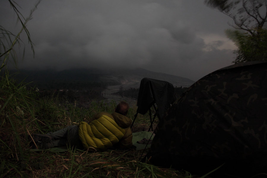
Nighttime observation from elevated SSE viewpoint |
SSE overview |
SSE overview |
 |
 |
 |
|
SSE overview, evacuated village to bottom left |
Lighter deposits from recent pyroclastic flow |
Lenticular cloud forming on summit |
 |
 |
 |
|
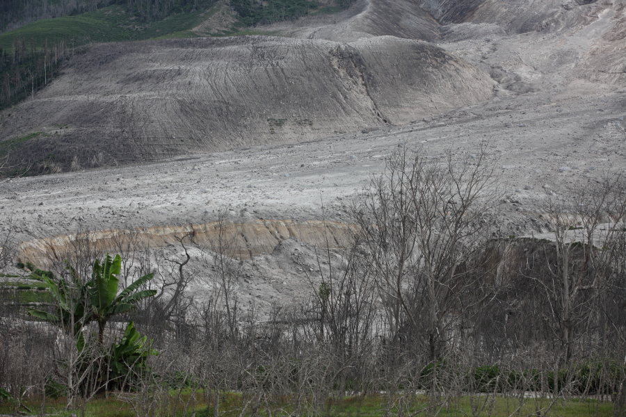
Detail of flow field looking NW |
Detail of flow field looking NNW |
View from main road SE of Sinabung |
 |
 |
 |
|
Location of fatal 01. Febr. 2014 pyroclastic surge. The flow followed its usual path turning left (left image), but a surge spilled outwards as it turned and reached nearby road. |
||
 |
 |
|
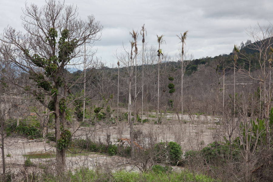
Vegetation still shows signs of damage more than 1 year later |
Flow bed seen through damage vegetation |
 |
 |
 |
|
Villages in exclusion zone (theoretically evacuated) |
 |
 |
 |
|
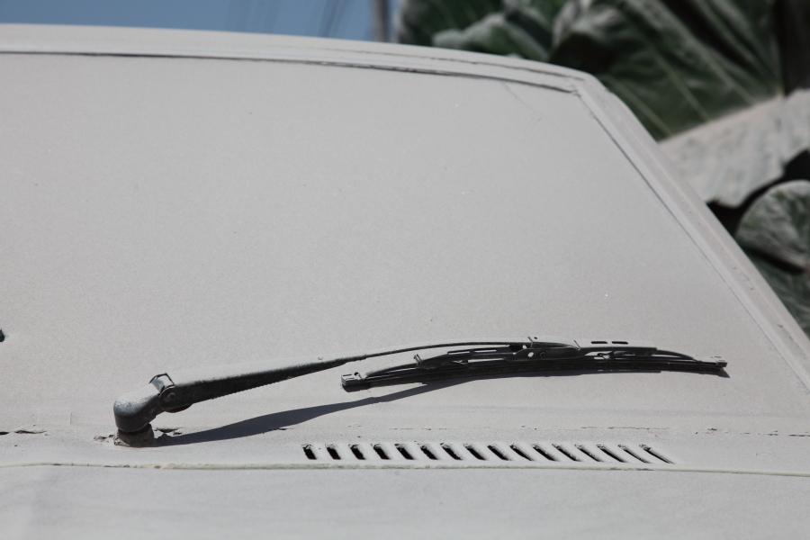
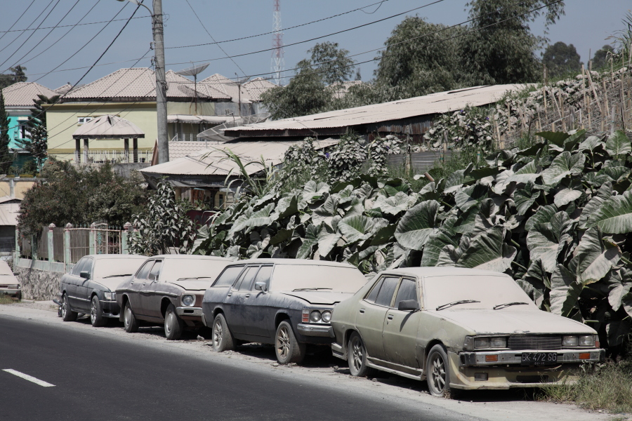
Ash on cars in Berestagi |
 |
 |
|
Main viewing hill with temporary visitor infrastructure |
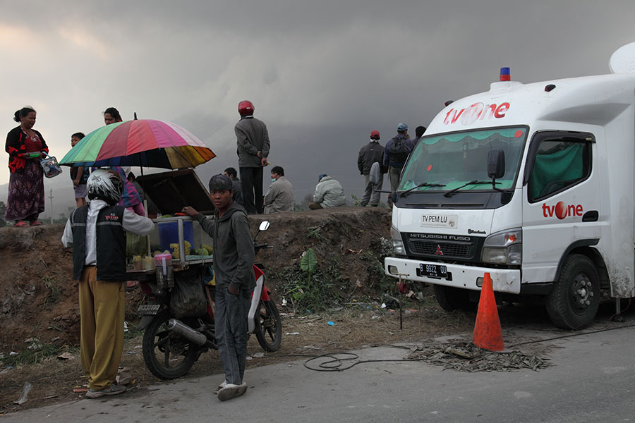
TV crew at one of Viewpoints |
 |
 |
 |
|
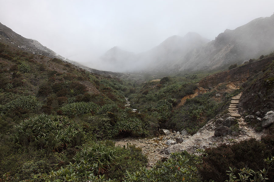
Approaching Sibayak crater |
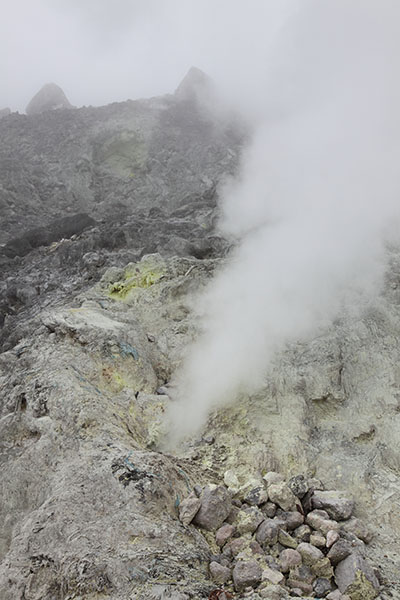
Roaring gas vent |
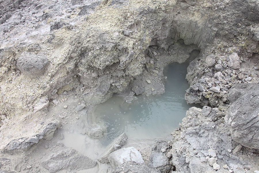
Bubbling pool |
 |
 |
 |
|
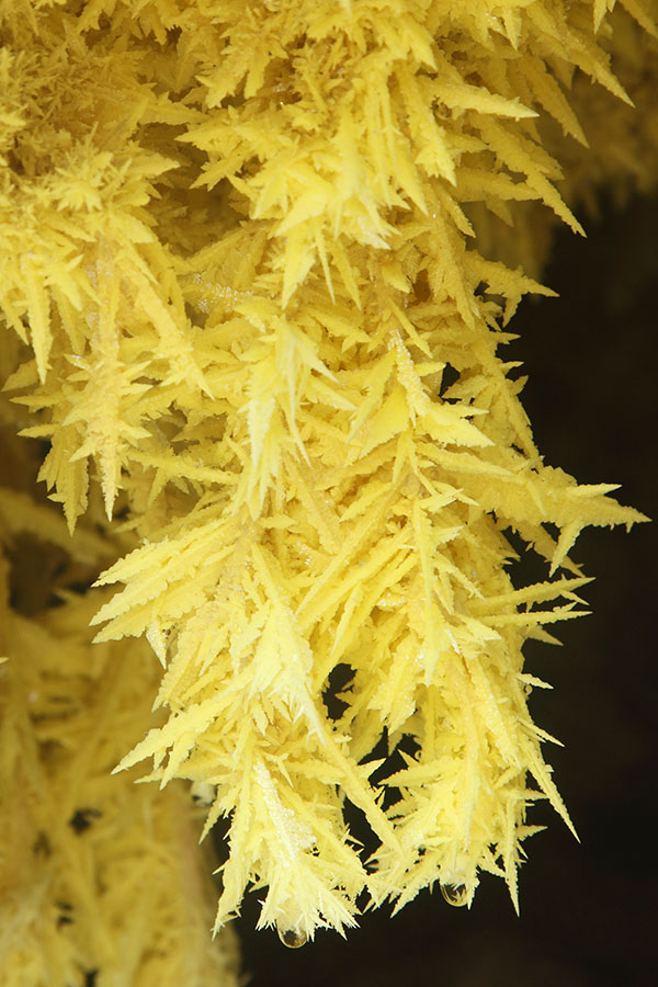
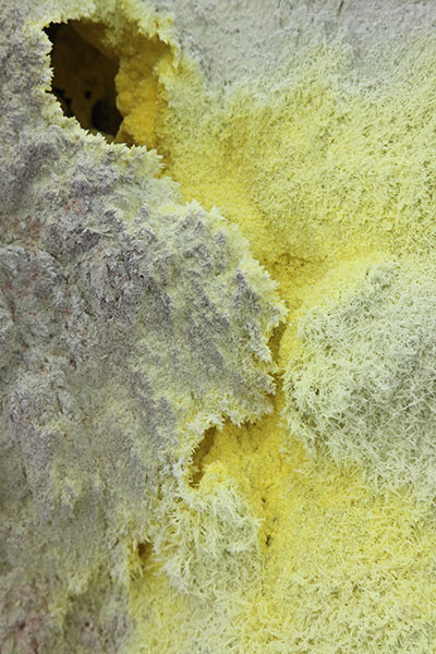
Crystalline Sulfur Deposits in Sibayak |
 |
 |
 |
|
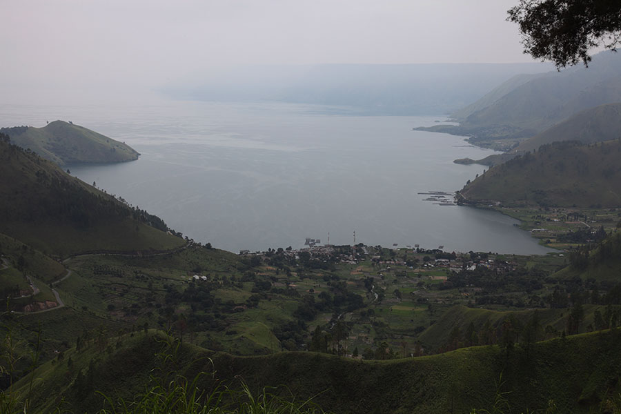
Lake Toba, North end |
Waterfall feeding into Lake Toba |
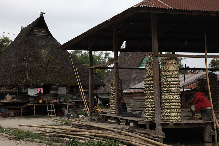
Traditional Village near Lake Toba |
 |
 |
|
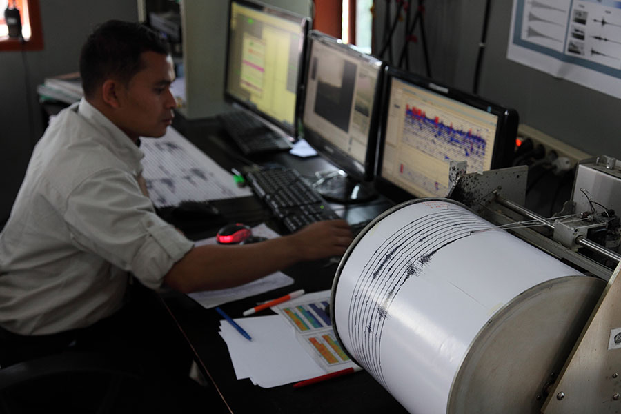
Monitoring the seismic data in Observatory |
Thermal imaging of Sinabung |
 |
 |
|
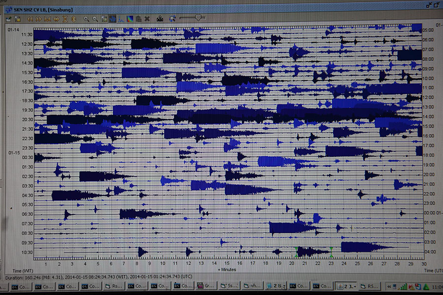
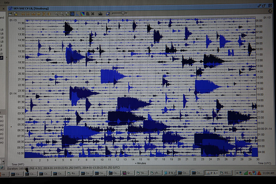
Digital seismic readout |
Digital seismic readout |