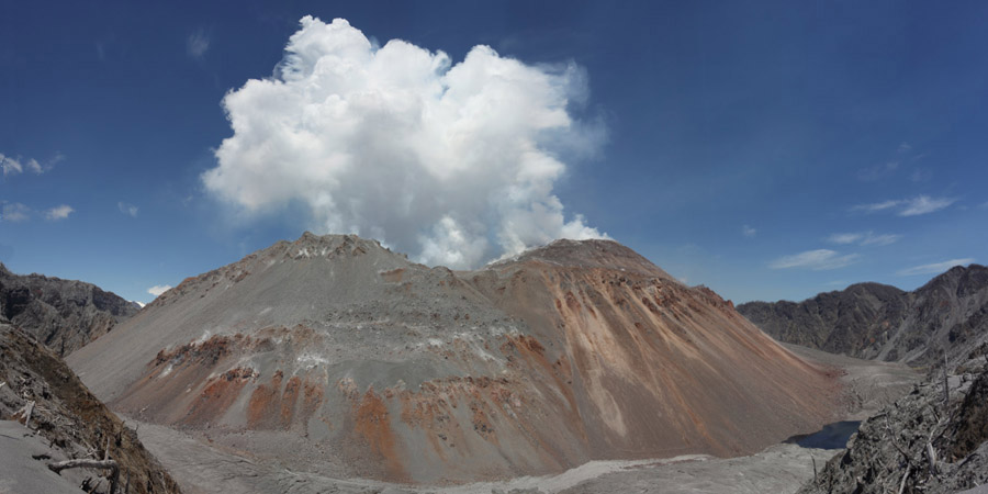
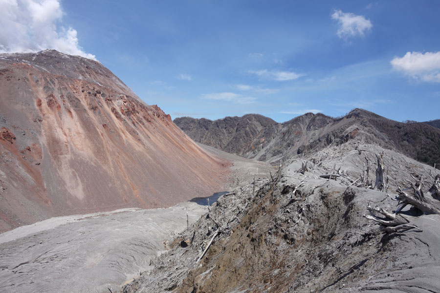
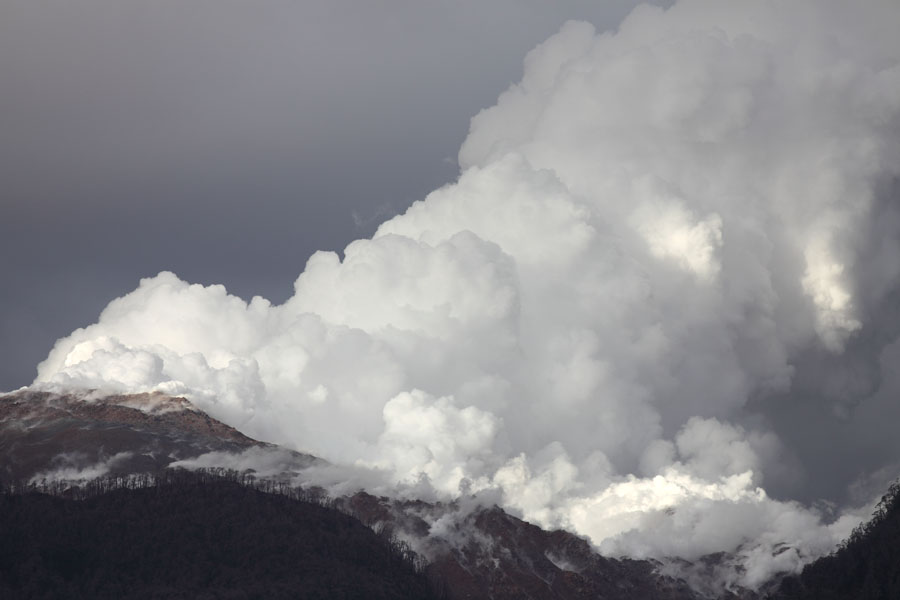
Chaiten Lava Dome viewed from North Caldera Rim on 6. Dec. 2009 (Stitched Panorama Image). Dome was in phase of degassing and low level extrusion.
|
|
Chaiten Lava Dome viewed from North Caldera Rim on 6. Dec. 2009 (Stitched Panorama Image). Dome was in phase of degassing and low level extrusion. |
 |
 |
 |
|
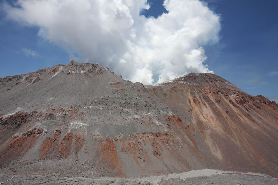
Overview |
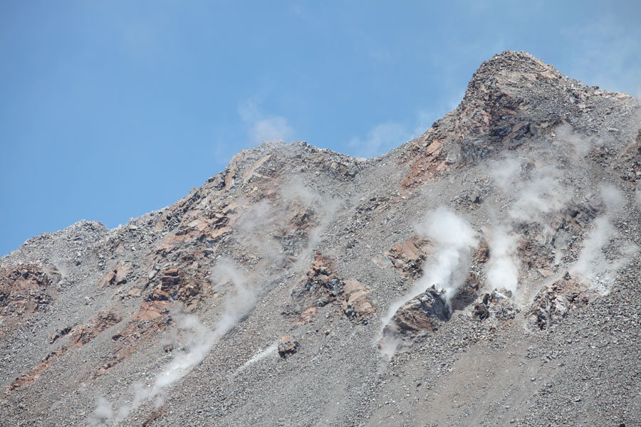
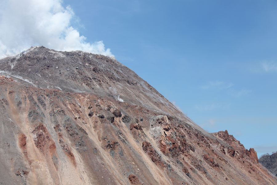
NW flank of dome |
Overview |
 |
 |
|
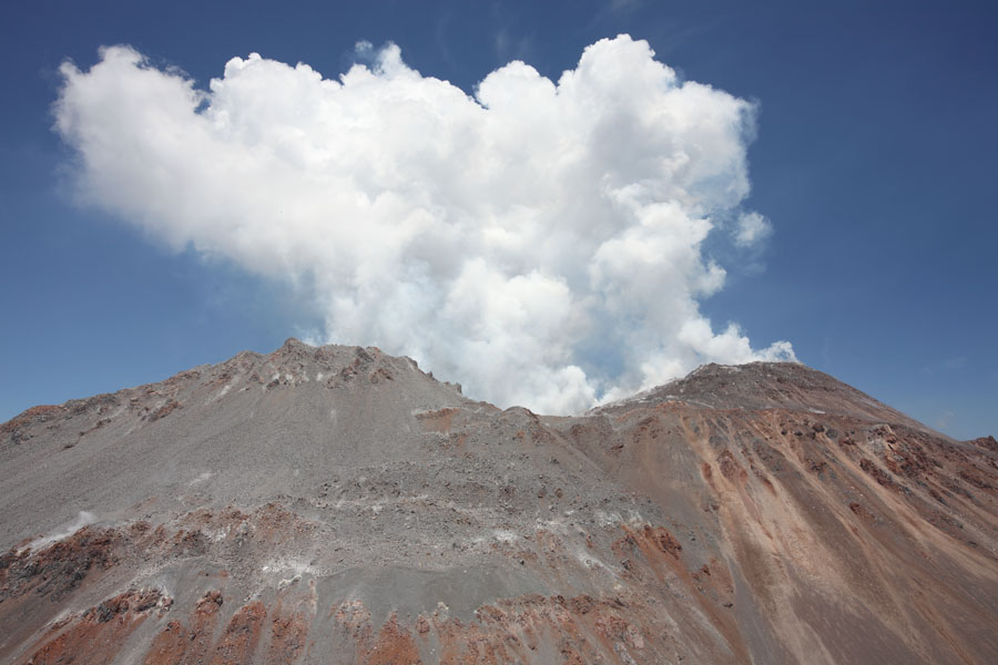
NE summit of dome |
NE summit of dome |
 |
 |
 |
|
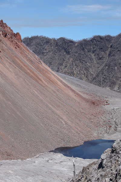
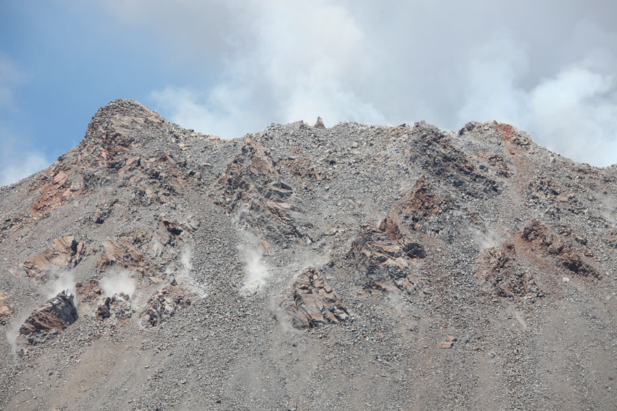
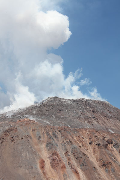
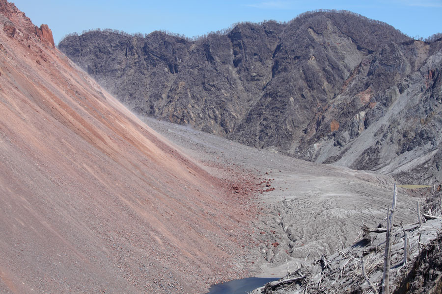
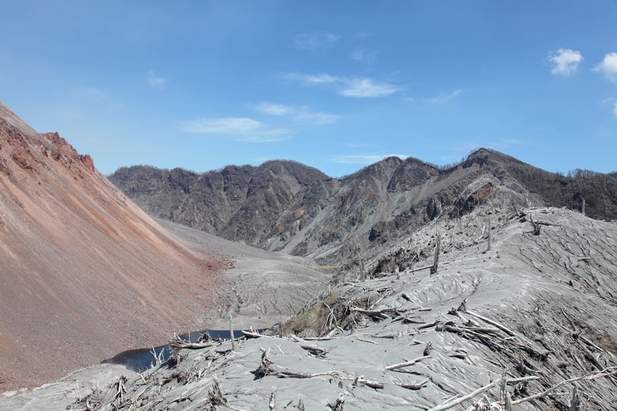
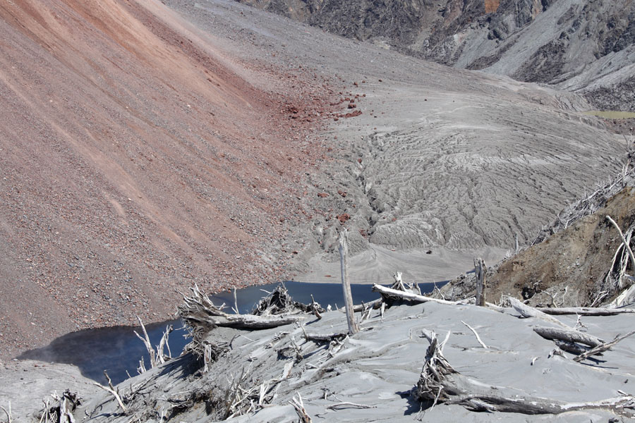
NW part of caldera / dome |
 |
 |
 |
|
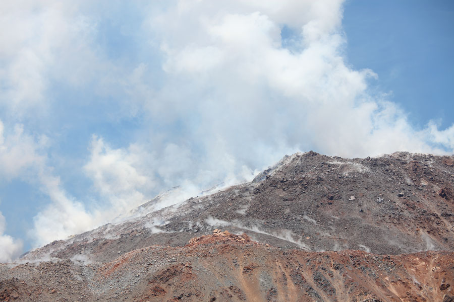
NW summit of dome (audibly extruding during visit) |
 |
 |
|
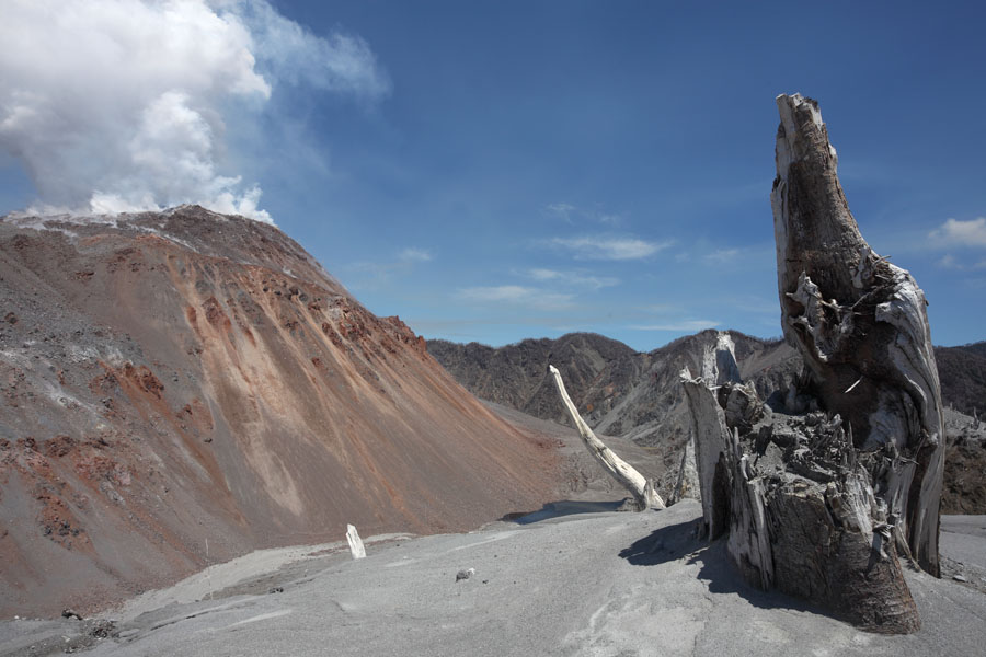
Remains of extrusions |
Remains of extrusions |
 |
 |
 |
|
Remains of extrusions |
 |
 |
|
Dome, damaged vegetation on caldera rim. |
Dome, damaged vegetation on caldera rim. |
 |
 |
|
Dome, damaged vegetation on caldera rim. |
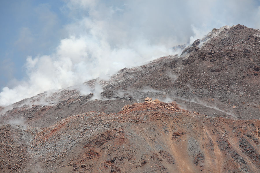
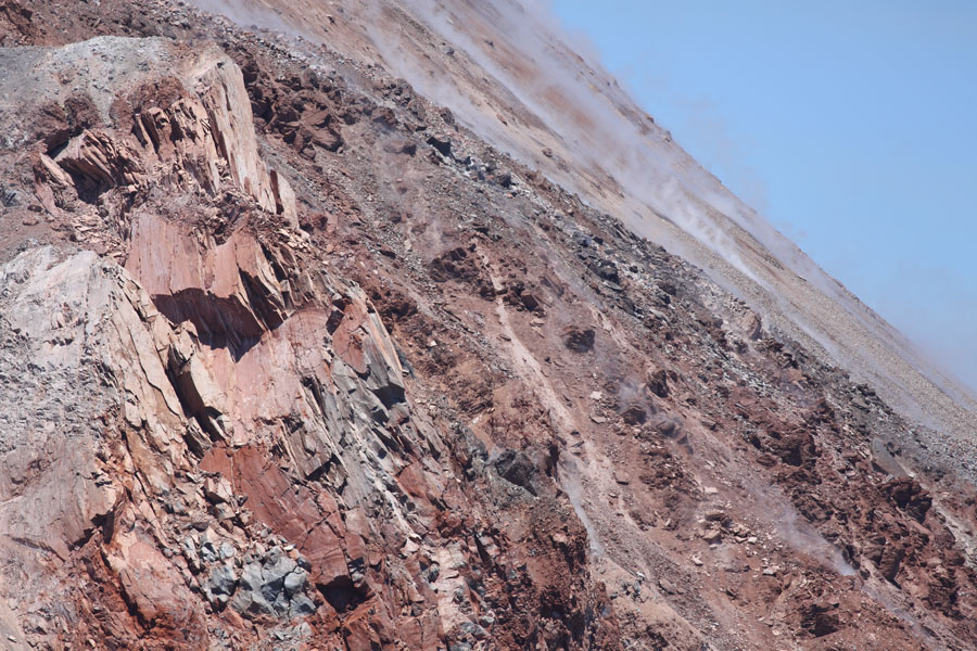
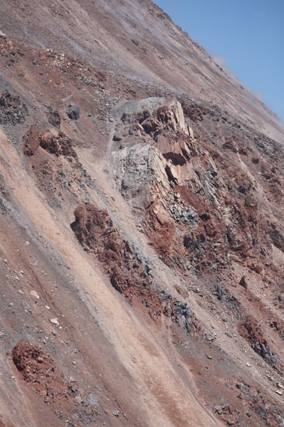
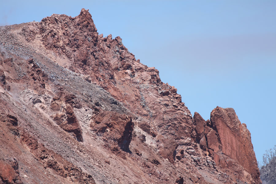
Pillars of lava in eastern caldera rim |
 |
 |
|
South side of dome - note: right side not contained by caldera wall |
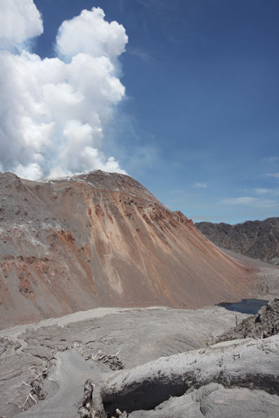
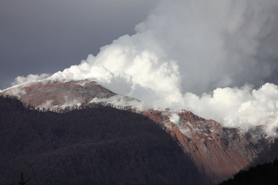
Increased steam emission following period of heavy rainfall |
 |
 |
|
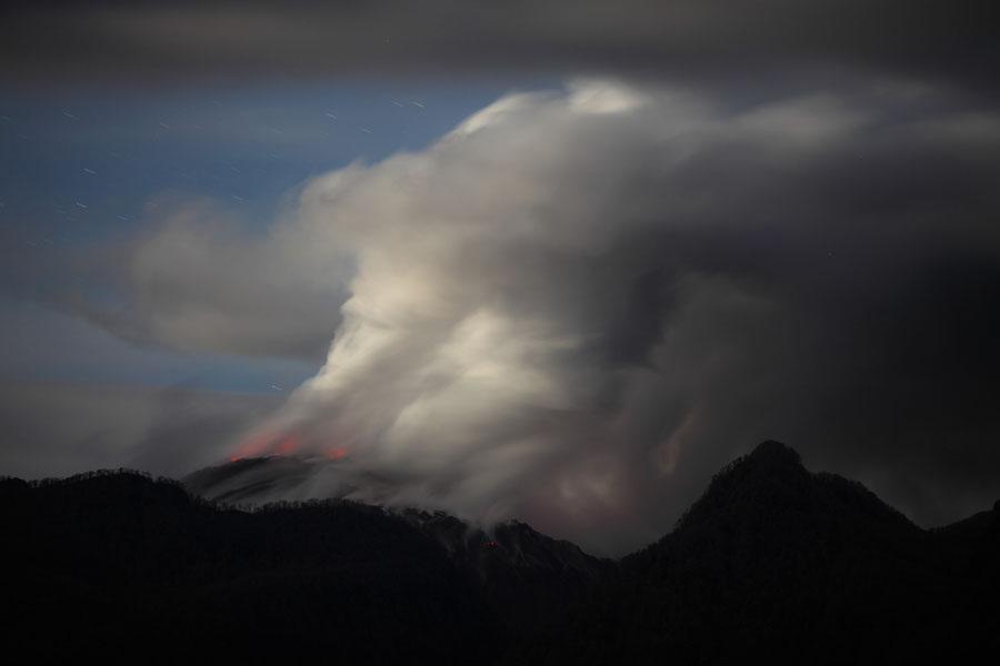
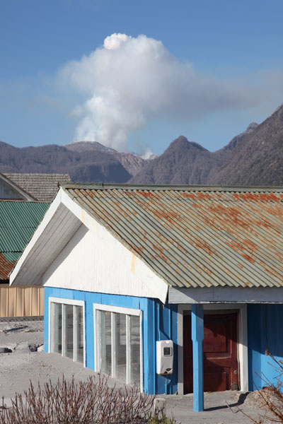
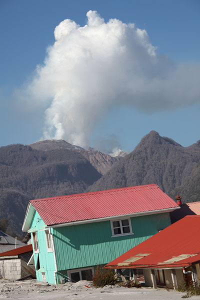
Incandescence visualized by long exposure photography (early morning 28. Nov. 2009) |
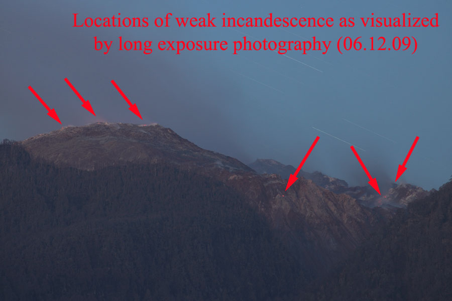
Locations of weak incandescence (evening 6. Dec. 2009) |
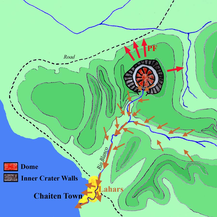 |
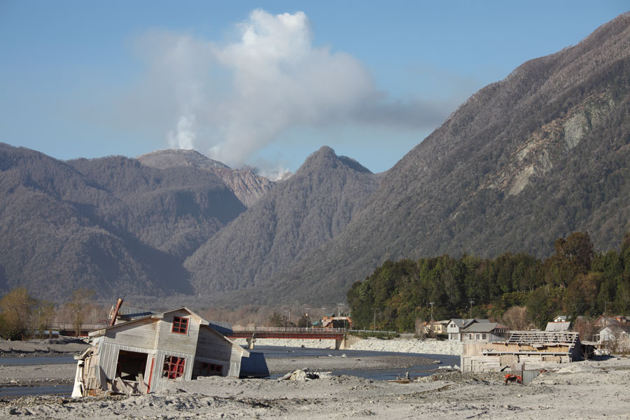
Rough Sketch of Area Around Chaiten Volcano and Impact of Eruption (North at top, area covered approx. 15x15 km). Red arrows indicate areas most affected by Pyroclastic Flows (PFs). Brown areas indicate washing of mud into Rio Blanco during periods of rainfall, generating mudflows (Lahars) which inundated the center of Chaiten Town. |
 |
 |
 |
|
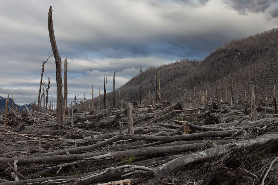
Forest destroyed by pyroclastic flows |
Forest destroyed by pyroclastic flows |
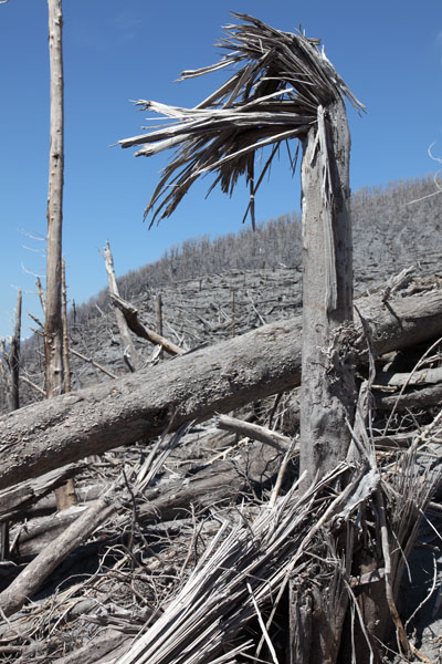
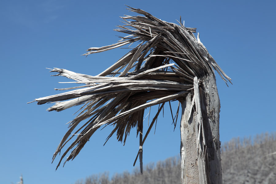
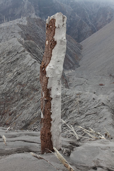
Tree trunk torn off by pyroclastic flow |
 |
 |
 |
|
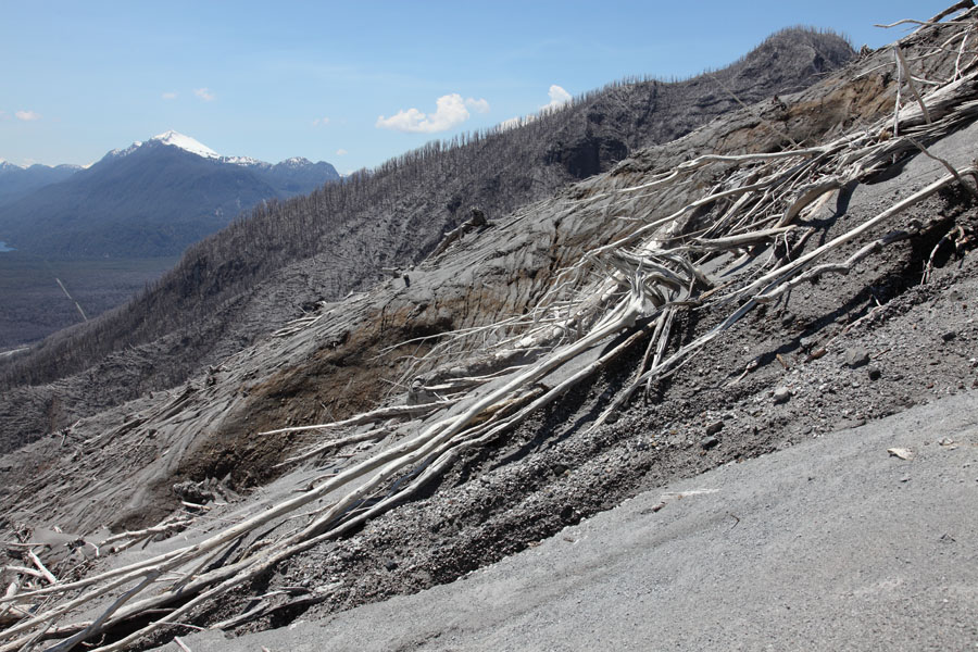
Pyroclastic Flow Damage, N Flank |
Tree with bark removed on side facing PF |
Edge of Pyroclastic Flow Impacted Area |
 |
 |
 |
|
Small rock embedded in tree-trunk by PFs |
Tree with bark removed on side facing PF |
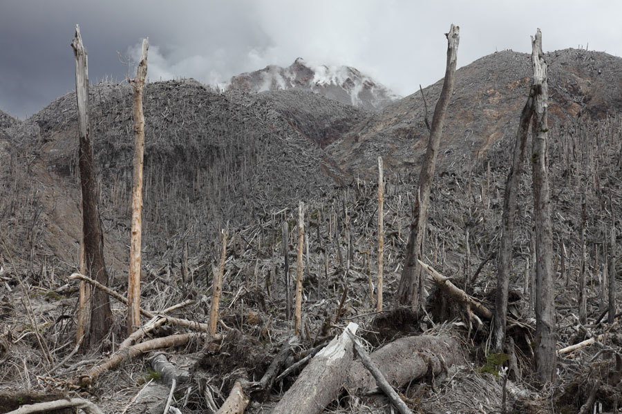
Slope stripped of forest, upper N Flank |
 |
 |
|
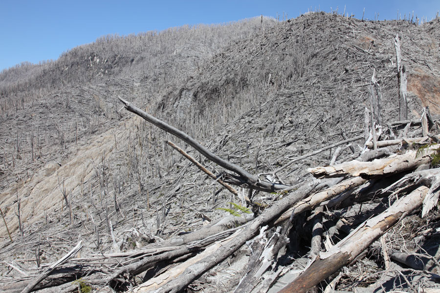
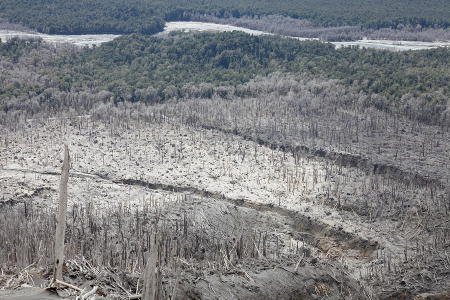
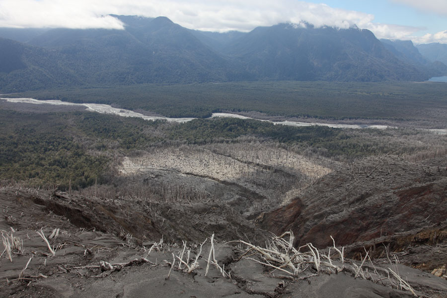
View over forest destroyed by PFs |
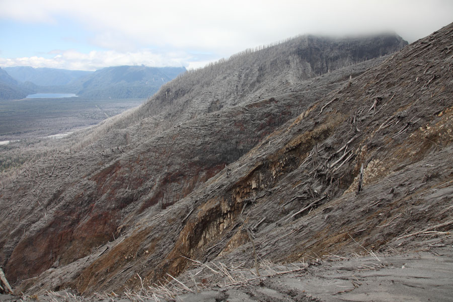
Upper slopes partially stripped down to bedrock |
 |
 |
|
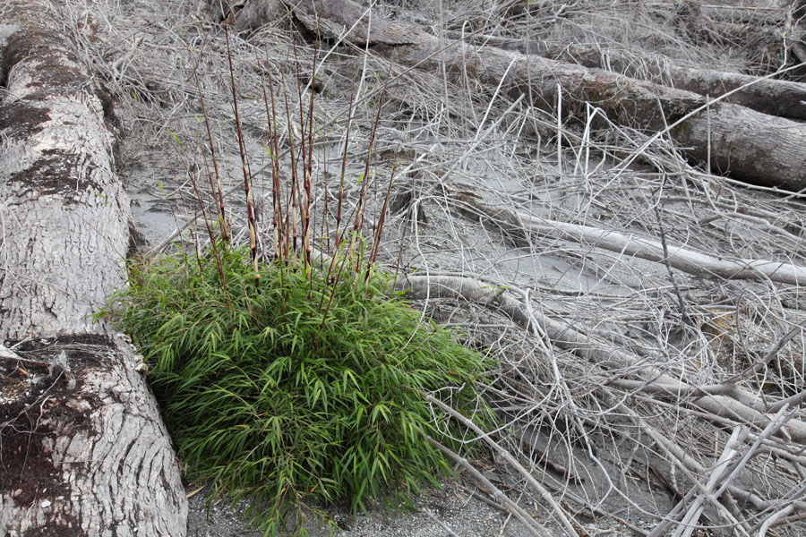
First plant (bamboo) reestablishing itself in PF zone |
Flattened forest at base of N flank |
 |
 |
|
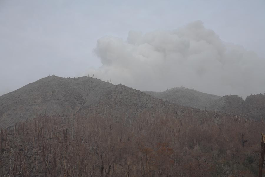
View of singed forest in July 2008 with ash eruption in background |
Overview of N flank PF zone |
 |
 |
|
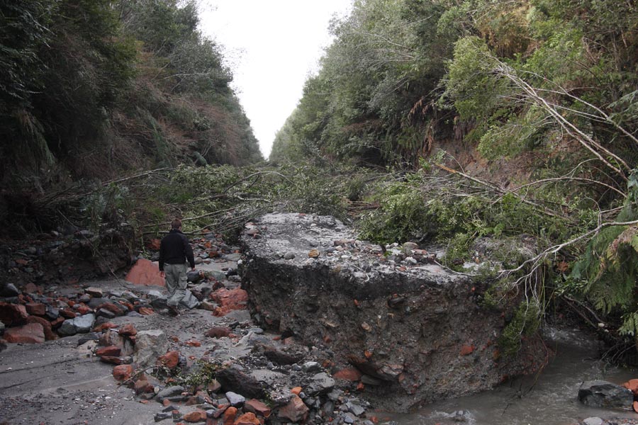
Caleta Gonzalo road, brown singed forest near Chaiten, glaciated Minchinmavida volcano |
Eroded road to Caleta Gonzalo (July 2008). Location approx. middle left edge of image above. |
 |
 |
 |
|
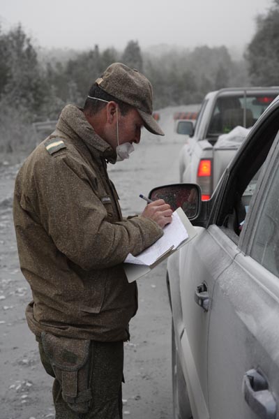
Control Post Road Leading N from Chaiten Town |
Policeman Controling Papers |
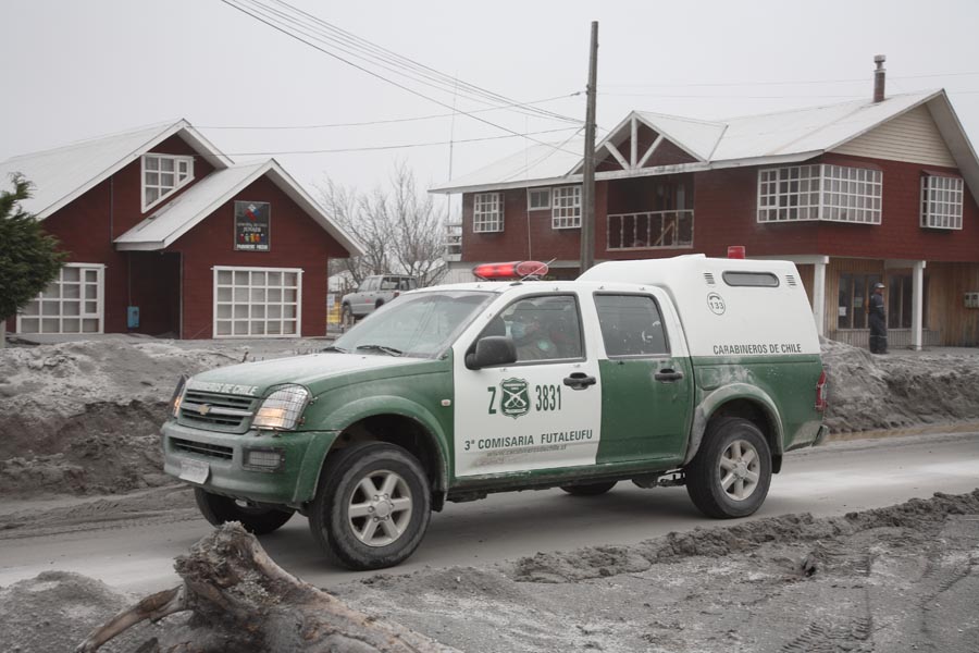
Police Car Patroling Streets of Chaiten |
 |
 |
|
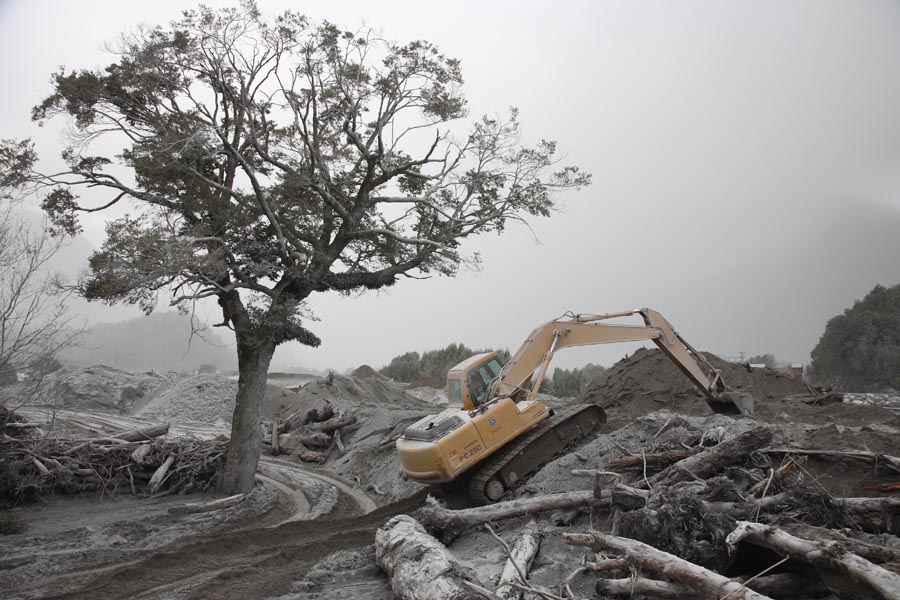
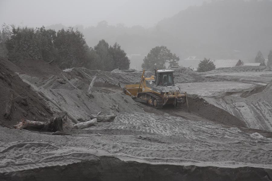
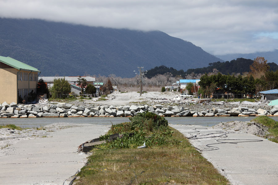
Work to Strengthen River Banks to Protect Town from Lahars |
Work to Strengthen River Banks to Protect Town from Lahars |
 |
 |
 |
|
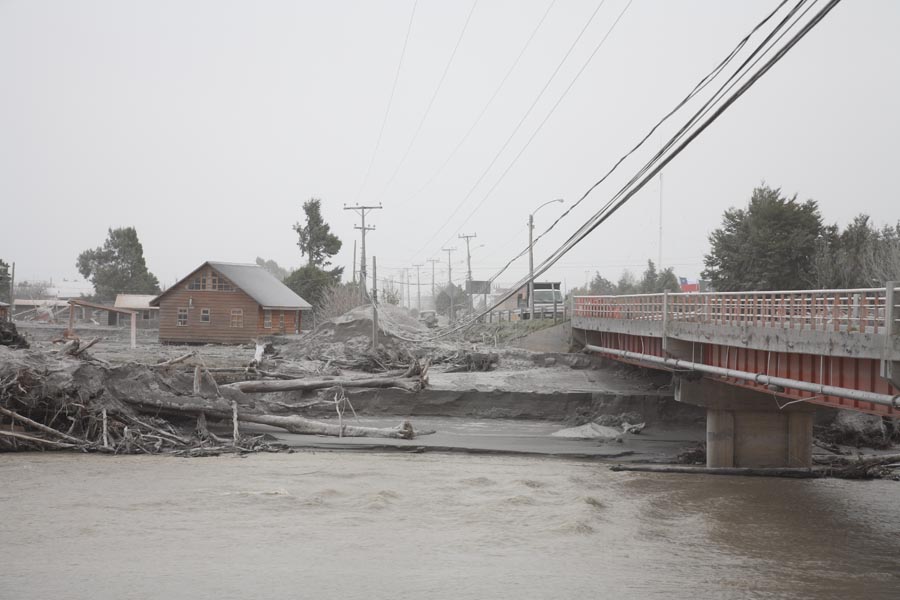
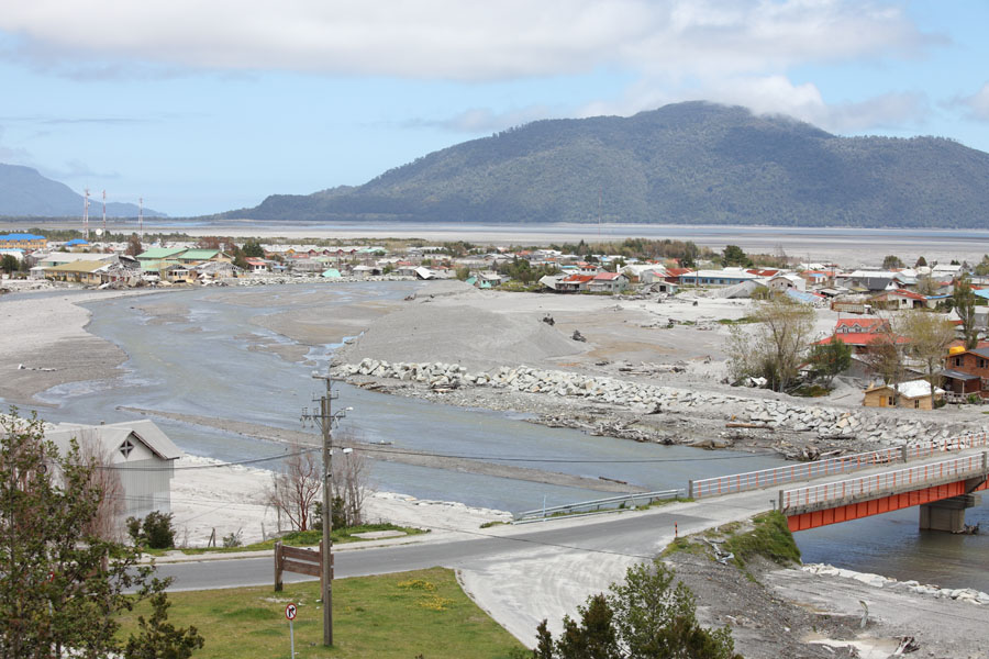
Chaiten Bridge, View Towards Town Center |
View from Bridge Upstream |
Lahar Deposits Downstream from Bridge |
 |
 |
|
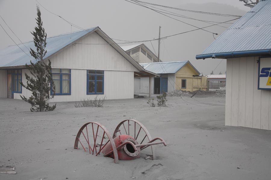
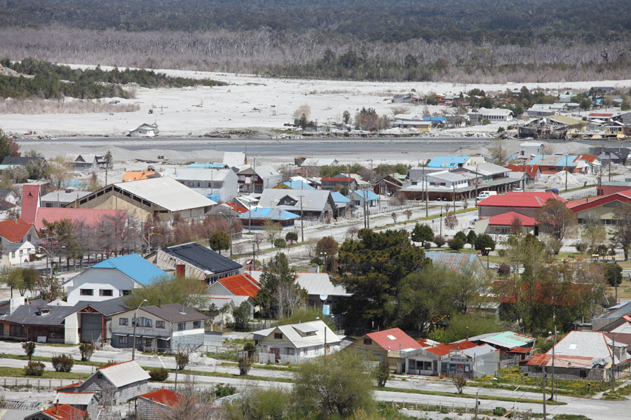
Lahar Deposits in Chaiten Town |
Lahar Deposits in Chaiten Town |
 |
 |
 |
|
Lahar Deposits in Chaiten Town |
Lahar Deposits in Supermarket |
Lahar Deposits in Chaiten Town |
 |
 |
 |
|
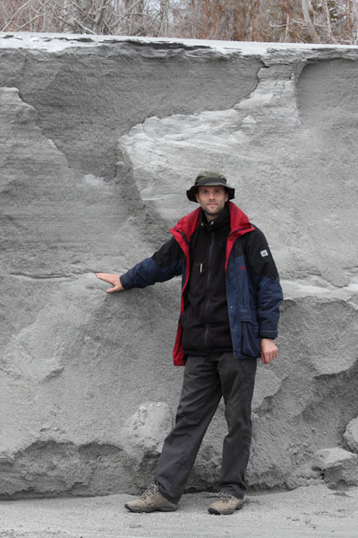
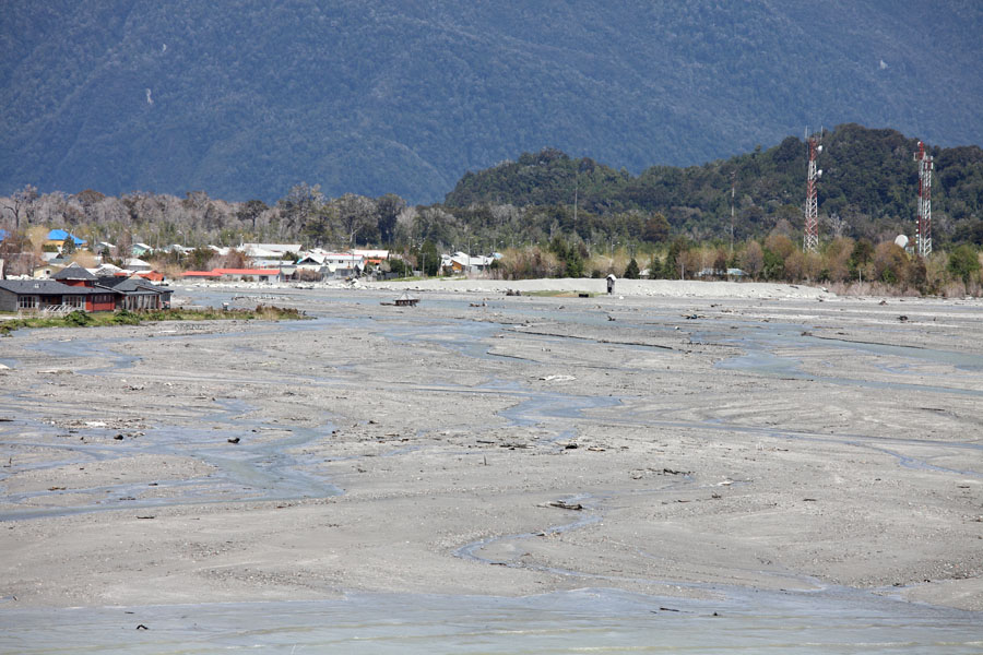
Original river bed filled with sediments |
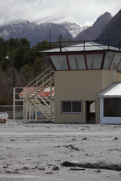
Control tower with dome behind |
Lahars flooded the entire runway of Chaiten airport |
 |
 |
 |
|
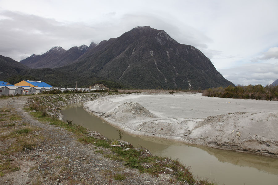
Light areas (top): old river bed going round back of town and airport runway (top left) |
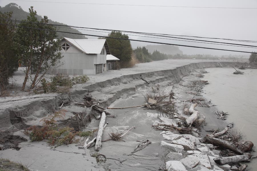
Lahar deposits by Rio Blanco |
New course of the Rio Blanco river through town |
 |
 |
|
View out of Escuela Italia towards volcano over area cleared by redirected river |
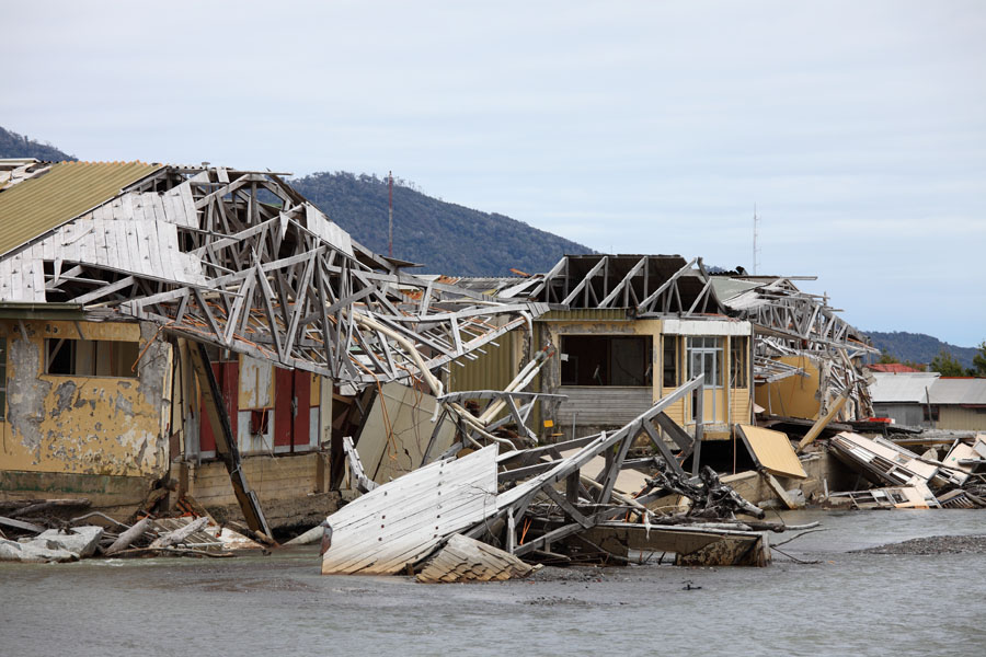
Severely damaged buildings of Escuela Italia |
 |
 |
|
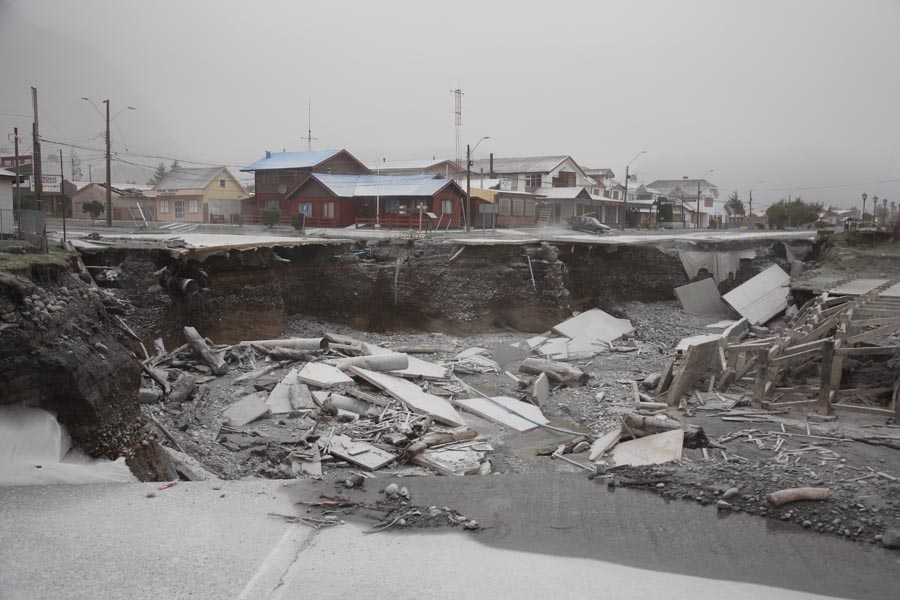
New river bed cuts Avenida Libertad at height of Av. Pillan |
Harbour area full of sediments on right |
 |
 |
|
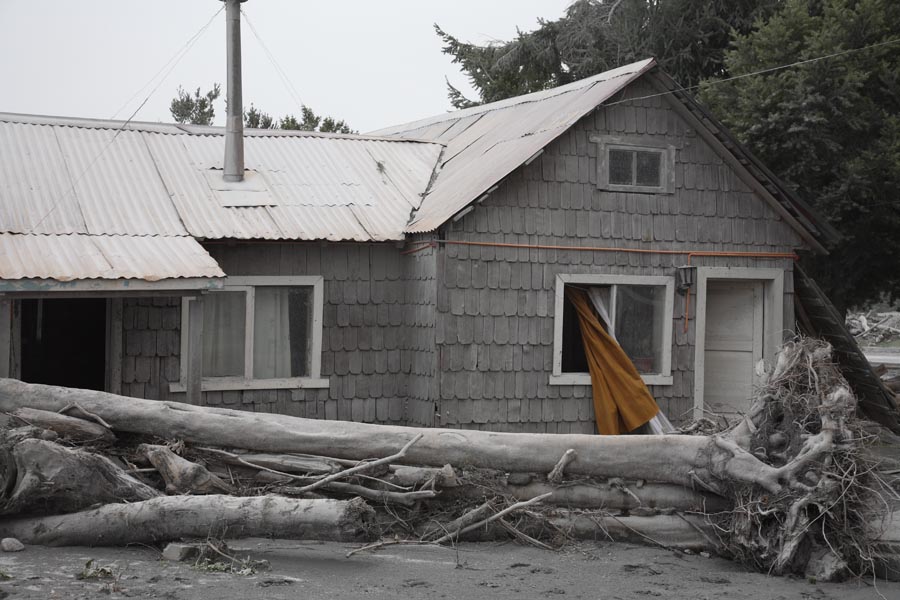
Riverside property missing section due to impact of lahar |
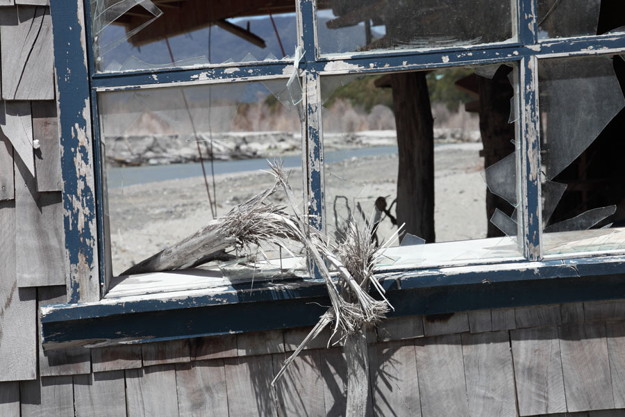
Twisted branch lodged in window-frame by lahars |
 |
 |
 |
|
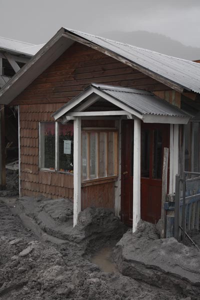
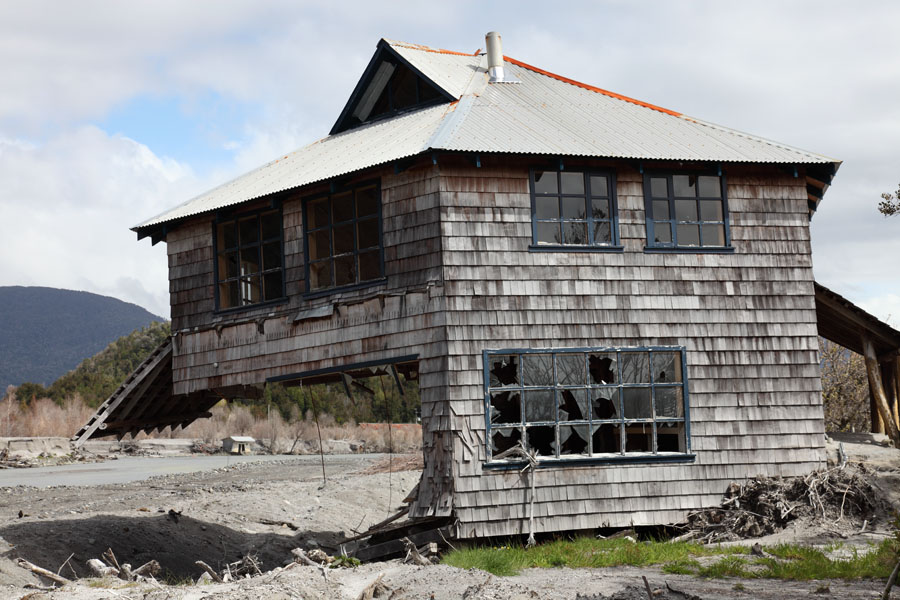
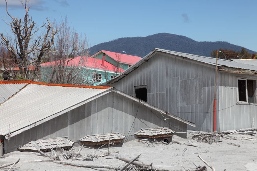
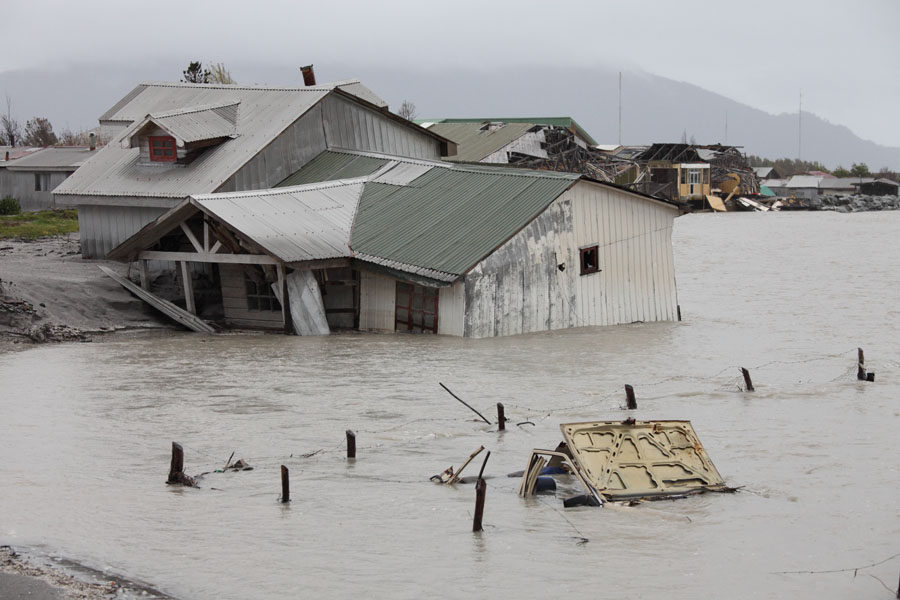
Partially buried house (Av. Rio Blanco) |
Deep lahar deposits along Av. Rio Blanco |
Houses tipped by lahars along Av. Rio Blanco |
 |
 |
|
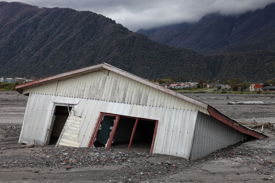
House deposited in sediment delta |
House deposited in sediment delta |
 |
 |
|
House deposited in sediment delta |
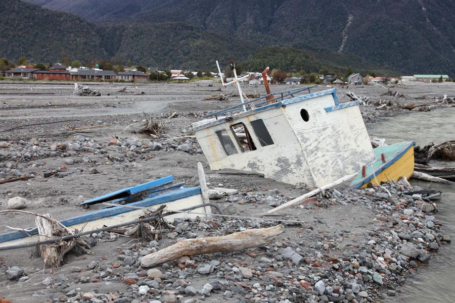
Small fishing vessel stuck in lahar deposits |
 |
 |
|
Buried window survived as not in most energetic lahar flow path |
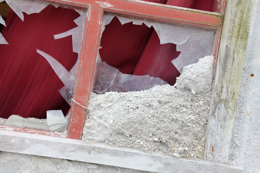
Window broken by debris in main lahar path |
 |
 |
|
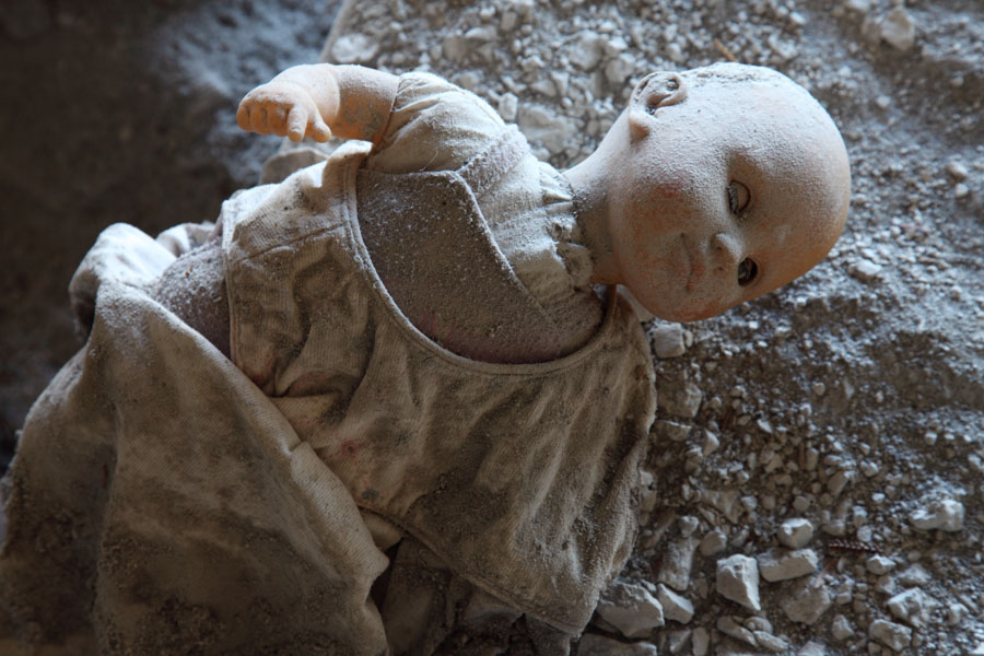
Doll partially stuck in lahar deposits |
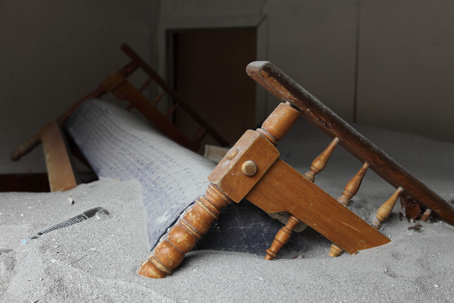
Buried sofa - Living room flooded by lahars |
 |
 |
|
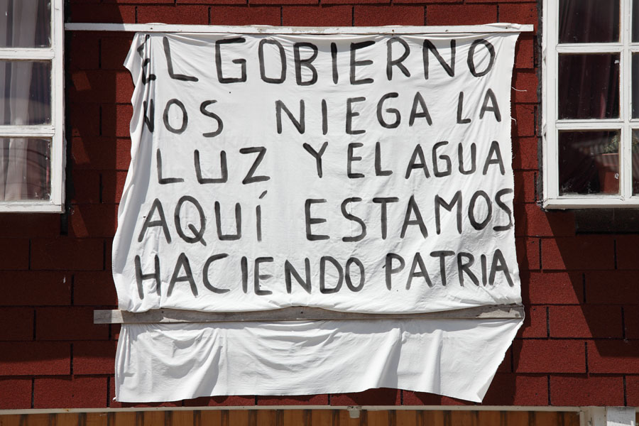
"The goverment is denying us light and water, but here is our home" |
"Chaiten lives. Do not sacrifice it" |
 |
 |
|
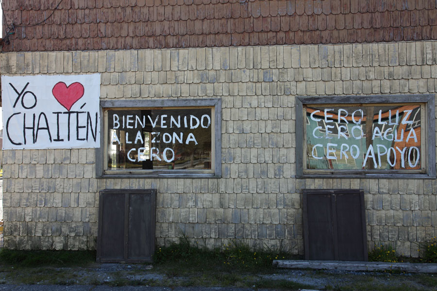
"I love Chaiten" / "Welcome to the zone of zero" / "Zero light, zero water, zero support" |
Grafiti on wall of hotel that burnt down due to lack of water for fire-fighting. Blaming government for destruction of livelihood |
 |
 |
|
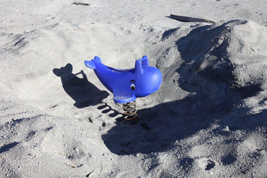
Sign of hope ? The playground dolphin has been dug out so children may play. The dolphin is a symbol of Chaiten. |
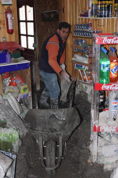
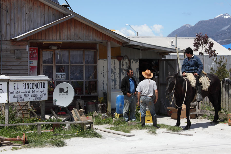
Locals in front of only supermarket to open again in Chaiten cities southern district. |
 |
 |
|
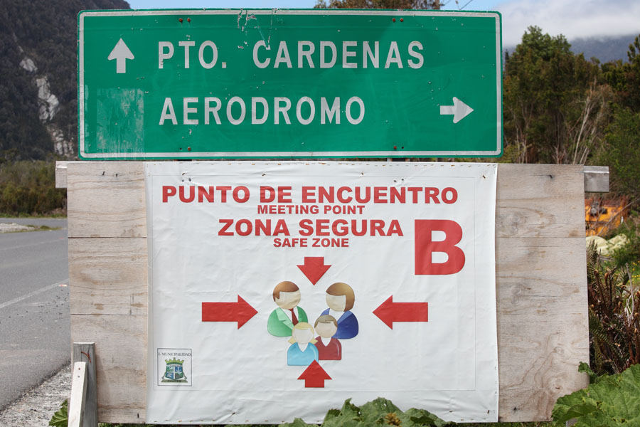
Safe zones have been designated in case of heightened activity. |
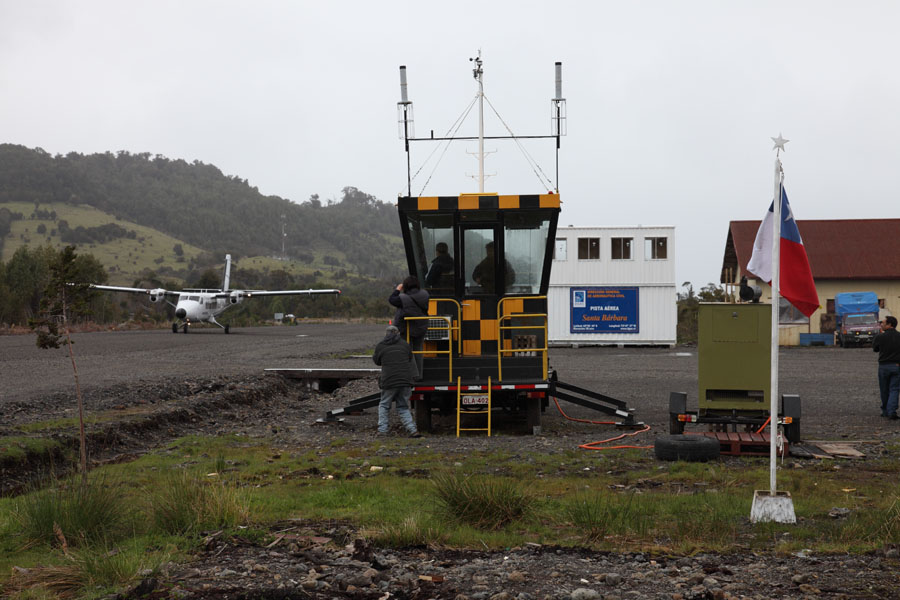
Santa Barbara airstrip. Planes take off on a widened section of road. |
 |
 |
|
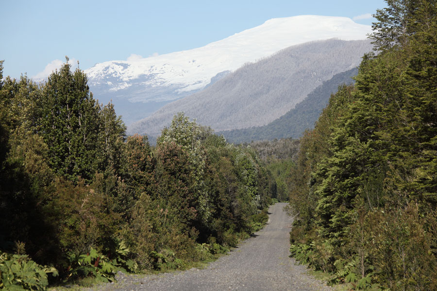
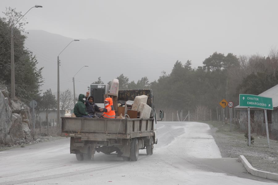
Ash on Pavement in Futaleufu near Argentinian Border |
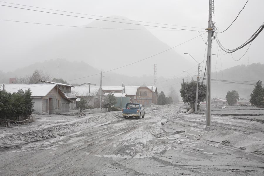
Compacted Ash on Road Leading out of Chaiten to East |
 |
 |
|
. |
. |
 |
 |
|
. |
. |
 |
 |
|
. |
. |