Soufriere Hills Volcano


Soufriere Hills volcano is a dominantly andesitic structure located on the small carribean island of Montserrat. The summit of the volcano had a pre-eruption height of 915m and is composed of the remains of a series of lava domes emplaced by previous eruptions. No historical activity had been documented, apart from the 17C eruption of Castle Peak lava dome. Increased seismic activity damaged buildings was in the 1890s, 1930s and 1960s and probably represent precursors of the current eruption. Renewed seismic activity in 1992 marked the onset of the current unrest. Since 1995, Soufriere Hills volcano has been in a phase of nearly continuous activity characterized by episodes of dome building, rockfalls, pyroclastic flows and occasional major dome collapses and explosive events. Activity has forced the activation of the south part of Montserrat including the capital Plymouth, much of which is today destroyed and burried in lahar deposits. A full chronology of the current eruption can be found on the website of the Montserrat Volcano Observatory (www.mvo.ms). The most important events are summarized here.


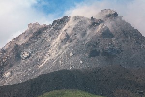
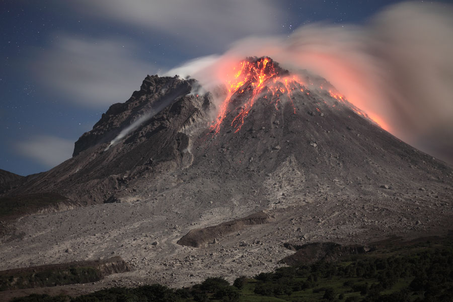
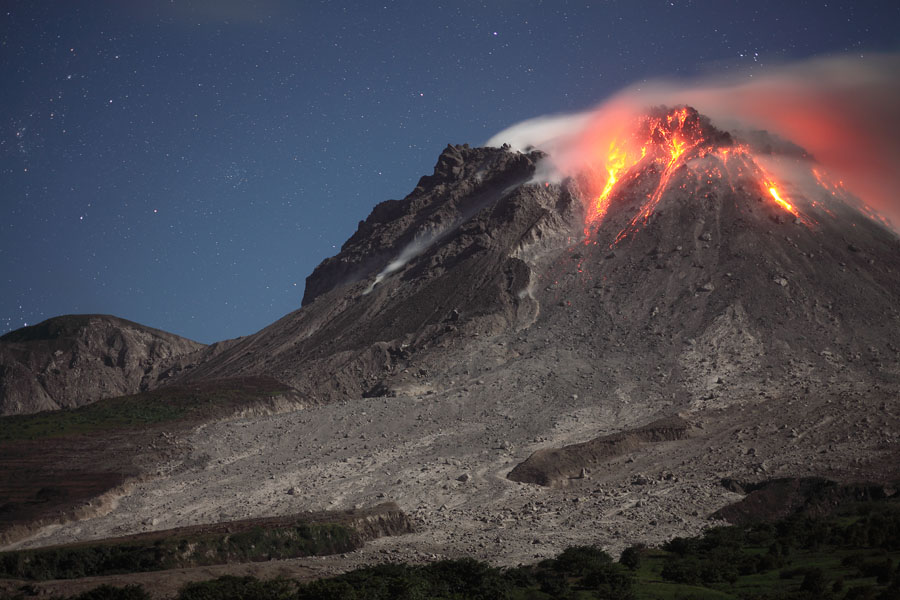
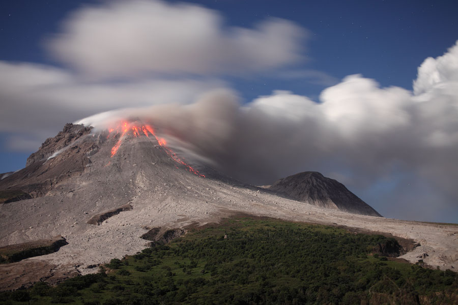
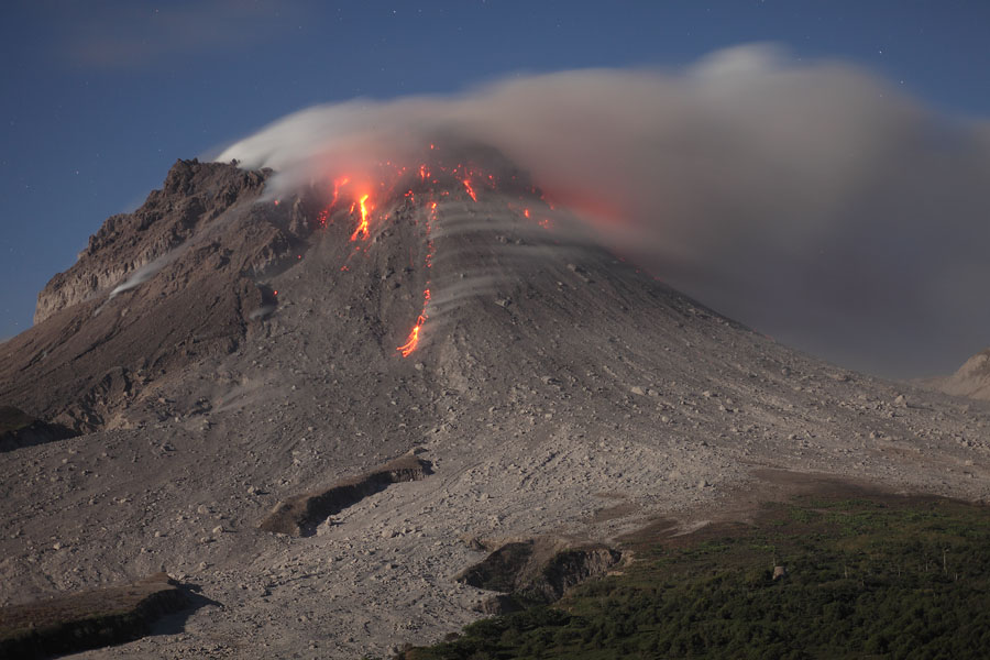
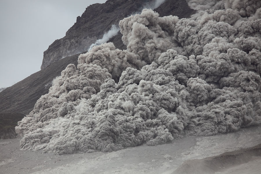
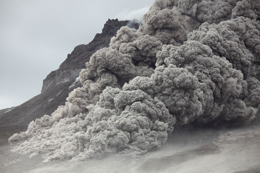
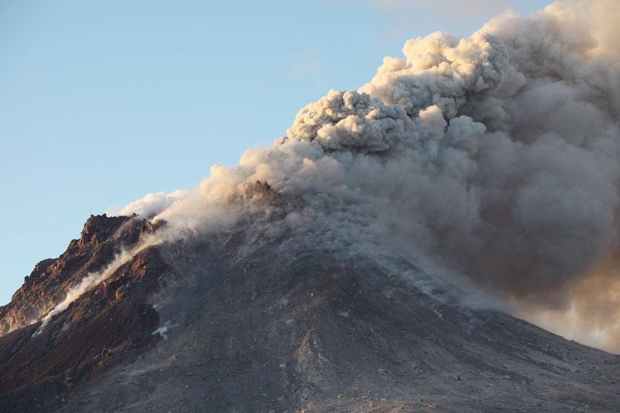
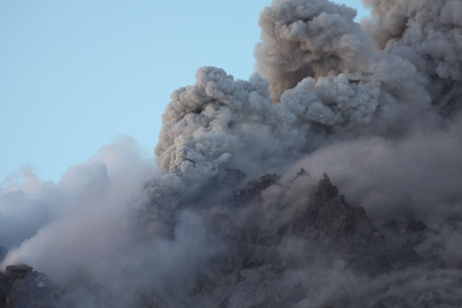
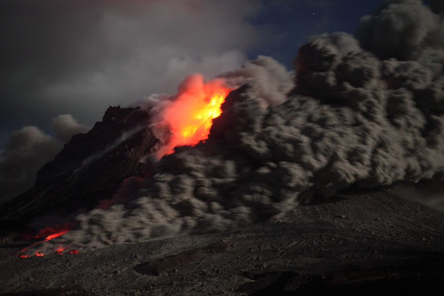
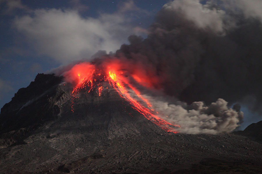
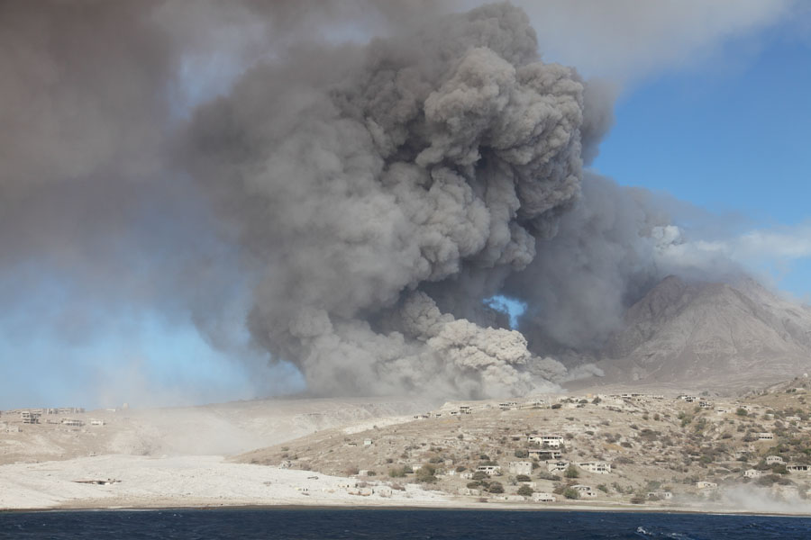
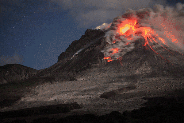
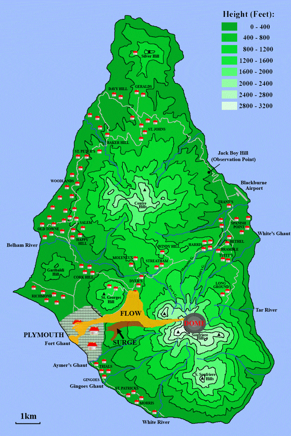
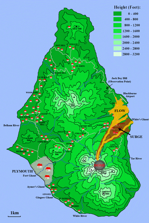
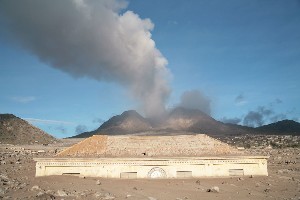
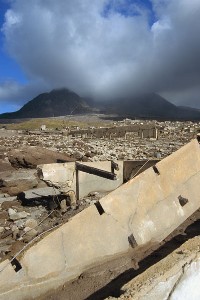
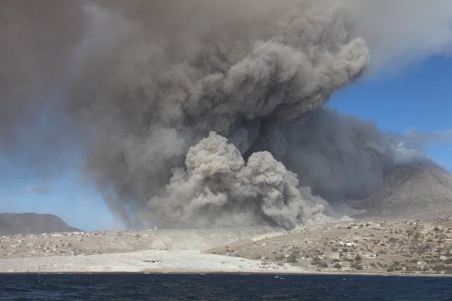
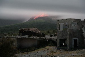
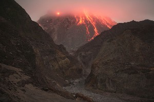
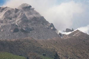
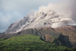
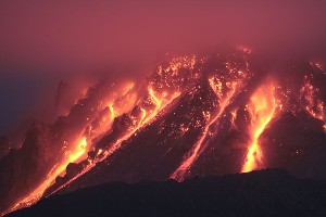
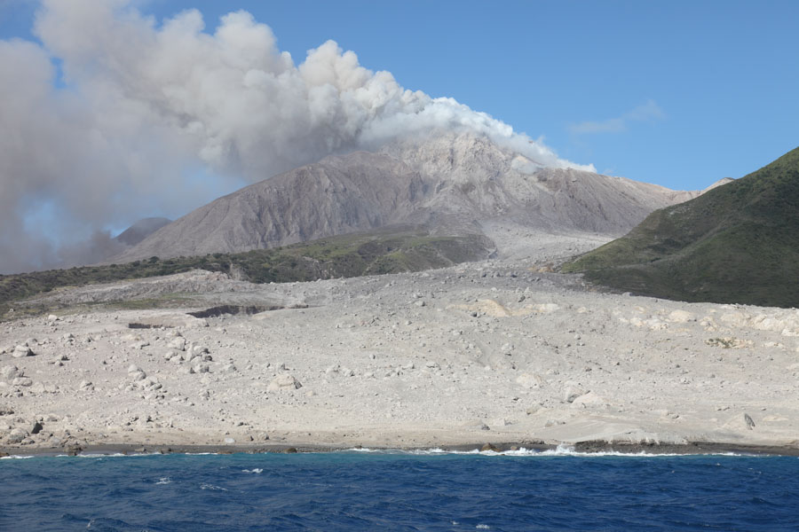
Soufriere Hills Volcano in March 2006. The active lava dome is growing in the crater left by a former larger dome.

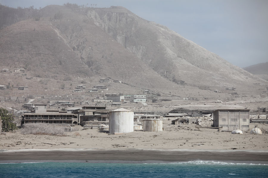
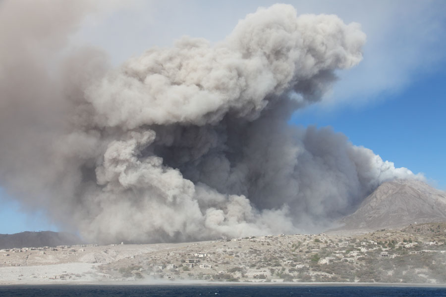
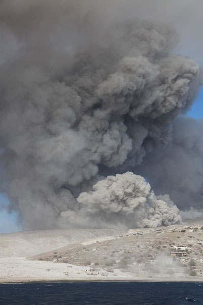
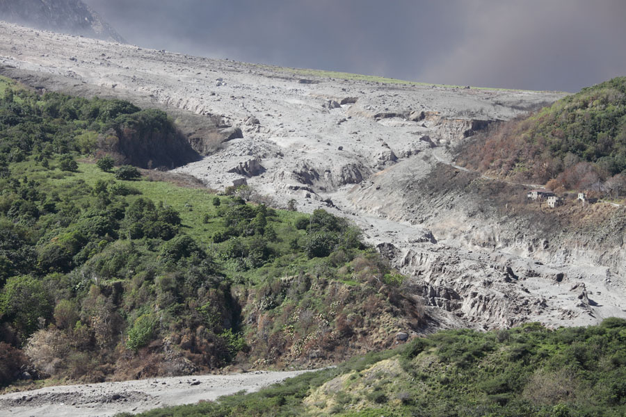
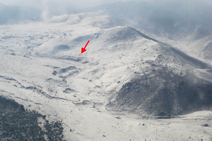
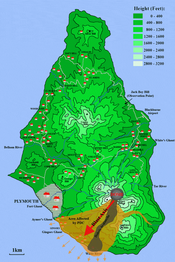
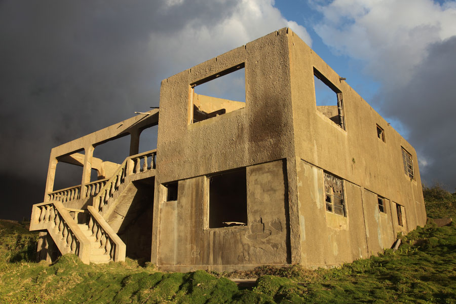
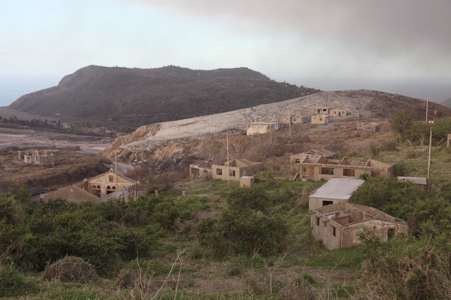
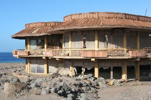
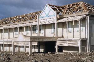
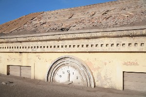
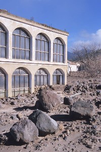
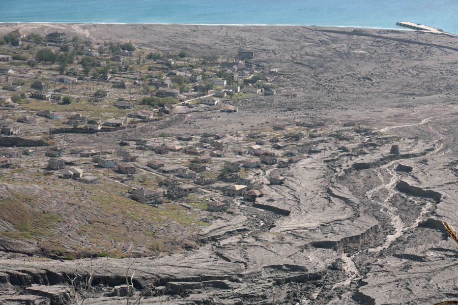
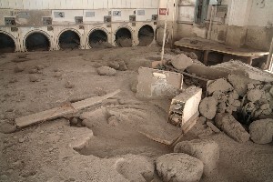
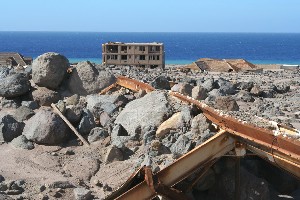
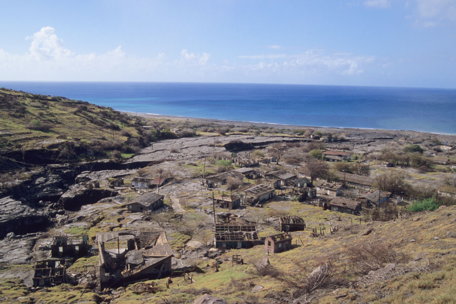
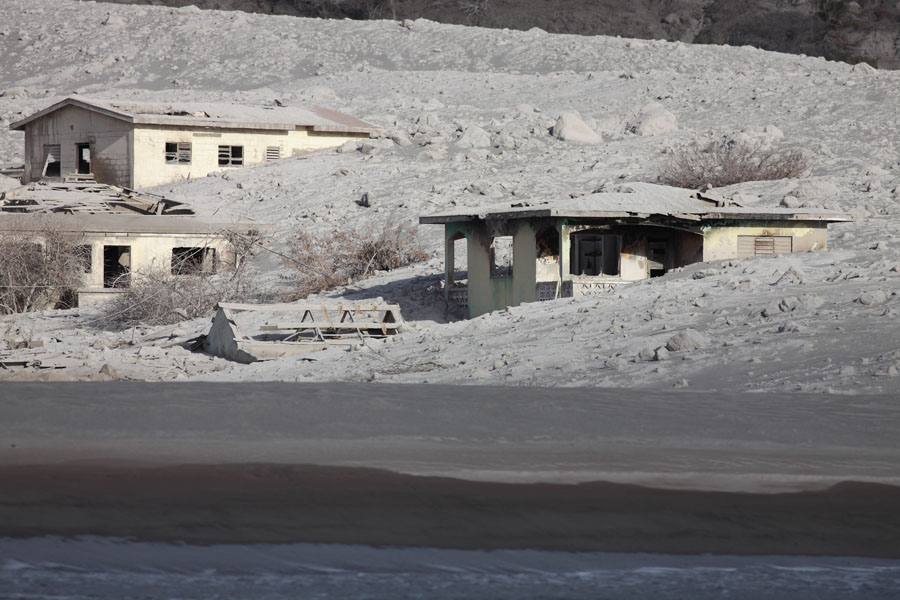
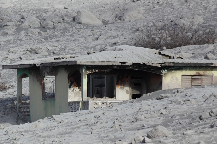
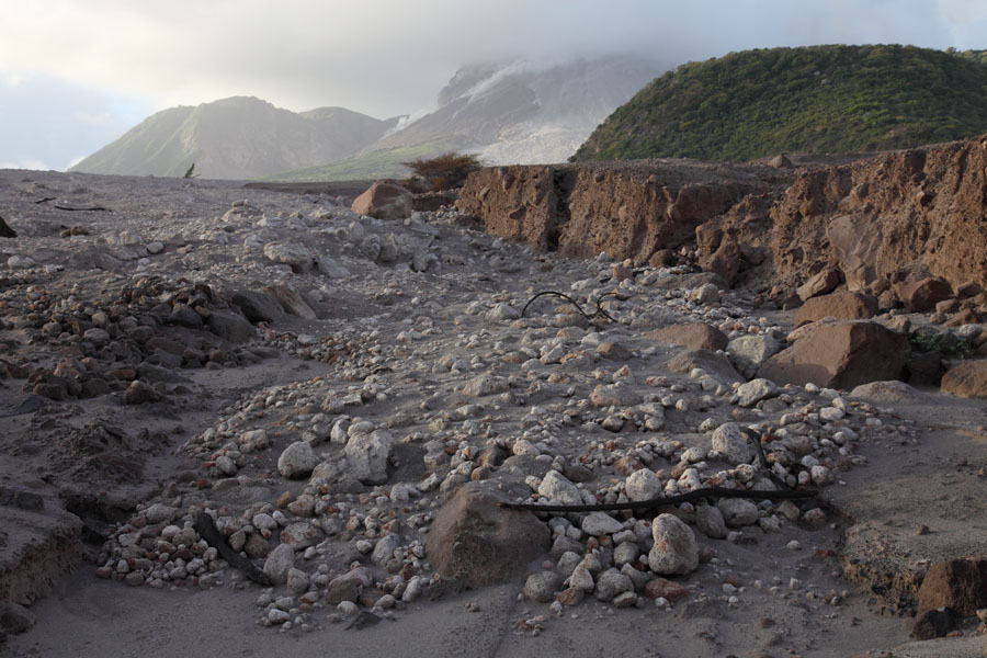
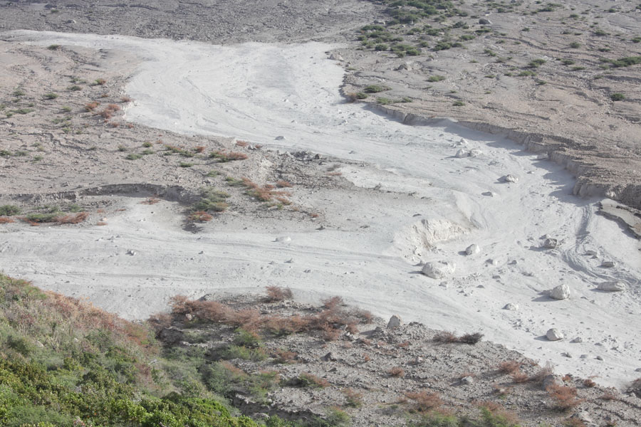
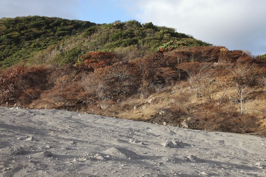
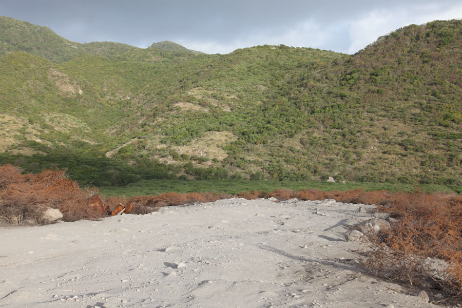
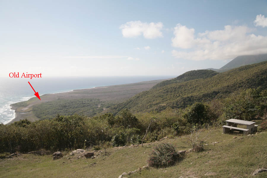
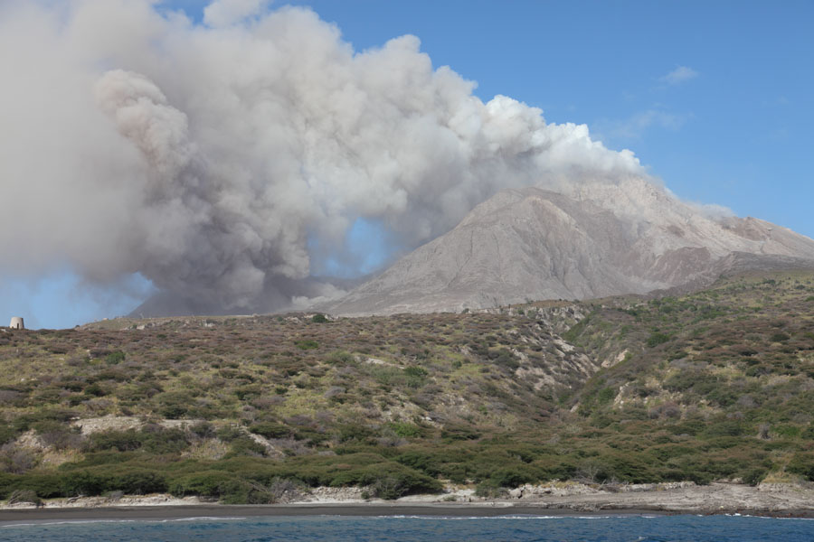
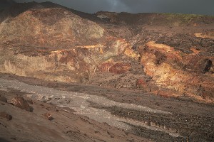
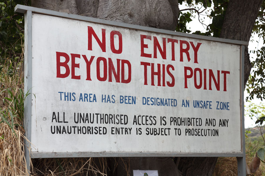
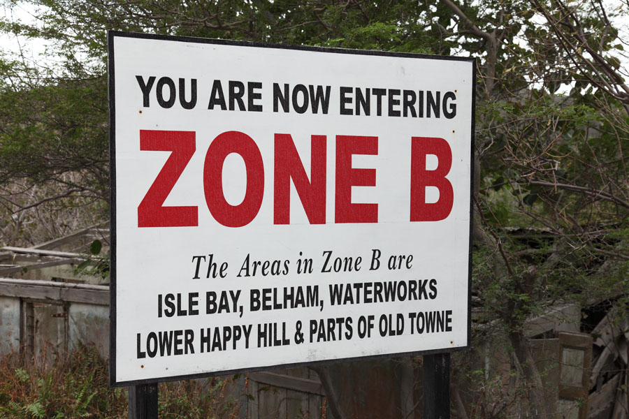
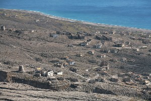
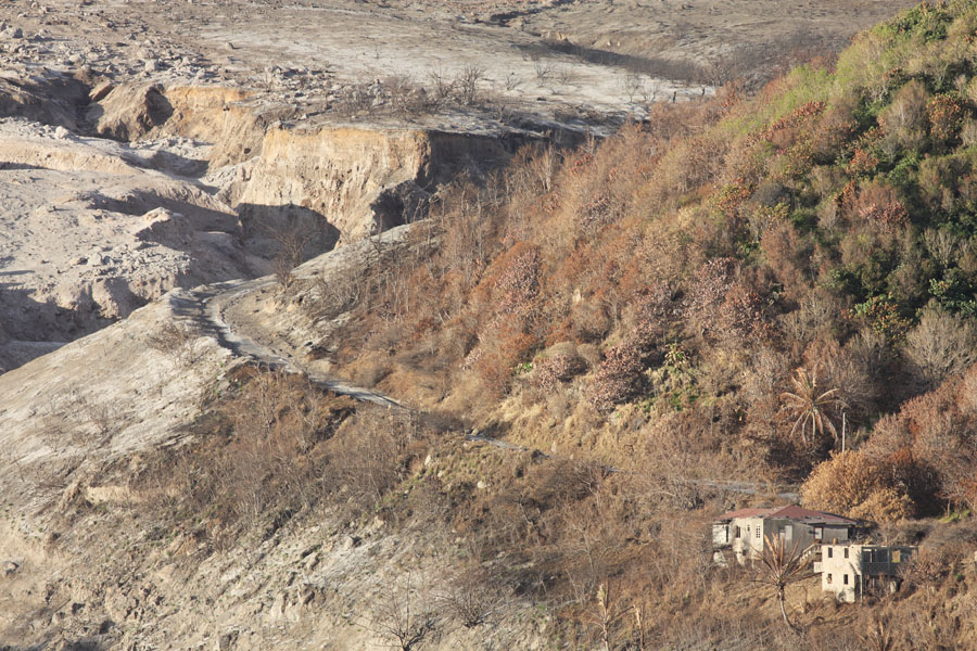
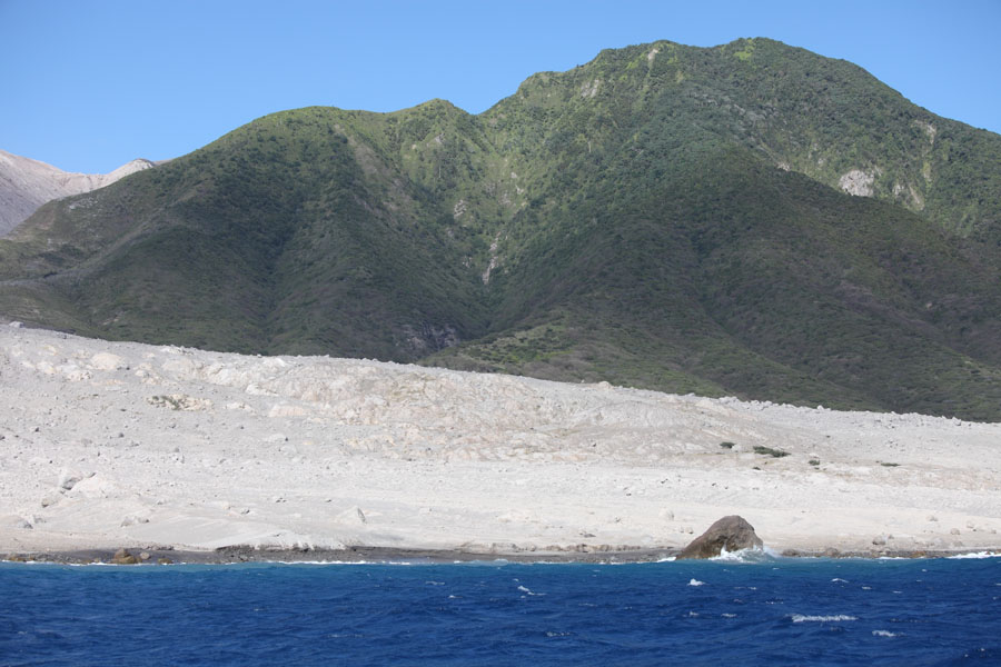
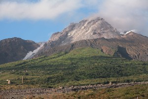
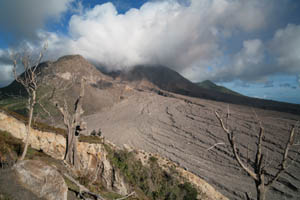
West flank of Soufriere Hills volcano with extensive lahar flow field. The remains of Plymouth are just off the right hand side of the picture.


Close-up of Soufriere Hills lava dome in March 2006.

Nighttime view revealing incandescence of same dome as picture on left.


On July 18 1995, ash and steam venting was first observed. Largely phreatic activity continued, reaching a first climax in a large phreatic explosion on 21. August which threw ash over much of Plymouth and initiated a first evacuation. First signs of dome growth were observed in "English crater" (a 1km wide crater left by a massive collapse event during an eruption about 4000 years ago) towards the end of September 1995.


Starting on 29th March, 1996, pyroclastic flows (PFs) in Tar River Valley were observed. On the 12th of May, first PFs reached the sea and this happened repeatedly in the following months. By July, extrusion rates reached 10 cubic meters / sec and repeated small dome collapses accompanied by large pyroclastic flows were observed. On 17 September 1996, a series of dome collapses were followed by a massive magmatic explosive eruption with a 13km high ash column which deposited over 500000 Tonnes of ash on the Island. Dome growth restarted in December.


On March 30, 1997, PFs occurred to the south of the dome into White River valley, destroying the touristic sites of Galways Soufriere and Great Alps waterfall. Increasing PF activity to the N and NE culminated in PFs reaching to within 50m of Blackburne Airport on the 25 June 1997. These flows also destroyed the settlements of Streathhams, Riley, Harris, Windy Hill, Bramble, Bethel, Spanish Point, Trants and Farms. Although these had been previously evacuated, people were continually returning to salvage belongings and tend to cattle and 19 fatalities were recorded. On 1 July 1997, a PF reached the Catholic Church in central Plymouth. Further flows destroy parts of Plymouth on the 3rd and 4th. From the 4th to 8th August, numerous vulcanian explosive events threw ash and pumice to heights reaching 13km. Column collapse of an explosion cloud was observed. On 21 September, a major dome collapse resulted in PFs which reached the sea at several points to the E and NE of the volcano and set fire to the terminal building at Blackburne airport. Further about 10-hourly vulcanian explosions occurred between 22 September and 21 October with column heights of 13km being regularly reached. On 4 November 1997, a southerly oriented dome collapse sent PFs down White River valley to the sea. Smaller PFs had reached the sea at this point in the previous month. Destruction of many settlements at the SW side of the volcano was most notable on 26 December 1997, when after a number of vigorous PFs in the area, a highly energetic PF surge possibly associated with a lateral blast blew many houses off their foundations in the St Patricks and Morris settlements near the White River valley.


Pyroclastic Flow emerging from cloud cover and travelling down Tar River Valley. Viewed from old airport control tower in January 2006.

Small pyroclastic flow travelling down flank of Soufriere Hills lava dome, March 2006


1998 witnessed a period of dome degradation with only sporadic minor activity. Occasional collapses of the dome continued to generate PFs. Passage of Hurricane George in September caused massive lahars which swept huge amounts of loose volcanic debris down the flanks of the volcano, burying parts of Plymouth and other locations in in places several meter thick deposits. Further periods of heavy rainfall in November and December had a similar effect.


Plymouth Courthouse buried in ash and lahar deposits, March 2006.

Ruined buildings in central part of Plymouth which has been destroyed by pyroclastic flows and lahars.

View from St Georges Hill over center of Plymouth in March 2006. The center of town (top right near pier) is buried in up to 20m of lahar deposits.


Remains of the former Arrows Manstore buried in lahar deposits, Plymouth, January 2006. The store, like many others, has been reestablished on the safe N side of the island.

Remains of Catholic Church Plymouth. The church was set on fire by a pyroclastic flow and then gradually buried in lahar deposits. January 2006.

West facade of Government Headquarters, Plymouth. The building is partially buried in lahar deposits. January 2006.


Huge boulders deposited by lahars in a residential area, Plymouth. January 2006.

Remains of house set on fire by pyroclastic flows in 1997, Trials Estate. January 2006.


Dome degradation continued into 1999, with a large collapse event throwing ash up to 12km on the 20th of July. At the end of November, renewed dome growth was observed.


By February 2000, small PFs were reaching the sea down Tar River valley as the new dome gained in stature. A first major collapse of the new dome occurred on 20 March 2000 during a period of heavy rainfall, with much of the dome making its way down Tar River valley. This was followed by Vulcanian explosions and inevitable lahars. Dome growth resumed afterwards.


Continued growth in 2001, results in the volume of the dome reaching a record 162 Million cubic meters by the end of July. On the 29th of said month, during a period of heavy rainfall, 45 million cubic meters of the East flank of the dome collapsed over a period of 8 hours, resulting in near-continuous PFs down Tar River valley into the sea. A smaller collapse of the N side of the dome occurred on 4th October with several PFs again reaching the sea. On 14 October, outer parts of the dome on the SE gradually collapse, producing continuous low energy PFs down Tar River valley into the sea over a 6 hour period. On 28 December a small collapse of the NE of the dome produced PFs lasting for over an hour and flowing into the sea.


Piano coated in ash, Plymouth.

Pipettes coated in Ash, Montserrat Technical College, Plymouth.

Bottle coated in Ash, General Store, Church Road, Plymouth.


On January 12, 2002, an energetic flow down the Tar River valley was accompanied by a 2-3km ash column and over 1km high steam column at the point of sea entry. In February, PFs continued to reach the sea and an extruded spine on the dome was measured reaching up to 1080m (90m above the rest of the dome). Heightened PF activity was observed in the following months. On September 29, a minor dome collapse sent PFs into the sea near Spanish point. On the 8th December a further larger collapse (5 Million cubic meters) sends energetic PFs to the same area and fills much of White Ghaut.


>

Dome growth and PF activity continued into 2003, culminating in a major collapse event on 12/13 July. The collapse was the largest to date, involving 210 million cubic meters of dome material. Ash clouds reached a height of 15km and massive PFs reach the sea down Tar River valley resulting in secondary phreatic explosions. Much of the Island is coated in a thick layer of ash. This is followed by 3 vulcanian explosions on 13, 14 and 15 July, throwing ash and lithics up to a height of up to 12km. After a period of intense ash venting on 1 August, dome growth ceases and activity remains low for the rest of the year.


The only notable event in 2004 was a collapse event on March 3rd. Ash clouds reached an altitude of 7km and PFs reached the sea down Tar River Valley on two occasions.


Destroyed Airport Montserrat

View from Jack Boy Hill over eastern Montserrat. The location of Blackburne Airport is indicated. The dome is just off the top right of the picture.

Remains of Blackburne Airport viewed from runway which is covered in lahar deposits. January 2006.

Destroyed building in Spanish Point area south of Blackburne Airport. March 2006.


The early part of 2005 remained uneventful until increased seismic activity in May and June, accompanied by some ash venting, was followed by two explosive events on 28 June and 3 July, the first of which producing PFs into the sea at Tar River, and both producing about 6km high ash clouds. On August 5, first signs of renewed dome growth were visible and minor PF activity occurred in the following months.


The first major collapse of the new dome occurred on 20 May 2006. Most of the 90 million cubic meters of the dome collapsed over a period of under 3 hours. Seismic activity increased in the early hours of the morning, and by 6:45 PFs were flowing down Tar River valley to the sea. At 7:40, a huge explosion threw an ash cloud to a height of 17km and large ballistics rained down on the flanks of the volcano. Massive PFs flowed to the sea generating a blast which spread north along the coast and set vegetation alight as far as the Spanish Point area. Vigorous ash venting continued for much of the day and rainfall caused massive mudflows down all sides of the volcano. By 23 May 2006, a new lava dome could be observed in the crater. On June 06, a small collapse of this dome occurred, once again sending PFs to the sea via Tar River valley. On the 29th August, eruptions involving PFs reaching the sea caused steam and ash clouds to an altitude of 10km. From 31 August to 10 September, several episodes of vigorous ash venting from vent located between dome and Gages wall. Small PFs from N to E of dome observed in following months as activity starts to shift to N and NW.


On 08 Jan 2007, explosive activity accompanied by a 10km high ash cloud was reported. Importantly, a large PF was able to flow NW along the Belham River valley. This PF had a runout of 5km, a new record for this side of the volcano. Numerous smaller PFs were observed to the N of the dome. During April, the dome which had reached the huge volume of 208 million cubic meters ceased growing. Due to its huge size, even in the absence of renewed growth, collapse events remain a constant danger.


(last updated August 2007)


Nighttime view of Soufriere Hills lava dome with Tar River Valley in the foreground, March 2006.

Early morning view of pyroclastic flow deposits in Tar River Valley, March 2006.


Montserrat Island is only reachable by Winair flights from Antigua. Flights land at the new airport, replacing Blackburne airport which has been destroyed by the eruption. Due to the wind-exposed location of the new airport, flights may not be possible for days during poor weather conditions. Most of the South of Montserrat is a volcanic exclusion zone which may not be entered without permission. The volcano can be safely viewed from the observation point on Jack Boy Hill at the edge of the exclusion zone, overlooking the remains of Blackburne airport on the East coast. The new volcano observatory on the hillside above Salem provides an alternative viewpoint to the West. During periods of small dome volume and low activity, it may also be possible to climb Garribaldi or St Georges Hill on the West side of the Island. Comfortable accommodation and friendly service can be found at the View Pointe Hotel when this is not closed due to the risk of PFs entering Belham valley. One or two simpler alternatives are found in the North of the Island.

The kind of hazards in the exclusion zone can be seen from the chronology of volcanic activity above. Collapse events can occur without warning at any time. Additional hazards in the exclusion zone include the risk of building collapses, but also free-running bulls and large pigs which have been reported to attack people.


Readers interested in the impact of Lahars may also find the section on Chaiten volcano interesting.


Further Photos


Photovolcanica Full Index