Tarawera Volcano


Mount Tarawera (1111m), located on New Zealand's N Island, was the source of one of the most powerful historical eruptions. On June 10. 1886, between 1 and 2 cubic km of basaltic lava was erupted from a fissure which bisected the preexisting rhyolite dome complex over a length of 8km and extended a further 9km to the SW. The eruption destroyed the world-famous pink and white sinter terraces in lake Rotomahana, killed about 120 people and spread ash over an area of over 10000 square kilometers.


Tarawera Volcano Wahanga Dome 1886 Fissure Tarawera Volcano Wahanga Dome 1886 Fissure Tarawera Volcano Wahanga Dome 1886 Fissure

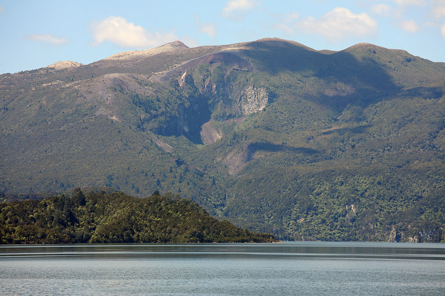
Wahanga Dome, Tarawera Volcano. View from N.

View from NE along most NE section of 1886 fissure in flank of Wahanga Dome.

View from E of NE section of fissure in flank of Wahanga Dome (on right).


Tarawera Volcano Ruawahia Dome 1886 Fissure Tarawera Volcano Ruawahia Dome 1886 Fissure Tarawera Volcano Ruawahia Dome 1886 Fissure

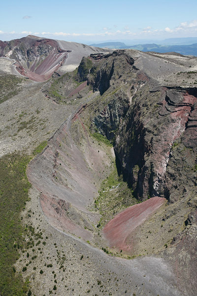
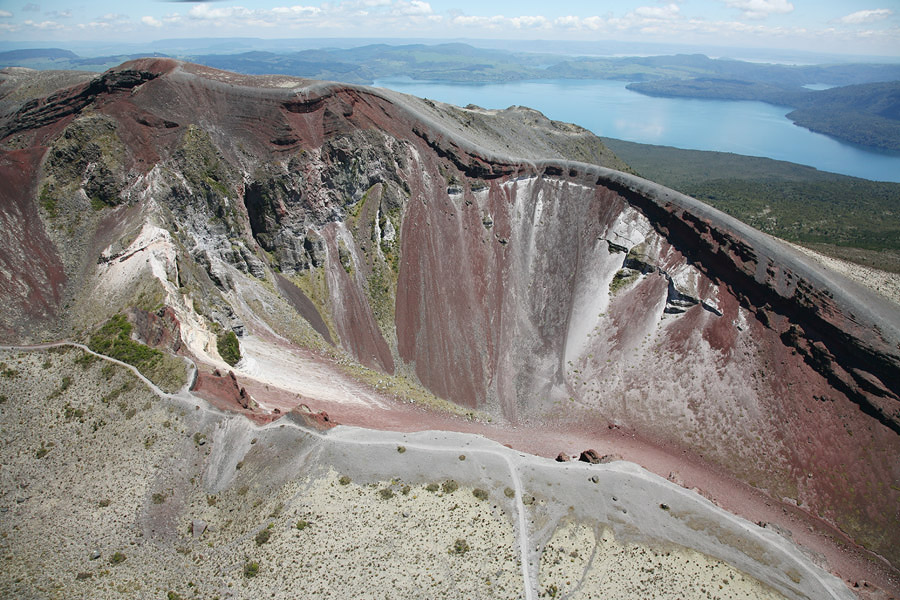
Crater in NE flank of Ruawahia Dome. View from N.

Crater in NE flank of Ruawahia Dome. View from NE.

Crater in NE flank of Ruawahia Dome. View from E.


Tarawera Volcano Wahanga Ruawahia Dome 1886 Fissure Tarawera Volcano Ruawahia Dome 1886 Fissure

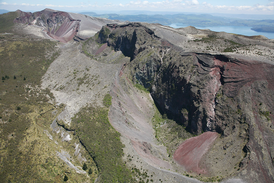
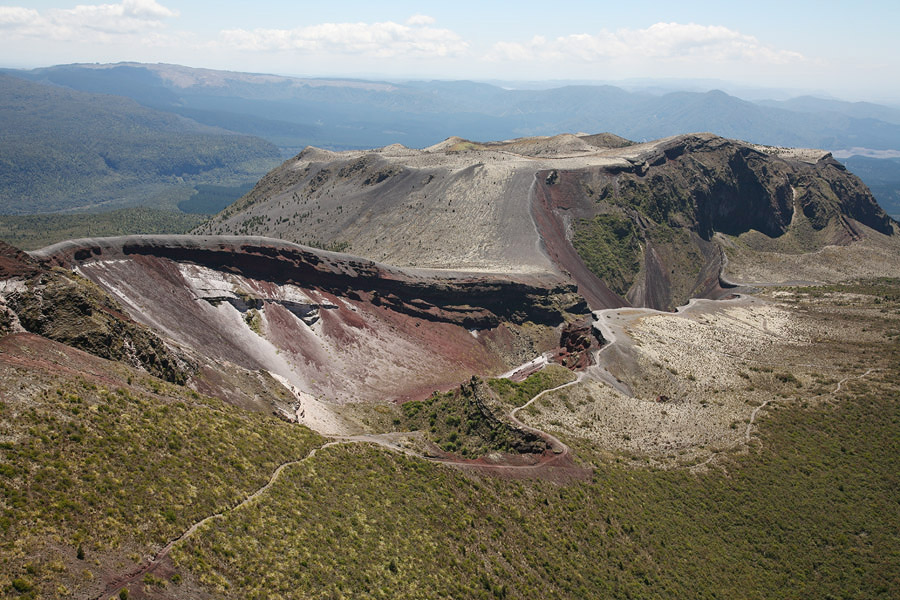
Crater in NE flank of Ruawahia Dome, Wahanga Dome behind. View from S.

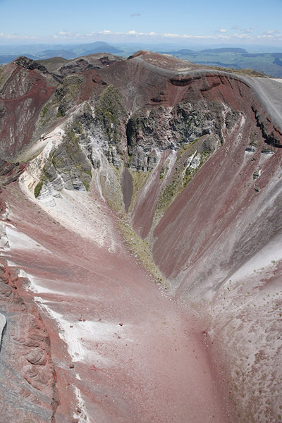
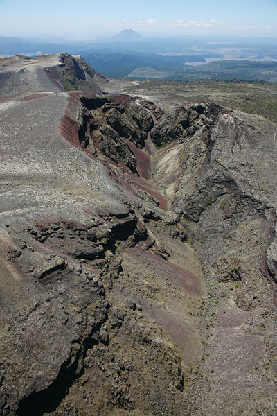
Crater in summit of Ruawahia Dome viewed from SSW.


Tarawera Volcano Ruawahia Dome 1886 Fissure Tarawera Volcano Ruawahia Dome 1886 Fissure Waimangu Valley Southern Crater

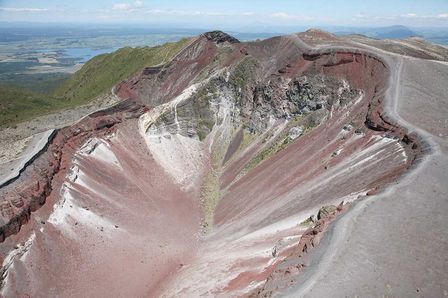
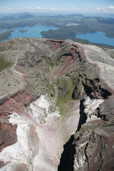
Fissure in summit of Ruawahia / Tarawera Domes. View to SW. Lake Rotomahana in top left corner.

Fissure in summit of Ruawahia / Tarawera Domes. View to NE.

Fissure in summit of Ruawahia Dome. View to NE.


The Okataina volcanic center in the Taupo volcanic zone on New ZealandĀ“s N Island is defined by the Haroharo caldera (approx. 25km diam.) and the Haroharo and Tarawera rhyolite dome complexes (respective volumes of 34 and 13 cubic km) formed therein. The period of caldera formation and modification involved massive explosive events which erupted a total of over 1000 cubic km of material. At least 4 distinct ignimbrite sheets can be attributed to this phase which started 250000 years ago. In the last 30000 years, no further eruption involving the whole caldera occurred and activity involved the emplacement of rhyolytic dome complexes within its boundaries along two linear fissure zones. The Tarawera complex as we see it today is the result of 5 major eruptive episodes starting with the Okarera episode 21.9 ka (21900 years) ago, followed by Rerewhakaaitu (17.6 ka), Waiohau (13.8 ka) and Kaharoa (0.7 ka) episodes and of course the 1886 eruption. Deposits of each of these episodes have been extensively studied since the deep chasms opened by the 1886 eruption provide access to cross-sections of material erupted during much of the history of the complex. It is now known that with the possible exception of the Waiohau episode, intrusion of basaltic lavas triggered each of the eruptions. The Okarera episode involved a brief eruption of basaltic scoria before large volumes of rhyolytic pyroclastics and lavas were erupted. The Rerewhakaaitu episode is thought to have involved the intrusion of basaltic magma into 2-3 preexisting rhyolite magma bodies (Shane et al., J Volc. Geotherm. Res. 164 (2007) p.1-26). The rhyolite magma bodies were "energized" by the basaltic magma and rose to the surface at several points. Widespread tephra deposits and pyroclastic flow deposits around the vents resulted from the Plinian phases of the eruption. Lava domes and flows were emplaced during the latter stages of the eruption. The Waiohau episode was purely rhyolitic, yet similarly explosive and resulted in emplacement of a number of lava domes in the NE part of the Tarawera complex. The Kaharoa episode that shaped Tarawera prior to the destructive eruption of 1886 has been studied in detail (Nairn et al., J Volc. Geotherm. Res. 131 (2004) p.265-294). This eruption occurred from 7 vents along an 8km rift and is thought to have been triggered by sequential basaltic intrusions into a single elongated rhyolitic magma body. The approximately 4 year long eruption commenced with phreatomagmatic explosive events from two vents, followed by massive plinian eruptions from Crater vent. Further vents opened and plinian / subplinian activity continued for some time. Later, a predominantly effusive phase resulted in the emplacement of a number of lava domes (from SW to NE: Tarawera dome, Crater dome, Ruawahia dome (and Tuff cone) and Wahanga Dome) and massive block and ash flows at their margins. These domes are still visible yet are cut down the middle by the craters formed during the 1886 eruption.


The 1886 eruption differed from previous episodes in that it was a basaltic eruption. It is supposed that the basaltic magma rose to the surface without encountering any eruptible rhyolite bodies as in previous eruptions. Tarawera had been quiet since the Kaharoa eruption. The pink and white sinter terraces attracted many tourists to the area, who were accommodated in Rotomahana hotel in the village of Te Wairoa. From there, they were ferried across lake Tarawera and after a short hike were taken across lake Rotomahana to the terraces which were located at the side of the lake. On June 1, 1886, strange waves were observed on lake Rotomahana. These waves were alternatively identified as a Maori war canoe by visiting tourists - the local Maori priest reputedly interpreted this as a sighting of a spirit canoe which represents an omen of some terrible future event. For the next few days nothing unusual was reported. However at 0:30 in the morning of the 10th of June, locals were awakened by violent tremors which marked the onset of the eruption.


The chronology of the eruption can be reconstructed by a combination of eyewitness accounts and studies of the up to 75m thick layers of material deposited along the eruptive fissure during the eruption (Carey et al., Bull. Volcanol. 69 (2007), p.903-926; Sable et al., Bull. Volcanol. 69 (2006), p.89-103). Fissure opening occurred explosively at around 1:30 in the flank of Wahanga dome. This and further phreatomagmatic explosions resulted in sequential opening of craters along the fissure in a SW direction. Around 2:00 massive ash columns were observed above Wahanga and Ruawahai and by 2:30 the entire 8km long NE section of the fissure spanning Tarawera was in eruption and producing an 10km high eruption column. Observations also suggest first columns forming at Rotomahana at this time. At 3:20 a massive earthquake was recorded, possibly associated with the onset of the main eruptive events at Rotomahana and the SE 9km section of the fissure extending as far as Waimangu valley. Massive phreatic / phreatomagmatic eruptions resulted in a huge steam and ash plume and a base surge of mud, ash and steam travelled 4-6km from Rotomahana into the surrounding hills. Whilst some fatalities were directly attributable to these flows, many perished when accumulation of the heavy damp ash on roofs lead to their collapse burying those inside. The eruption then continued along the whole fissure from about 50 different vents until fading at about 6:00 in the morning. The eruption completely reshaped Tarawera and the surrounding landscape. The mountain was left with a series of huge chasms disecting its summit and Lake Rotomahana increased in size 10-fold. Several new craters were also formed in the Waimangu valley.


Southern Crater 1886 Waimangu Valley Waimangu Valley Frying Pan Lake

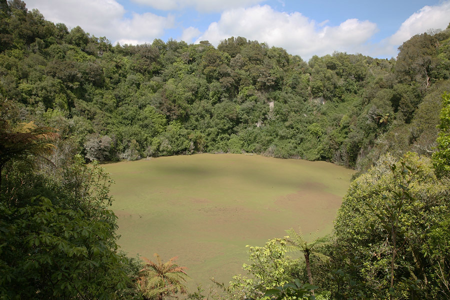
Southern Crater (SW-most crater of 1886 eruption), Waimangu Valley.

Frying Pan Lake viewed from NE. Site of Waimangu Geyser. (2nd most SW crater of 1886 eruption)


Waimangu Valley Echo crater 1886 Waimangu Valley Hot Springs

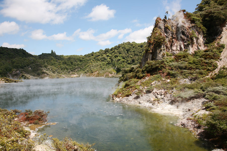
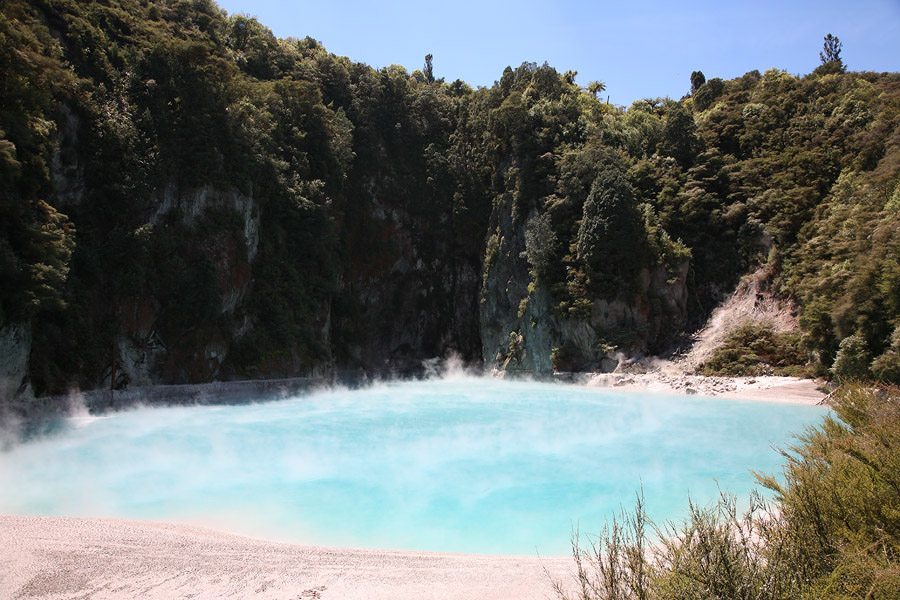
Echo Crater (3rd most SW crater of 1886 eruption), Waimangu Valley.

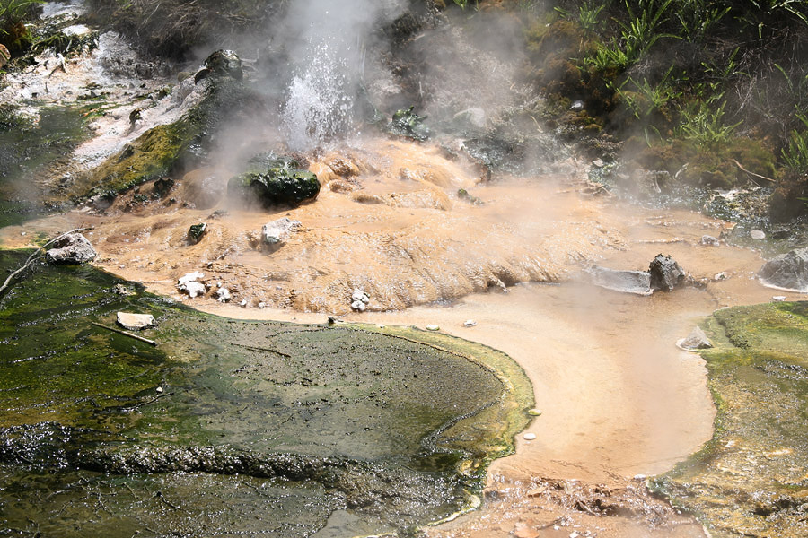
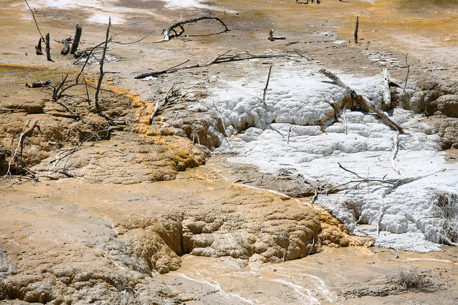
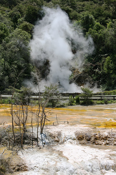
Hot Spring near Echo Crater


Tarawera Volcano Rotomahana Lake Tarawera Volcano Rotomahana Lake Tarawera Dome

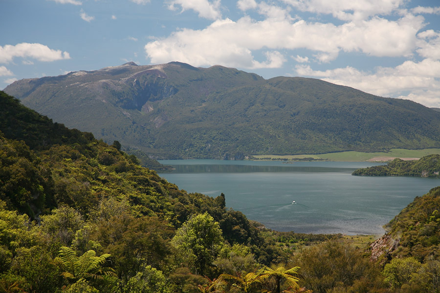
View over Rotomahana Lake to SE flank of Tarawera

SE flank of Tarawera dome with crater from 1886 eruption


The initial phase of the eruption is now known to have been phreatomagmatic and is thought to have resulted from rising magma interacting with groundwater at a depth of about 300m below the surface. The sequential opening and widening of the fissure resulting in a series of 13 craters across the Tarawera dome complex alone. The main Plinian phase of the eruption that followed resulted in a nearly 30km high eruption column according to analysis of its deposits and may have lasted for over 4 hours. Studies on fissure-proximal deposits corroborate eye-witness accounts of multiple discrete columns feeding the main Plinian column. It is now thought that vents within 4 craters located in the area from the site of the Ruawahia tuff cone to the SW portion of Tarawera dome contributed to the Plinian column. The weaker vents in the NE fissure section are thought to have predominantly erupted in strombolian fashion during this phase of the eruption. As the Plinian phase finished, a short weak phreatomagmatic phase occurred, possibly as the result of the top of the magma column (the fragmentation surface) sinking down again into groundwater containing rocks (it had presumably been near to the surface during the most intense phase of the eruption).

Basaltic Plinian eruptions are extremely rare, since eruptions of relatively fluid basaltic lavas are usually far less explosive than eruptions of more viscous andesitic, dacitic or rhyolitic material. Further examples are the 122 BC eruption of Etna volcano and two eruptions of Masaya volcano (Nicaragua) which probably occurred about 2 and 60 thousand years ago, forming the San Judas and Fontana deposits, respectively


Following the 1886 eruption and loss of the sinter terraces, touristic interest in the area declined until 1900 saw the birth of the largest geyser ever recorded. Echo crater is the second most SW crater of the 1886 fissure and is found in the Waimangu Valley geothermal area. Following the eruption it filled with sediments and its W section became known as frying pan flat, since it contained several fumaroles and hot springs. It was the NE section of Echo crater in which the Waimangu (black water) geyser suddenly sprang to life. A 36 hour cycle with eruptions lasting for up to 6 hours was established. The geyser erupted water containing dark sediments, rocks and steam to a height of over 100m, sometimes reaching 400m. An accommodation house and viewpoints were established for the growing numbers of visitors. Unfortunately, the geyser claimed 4 lives when a group ventured too close and were swept away by the outflow in 1903. After a period of irregular and weaker activity, the geysers last eruption was recorded on 1. Nov. 1904.

In 1915, several small hydrothermal eruptions occurred at frying pan flat. Then, on April 1. 1917, a massive hydrothermal eruption projected steam and sediments and rocks filling Echo crater in a SW direction towards the accommodation house. The roof was blown off and a woman and child inside were so badly scalded that they later died. The eruption continued to throw rocks hundreds of meters into the air for several days. Since then, the crater has filled with water and forms one of the largest hot springs in the world, frying pan lake. In 1973 a minor hydrothermal eruption occurred at the side of the lake, yet no further notable events have occurred in recent times. Waimangu valley nevertheless remains an active geothermal area with many hot springs, fumaroles and sinter terraces. It is indeed one of the youngest geothermal areas in the world.


Waimangu Valley Hot Springs Mud deposits Echo Crater, Waimangu Valley

Hot Spring NE of Frying Pan Lake

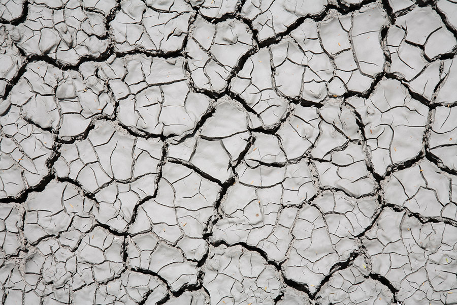
Mud deposits in Echo Crater


Waimangu Valley Hot Springs Marble Terrace Waimangu Valley Hot Springs Marble Terrace Waimangu Valley Hot Springs Warbrick Terrace

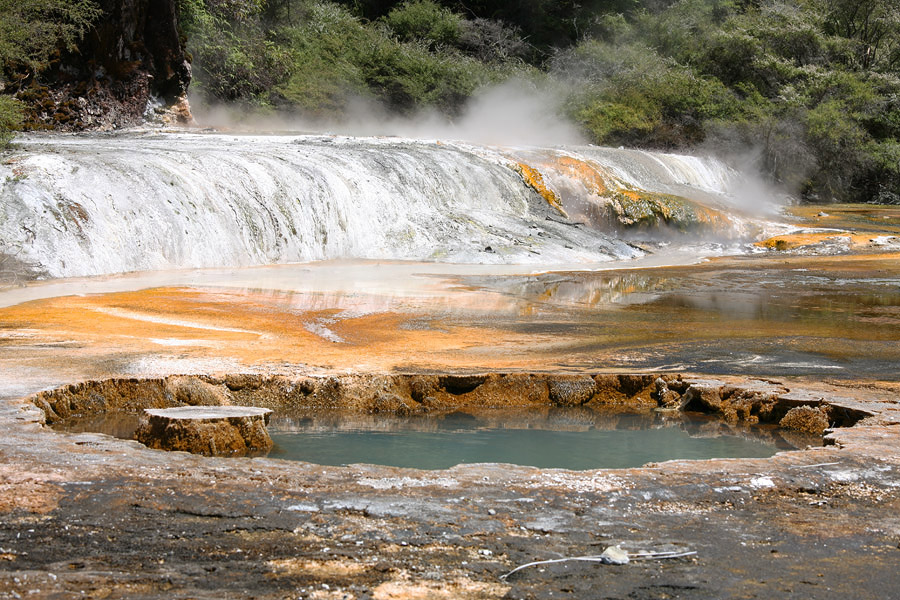
Marble Terrace, Waimangu Valley.

Marble Terrace, hot spring behind.

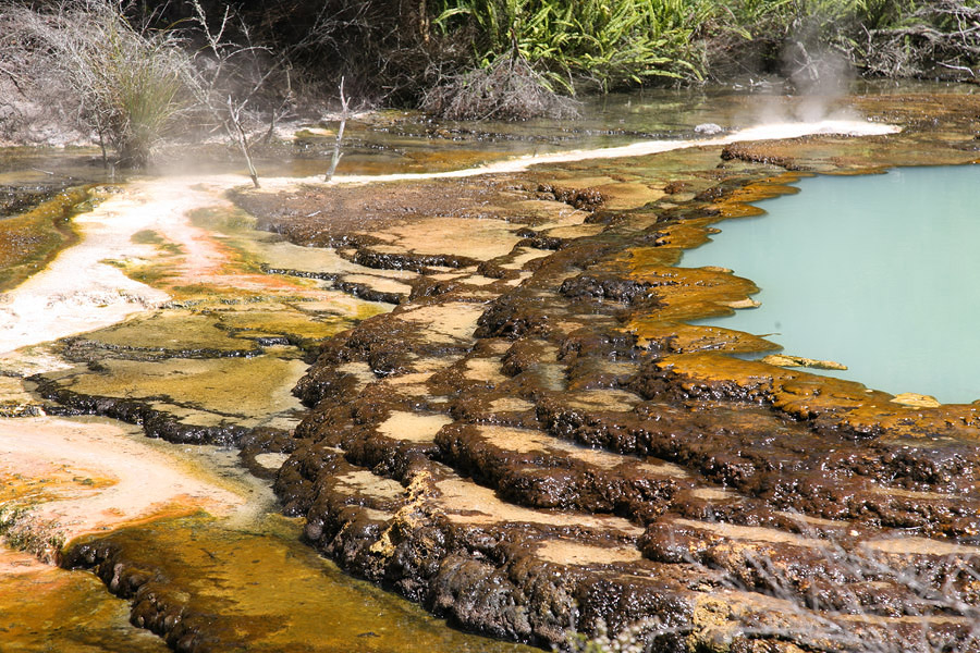
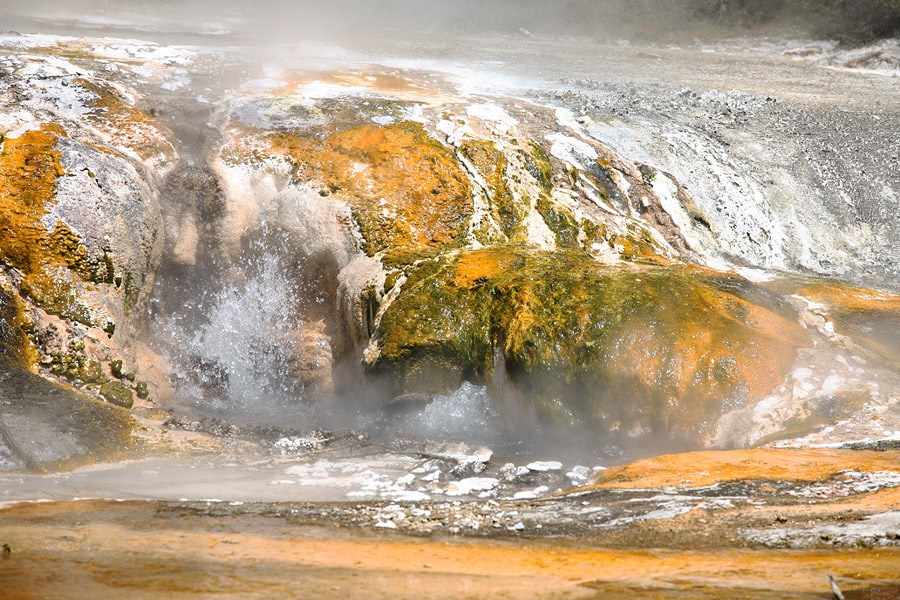
Warbrick Terrace, Waimangu Valley.


Waimangu Valley Hot Springs Warbrick Sinter Terrace Waimangu Valley Hot Springs Warbrick Terrace

Warbrick Terrace

Warbrick Terrace


Access to Mount Tarawera is apparently restricted. Permits are necessary and tourists may be taken up by 4WD vehicle or helicopter. The geothermal area of Waimangu valley can be visited after paying an entrance fee at the visitor center. For further info on New Zealands volcanoes, see sections on Ruapehu, Tongariro, White Island and Wai-O-Tapu geothermal area.


Photovolcanica Full Index