Milos Volcanic Field


The archipelago of Milos is a member of the South Aegean Volcanic Arc, formed as a result of subduction of the African under the Eurasian plate. Whilst Milos appears superficially similar in shape to Santorini Caldera, the somewhat horseshoe-shaped island was built by a succession of eruptions from different centers which coincidentally resulted in the present day form. The central bay is thus not attributable to caldera collapse. Volcanic activity has occurred over an extensive period of time and from a variety of volcanic centers at Milos. Since the last magmatic activity occurred about 90000 years ago, with only sporadic phreatic events occuring in more recent times. Hence, the focus of this page is on the resulting deposits and their exploitation in historical times.

Profitis Ilias, Milos Bombarda rhyolitic lava dome, Milos

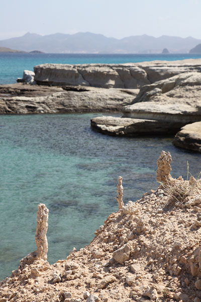
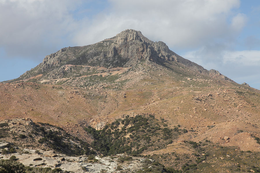
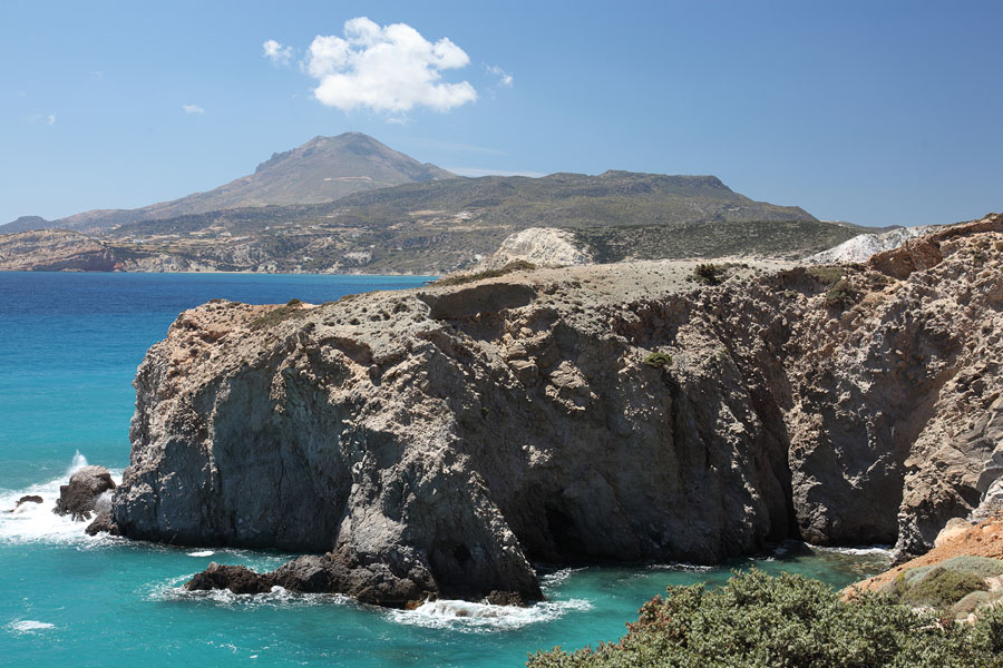
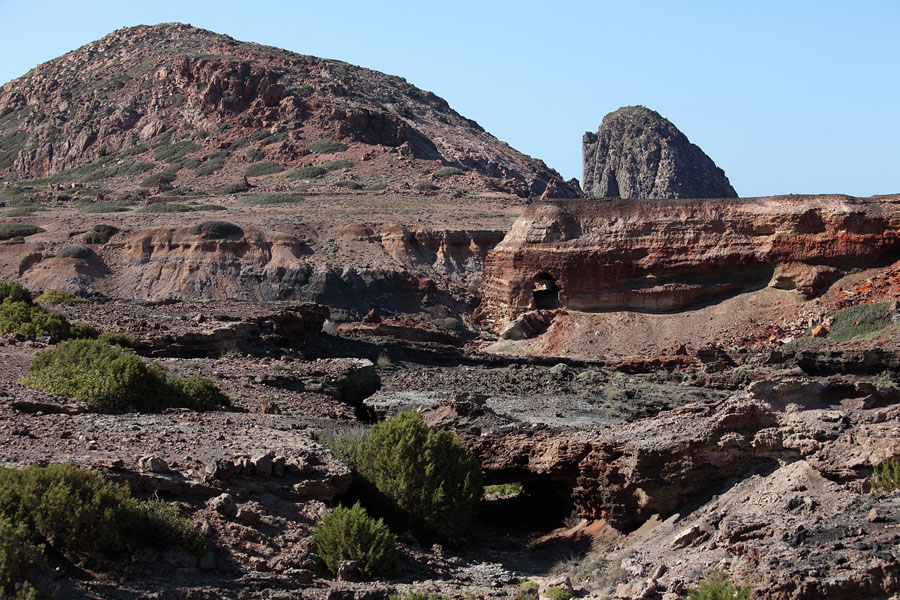
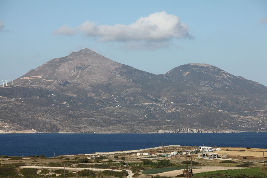
View westward over Milos bay to highest point on island - Profitis Ilias (748m). Ch. Vouno (636m) is seen on right. Both are rhyolitic volcanic bodies.

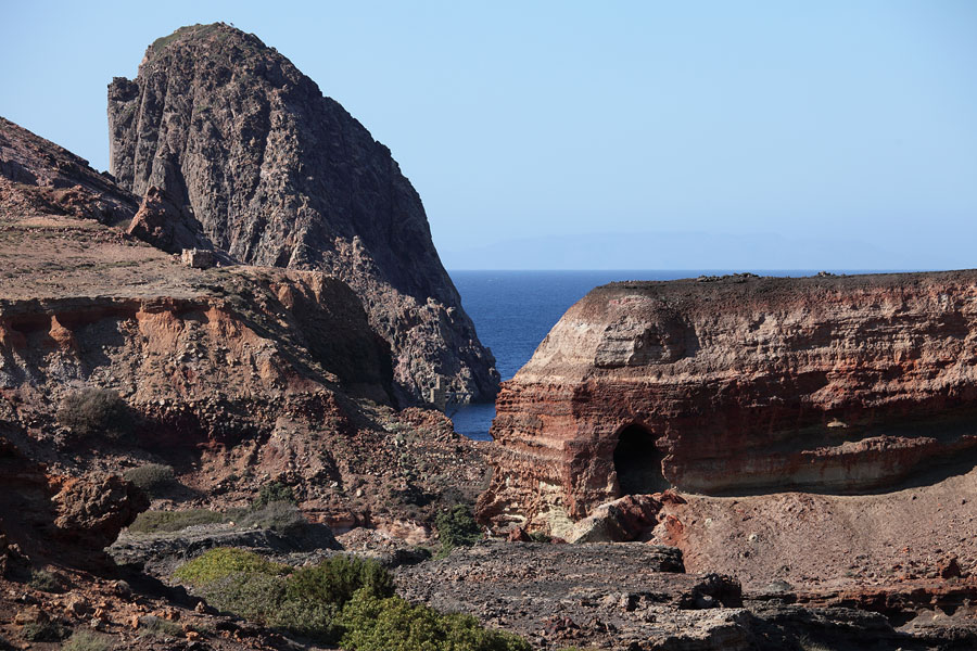
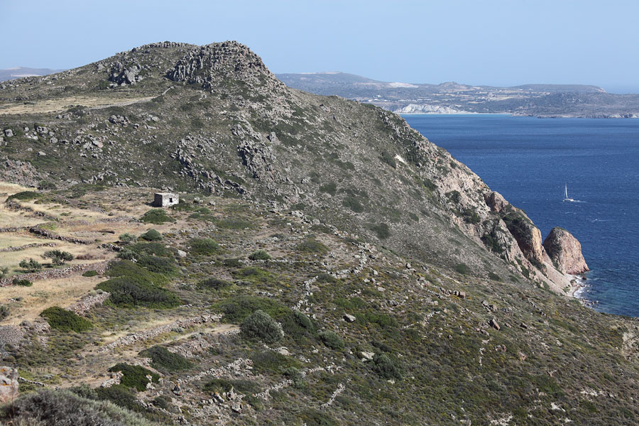
View from north of Bombarda rhyolitic lava dome west of Adamas. In this area at Nychia, obsidian was mined as far back as 11,000 years ago


Geological Setting

Geology Milos in Setting Hellenic Arc

The South Aegean (or Hellenic) Volcanic Arc extends almost 500 km from mainland Greece to Turkey. The trench formed by subduction of the African plate lies about 250 km south of the arc, the latter lying in a zone with a crustal thickness of about 30 km. The subduction process is responsible for the magmagenesis which has resulted in the formation of the arc. Volcanic centers on the arc include Aegina, Methana, Poros, Milos, Santorini, Kos, Yali and Nysiros and are indicated by red Triangles. The red lines dissecting the active arc indicate fault lines associated with volcanic activity since they allow magma easier access to the surface. Grey arrows indicate directions of movement of the Aegean Plate (north of trench) and African Plate (south of the trench), the latter of which is subducting under the Aegean Plate.

The map represents an extreme simplification of the complex tectonic structures in the region. The interested reader could view e.g. Vassilakis et al. 2011 (Earth Planetary Sci. Lett. 303, p.108-120) for a far more detailed analysis.


Volcanic Evolution of Milos


Milos is almost entirely volcanic in origin, except for a couple of outcrops of pre-volcanic units visible along the south coast of the island. The structure of the island is highly complex. Many parts of the island were originally formed underwater, only to breach the surface as a result of regional uplifting processes. Indeed, the highest point on the island, Profitis Ilias is thought to be a rhyolitic cryptodome-pumice cone volcano formed in a submarine environment. It is today 748 meters above sea level.

Whilst the understanding of the volcanic evolution of Milos continues to evolve, a brief summary based largely on the 2006 paper of Stewart and McPhie (Bull. Volcanol. 68, p.703-726) follows to give a rough idea of the sequence of events.

Dating of volcanic rocks suggests that volcanic activity at Milos began over 3 million years ago (MYA). Volcanism was initially submarine and volcanic structures probably started to emerge from the sea about 1.44 MYA due to continuing buildup of volcanic products in combination with fault-constrained volcano-tectonic uplift.

Volcanism was initially focussed in the western sector. Large cryptodome / pumice-cones of predominantly rhyolytic composition initially formed on the sea floor. These were constructed by emplacement of large explosively erupted pumice-breccia deposits, following which rhyolitic magma bodies infused these deposits causing formation of a domed structure without however breaching the overlying deposit layer. In total, four such structures exist, each being about 5 cubic km in volume (2.5 DRE), and together extending over 85% of Milos, although in many places being overlain by more recent deposits. The Profitis Ilias complex formed about 3.08 MYA, further structures of this type are the more recent Bombarda (1.7 MYA), Filakopi (2.66 MYA) and Dhemeneghaki (1.84 MYA) volcanic centers. During the submarine development of Milos, dacitic and andesitic structures also formed. These cover about 10% of the present island. For example Mavro Vouni formed south of Profitis Ilias about 2.5 MYA. The Filakopi complex in NE Milos was formed in a submarine environment about 2.66 MYA, the Kalegoros complex in NE Milos also evolving at around this time. The Triades complex of dacitic and andesitic lava domes today forming much of NW Milos formed in a submarine environment from about 2.18-1.44 MYA and the Plakes complex (which may have been partially subaerial) north of Bombarda more recently, 0.97 MYA.

It is thought that the rhyolitic Bombarda complex may have breached the surface already about 1.7 MYA but was still at least predominantly submarine (Rinaldi and Campos, 2003. Bull. Volc. 65, p.282-293). Several dacitic-andesitic domes formed in at least a partially subaerial environment. These were Krotiraki on the south coast, Kontaro on the opposite side of the Gulf of Milos to Bombarda, and Korakia (1.59 MYA) in NE Milos. Whilst several small islets may have existed before this time, geological records show that a significant island started to establish itself above sea level about 1.44 MYA. About 0.95 MYA the effusive rhyolitic complexes of Halepa formed south of the present-day Gulf of Milos. Between about 0.5 and 0.1 MYA, the rhyolitic Trachilas and Firiplaka complexes evolved. Both are essentially circular pumice cones generated by successions of phreatic and phreatomagmatic eruptions.The Fyriplaka complex was active until magmatic volcanism subsided. After this period, the surface morphology of Milos has been further formed by explosive phreatic eruptions which created ring-shaped craters.

It is noted that there is no clear spatial or temporal trend in eruption style of predominant type of products (in terms of silicity). Whilst there is no doubt that the volcanic structures above have formed during the development of Milos, it is noted that other authors provide sometimes significantly different dates for their formation. Hence, the exact chronology remains subject to debate.

The shape of the island as a whole has also been strongly influenced by faulting and regional uplift processes associated with the location of fault lines. These have significantly contributed to the shape of Milos as we see it today. The bay (gulf) is flanked by NW-oriented faults which define the Milos Gulf graben which is considered the most "active" part of Milos today. This includes the most recently active Fyriplaka complex and several younger phreatic craters. The most recent of these apparently occurred in Roman times, since a small lahar associated with the eruption buried walls in a Roman harbour town east of the Fyriplaka tuff ring. It is possible that magmatic activity at Milos may resume in the future, since geothermal activity suggests that magma may still be quite close to the surface.

Sites of Geological Interest


Paleochori


Paleochori is near the most recent location of magmatic activity and subsequent center of phreatic activity in SE Milos. Hence, it is not surprising that hydrothermal alteration of rocks has occurred at this location and that weak fumarolic activity can be observed along the coastal cliffs. A number of submarine hydrothermal vents also exist offshore. These emit hydrothermal fluids rich in arsenic and largely carbon dioxide gases (55-92%), with up to 3% hydrogen, 10% methane, and 8% hydrogen sulfide. The latter is largely responsible for the colourful deposits at the base of the cliffs. A large number of vents are found in shallow water near the coast with many bubbling so vigorously that they can be detected by sonar (Dando et al., 1995. Cont. Shelf Res. 15(8), p.913-929).


Colourful geothermally altered cliffs of volcaniclastic deposits at Paleochori, Milos Colourful geothermally altered cliffs of volcaniclastic deposits at Paleochori, Milos. Yellow, red and white deposits. Colourful geothermally altered cliffs and beach at Paleochori, Milos

Colourful geothermally altered cliffs at Paleochori


Colourful geothermally altered cliffs at Paleochori, Milos Colourful geothermally altered cliffs at Paleochori, Milos Colourful geothermally altered cliffs at Paleochori, Milos. Yellow and red deposits

Colourful geothermally altered cliffs at Paleochori


Green fumarolic deposits at Paliochori beach, Milos Colourful geothermally altered cliffs at Paliochori, Milos Yellow sulfurous fumarolic deposits at Paliochori beach, Milos

Fumarolic deposits, base of cliffs at Paleochori

Colourful geothermally altered cliffs at Paleochori

Fumarolic deposits, base of cliffs at Paleochori


Sarakiniko


Sarakiniko beach is famous for its erosionally sculpted pliocene white tuff formations. The Sarakiniko formation is about 50 meters thick and consists of layers of thickly bedded sandstone, pumice breccia and mudstone containing numerous marine fossils and fossilized tree roots. The formation was largely emplaced in a shallow marine environment after which it was gradually uplifted.

Shipwreck at Sarakiniko, Milos Eroded coastal arches at Sarakiniko, Milos Erosionally sculpted pillar of layered volcaniclastic deposits (tuff) , Sarakiniko, Milos

View along coast at Sarakininko towards Fyropotamos

Arches formed by erosion

Erosionally sculpted pillar of layered deposits of pumice / ash


Erosionally formed mushroom rocks, Sarakiniko, Milos Erosionally sculpted pillar of layered volcaniclastic deposits (tuff) , Sarakiniko, Milos Erosionally formed mushroom rocks, Sarakiniko, Milos

Mushroom-shaped rock formations

Erosionally sculpted pillar

Erosion resistant boulder perched on pillar of tuff


Fossilized seashell, Sarakiniko, Milos Fossilized roots, Sarakiniko, Milos Fossilized roots, Sarakiniko, Milos

Fossils embedded in deposits at Sarakiniko


Fossilized marine snail, Sarakiniko, Milos Fossilized seashells, Sarakiniko, Milos Fossilized sea urchin, Sarakiniko, Milos

Fossils embedded in deposits at Sarakiniko


Intercalated beds of fine ash and small pumice, Sarakiniko, Milos Intercalated beds of fine ash and small pumice, Sarakiniko, Milos Intercalated beds of fine ash and small pumice, detail, Sarakiniko, Milos

Intercalated beds of fine ash and small pumice


Thick seam of light volcaniclastic deposits, Sarakiniko, Milos Erosionally exposed pumice agglomerate, Sarakiniko, Milos Erosionally sculpted volcaniclastic deposits, Sarakiniko, Milos

Thick seam of lighter material

Erosionally exposed pumice agglomerate

Erosionally sculpted ash / pumice deposits


Erosionally exposed pumice agglomerate, Sarakiniko, Milos Sarakiniko, Milos Erosionally exposed pumice agglomerate, Sarakiniko, Milos

Erosionally exposed pumice agglomerates

Valley disecting Sarakiniko deposits

Erosionally exposed pumice agglomerate


Fyriplaka


Fyriplaka is a volcanic center that was active in the late Upper Pleistocene period. The structure was formed by the emplacement of a series of overlapping cones followed by a period characterized by effusive eruptions. Activity in the area probably ceased about 90000 years ago (Fytikas et al. 1986. J. Volc. Geotherm. Res. 28, p.297-317). Images show Firiplaka Beach where part of the complex has been erosionally disected, revealing colourful formations of hydrothermally altered rocks.


Fyriplaka Beach, Milos Fyriplaka Beach, Milos Fyriplaka Beach, Milos

Firiplaka Beach and cliffs


Other Features


A large variety of geological and other features are found on Milos. Only a small selection are presently shown on this site.


Profitis Ilias, Milos Tsigrado, Milos

Profitis Ilias (748m), view from southwest. Gold-rich deposits are found nearby.

View west from Tsigrado, Profitis Ilias in distance


Klima fishing village, Milos Kleftiko, Milos

Fishing village Klima

The arch at Kleftiko, near southwest tip of Milos


Mining History of Milos


The mining history on Milos goes back thousands of years. The wide variety of minerals available on the island is a result of the range of different volcanic activities which occurred on the island in prehistoric times. Obsidian was mined over 10000 years ago, mainly in the vicinity of Nychia, near Adamas, and Dhemenegaki on the east coast. Until the development of metal tools, obsidian was a coveted material for making cutting devices. Sulfur was mined on the island by the ancient Greeks, starting over 2500 years ago, Trachyte was quarried for use as millstones and a variety of other minerals such as Kaolin or other volcanic clays were also extracted on a small scale. Small-scale mining operation continued throughout the recent history of Milos but it was only some time after the establishment of an independent modern Greek state and coincidental with increased demand for materials in the wake of the industrial revolution that mining operations became more organized and extensive. Following passing of a mining law in 1861, a first concession was issued for mining of Sulfur on Milos, encompassing the Paliorema site. Mining of manganese ore started in 1890 at the Cape Vani site.

In the early 20th century, further enterprises developed for mining of Baryte (S&B Mining, who today control most of mining activities on Milos and financed creation of the Milos Mining Museum) and Kaolin. Present mining activities involving large opencast mines focus mainly of bentonite, perlite and puzzolane.


Paliorema Sulphur Mine


More images and technical information on DETAILED PAGEĀ ABOUTĀ PALIOREMA


In ancient times sulfur was mined in Milos although the exact locations are unclear. Industrial-scale sulfur mining started on Milos shortly after the issuing of modern Greeces first ever official mining concession in 1862. Paliorema is the most prominent relic of the sulfur mining history of Milos. Mining was initially focussed at the coast south Paliorema, with operations gradually focussing on Paliorema in the early 20th century. Mining operations ceased in 1958, following bankruptcy of the company involved as a result of a several-fold drop in sulfur prices. Since then, the mine has been subject to gradual decay and plundering. The sulfur processing plant was built as part of a modernization process at the mine starting in the late 1930s. It was fully operational from 1953-58, employing the innovative Svoronos process for extraction of sulfur from ore. Most of the heavy machinery for performing this process remains in place in the ruins of the processing plant. The sulfur was mainly extracted from underground deposits which were accessed by horizontal adits. These were located in the hillsides several hundred meters further up the valley and connected to the processing facilities by rail tracks. Workers pushed mine-carts containing ore along these to the processing facilities.


Paliorema Sulfur Mine and processing plant, Milos Paliorema Sulfur Mine Svoronos Processing Plant, Milos Paliorema bay and Sulfur Mine, Milos

Ruins of Svoronos process sulfur-processing plant

Sulfur-processing plant viewed from beach

Paliorema Bay with mine buildings


Paliorema Sulfur Mine with powered incline, Milos Sulfur crystal containing ore, Paliorema Sulfur Mine, Milos Minecart, Paliorema Sulfur Mine, Milos

View from valley with track of powered incline in front of processing buildings

Sulfur crystals embedded in tuffaceous material (sulphur ore), Paliorema

Manpower-operated tippable minecart for ore transport


Twin-tracked powered incline, Paliorema Sulfur Mine, Milos Svoronos processing plant, Paliorema Sulfur Mine, Milos

View up twin-tracks of incline. Used to move ore from bunker to processing facility.

Core part of Svoronos processing plant: autoclave chamber with sieving / flotation machinery


Sulfur Processing Plant ruins, Paliorema Sulfur Mine, Milos Gilardoni Centrifugal Hammer mills, Paliorema Sulfur Mine, Milos Sieving machinery, Svoronos Process, Paliorema Sulfur Mine, Milos

Storage bunker above sieving / flotation machinery

Centrifugal hammer-mills (Presumably for breaking sulfur clumps into powder form)

Sieving / flotation machinery for separation of sulfur from fine rock fragments


Entrance to mine shaft (adit) Paliorema Sulfur Mine, Milos Administration block, Paliorema Sulfur Mine, Milos Tunnel with rail tracks, Paliorema Sulfur Mine, Milos

Entrance to horizontal mine-shaft (adit) No. 2

Administration and accommodation block

Tunnels by ship-loading facility (Adit No.0)


Cape Vani Manganese Mine


The Vani manganese deposit is described in detail in the scientific literature (e.g. Liakopoulos et al. 2001. Ore Geol. Reviews 18, p.181-209). Following an extensive period of dacitic volcanic activity, magma-chamber collapse accompanied by a massive release of pyroclasts resulted in the formation of a marine basin largely filled with pyroclastic materials about 2 million years ago. Gradual compaction of the material formed a volcaniclastic sandstone which is the host rock for the seams of manganese rich ore. The manganese was emplaced in the submarine sandstone deposits by hydrothermal processes occuring over a period of no more than several tens of thousands of years. Hot hydrothermal fluids entered the sandstone and as they cooled, manganese oxides were deposited therein. Tectonic processes eventually lifted a portion of the deposits to up to about 35 meters above sea-level. The total volume of the deposit is probably over 2 million tonnes. The deposit is overlain by sedimentary rocks of volcanic origin from eruptions in the period between 0.4 and 0.9 million years ago. The manganese ore horizon is about 4 meters thick. Manganese oxides form a K-feldspar-rich cement. Two generations of manganese oxide are identified, the first being rich in pyrolusite and ramsdellite, the second having higher levels of K, Ba, Pb and Zn resulting from additional intrusion of hydrothermal fluids rich in this components into the primary deposit. The deposit is generally overlain by a green (glauconitic) horizon, a white horizon rich in K-feldspar, conglomerates, sandstone and soil. The presence of up to 15% Arseniosiderite (which contains iron) in the "white" horizons is largely responsible for the reddish colouration characteristic of Vani.

Mining of manganese ores began at Cape Vani in 1871. Initially several small mining operations existed, yet in 1898 french company Serpieri & Cie took over all operations at the Cape. Annual production at this time was about 18000 Tonnes of ore which was largely shipped to England, France and the USA by steamers. The remainder was shipped to the Lavrion smelters in Greece. No smelters existed at Vani itself. About 150 miners were employed, together with about 80 women and children who collected the ore and picked out the useable fragments. The ore was then washed using pulsating cylindrical sieves (trammels) before shipping. About 50-100 people worked in the loading and shipping of the ore. Production ceased in 1909 after the extraction of a total of about 220000 tonnes of ore. Operations were resumed in 1916 and continued until final closure of the mine in 1928.

In contrast to Paliorema, no mining machinery or rail tracks are left at Vani. Narrow gulleys and tunnels reveal the location of tracks and of underground mine works.


Overview, northern section of mine, Cape Vani Manganese Mine, Milos Tunnel for ore transport, Cape Vani Manganese Mine, Milos View to Cape, Cape Vani Manganese Mine, Milos

Overview, northern section of mine

Tunnel for ore transport

View towards Cape Vani


Meeting point of ore transport gulleys, Cape Vani Manganese Mine, Milos Remains of tunnel (adit), Cape Vani Manganese Mine, Milos Remains of tunnel (adit), Cape Vani Manganese Mine, Milos

Meeting point of ore transport gulleys

Remains of tunnel exposed by subsequent opencast mining activity

Tunnels and gulleys


Remains of tunnel (adit), Cape Vani Manganese Mine, Milos Bay area, Cape Vani Manganese Mine, Milos Ruins of mine building, Cape Vani Manganese Mine, Milos

Mining tunnel

Bay near mine. Presumably used for loading of ships

East wall of northern section of mine


Ruins of mine building, Cape Vani Manganese Mine, Milos Ruins of mine building, Cape Vani Manganese Mine, Milos Ruins of mine building near bay, Cape Vani Manganese Mine, Milos

Remaining mine buildings (central and harbour)

Central mine building

Building near harbour


Ruins of mine building, Cape Vani Manganese Mine, Milos Ruins of mine building, Cape Vani Manganese Mine, Milos Harbour area, Cape Vani Manganese Mine, Milos

Central mine building

Central mine building

Harbour area


Cape Vani Manganese Mine ship  loading facility, Milos Remains of tunnel (adit), Cape Vani Manganese Mine, Milos Remains of building perched above Cape Vani Manganese Mine, Milos

Cape with loading facility

Exposed section of tunnel

Building perched above main opencast mine at north end


Cape Vani Manganese Mine, Milos Remains of tunnel (adit), Cape Vani Manganese Mine, Milos Cape Vani Manganese Mine overview, Milos

Remaining mine buildings (central and harbour) view from northwest

Mine tunnel near harbour

northern pit of mine - viewed from west


Cape Vani Manganese Mine overview, Milos Cape Vani Manganese Mine, Milos Converging gullies for railtracks, Cape Vani Manganese Mine, Milos

Overview of main mining area

View over harbour entrance building to Milos bay

View southwards across mine - numerous converging gulleys for ore transport are visible on right side of image


Cape Vani Manganese Mine, Milos

Southeastward view over mine


Current Mining Activity


A number of large opencast bentonite mines are operational in Milos, especially in the northeast part of the island. Bentonite may form when volcanic ash weathers over long periods of time in the presence of water. Its main component is montmorillonite which is a hydrated sodium calcium aluminium magnesium silicate hydroxide which may also contain potassium and iron. Bentonite is a highly absorbent form of clay which increases in size several times when coming into contact with water, forming a viscous hydrate. It is used in a variety of industries as a sealant, binding agent. It is used for pet-litter and also in paper-making where it may also be used for deinking during paper recycling.

Perlite is another mineral mined on Milos, with mines located on both the north and south coast. Perlite is a volcanic glassy material formed when rapidly cooling high silicate (70-75%) lava entraps water in its mass. When heated to 800-950 'C, the material softens and the pressure from the entrapped water vapour bubbles leads to an about 7-16 fold increase in volume. This results in a very light-weight foam-like material. This processed perlite is mainly used in building materials since it is cheap and light. It also may find use as a filtering material in the food industry since it is an inert porous material.

Pozzolana is also mined on Milos. This is a fine volcanic ash rich in silicic acid. It can be mixed with calcium hydroxide with which it will react in the presence of water to form a kind of cement.


Bentonite Mine Agia Irini, Milos Zoulia bentonite mine, Milos

Agia Irini bentonite mine (S&B Industrial Minerals S.A.)

Zoulia bentonite mine (S&B Industrial Minerals S.A.)


Voudia perlite processing facility, Milos Loading bulk carrier, Milos

Perlite processing facility at Voudia

Bulk carrier being loaded with processed perlite at Voudia


Drying bentonite near Voudia, Milos Pozzolan Mine, Ksylokeratia, Milos

Drying area for bentonite (?) ores near Voudia

Pozzolan mine by Ksylokeratia


Tsigrado Perlite mine, Milos Perlite mine, Milos

Tsigrado perlite mine and processing facility (S&B Industrial Minerals S.A.)

Perlite mine (S&B Industrial Minerals S.A.)


Visitor Information


Milos has an airport with daily flight connections to Athens and a port which connects the island to the mainland and neighbouring islands by ferry connection. The island is much less touristically developed than Santorini and has thus maintained much of its charm.

Those wishing to have a detailed geological tour of the island may consider joining one of the Milos Tours offered by Volcano Discovery, since the company specializes on Milos and the nearby spectacular island caldera of Santorini. Further, for anybody wishing to do a mediterranean volcano tour, visits to the italian volcanoes Stromboli, Etna and Vesuvius would also be recommended.


Photovolcanica Full Index