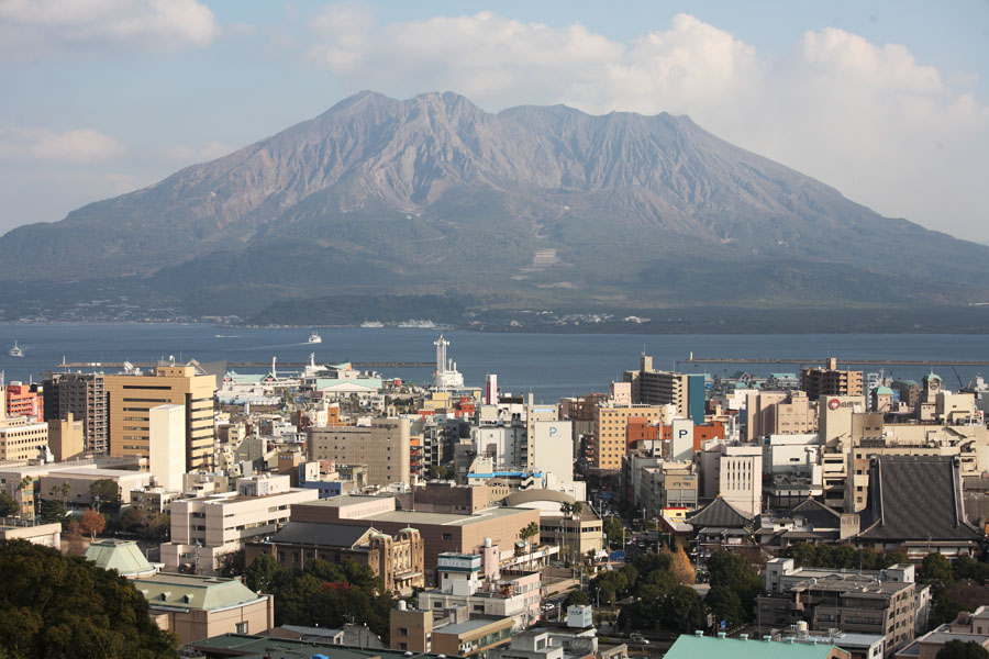
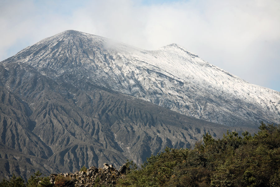
Kagoshima city and - Kita-dake (left), Minami-dake (right)
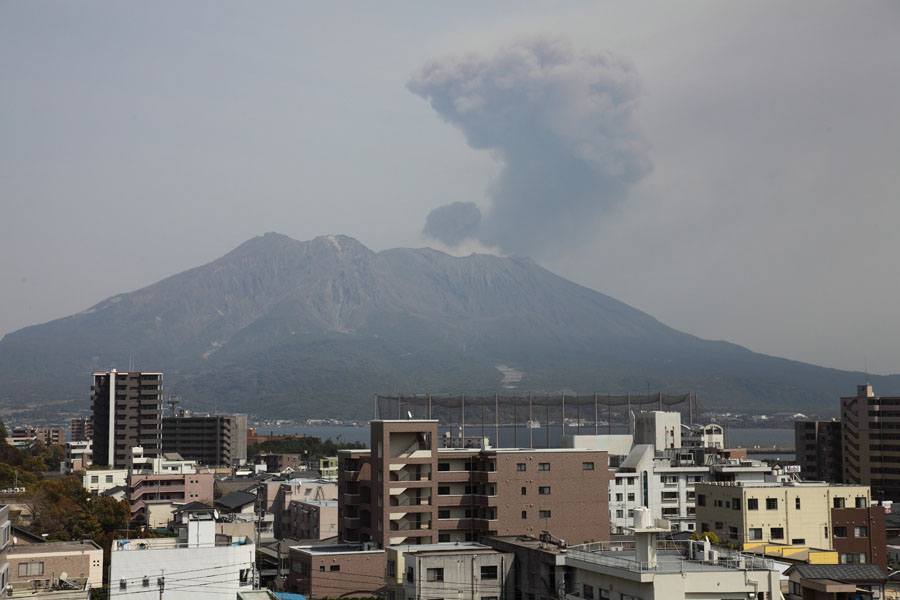
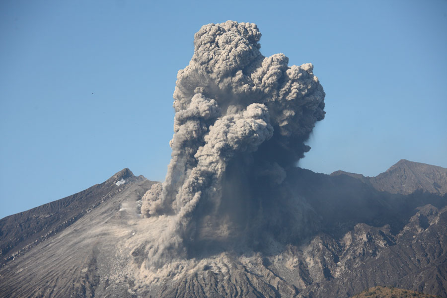
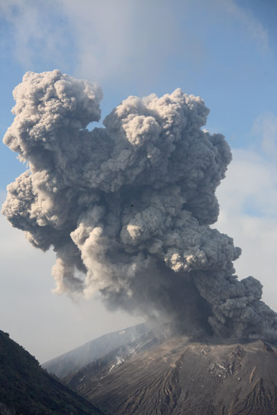
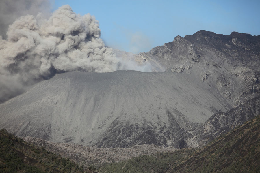
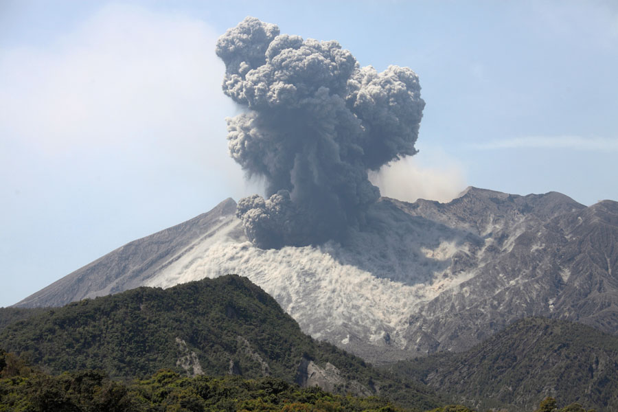
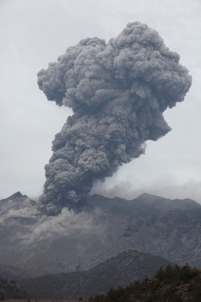
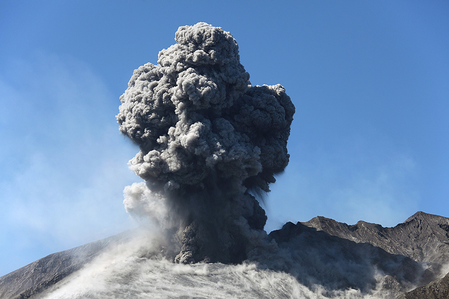
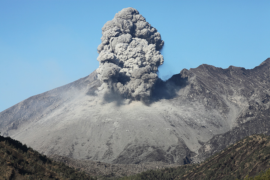
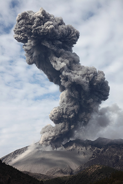
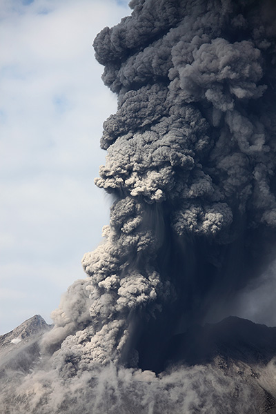
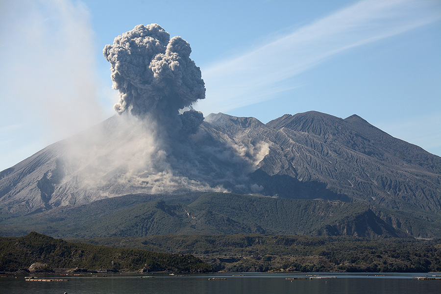
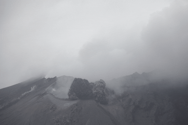
Ash cloud rising above Sakurajima
|
|
|
Kagoshima city and - Kita-dake (left), Minami-dake (right) |
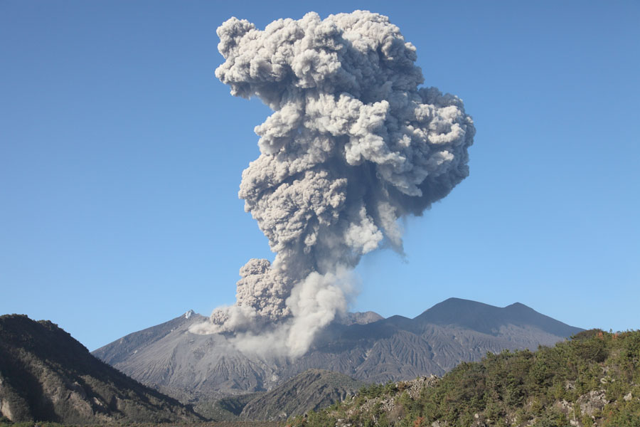
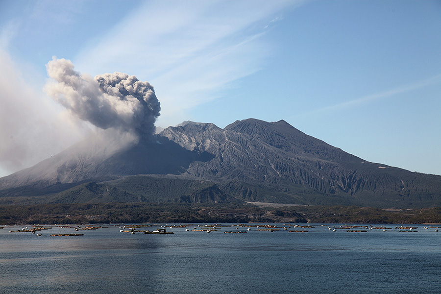
Ash cloud rising above Sakurajima |
 |
|
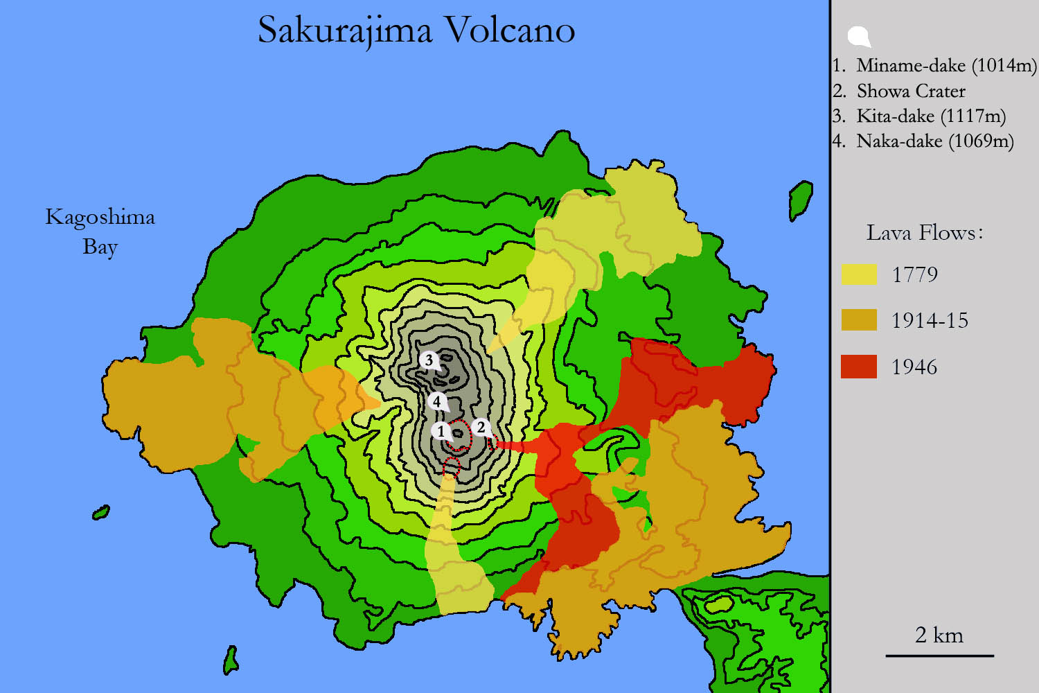
Map based on several maps from the Geological Survey of Japan |
 |
 |
 |
|
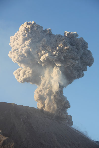
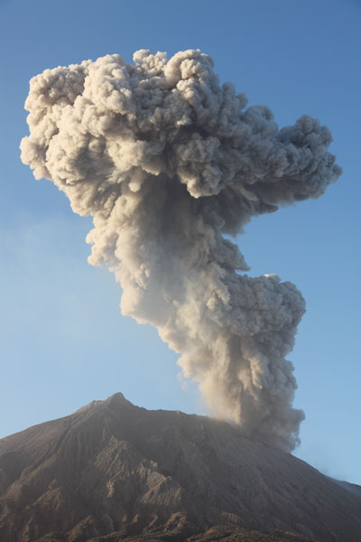
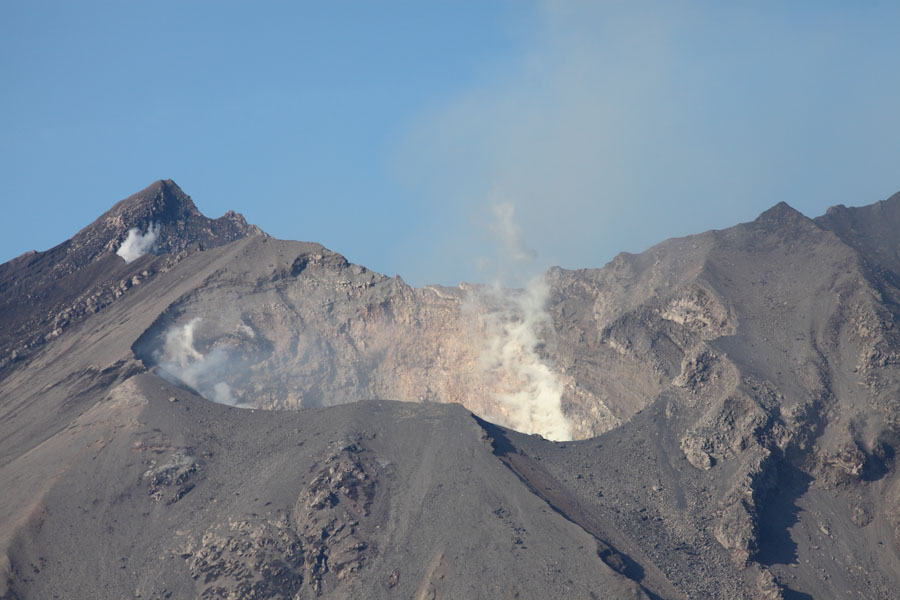
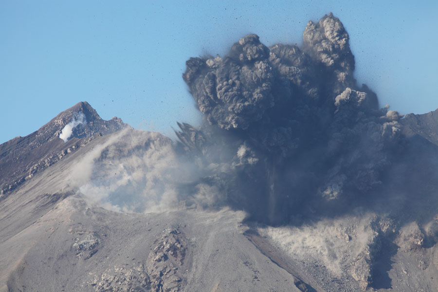
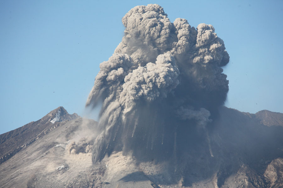
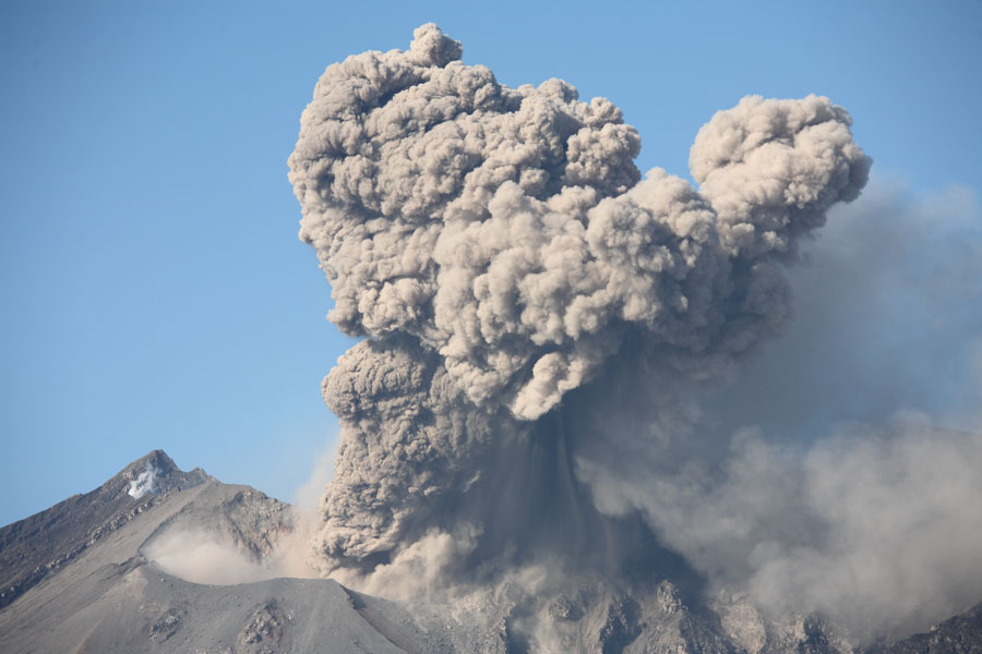
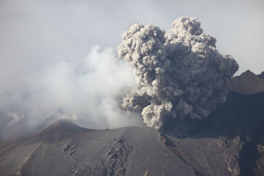
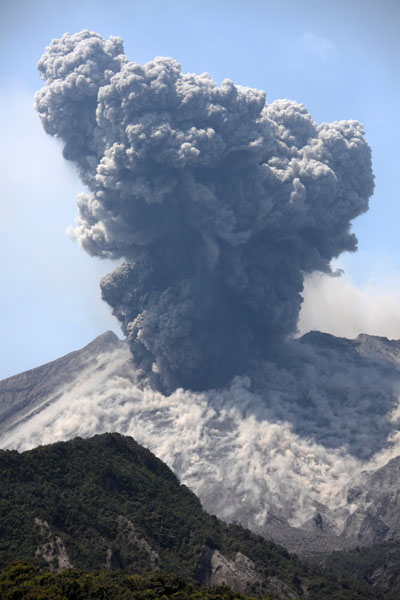
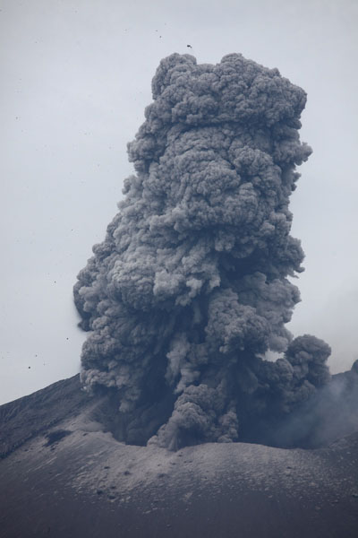
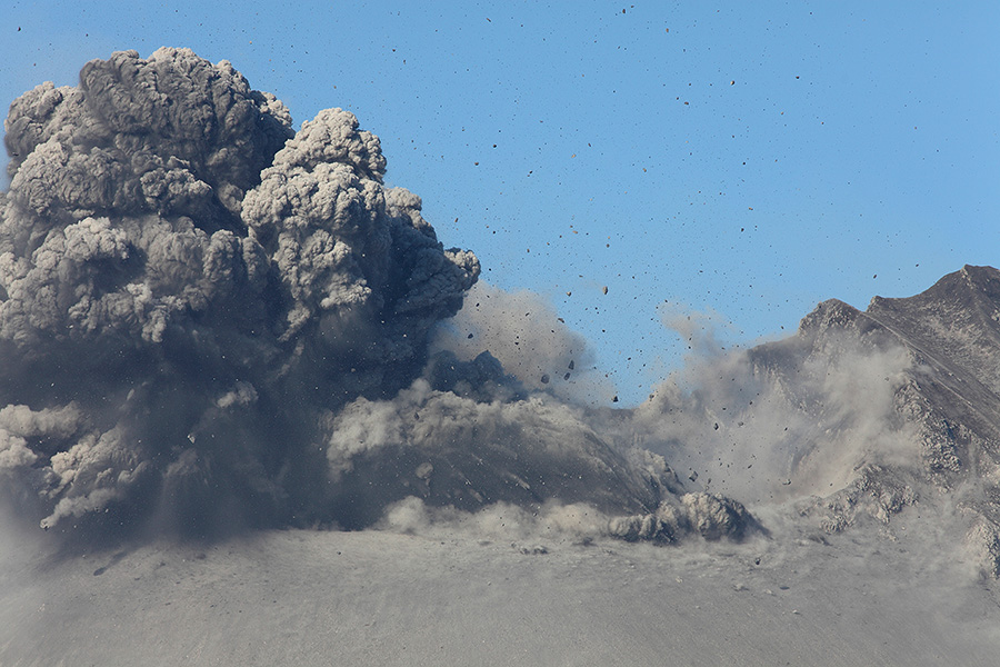
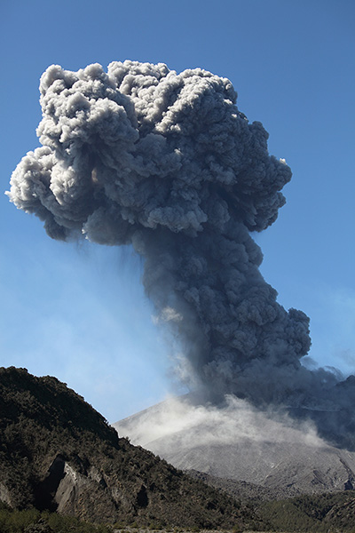
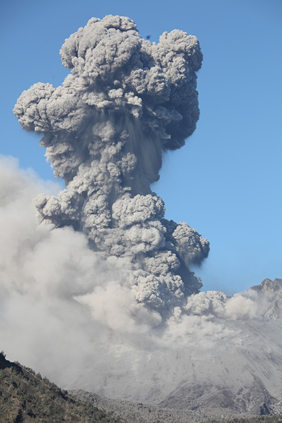
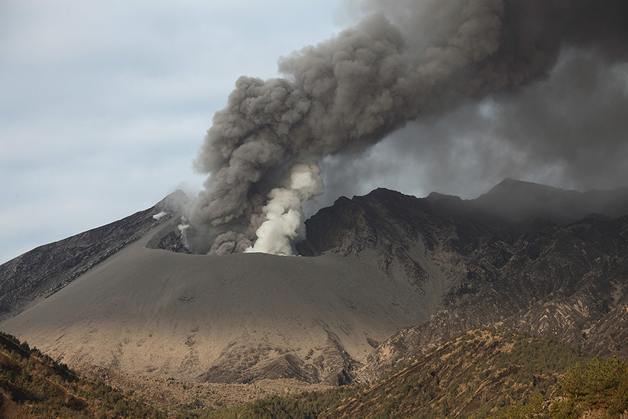
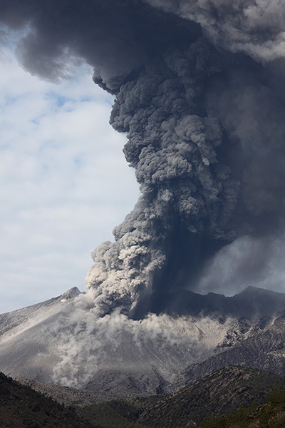
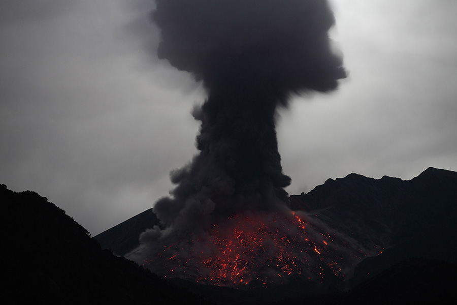
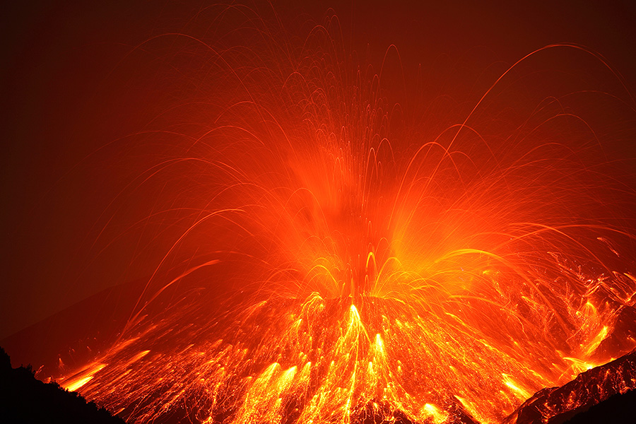
Ash-cloud from vulcanian eruption, Showa crater (26.12.09, 16:35 local) |
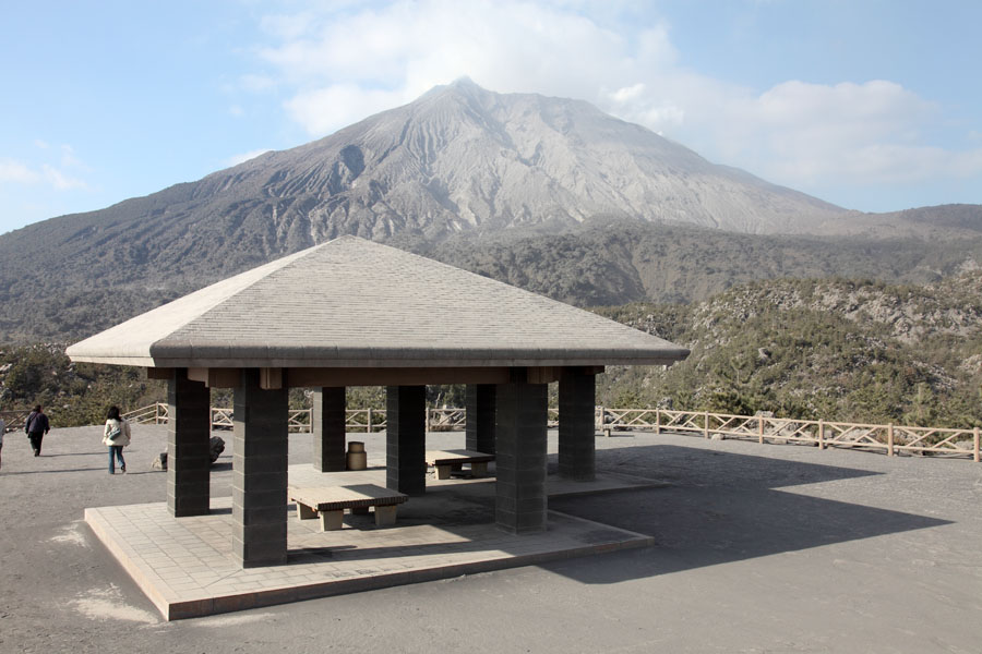
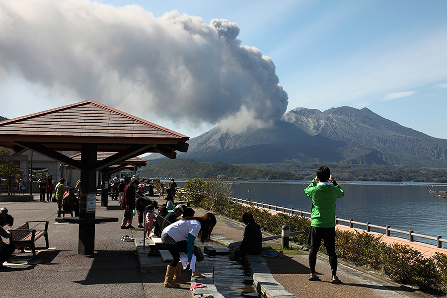
Official viewpoint (Arimura Observatory), concrete-roofed shelters |
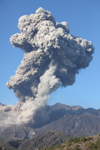
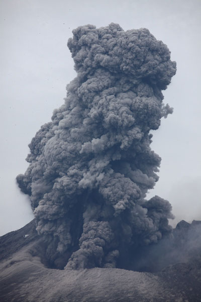
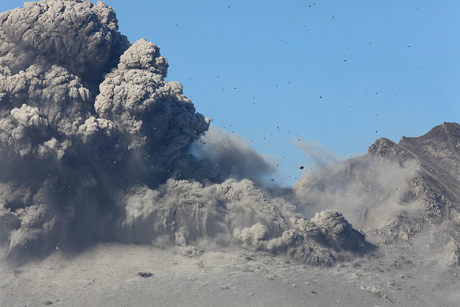
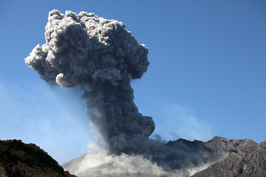
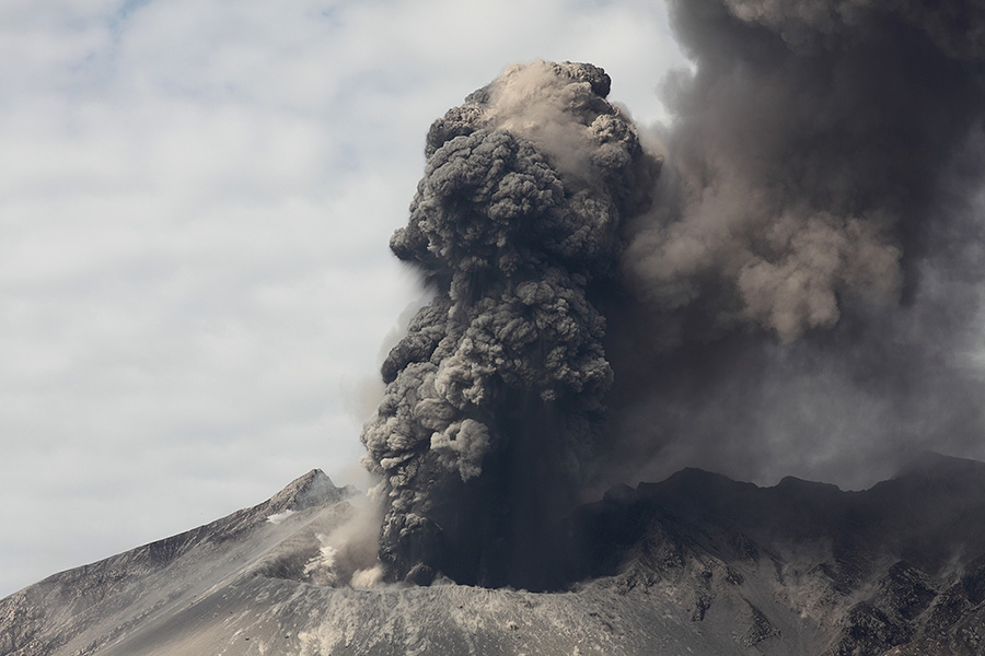
Ash-cloud from vulcanian eruption, Showa crater, 2009 |
    |
|
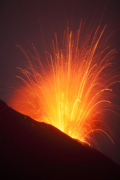
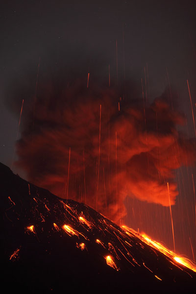
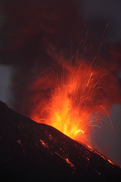
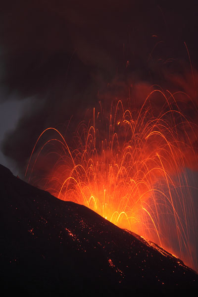
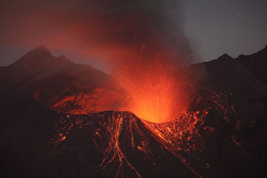
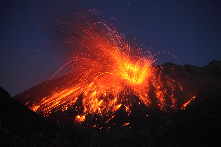
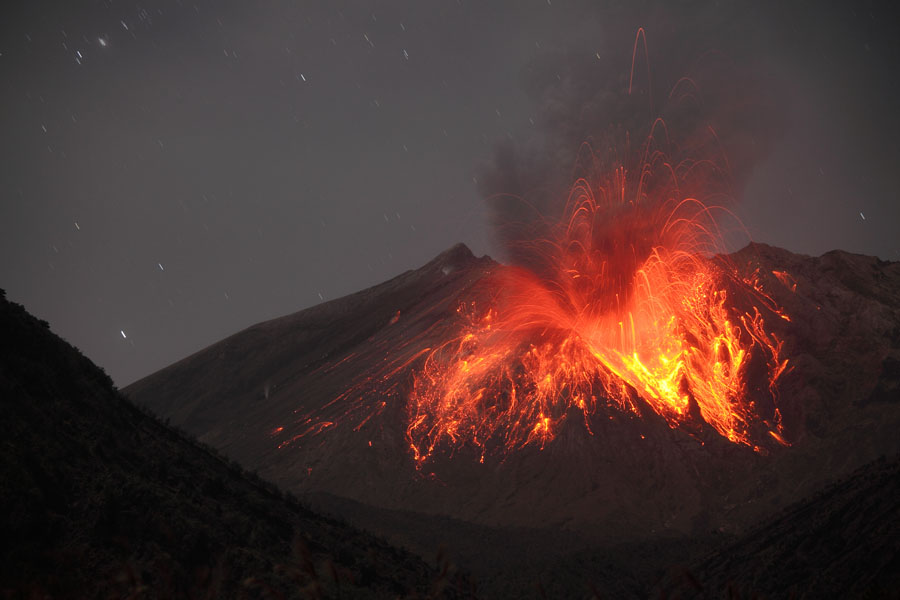
Series of images from nighttime eruption, viewed from Arimura Observatory (27.12.09, approx. 01:00) |
 |
 |
|
Showa crater, 1st of 2 vulcanian eruptions (01.01.10, a. 00:05) |
Showa crater, vulcanian eruption (01.01.10, a. 23:25) |
 |
 |
|
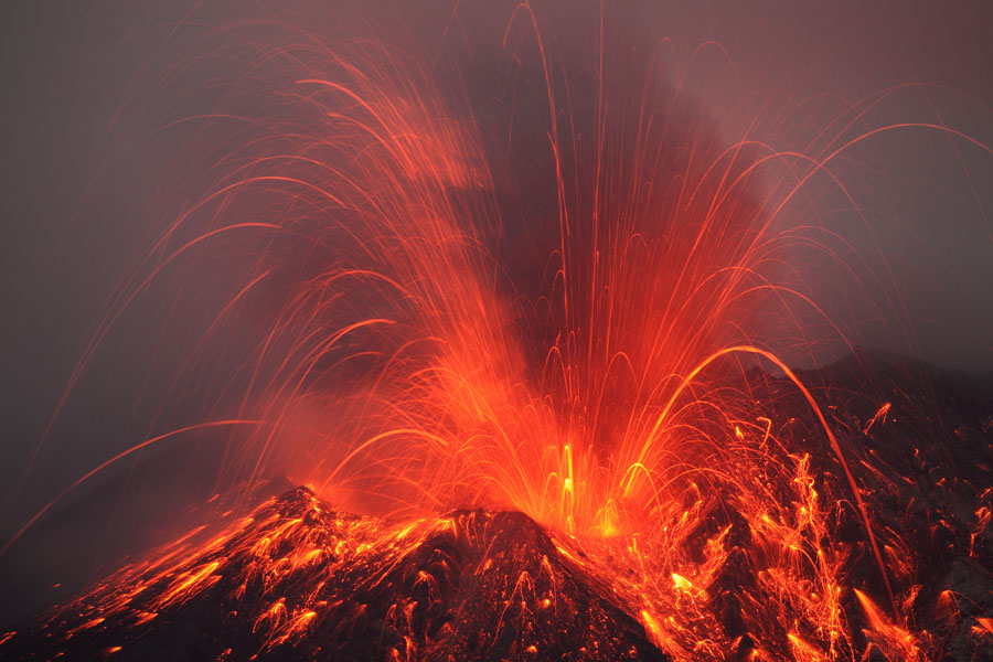
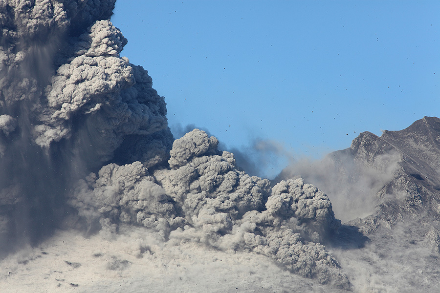
Showa crater, violent strombolian activity following vulcanian eruption |
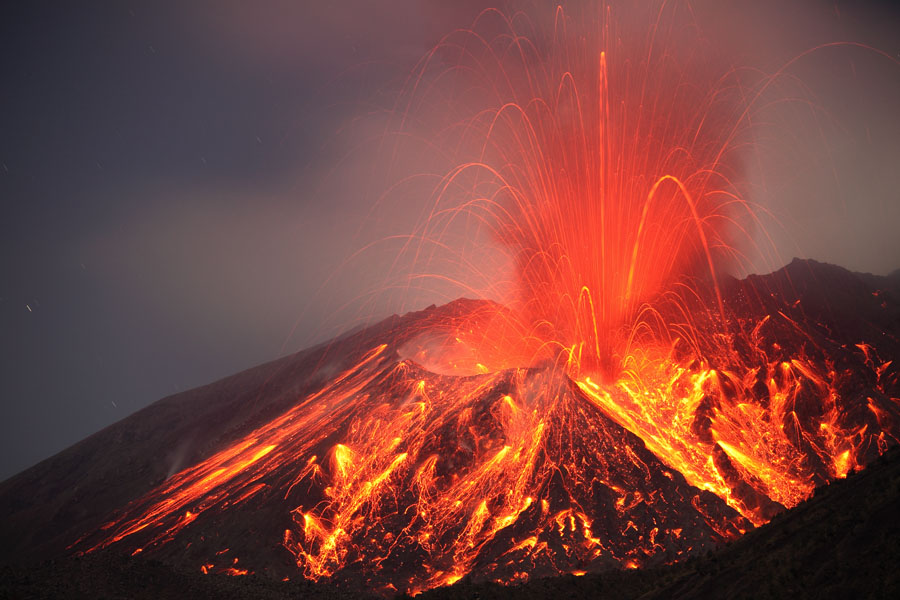
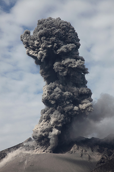
Showa crater, vulcanian eruption (03.01.10, a. 21:25) |
 |
 |
|
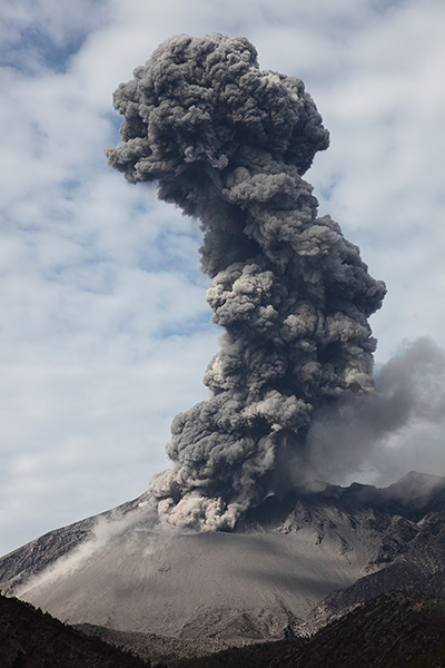
Showa crater, vulcanian eruption (02.01.10, a. 19:55) |
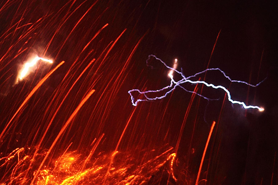
Static discharges in ash-cloud |
 |
 |
|
Showa crater just before vulcanian eruption on right |
Showa crater, vulcanian eruption (04.01.10, a. 09:20) |
 |
 |
 |
|
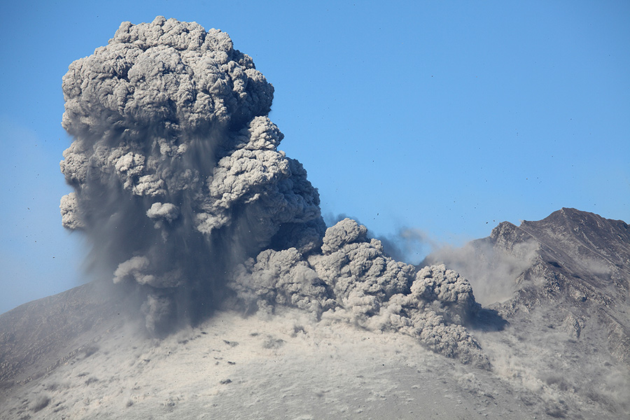
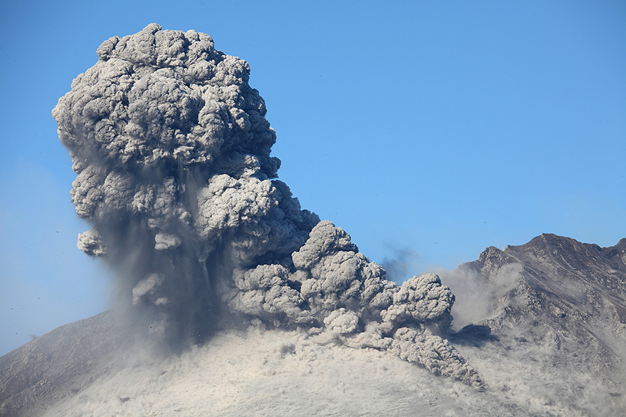
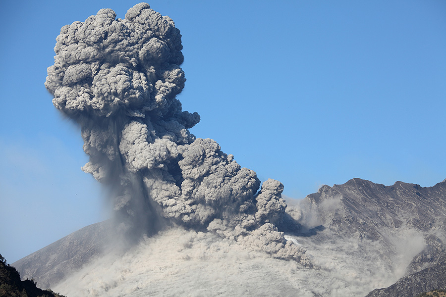
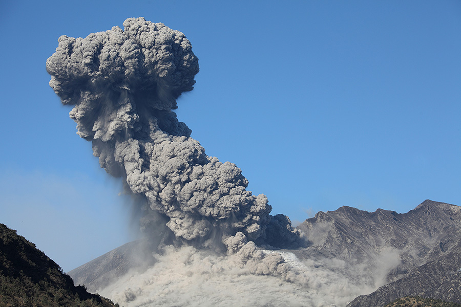
Further images of above vulcanian eruption |
 |
 |
|
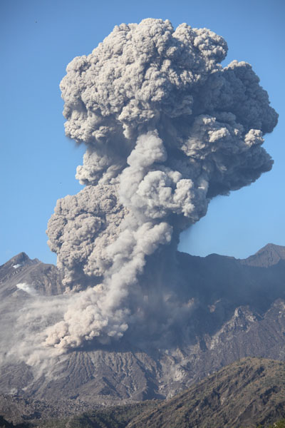
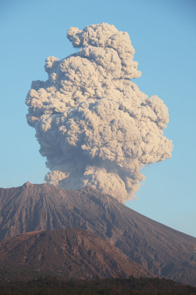
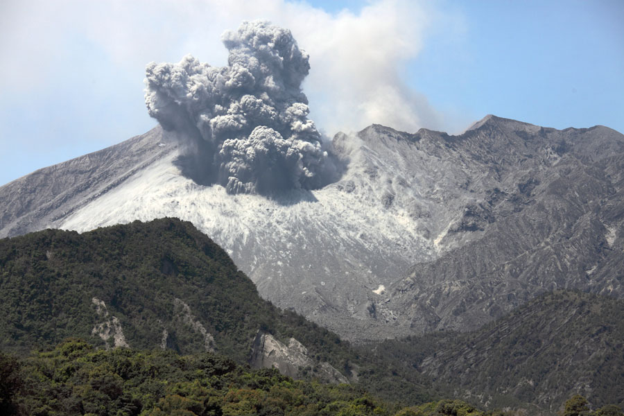
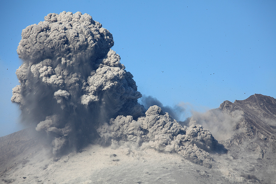
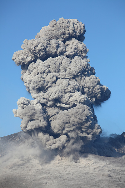
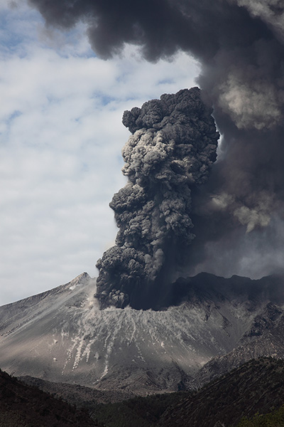
Ash cloud from vulcanian eruption, Showa crater |
Ash cloud from vulcanian eruption, Showa crater |
 |
 |
 |
|
Vulcanian eruption, Showa crater - view from SW (02.01.10, a. 13:30) |
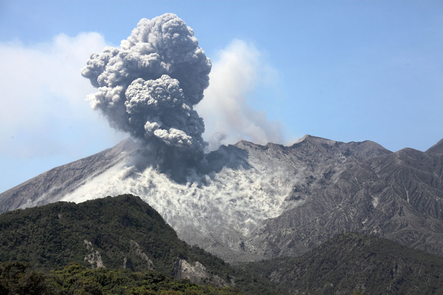
Vulcanian eruption, Showa crater |
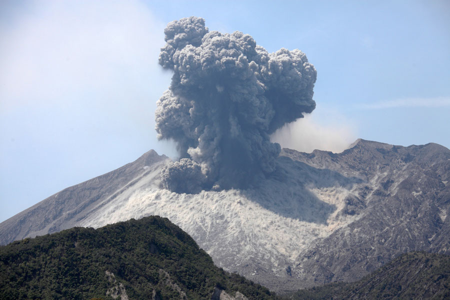
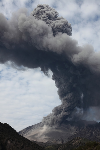
Ash cloud from vulcanian eruption, Showa crater (28.12.09, a. 10:30) |
 |
 |
 |
|
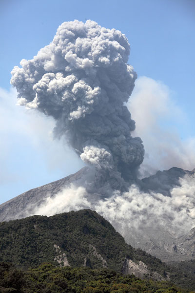
Vulcanian eruption, Showa crater |
Vulcanian eruption, Showa crater (view from W) |
Vulcanian eruption, Showa crater |
 |
 |
|
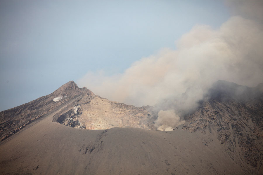
Crater morphology in April 2012. Approx. 20% wider (N-S) than begin 2010 |
East flank is covered in fresh deposits in April 2012 |
 |
 |
 |
|
Eruption 08.04.12, 10:39 local |
 |
 |
 |
|
Eruption 08.04.12, 11:27 local |
 |
 |
|
Eruption 10:04.12, 09:26 local |
|
 |
 |
 |
|
Eruption 10:04.12, 09:26 local |
 |
 |
 |
 |
 |
 |
 |
 |
 |
 |
 |
 |
 |
|
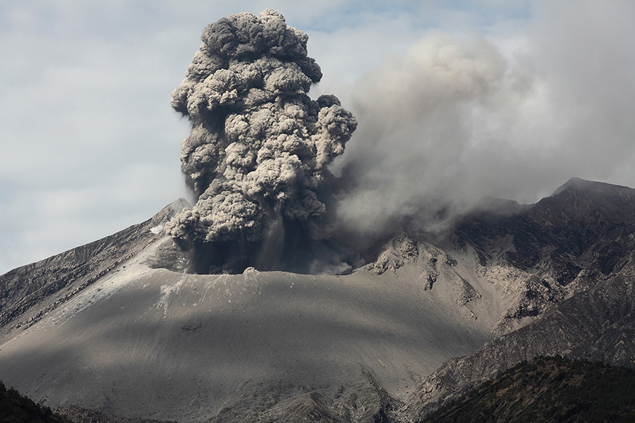
Eruption producing mushroom cloud (24.02.2013 12:27 local) |
 |
 |
 |
|
Various eruptions |
 |
 |
 |
|
Ash cloud bent by differing winds at differing altitudes (25.02.2013 10:38 local) |
 |
 |
 |
|
Different vents evident as one erupts ash and the other steam |
Second eruptive phase shortly after eruption above (1/5) (23.02.2013 10:40 local) |
(2/5) |
 |
 |
 |
|
(3/5) |
(4/5) - Towering ash column |
(5/5) |
 |
 |
 |
|
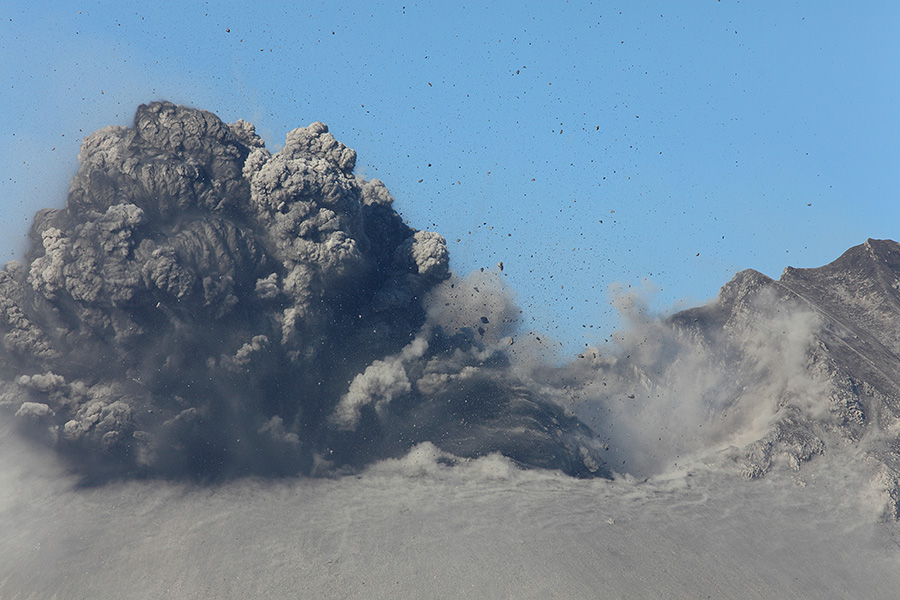
Medium sized explosive eruption (25.02.2013 10:39 local) |
 |
 |
|
View of Sakurajima from ESE |
View of Sakurajima from ESE |
 |
 |
|
View of Sakurajima from E |
Ash cloud ascending into clouds above |
 |
 |
 |
|
Nighttime explosion with lightning (23.02.2013 05:09 local) |
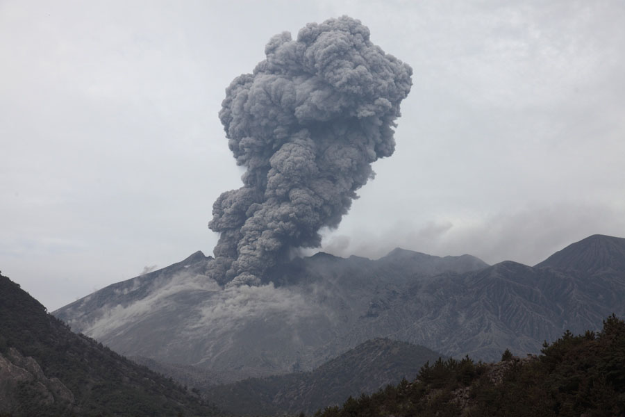
Ash cloud rising following nighttime eruption (25.02.2013 04:50 local) |
Powerful nighttime eruption (23.02.2013 06:25 local) |
 |
 |
 |
|
Kitadake summit viewed from Yunohira Observatory |
Kitadake summit viewed from SE |
 |
 |
 |
|
Ash remobilized by wind, view along S coast of Sakurajima |
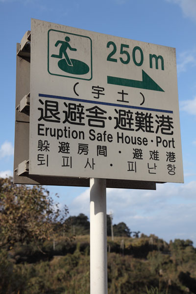
Sign for evacuation |
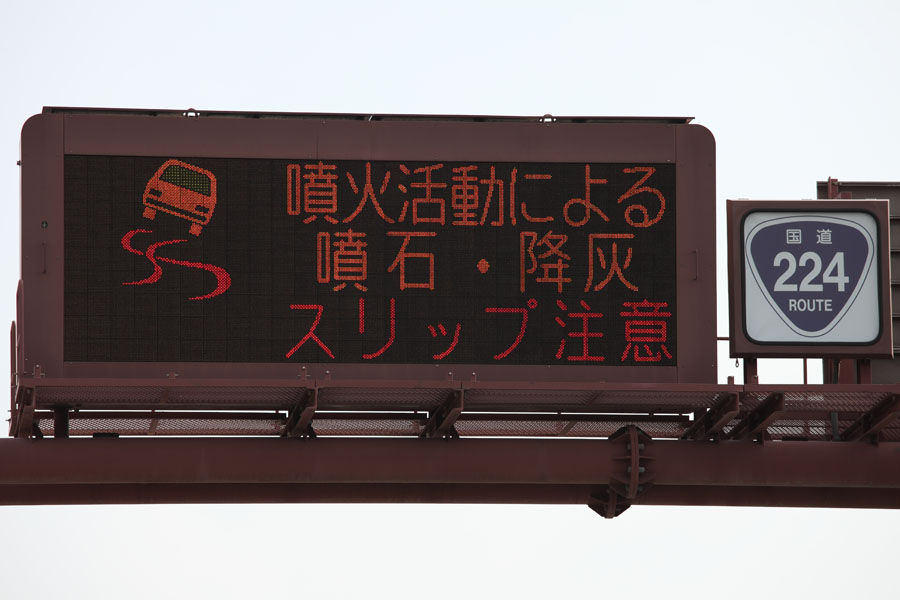
Sign warning about ash on roads |
 |
 |
|
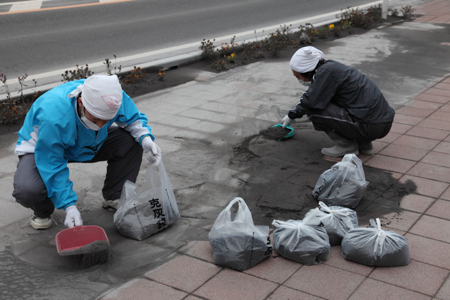
Collecting ash, S coast, Sakurajima Island |
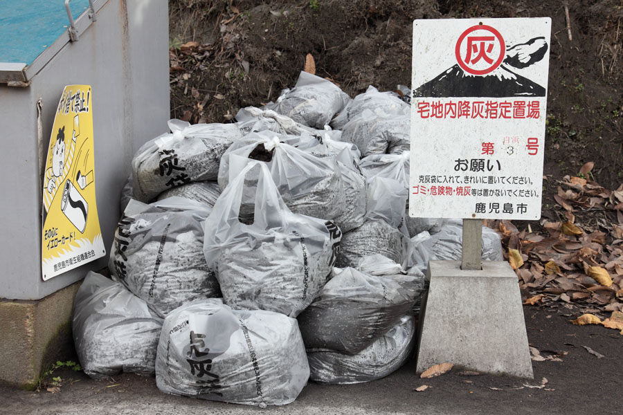
Ash collection site, Sakurajima Island |
 |
 |
|
Agricultural land SE of Sakurajima, the latter being veiled in ash |
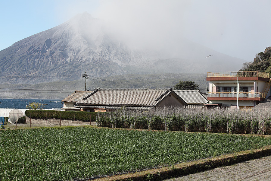
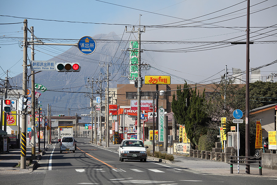
Town SE of Sakurajima with ashing volcano behind |
 |
 |
|
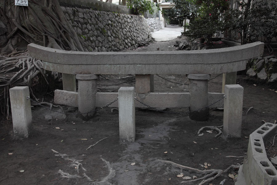
Buried Torii in Kurokamicho, E flank of Sakurajima |
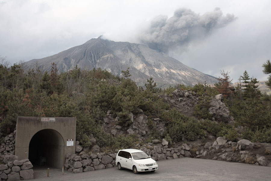
Shelter near official viewpoint |
 |
 |
|
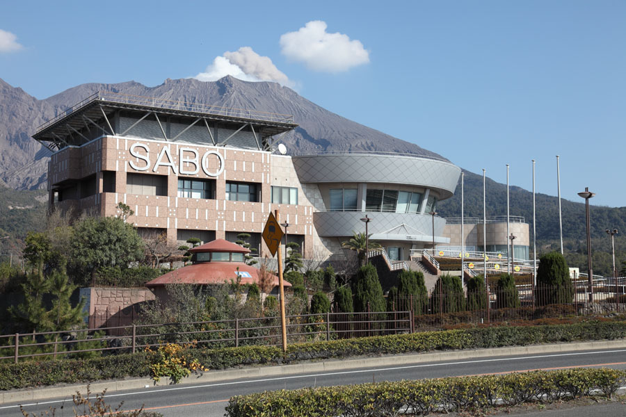
Sakurajima International Volcanic Sabo Center |
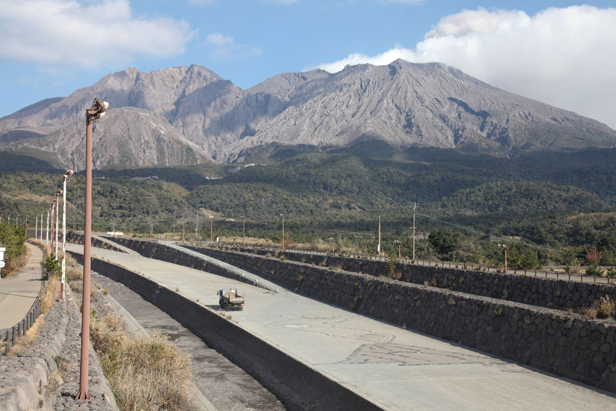
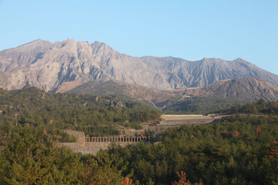
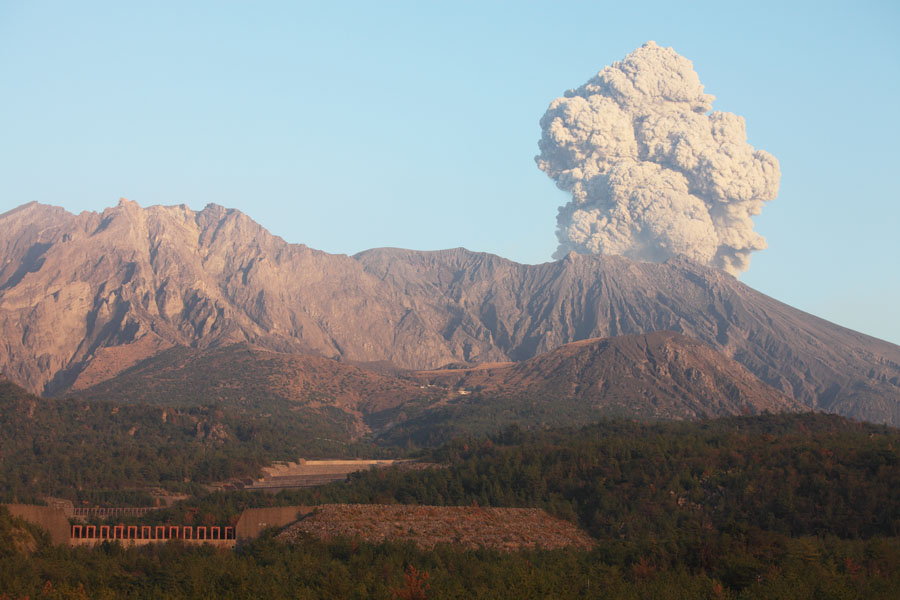
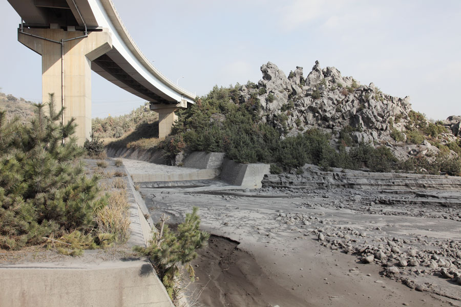
Nojiri River Sabo channel - site of approx. 20 debris flows / year |
 |
 |
 |
|
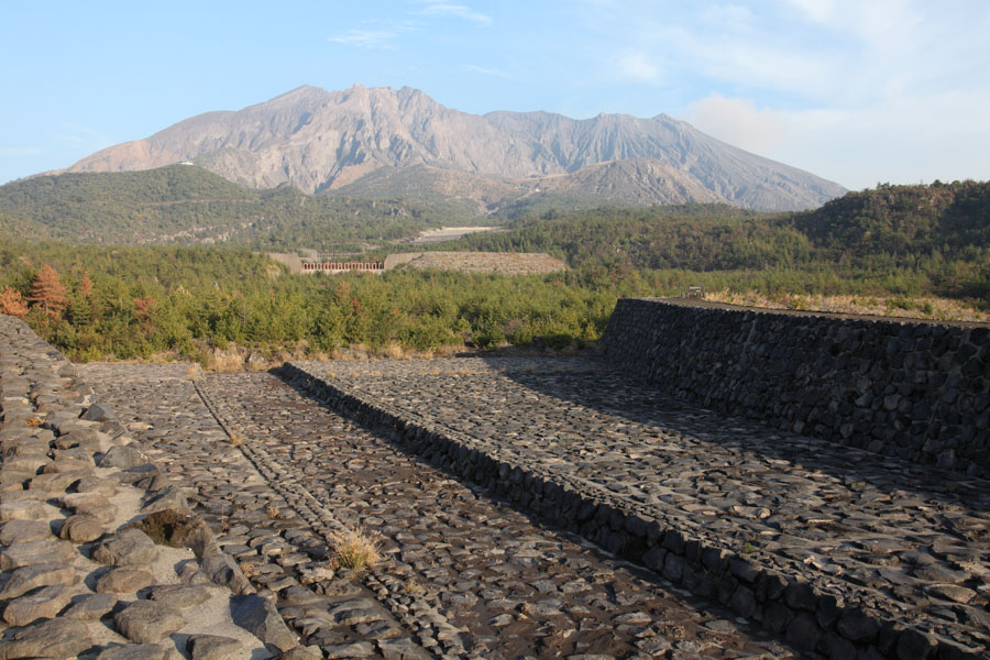
Sabo channel with tubular grid dam, Haramatsu River |
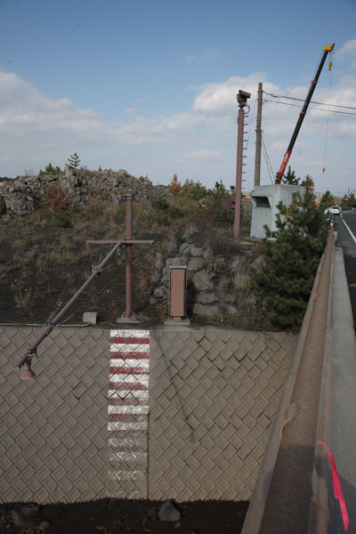
Ultrasonic sensor over Sabo channel |
Sabo channel with tubular grid dam, Haramatsu River |
 |
 |
|
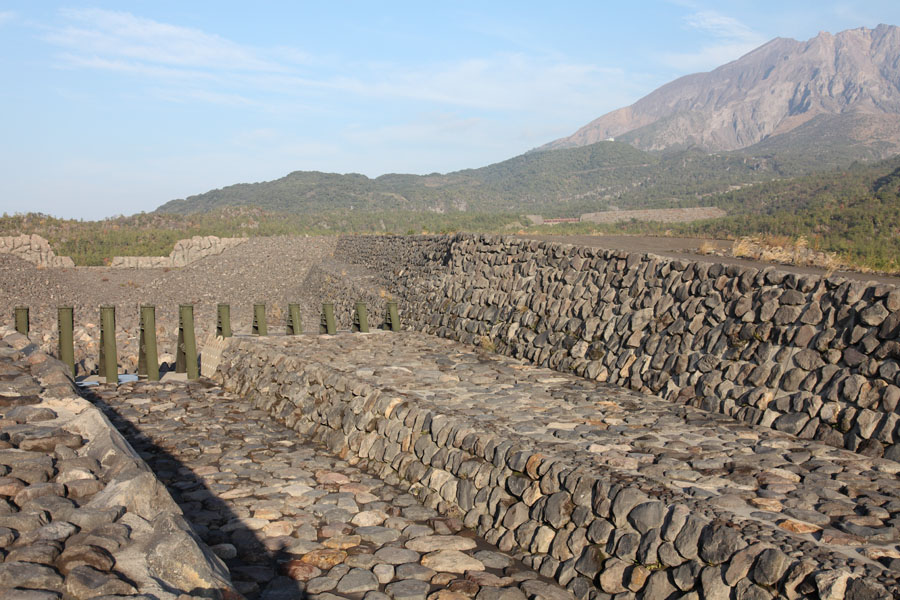
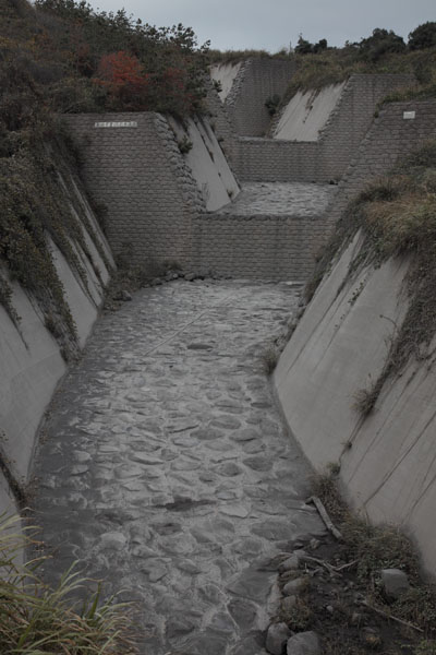
Sabo channels, Haramatsu River |
Sabo structures, Haramatsu River |
 |
 |
|
Sabo structures, Haramatsu River |
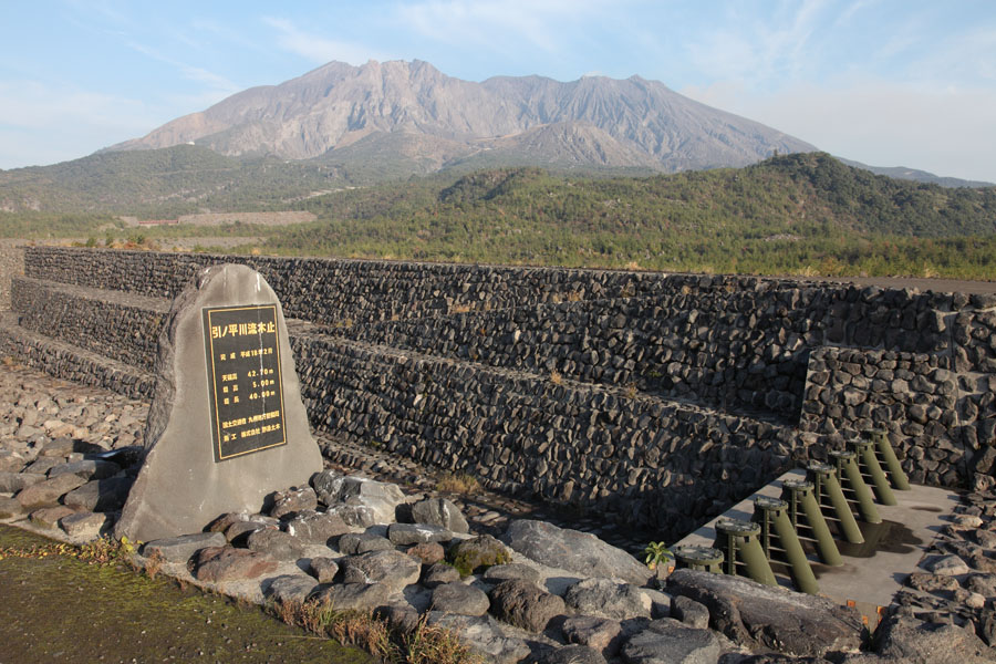
Large flood-plain surrounded by Sabo dams, Kurukami River |
 |
 |
 |
|
Arimura River Sabo channel under south coast road |
Arimura River Stepped Sabo channel, S coast |
Arimura River Sabo channel under south coast road at Arimuracho |