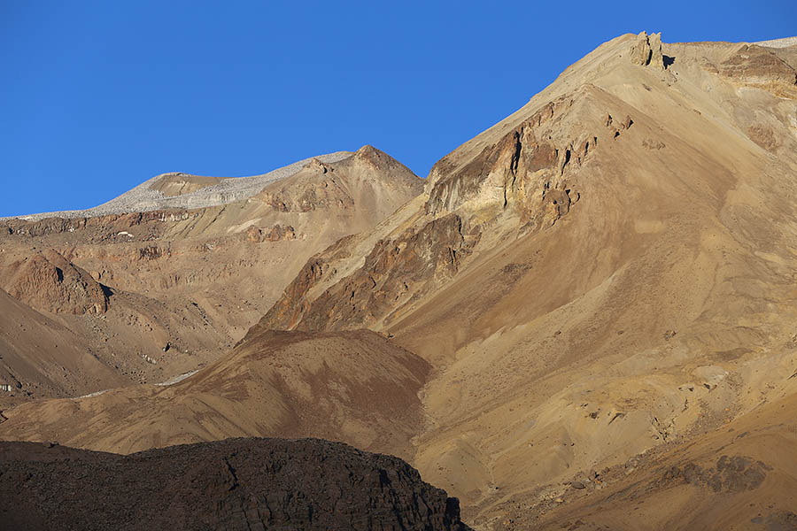
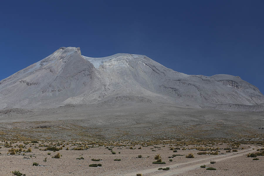
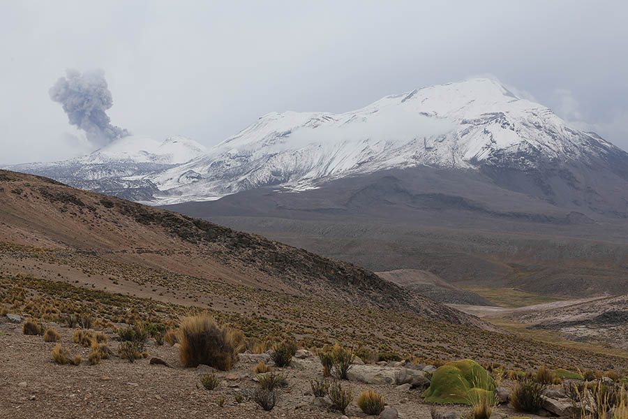
The predominantly andesitic Ampato-Sabancaya stratovolcanic complex comprises the older inactive Ampato edifice (6288m) and the currently active Sabancaya volcano (5976m). The glacially eroded Hualca Hualca (6025m), adjoining Sabancaya to the north, completes a small chain of three volcanoes. The complex lies in the Peruvian Andes about 75 km northwest of Peru’s second largest city, Arequipa, and about 20 km southeast of the famous Colca Canyon. All of these volcanoes are usually glaciated with eruptions potentially causing increased meltwater in drainages. Sabancaya means “Tongue of fire” in the local Quechua language.
Ampato-Sabancaya Complex
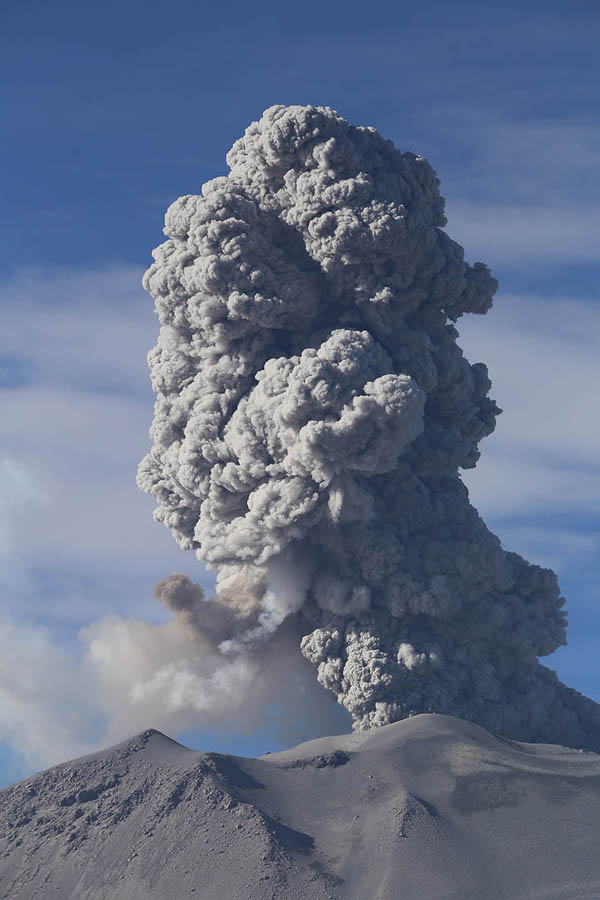
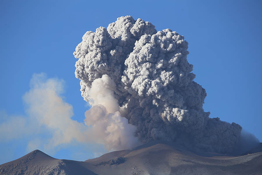
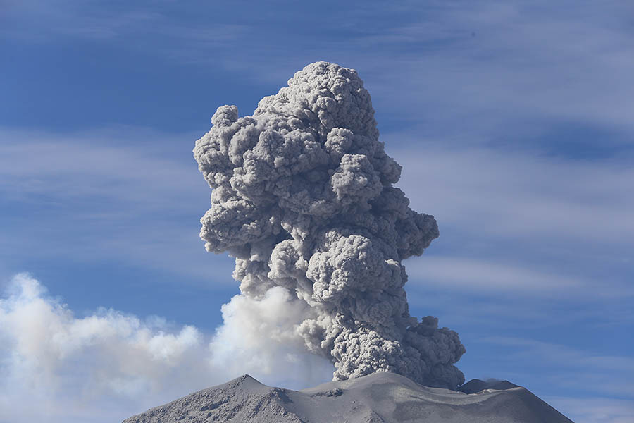
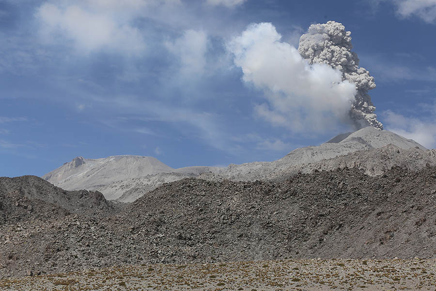
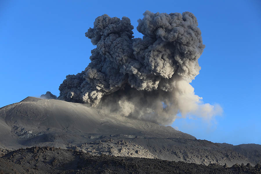
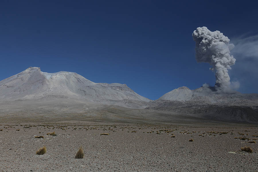
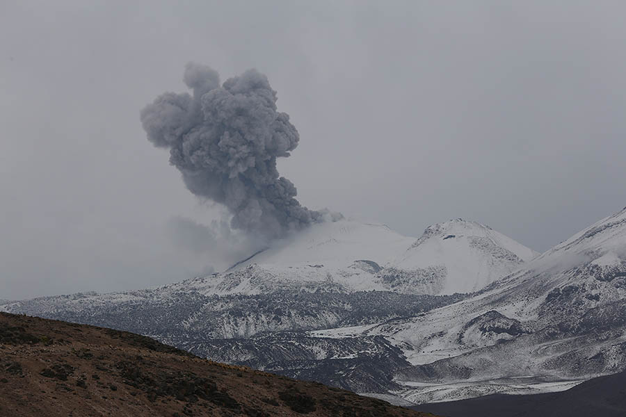
Sabancaya Erupting
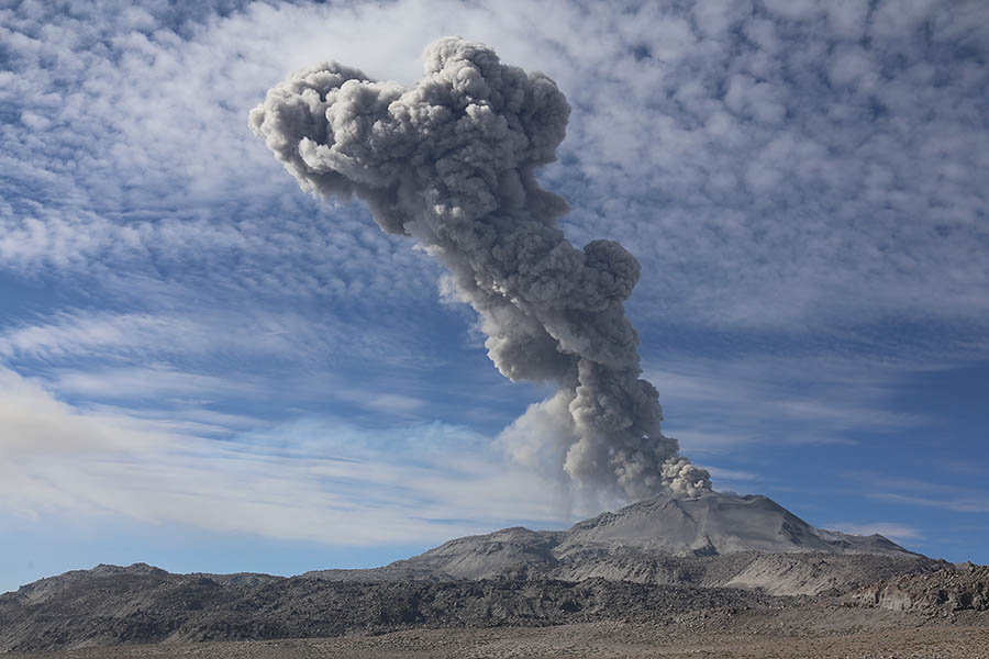
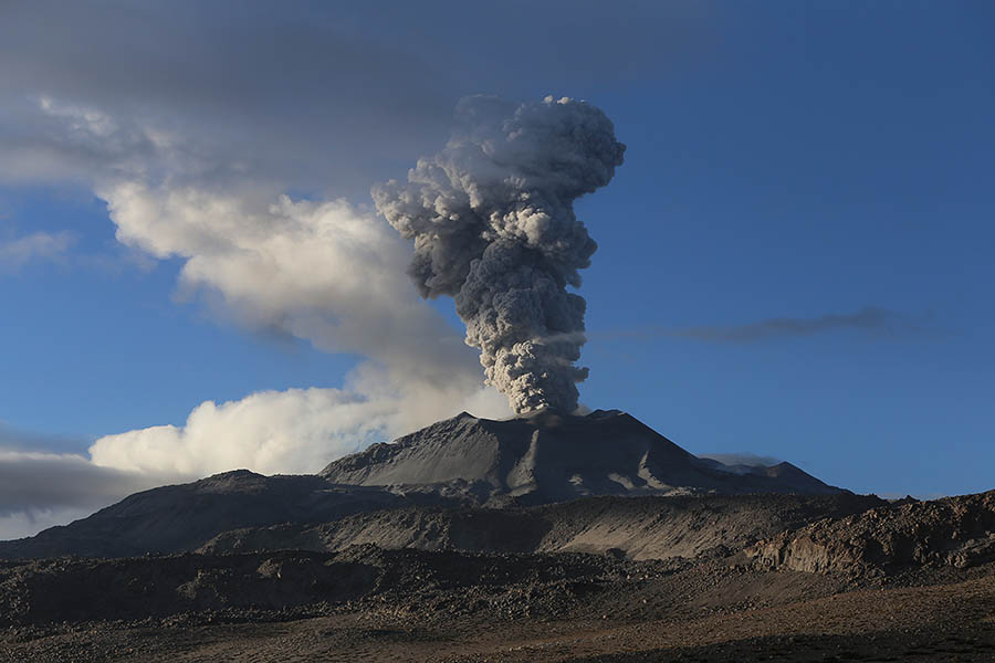
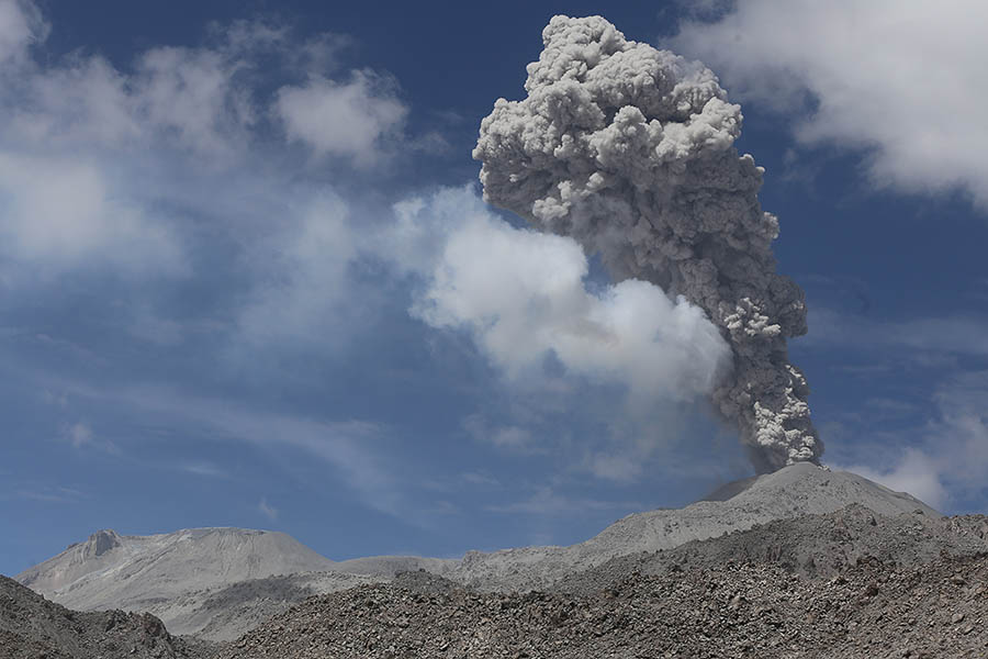
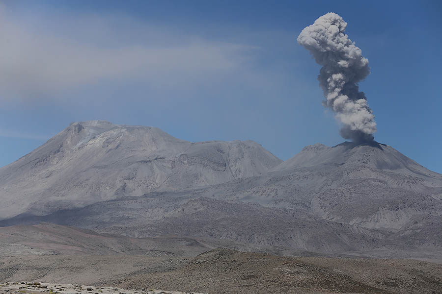
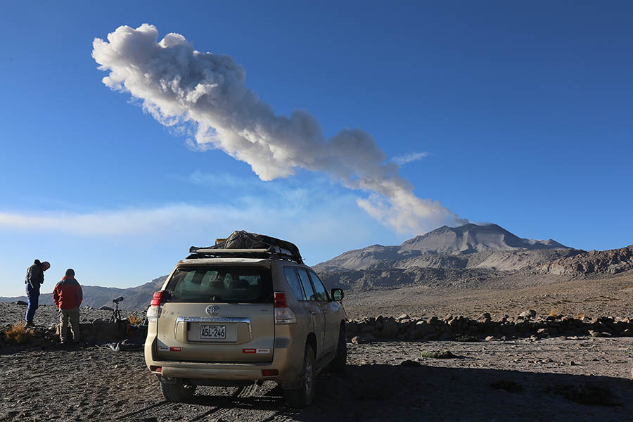
Ash cloud from Sabancaya
Sabancaya has had several phases of largely explosive activity in historic times, whilst extensive holocene andesite / trachyandesitic block flows on its flanks are testimony to its ability to erupt effusively. These flows form an apron around the volcano on all sides except to the south where the saddle connecting to Ampato topographically prevented their emplacement. These flows cover an area of nearly 60 square km around the summit domes / craters. At least 39 individual flow lobes can be recognized, of which 38% are less than 1km in length, 40% from 2-4 km, with the longest reaching about 5km (Gregg et al. 2002. Lunar and Planetary Science XXXII, 1565; see also detailed flow field maps - INGEMMET (e.g. Rivera et al. "Evaluacion de Peligros del Volcan Sabancaya")). Eruptions have been reported in 1750, 1784, 1986-1988, 1990-1998, 2000, 2003 and 2014-2017, yet may have been more frequent as the remote location in the past limited observations. Today the volcano has an entensive monitoring network (OVI - Observatorio Vulcanologico INGEMMET). The earlier eruptive history of Ampato and Sabancaya can be derived from studies of their deposits. For a detailed analysis, the reader may refer to Guillou et al. 2016 (J. Volc. Geotherm. Res. 323, p.110-128).
VIDEO OF ERUPTIONS AT DAY AND NIGHT:
(Taken during period 12.12.2016 - 16.12.2016)
Due to its remote location, impact on local populations is generally limited. Cattle (llamas and alpacas) may be poisoned by ingesting ash and some is reported to have died during the 1988 eruption. A major eruption with pyroclastic flows, which the volcano is undoubtedly capable of in view of holocene Plinian deposits, could however endanger the numerous settlements in the nearby Colca Valley. Thin Plinian tephra-fall deposits from historical eruptions have been found as far as 11 km from the crater, and block and ash pyroclastic-flow deposits as far as 7 km from the source. The most powerful historical eruptions were recorded in 1990 (VEI 3) at the onset of an eight year eruptive period. Tremors could be felt frequently in nearby towns and livestock had to be evacuated from around the volcano due to the ashfall on their pastures. The 1990-1998 activity involved andesitic and (in 1990) dacitic magmas which were expelled during vulcanian and phreatomagmatic eruptions. The petrology of the erupted products is discussed in detail in Gerbe and Thouret, 2004 (Bull. Volcanol. 66, p.541-), as is the model of a dacitic magma chamber supplying the volcano.
Activity in late 2016, involved frequent explosive eruptions sending ash clouds up to a height of several km above the volcano. Some volcanic bombs were thrown onto the flanks during the most powerful explosive episodes and incandescence was reported by observers in Colca Valley. During our visit (Dec. 12-16), the seismic record showed that the frequency of eruptions remained high, yet the 1-2 higher energy events per day being observed at the beginning of December were no longer occurring. This presumably accounts for the inability to photographicaly document flank impacts or significant incandescence.
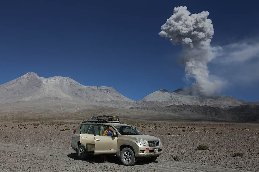
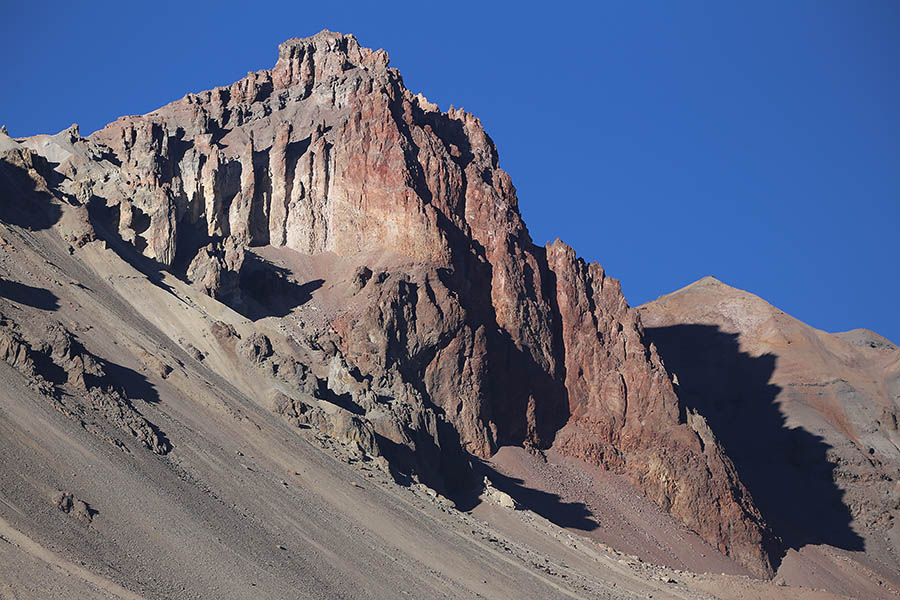
View from E Flank of Hualca Hualca at 5060m
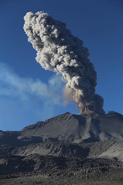
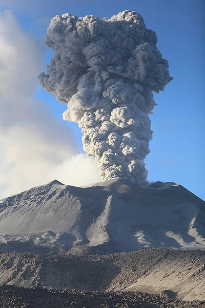
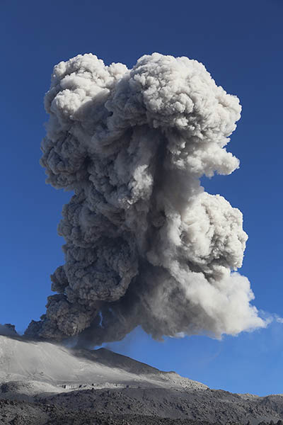
Ash clouds from low energy Vulcanian eruptions
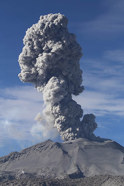
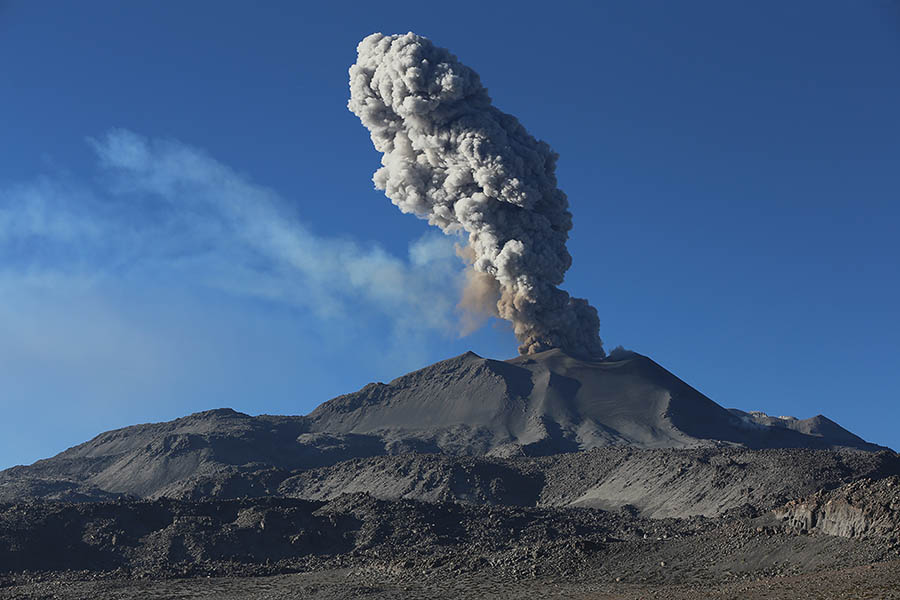
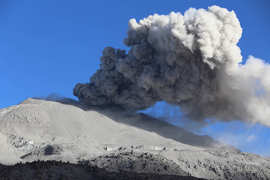
Typical ash cloud for observation period
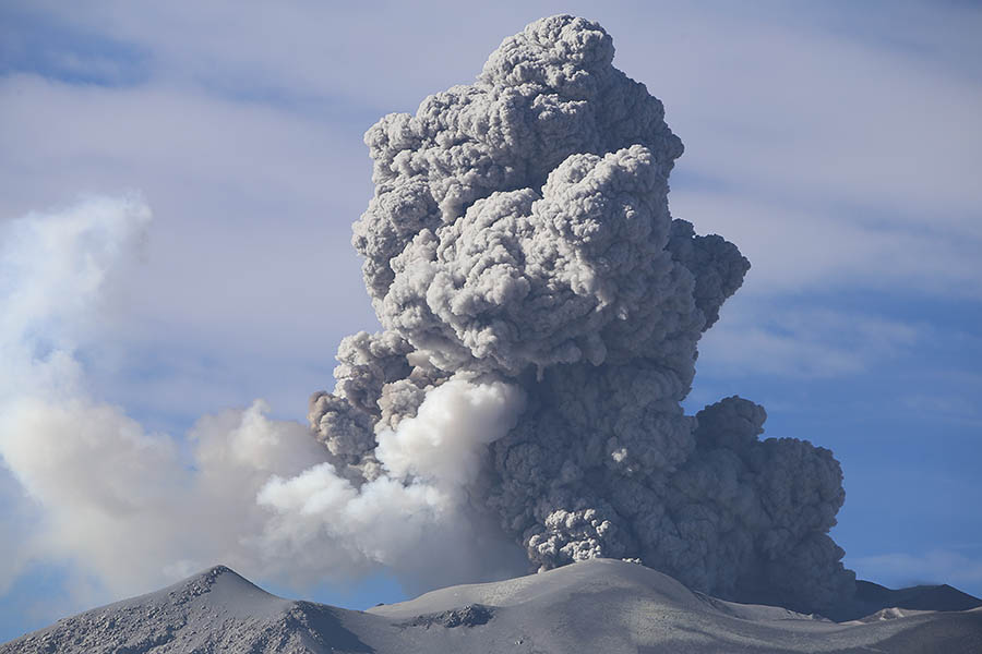
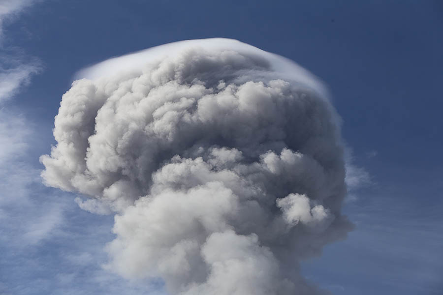
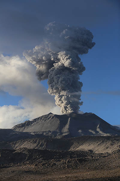
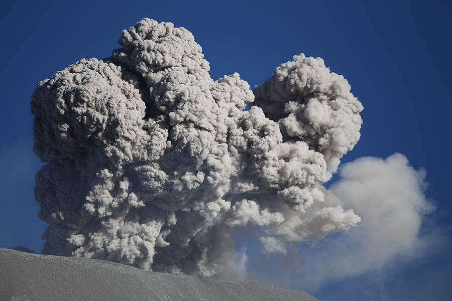
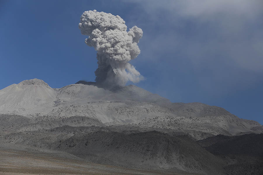
Cloud cap forms on top of eruption cloud
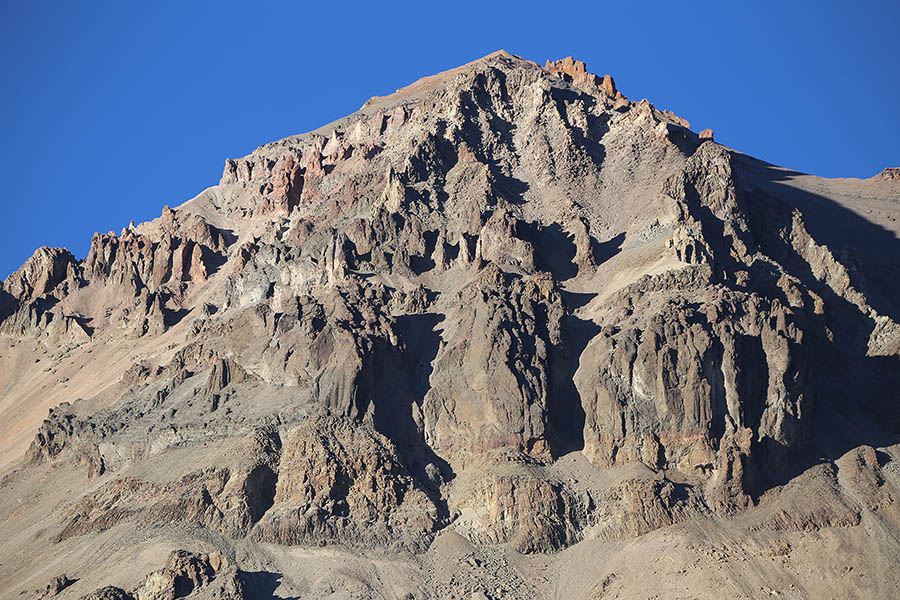
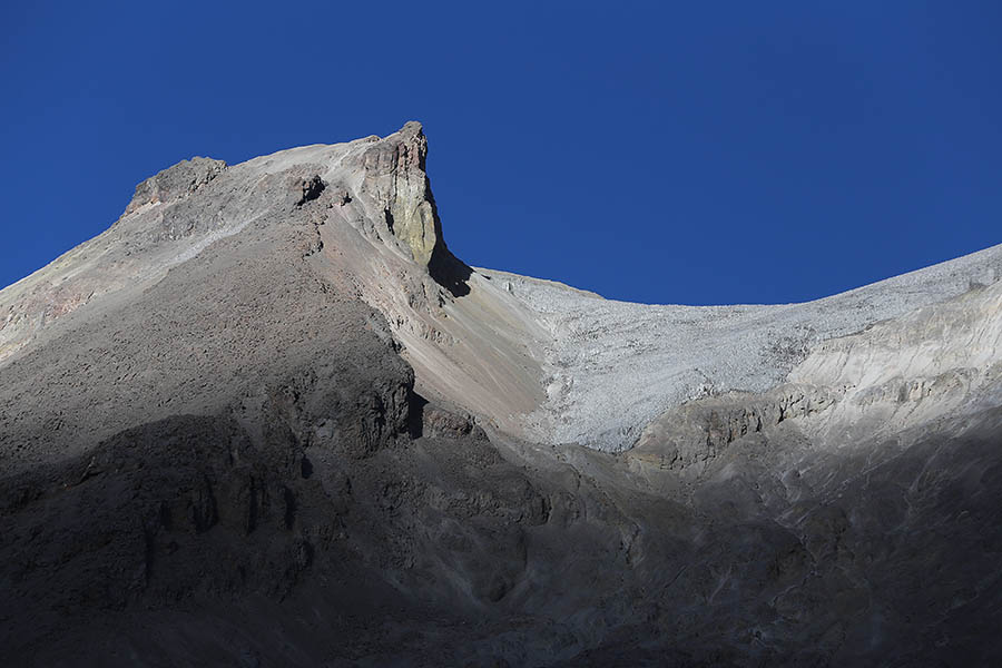
Eroded volcanic deposits on Hualca Hualca
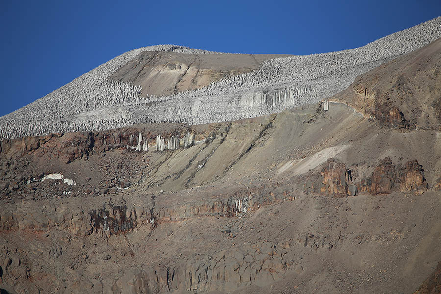
Hualca Hualca Summit Glacier
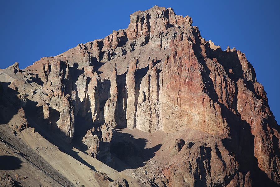
Hualca Hualca
View from NNE. Huge prehistoric andesite block flows in foreground
View from NNE
View from S (Trailhead for Ampato / Webcam Position)
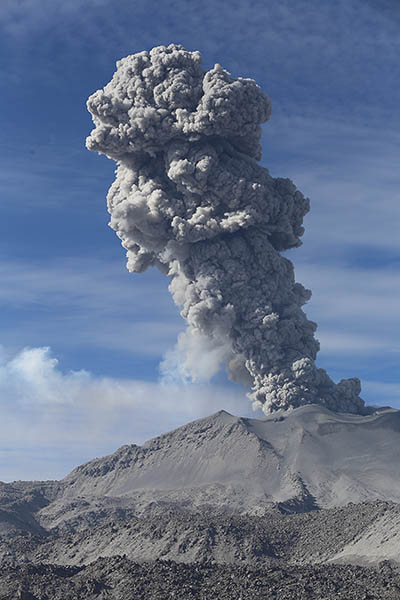
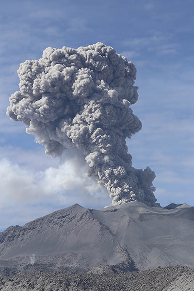
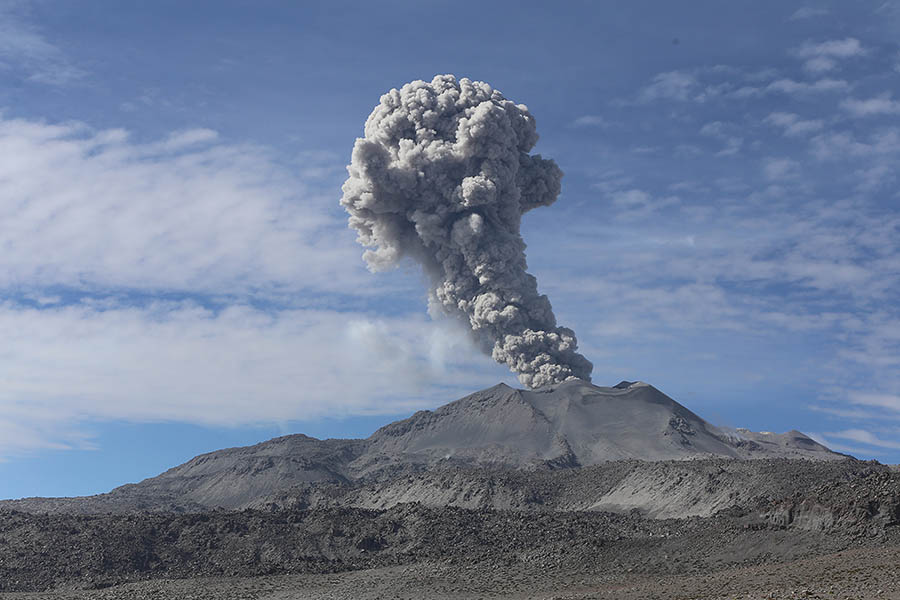
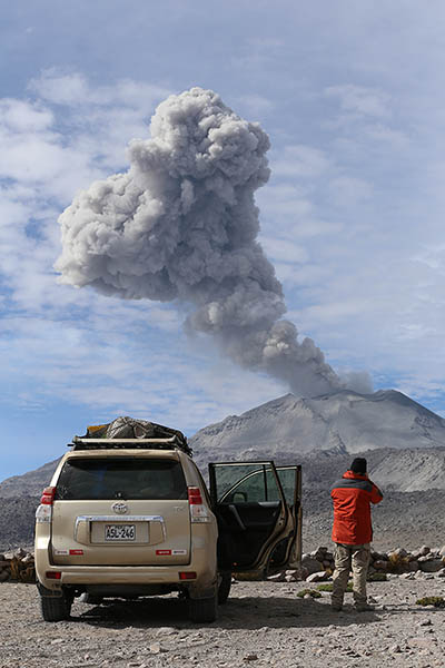
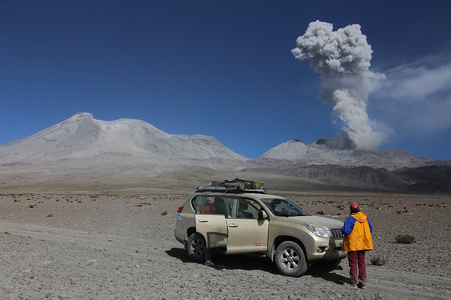
Smaller explosive eruptions
Smaller explosive eruptions
Large andesitic block flow deposits from prehistoric eruptions in foreground
Ampato-Sabancaya complex from S
Ampato-Sabancaya complex from E
(from road to S viewpoint)
Approaching Ampato from S
Ampato with remnants of summit glacier
View from W of Ampato-Sabancaya Complex
Ampato-Sabancaya coated in snow due to onset of rainy season
Ash cloud from snow-covered Sabancaya
Visitor Information
Visitors can reach Sabancaya most easily by flying to Arequipa. The second largest city in Peru has a charming center with many restaurants and tour operators who can organize trips to the volcano (e.g. Pablo Tours). The landscape around the volcano has many deep valleys and thus driving around the volcano takes many hours. Roads approaching the volcano require 4WD vehicles and may not be passable in the rainy season. This in particular applies to the road from Colca Valley to Hualca Hualca, where the soft ground makes the approach impassable in the rainy season and difficult during eruptions since ash fall on the Hualca Hualca glacier increases meltwater flows. Few drivers will be willing to take this route. Road maps are not up to date in the area.
Visitors need to be aware of the risks of high altitude when visiting Sabancaya. The best viewpoints are all at a altitude of about 5000m. Without acclimatization, most people will suffer from altitude sickness at such an altitude.
Whilst Peru generally has quite a poor reputation for security, the area around Sabancaya is relatively safe. Restaurants and shops are found in various villages around the volcano and in particular the Colca Canyon area is frequented by large numbers of tourists.
Peru has a number of other interesting volcanoes. Sabancaya is the northernmost of seven NW-SE aligned peruvian volcanoes for which activity has been documented in the last 500 years. The other six volcanoes are Misti (on the outskirts of Arequipa), Ubinas, Huaynaputina, Ticsana, Tutupaca and (furthest south) Yucamane. At least five further volcanoes in Peru are considered potentially active.
Stuck in mud on Hualca Hualca route
View from E flank of Hualca Hualca
Track S of Sabancaya (near webcam viewpoint)
Hualca Hualca E Flank Viewpoint (6km from Sabancaya)
Hualca Hualca E Flank Viewpoint (6km from Sabancaya)