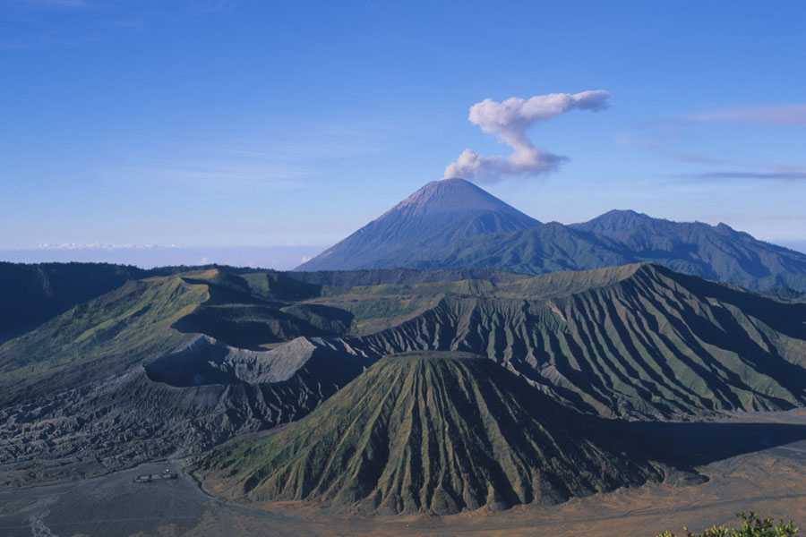
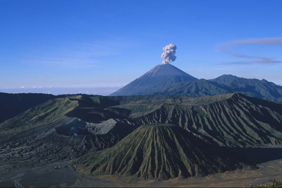
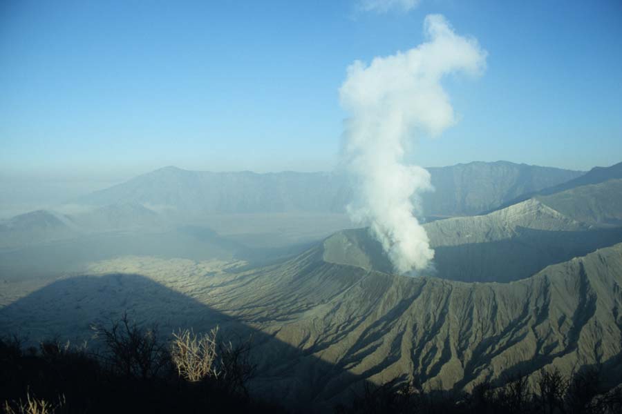
Post-caldera vents of Tengger Caldera - Batok in center, Bromo to its left. Semeru smoking in background (2004)
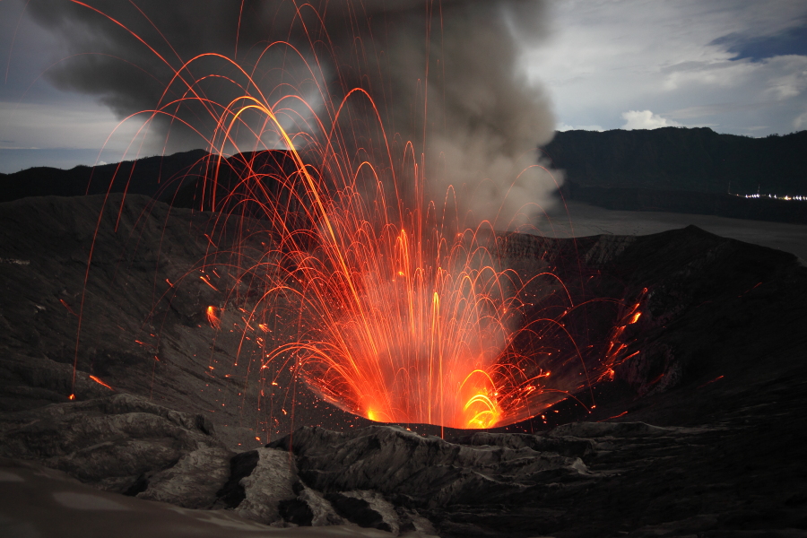
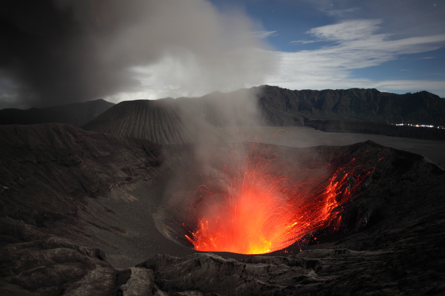
Strombolian activity in Bromo Crater, 2011
|
|
|
Post-caldera vents of Tengger Caldera - Batok in center, Bromo to its left. Semeru smoking in background (2004) |
Strombolian activity in Bromo Crater, 2011 |
 |
 |
 |
|
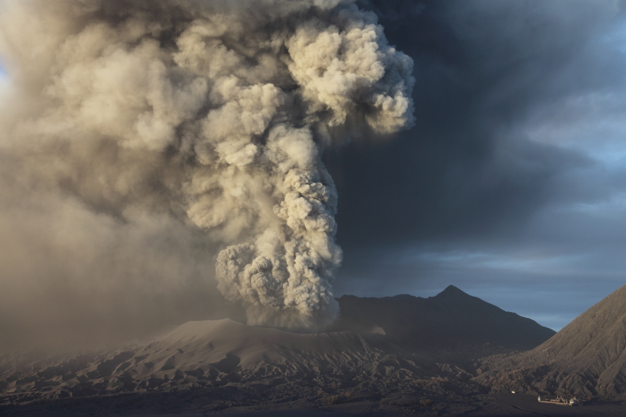
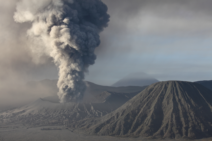
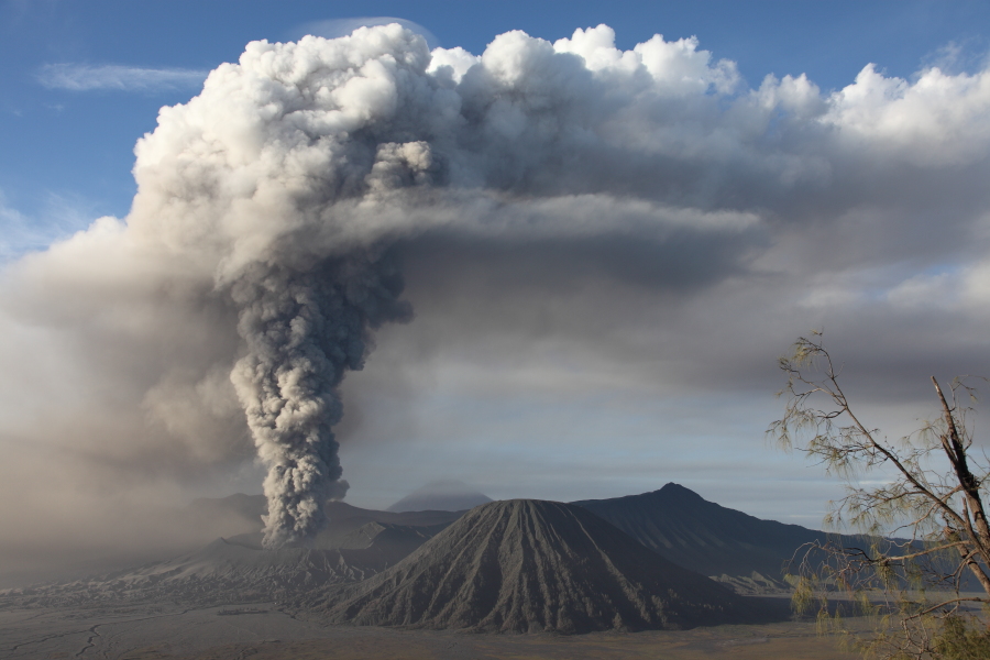
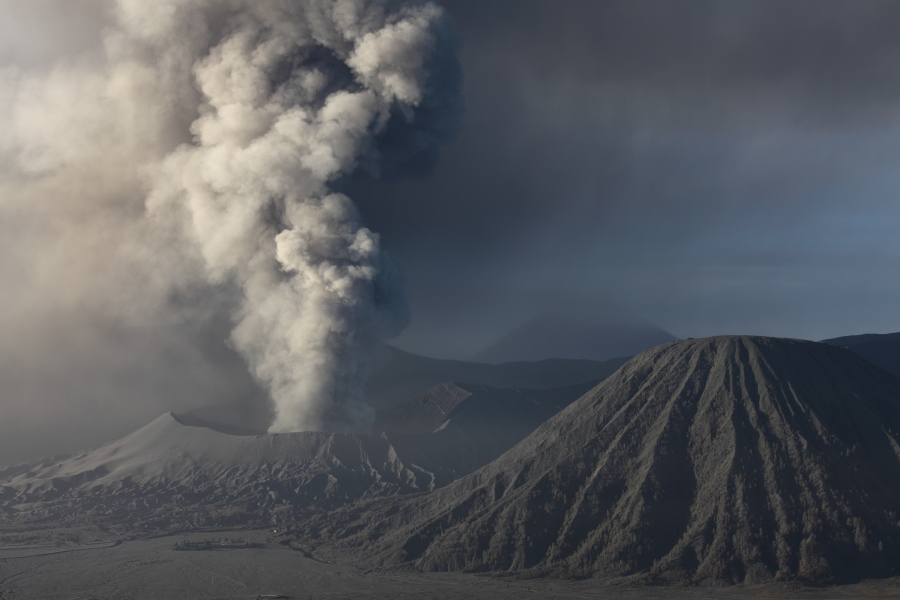
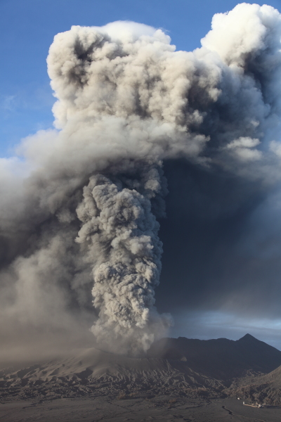
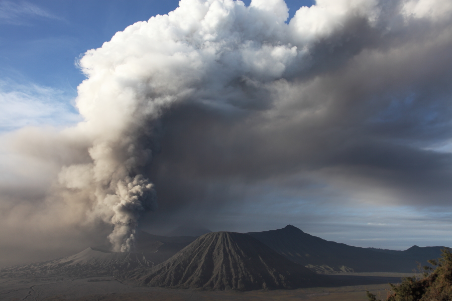
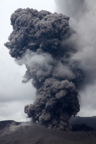
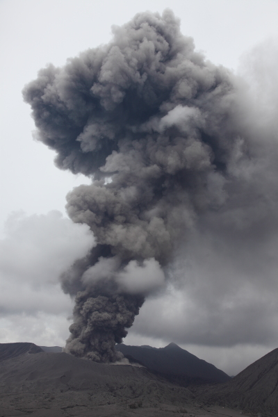
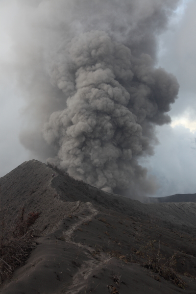
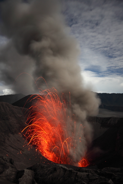
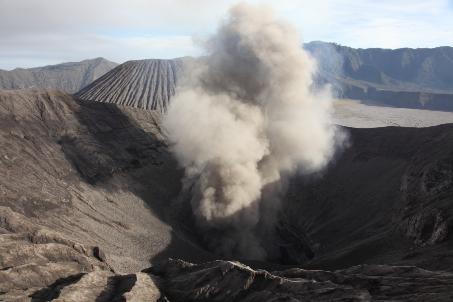
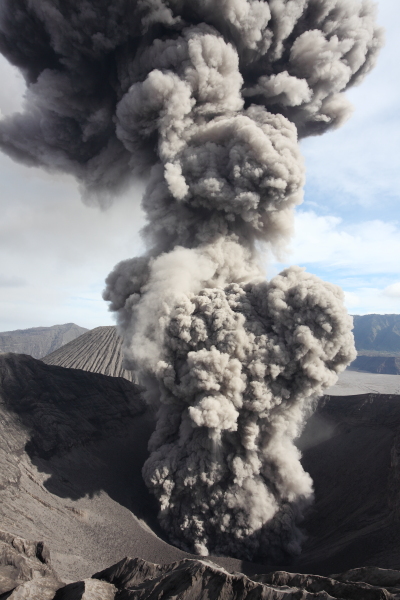
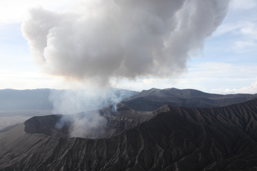
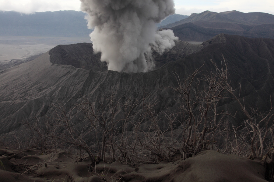
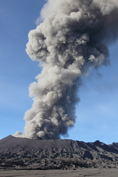
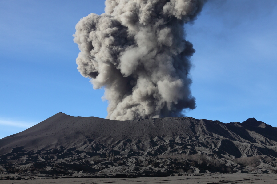
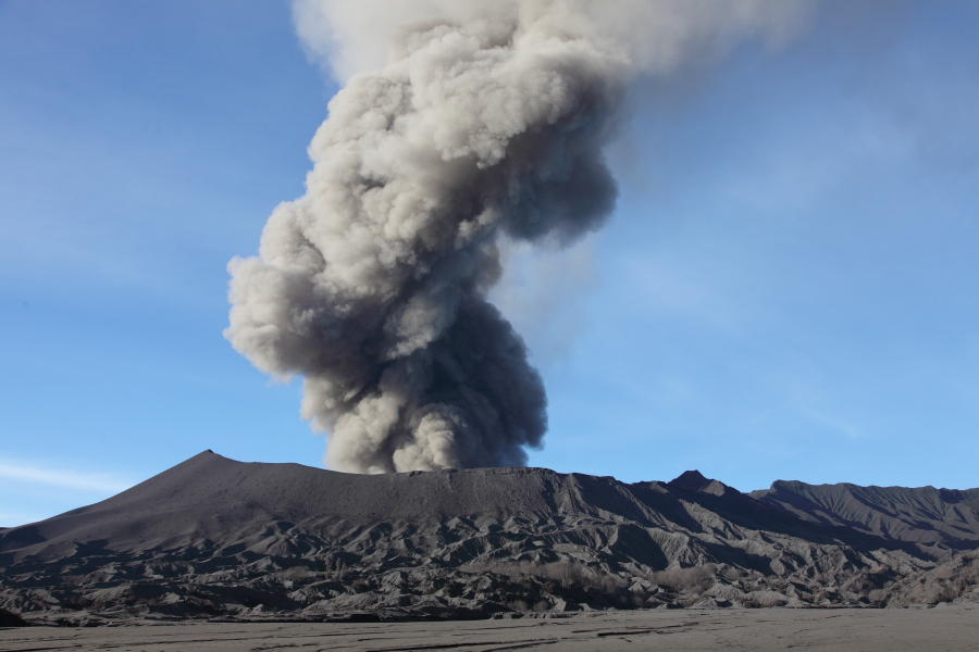
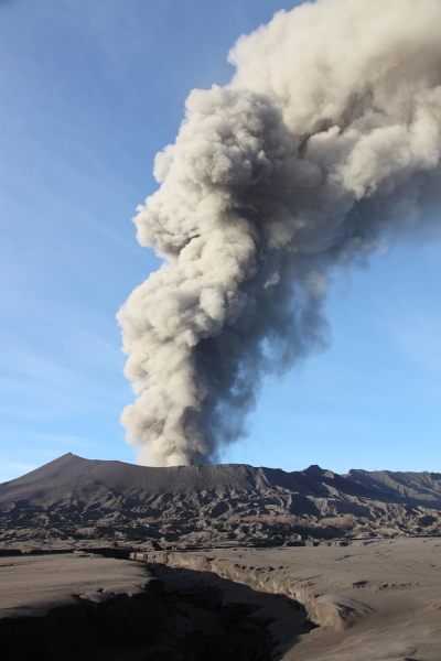
Bromo erupting in 2011 |
Bromo erupting in 2011 |
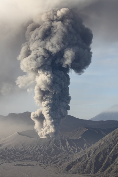
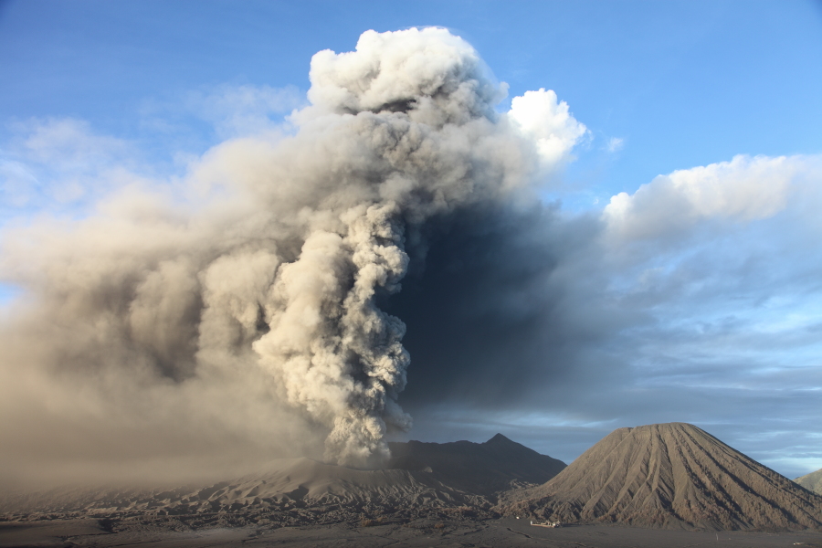
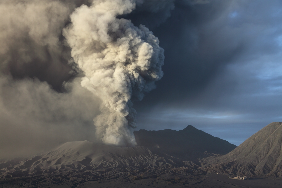
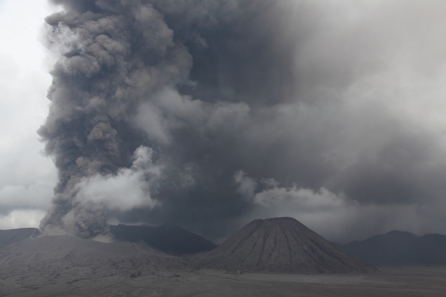
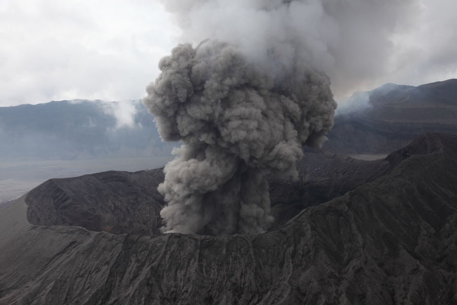
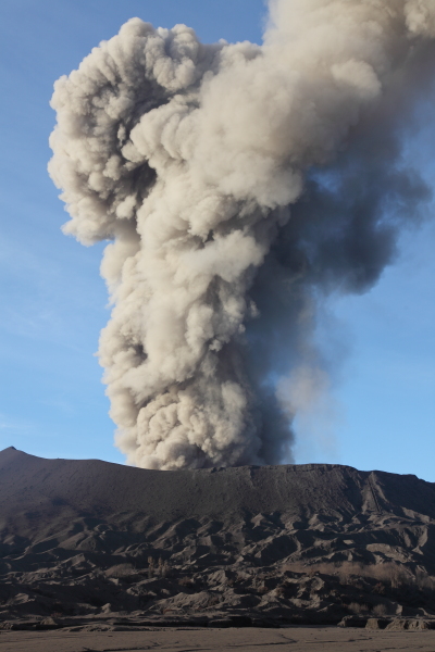
Bromo erupting in 2011 - Batok cone to right |
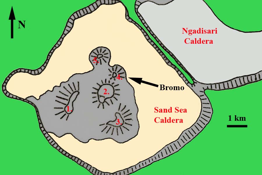 |
1. Segarawedi Kidul (2661m)2. Segarawedi Lor (I and II) (2650m)3. Mount Kursi (2581m)4. Mount Bromo (2392m)5. Mount Batok (2470m) |
|
Fig.1 Sketch Map of Tengger (Sand Sea) Caldera |
 |
 |
 |
 |
 |
 |
 |
 |
 |
 |
 |
 |
 |
 |
 |
|
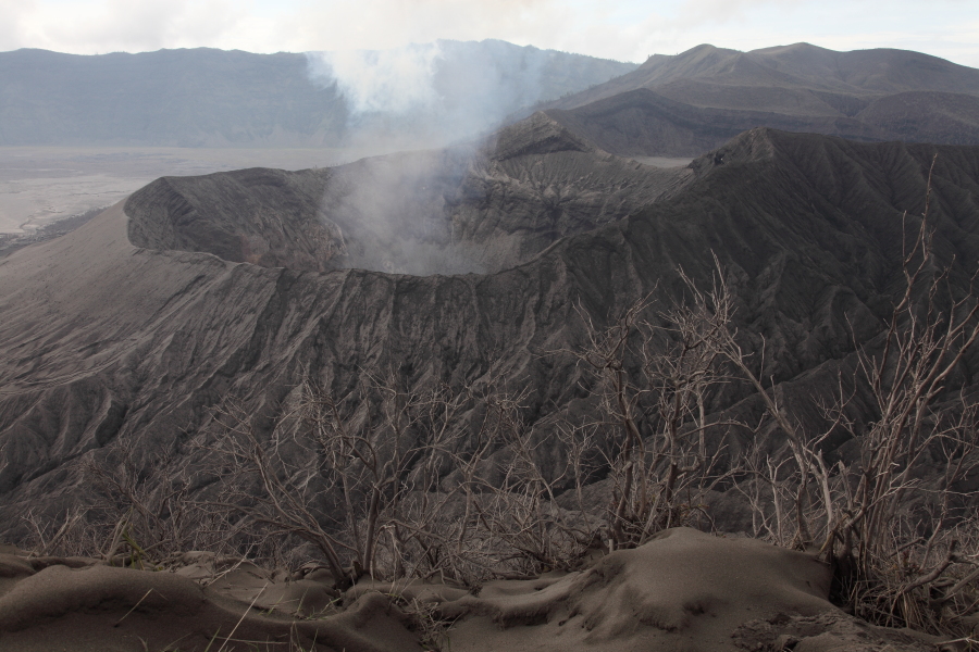
Bromo crater during pause in activity |
Walking along east rim of Segarawedi Lor, approaching Bromo |
Vent during pause in activity |
 |
 |
 |
|
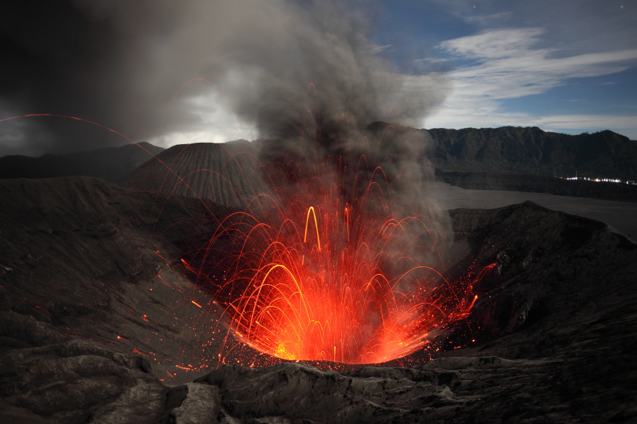
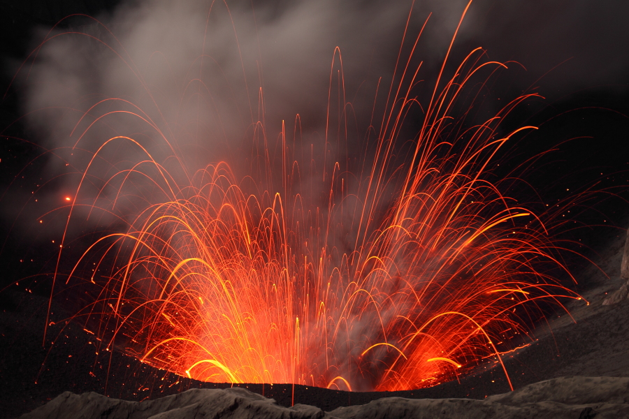
Strombolian eruptions of Bromo at night |
 |
 |
 |
|
Strombolian eruptions of Bromo at night |
 |
 |
 |
|
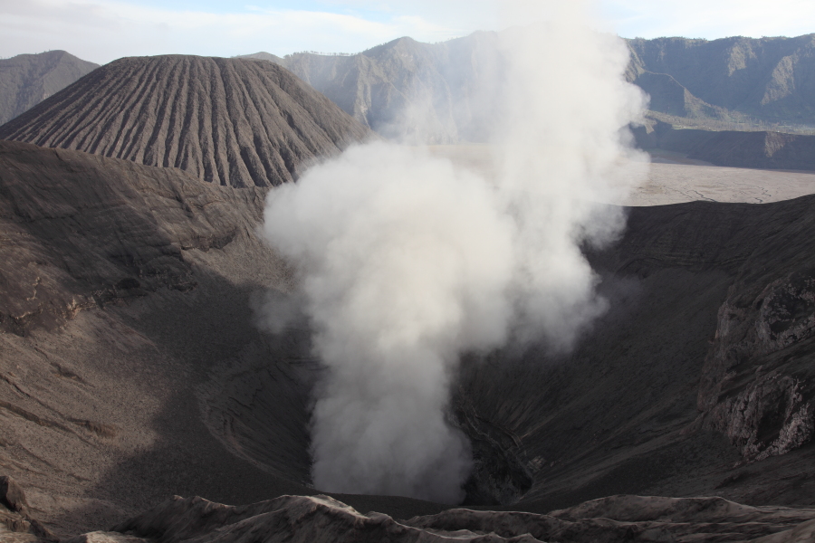
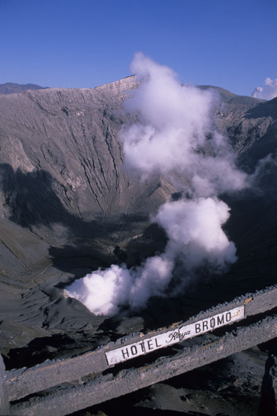
Degassing |
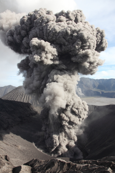
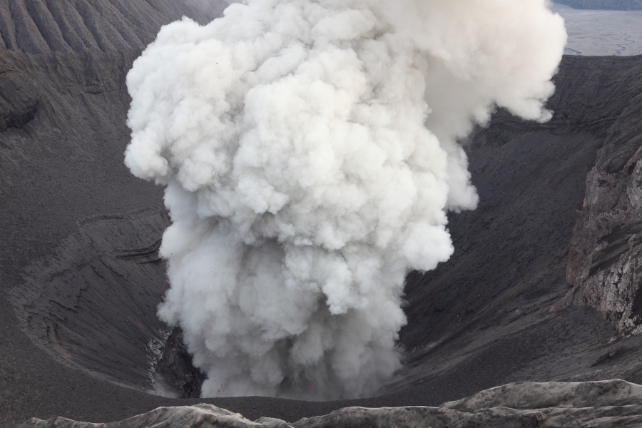
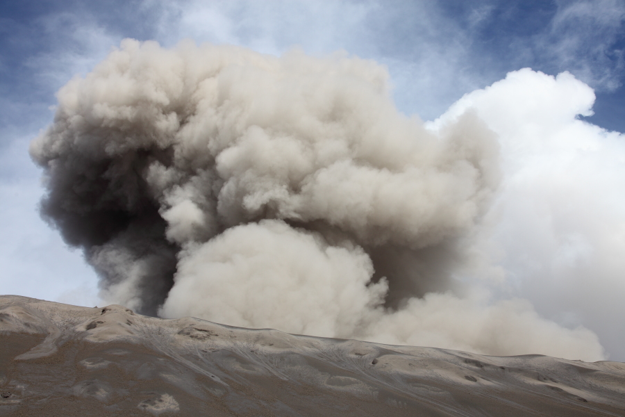
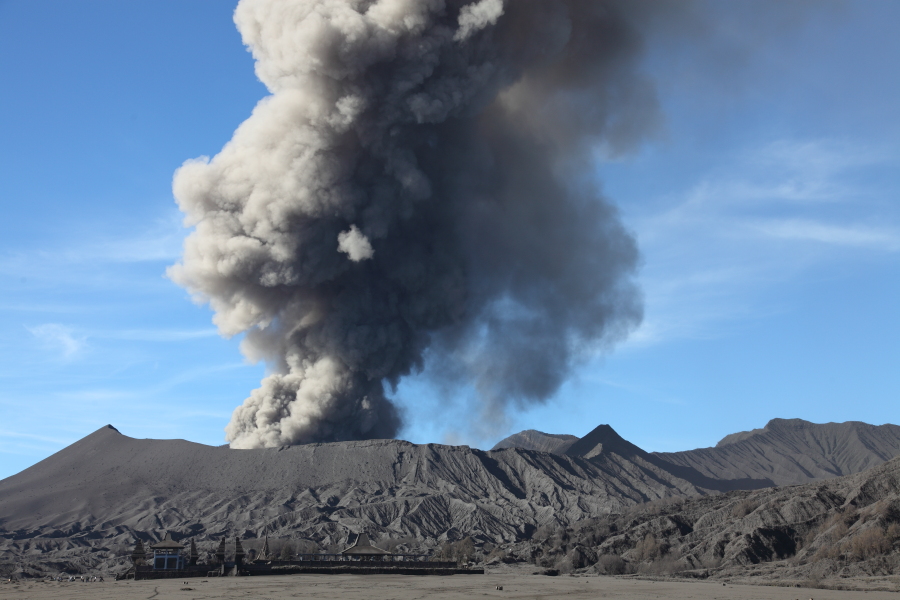
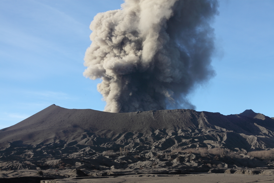
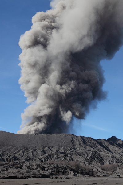
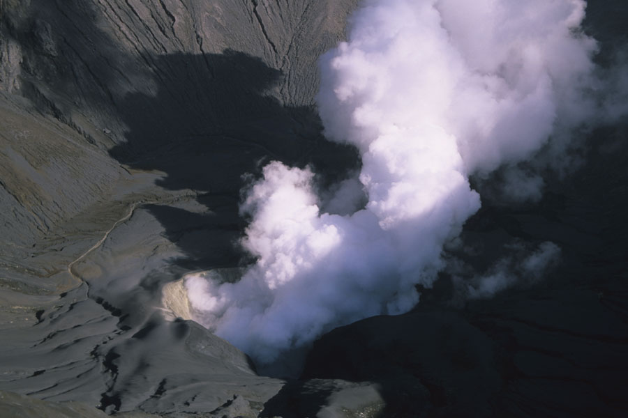
Ash eruption |
Ash eruption |
 |
 |
 |
|
Minor emission of gas with traces of ash |
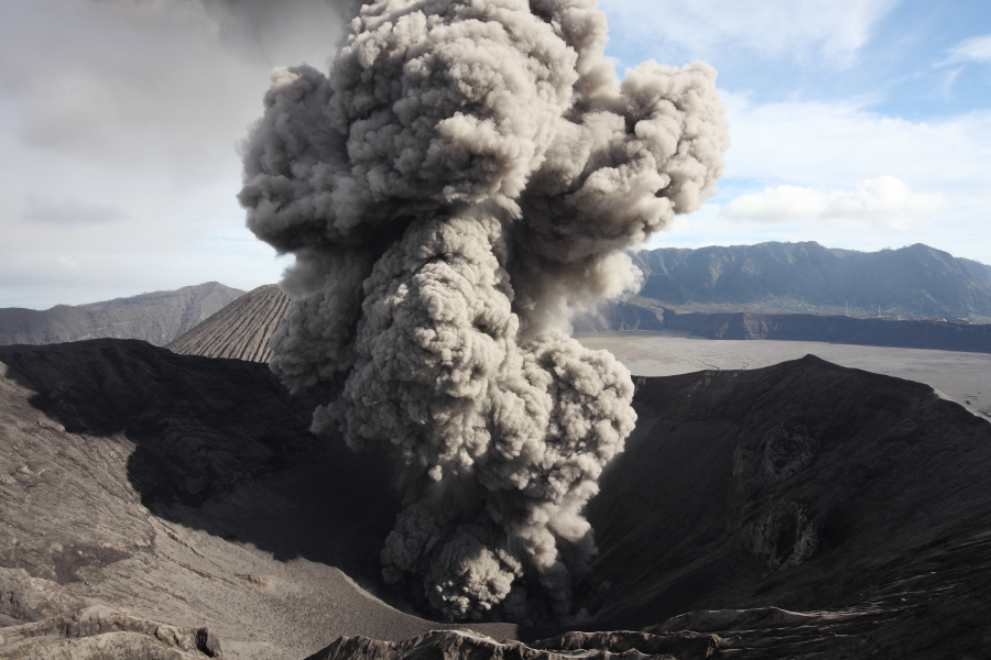
Ash eruption |
Weak strombolian activity accompanied by strong degassing |
 |
 |
|
View to rim from east flank |
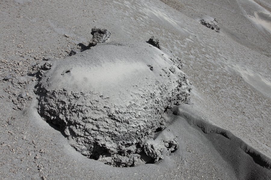
Large lava bomb on flank |
 |
 |
 |
|
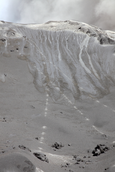
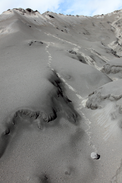
Trails on flank mark path of bombs |
Trail left by bomb in barren landscape |
Small bomb at end of trail |
 |
 |
 |
|
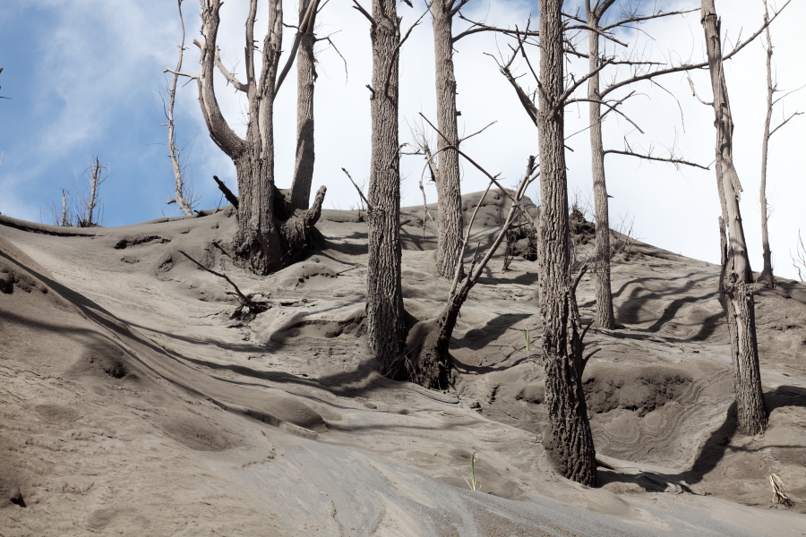
Forest on flank killed by heavy ashfall |
 |
 |
 |
|
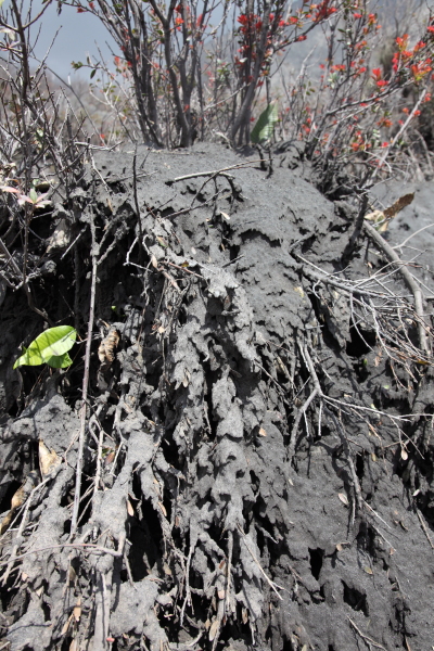
Large bush completely smothered by ash |
Ash on flank |
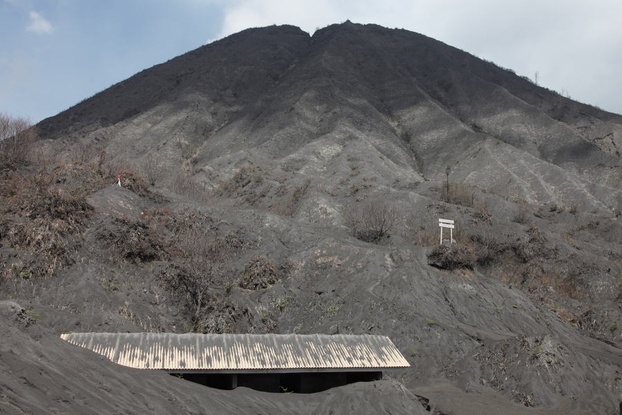
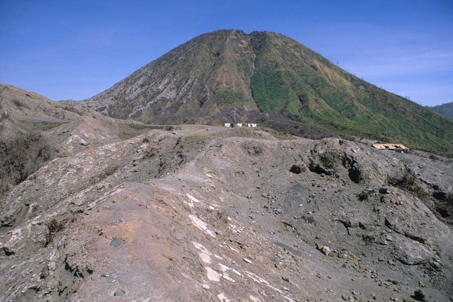
Extensive ash deposits, Batok in background |
 |
 |
 |
|
Building buried by ash at base of Batok |
Moisture condensing in cloud above crater |
View from Batok with dead vegetation in foreground |
 |
 |
|
View from Batok with dead vegetation in foreground |
Minor ash eruption |
 |
 |
|
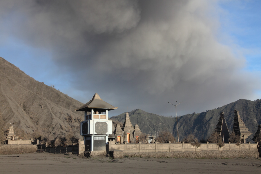
Pura Luhur Poten temple in foreground with erupting Bromo behind |
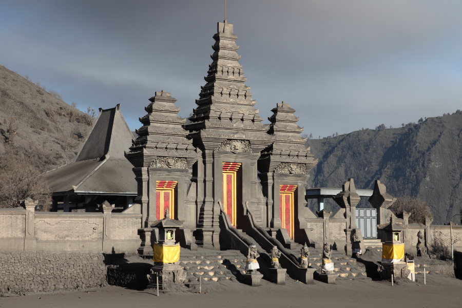
Pura Luhur Poten temple |
 |
 |
|
Pura Luhur Poten temple with ash cloud passing overhead |
Pura Luhur Poten temple viewed from trail up Batok |
 |
 |
 |
 |
 |
 |
 |
 |
 |
 |
 |
 |
|
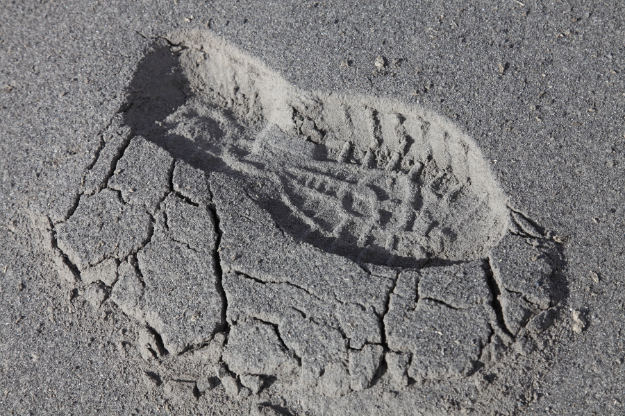
Footprint in fresh ash |
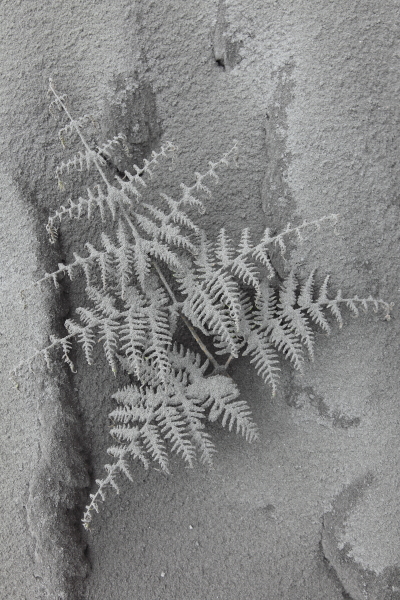
Fern coated in ash |
Plant buried in ash |
 |
 |
 |
|
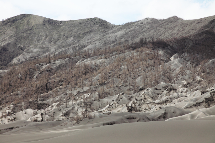
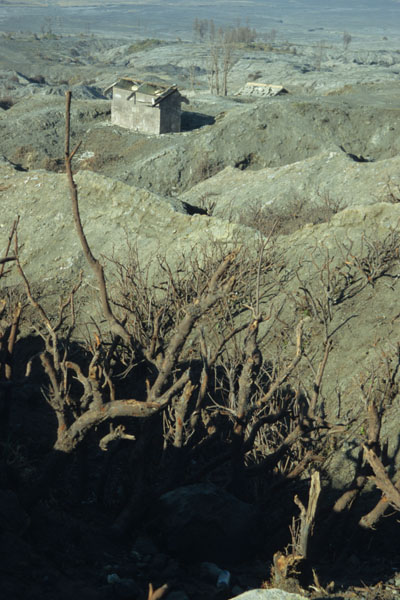
Dead forest on east flank of Bromo |
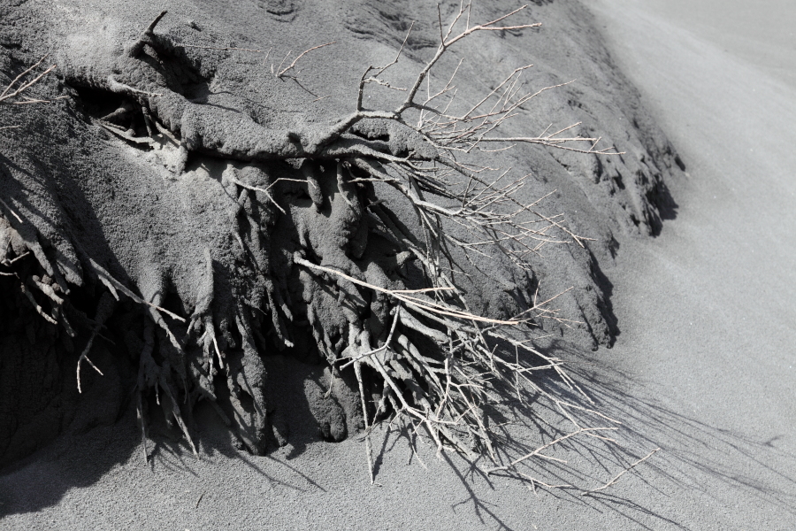
Plant smothered by ash |
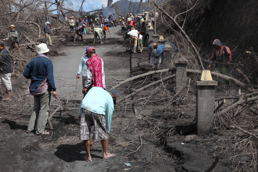
Locals clear trees broken by ash from road into caldera |
 |
 |
 |
|
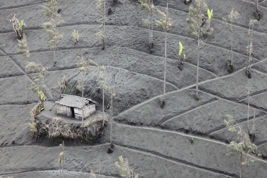
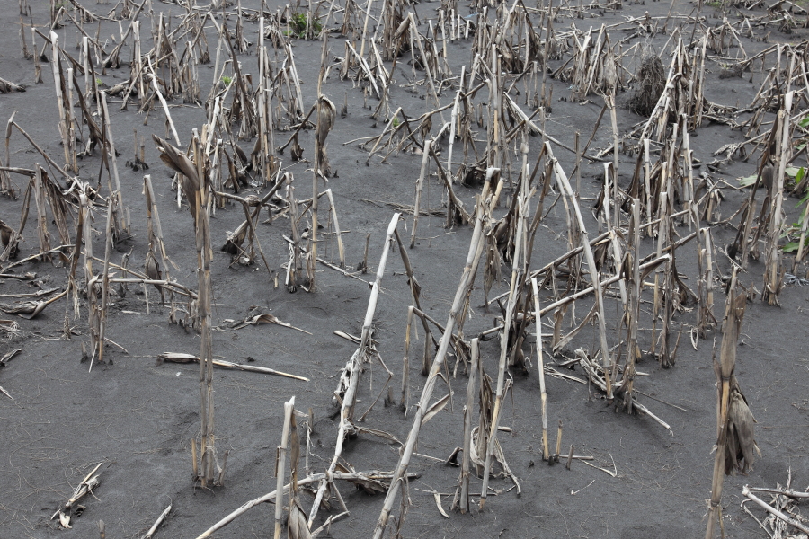
Agricultural land smothered in ash, 10km SSE of Bromo |
Trees snapped by weight of ash in caldera |
Crops bent and broken by ash fall |
 |
 |
 |
|
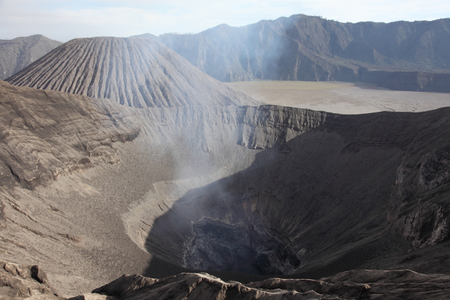
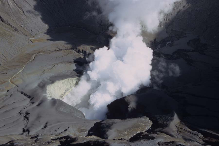
View into Bromo Crater, July 2004 |
View into Bromo Crater, July 2004 |
View into Bromo Crater, July 2004 |
 |
 |
 |
|
Building on Flank of Bromo with Roof Destroyed by 2004 Eruption |
Vegetation Damaged by Impact of Bombs from 2004 Eruption |
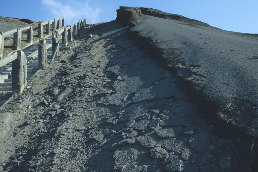
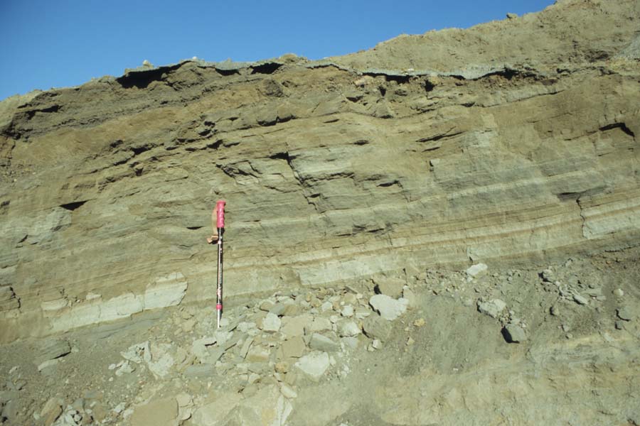
Fresh Lapilli from 2004 Eruption by Staircase |
 |
 |
 |
|
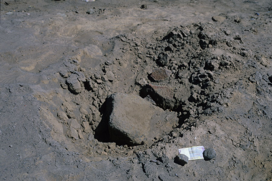
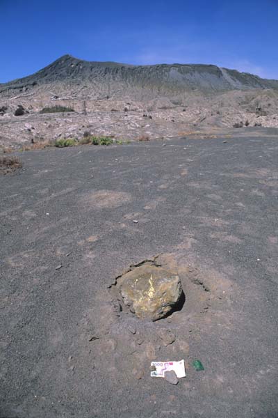
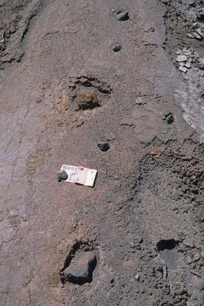
Volcanic Bomb from 2004 Eruption (Banknote for Scale) |
Volcanic Bomb from 2004 Eruption |
Ash Deposits on Flank of Bromo |
 |
 |
|
Morning View from Mt. Penanjakan Viewpoint |
Expansive Morning View from Mt. Penanjakan Viewpoint |
 |
 |
|
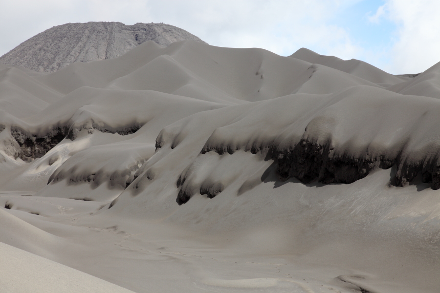
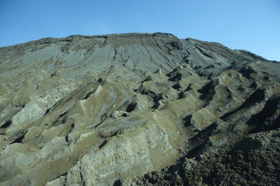
Erosion Valleys on N Flank of Bromo |
Evening View of Bromo from Batok |
 |
 |
 |
|
View from Bromo Flank to Batok |
Multiple Small Impact Craters from 2004 Eruption (Located in Foreground of Picture to Left) |
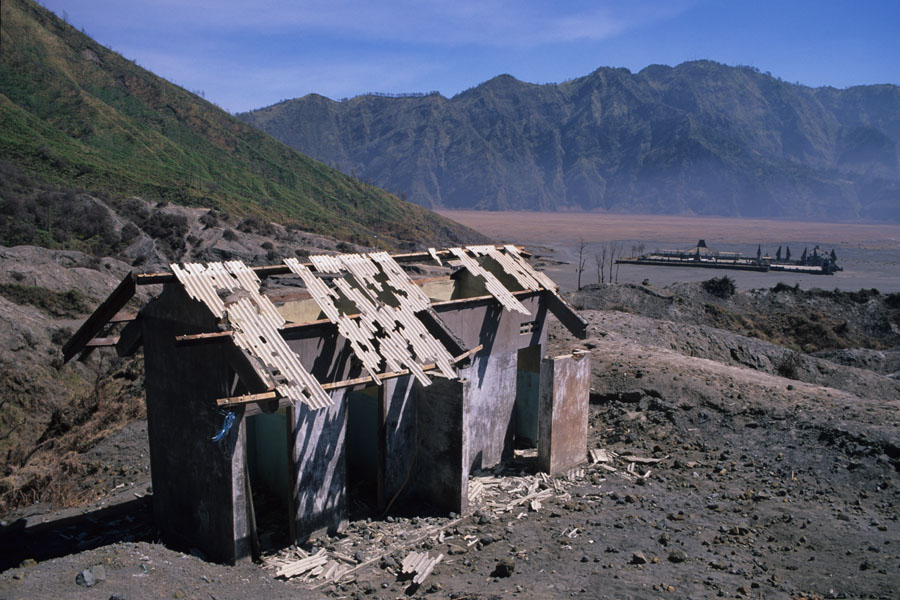
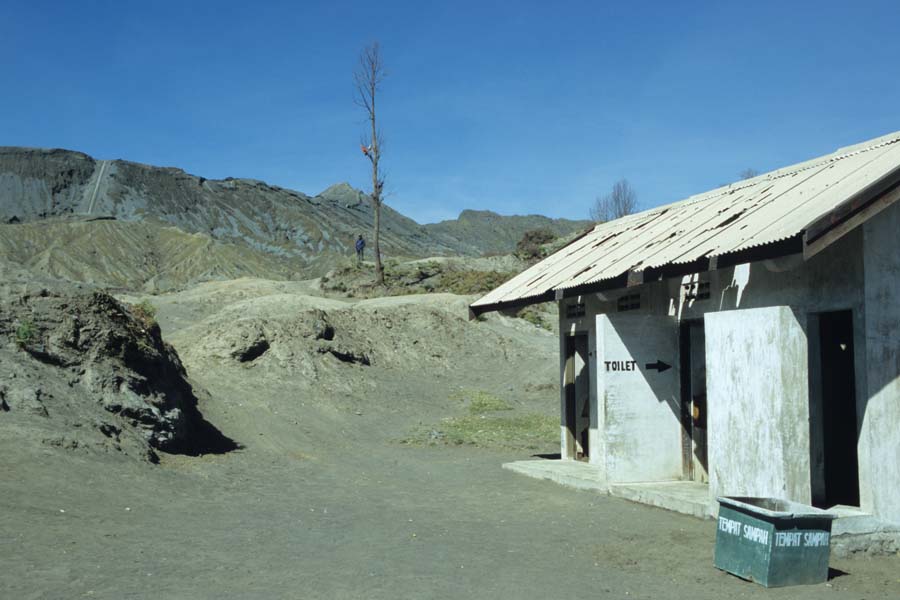
View from Base of Caldera to Bromo. Note Impact Damage to Roof of Toilet |
 |
 |
 |
|
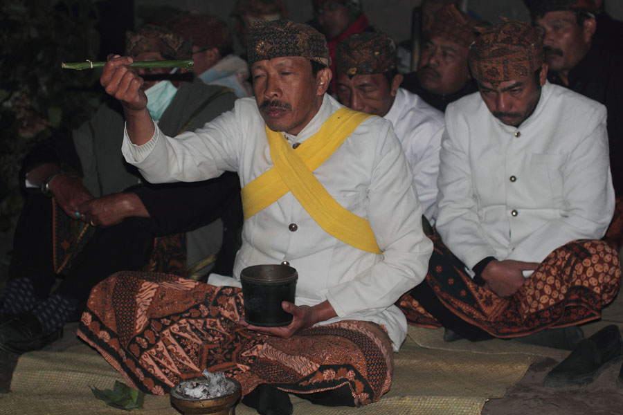
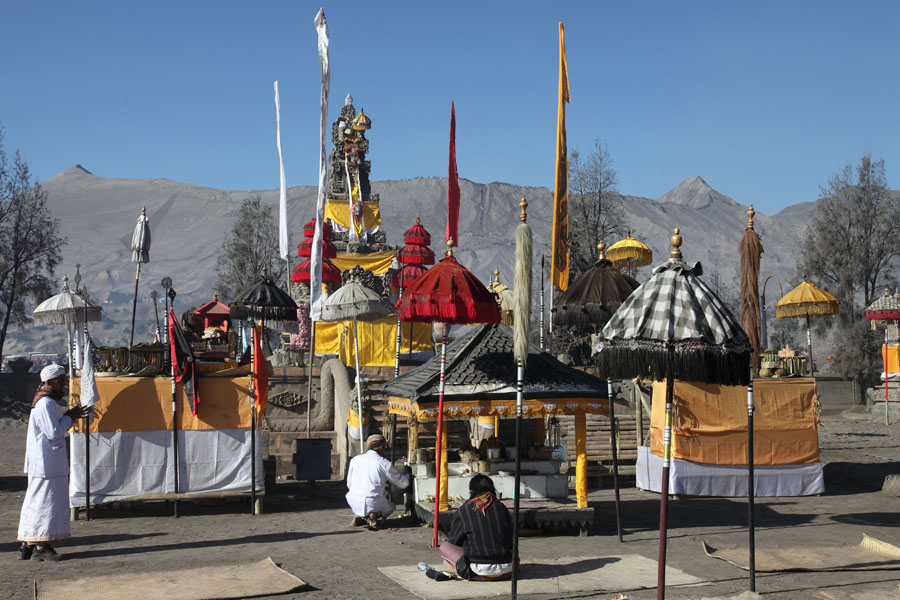
Priests performing ceremony before procession |
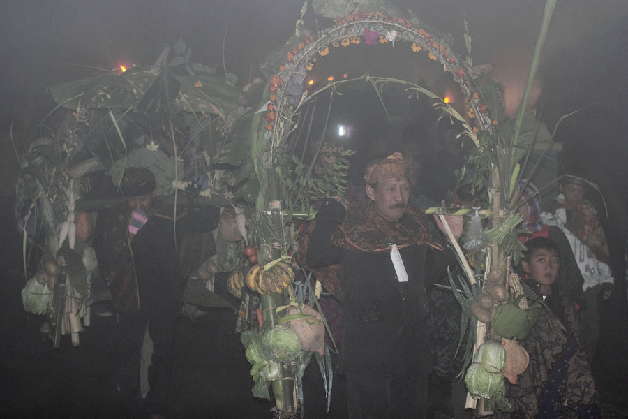
Procession through dense fog on caldera floor |
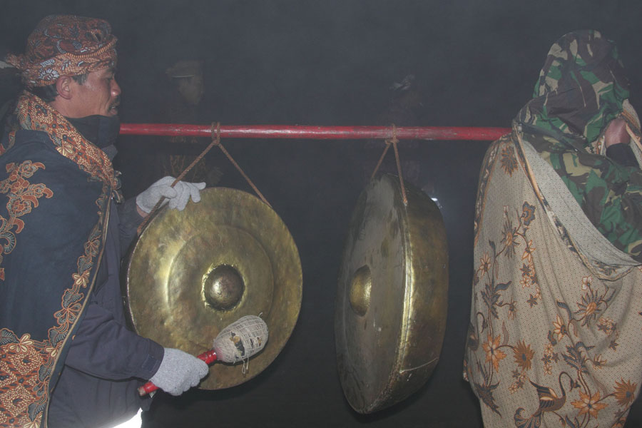
Musicians accompanying procession |
 |
 |
 |
|
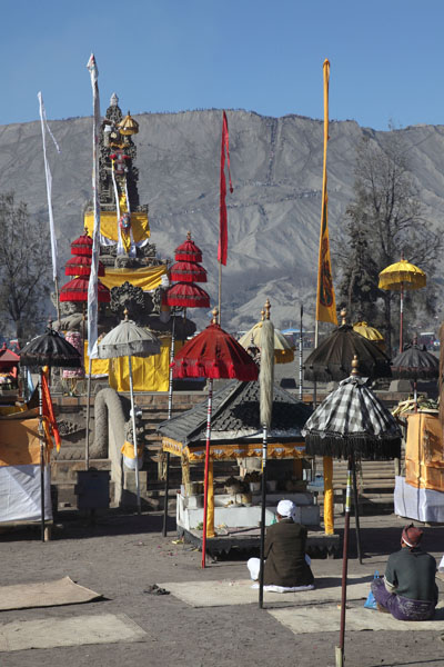
Priests meditating in Pura Luhur Poten temple |
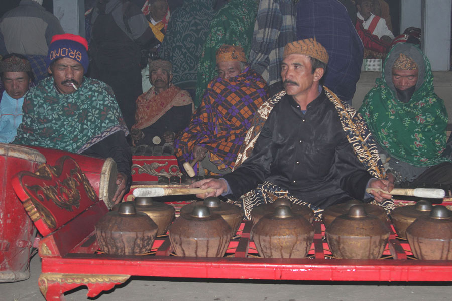
Musical accompaniment of ceremony |
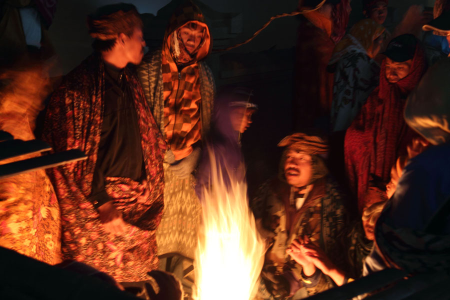
Pilgrims keep warm by fire in temple compound |
 |
 |
|
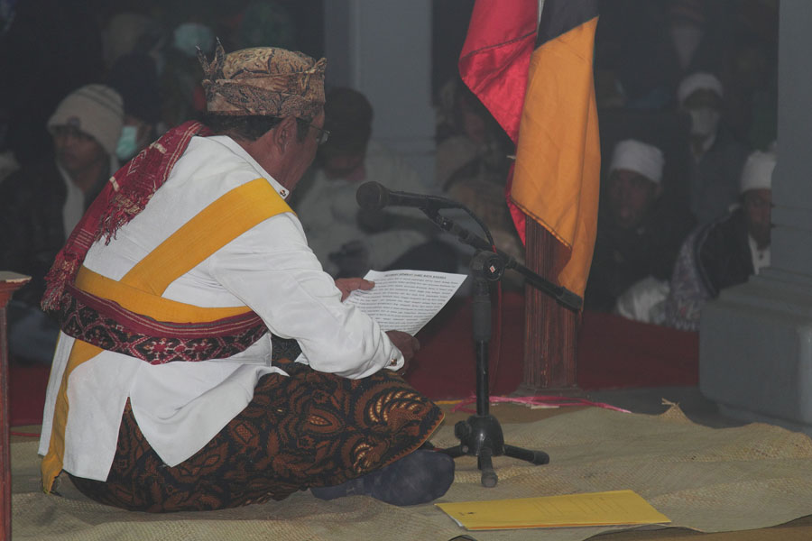
Priest holding speech in Pura Luhur Poten temple |
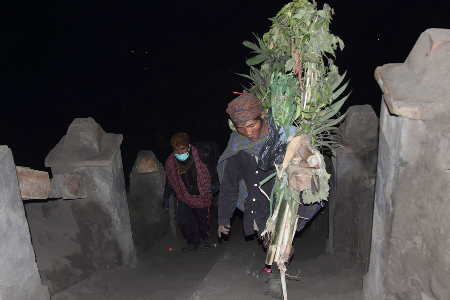
Sacrificial “wreath” being carried up stairs to Bromo crater |
 |
 |
 |
|
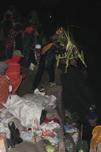
Sacrificial “wreath” being thrown into Bromo crater |
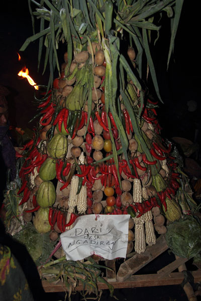
Bundle of agricultural produce for throwing into crater |
Priest with sacrificial “wreaths” on crater rim |
 |
 |
 |
|
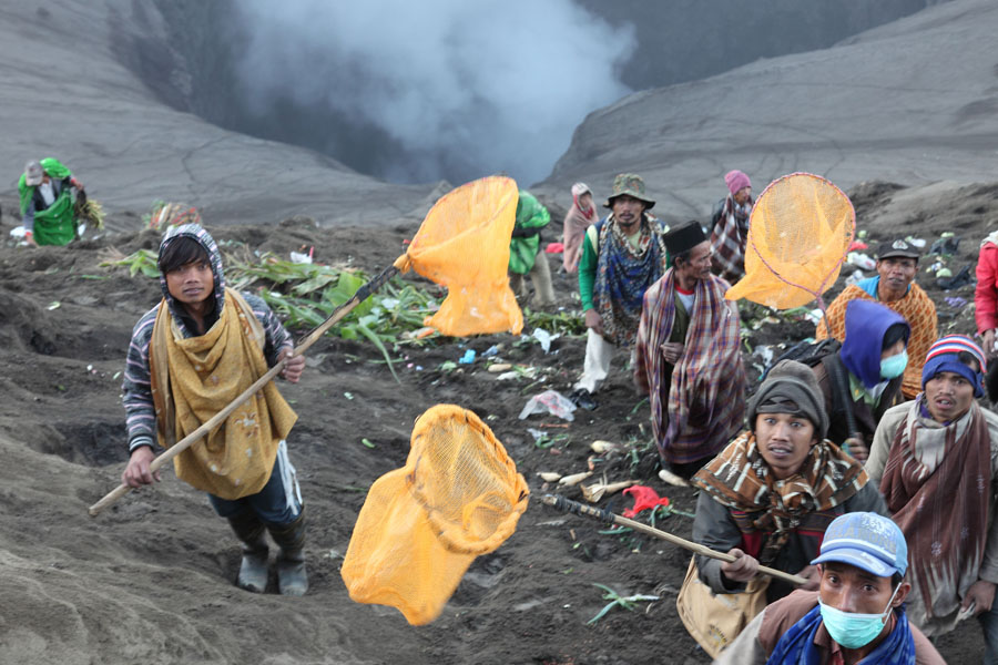
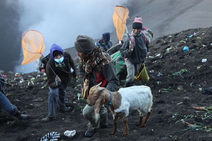
Waiting to catch sacrificial goods in crater |
Sacrificial goat being retrieved from crater |
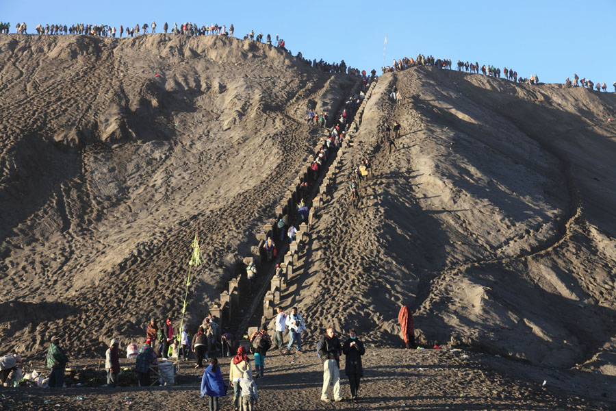
Pilgrims and onlookers ascending stairs to crater rim |
 |
 |
 |
|
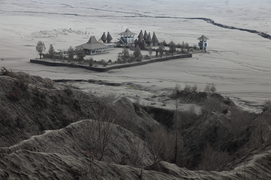
Pura Luhur Poten temple |
Pura Luhur Poten temple with Bromo Volcano behind |
Pura Luhur Poten temple with Bromo Volcano behind |